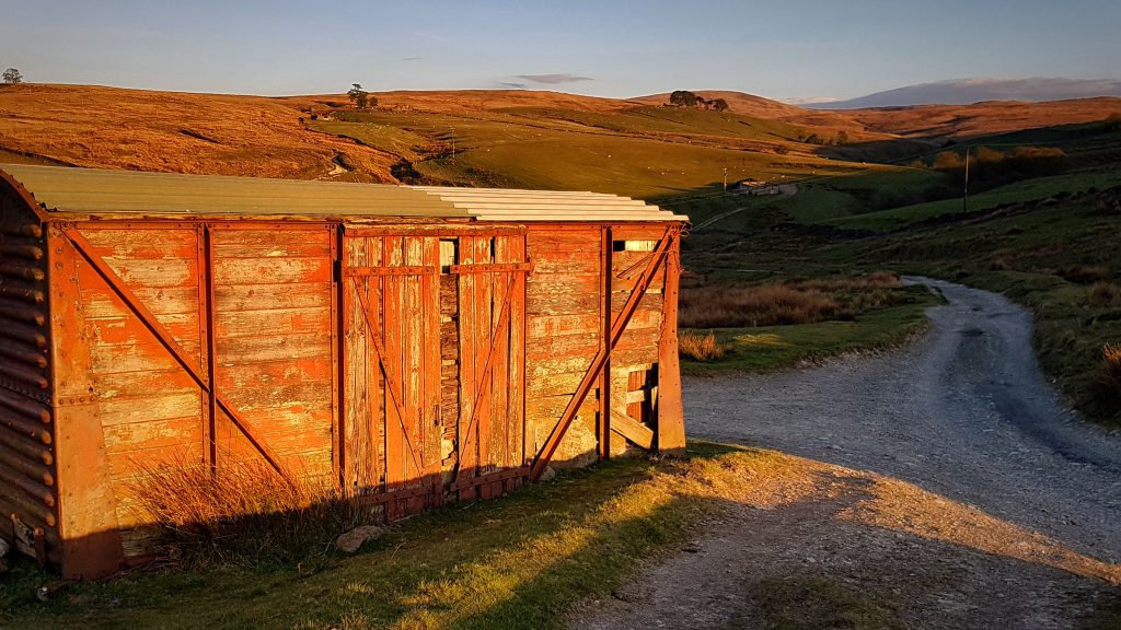
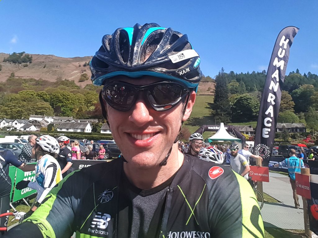
Bunree Caravan Club Site – probably the best backdrop we’ve stayed at (And the poorest weather!)
Bunree lies just north of Onich on the eastern shore of Loch Linhe and consists of little more than a few houses and a Caravan Site. With the A82 nearby however it is only a few miles from Glencoe and Fort William – which is the main town in this part of the Scottish Highlands and just a few miles from Ben Nevis.
Glen Nevis before the rain again came down!
While the views are undoubtedly spectacular, poor weather for the majority of out three day stay meant our tourist exploits were limited to an afternoon in Fort William, a very wet walk in Glen Nevis, and an enjoyable short walk up to Inchree Falls – just a mile or so away from where we were staying – where we were also able to spot some red squirrels!
Day 13 – Tuesday 14th August 2018 – Lost the woodland trail so played it safe on the A82…
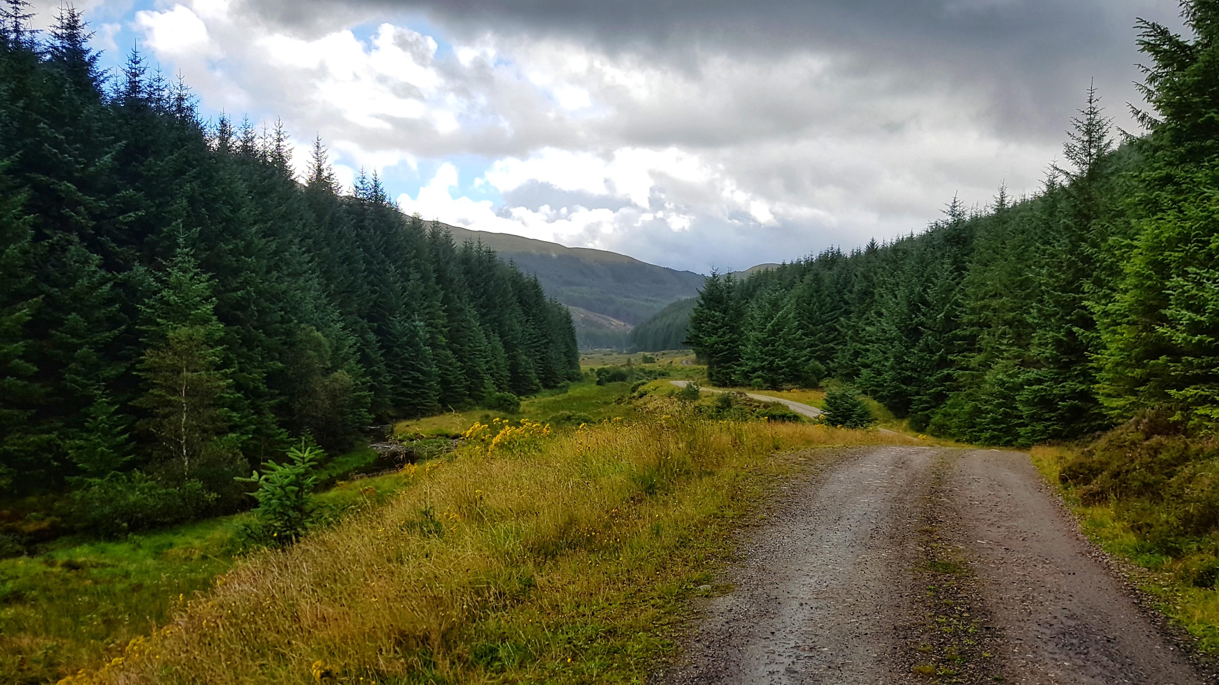
Not long after arriving at the spectacular Bunree Caravan Site I was reading the welcome brochure over lunch and it soon became clear that the place to head to for my first run was the nearby Glen Righ Forest, which promised miles of paths and tracks – ideal for walking and mountain biking. They didn’t specify running per se but I knew that this could be a runner’s playground!
It was a wet and wild afternoon in the Highlands so I was a little delayed heading out as the caravan’s awning was doing it’s best impression of being a sail as we struggled to attach it to the caravan and peg it down before it blew away. Finally at 3:40 pm I was on my way – thankfully the rain had stopped and the wind began to die down, the sun even threatened to make an appearance!
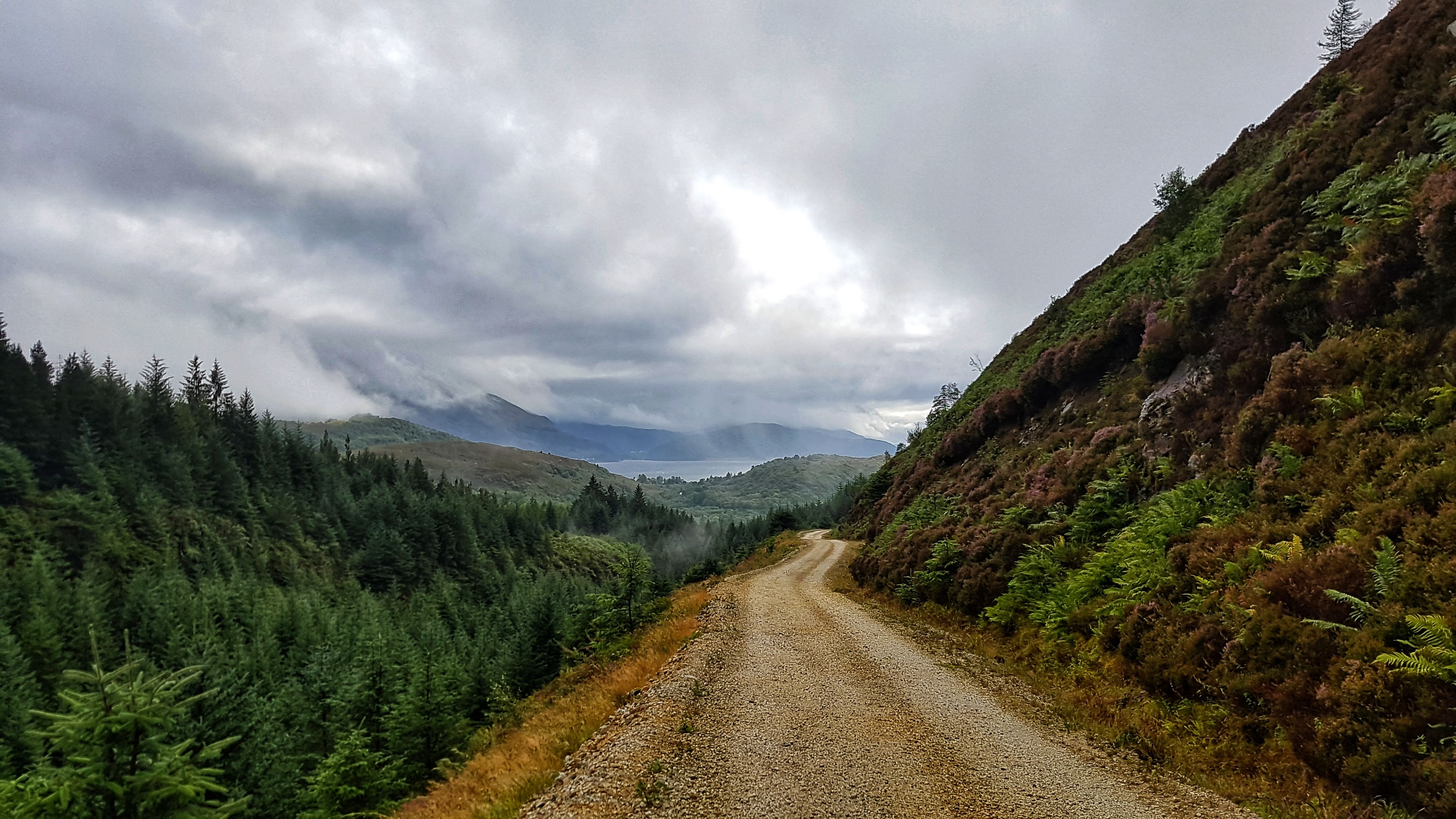
Half a mile of single track road later and I was on the busy A82, but it was just a case of crossing it and heading onto a small road that took me through the small village of Inchree and on to the Glen Righ Forest car park. There was an information board which offered up two circular walks – one was to the Inchree Falls, the other called Wades Road Walk, named after the Military Road.
I wanted to save the waterfalls experience as a family one so I opted for the Wades Road Walk, which was advertised as 3.8 km long. I set off along a trail which was narrow but very well maintained and not that technical as it made it’s way rapidly deep into the heart of the forest.
The photo doesn’t do justice to the colours in this forest (and the severity of the climb!)
The trail may not have been technical, but boy was it steep! My first mile, that took me to the car park, was a 7:34, my second mile 9:01, but Strava GAP rates it as a 6:12, having climbed 440 feet in just over 3/4s mile at an average of 9%, with a savage section of just 0.13 mile which averages 17% on the Strava Segment. I’m not sure the steepest bit of it is 72.7% as Strava claims, but I reckon it was around 33% for around 20 seconds of running. Given that I did this section at 10:47 per mile pace, yet sit third in the Strava segment gives an idea of its severity. The amusingly spoonerised segment for the entire climb Hairway to Steven has me second, a minute off the leader, which would have been less had I not stopped to take the photo above!
Arguably the most scenic half mile of running on my Tour in Glen Righ Forest.
Just as I felt like my legs would give up completely, thankfully the climb fizzled out as I presumably joined the Old Military Road. Following the coloured post I took a left turn or two and began to drop back down the hill I had just risen. It was probably a combination of the adrenaline still coursing through me after the hill as I began to hurtle downhill, the sun just attempting to break through after four days of thick cloud cover and the stunning scenery, with views of the forest, the mountains and the Loch below, but this half mile of running (as shown in the photo above) was perhaps the most enjoyable and scenic of the entire Tour.
Alas the views were not to last forever as the descent got steeper and steeper and dropped back into the forest, round some pretty tight alpine style hairpin bends. I think I missed the turning back to the car park for I continued to drop, quite quickly (a 6:22 third mile) past some holiday lodges and suddenly onto the A82. I had to rely on Google Maps to advise me that I had popped out around a third of a mile north from where I had last seen the popular A road.
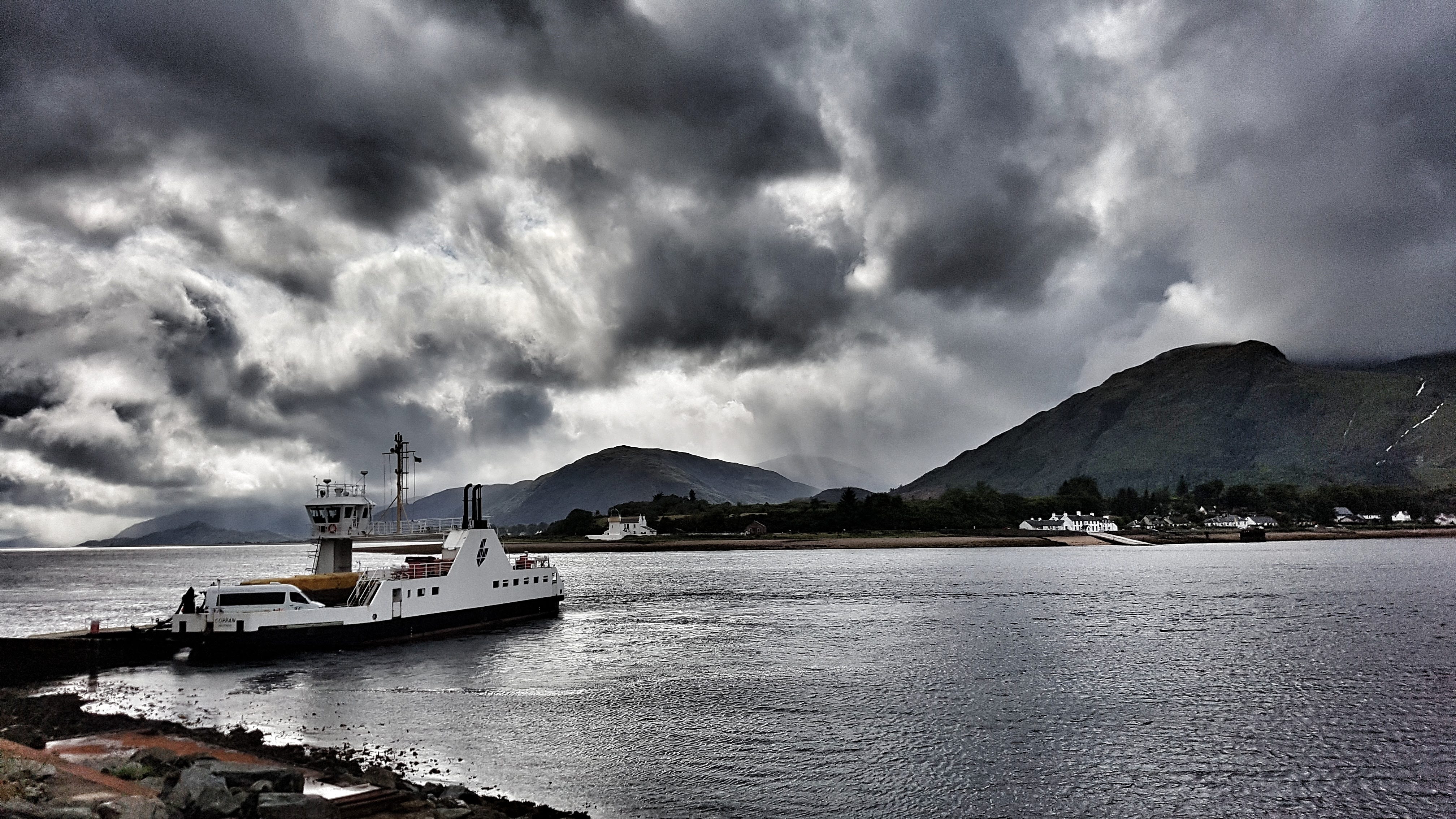
Luckily for me, although the overwhelming majority of the A82 has no pavement and is wholly unsuitable for running on, this section did in the form of a shared cycle path. Even more fortunate was the presence of an information board just a little way along the road which explained that this cycle path ran from North Ballachulish to Fort William, using the Corran Ferry and the continuation of the path on the A861 to offer cyclists especially an alternative route to Fort William, avoiding the busy A82.
The Corran Ferry – one of the few remaining ferry services in the Highlands – taking passengers from the A82 to the A861.
With less than four miles covered I knew that I would have to do plenty of exploring to make up the ten miles. I had wanted to spend longer on the forest tracks, but didn’t really fancy another long climb up. Instead I first turned right onto the A82 and headed down to the Corran Ferry crossing, which had a boat just about to depart. Free to foot passengers, I briefly considered taking the short journey across the water but, thought the better of it given that my stomach was giving a few distress signals.
I decided I would instead head back initially to the caravan site to use the toilet facilities before using the cycle path on the A82 towards North Ballachulish to make up the distance. Relieved of stomach cramps I was soon back on the main A82, enjoying a cycle path that was, at that time, used by no-one other than myself.
There was around a mile of running to take me from Bunree to the more populated village of Onich, which sits mostly on the A82 and features a large number of B&Bs, which offer splendid views of, and easy access to the shores of Loch Linhee, which when I dived briefly off the road to take a photo, felt and smelled far more like a sea beach than the side of a lake.
I ran along a bit further, the cycle path looking a lot more like a pavement and barely suitable as a means of taking bikes along. I got to within 3/4s mile or so of Ballachulish Bridge – fortunately for me as someone who really does not like crossing bridges, it was time to turn around and head back to keep the run at 10 miles. The pace had picked up by itself almost without effort, the final three miles 6:21, 6:22, and 6:11 as I enjoyed the relatively flat terrain and good surface underneath me.
All that was required once returning to the Caravan Park was a quick lap of the site to ensure the run came in at over 10 miles, taking in the fine views around us and making it over to the laundry room to deposit my well worn running clothing!
Best Strava Segment Performances: Hairway to Steven – 2nd/90; Onich to Keppanach – 2nd/51.
Day 14 – Wednesday 15th August 2018 – More time in Glen Righ Forest
With road based options limited, unless I wanted to catch a ferry, the nearby Glen Righ Forest with the promise of miles and miles of forest tracks and footpaths was bound to be the spot at which I would spend the vast majority of my time at Bunree running. After a wet and wild night that made sleep difficult in the caravan, it was a fairly tardy 8:40 am before I set off for the Day 14 in the 21 day run challenge.
I decided I would head initially on the forest track I exited the forest from the afternoon before and carry on running to see where it would take me. This route up to the quarry was not as severe as how I made my way up to the same place the day before, but it was still a mile and a half or so of climbing at an average of 6% which, with legs that had not fully woken up, was something of a challenge. It was surprising to see on my return that I had bagged the existing Strava segment for the climb as I didn’t think I was running particularly fluidly and had clocked a 8:15 mile after an initial 8:13 mile. The devil was in the detail though as I had climbed nearly 600 feet.
Following a brief plateau there was a choice of paths to take. I consulted Google Maps and took the one that appeared to go on for the longest distance. On I climbed for another mile and a half or so, still heading uphill, but not quite so slowly now the gradient had eased to a more manageable 4% average.
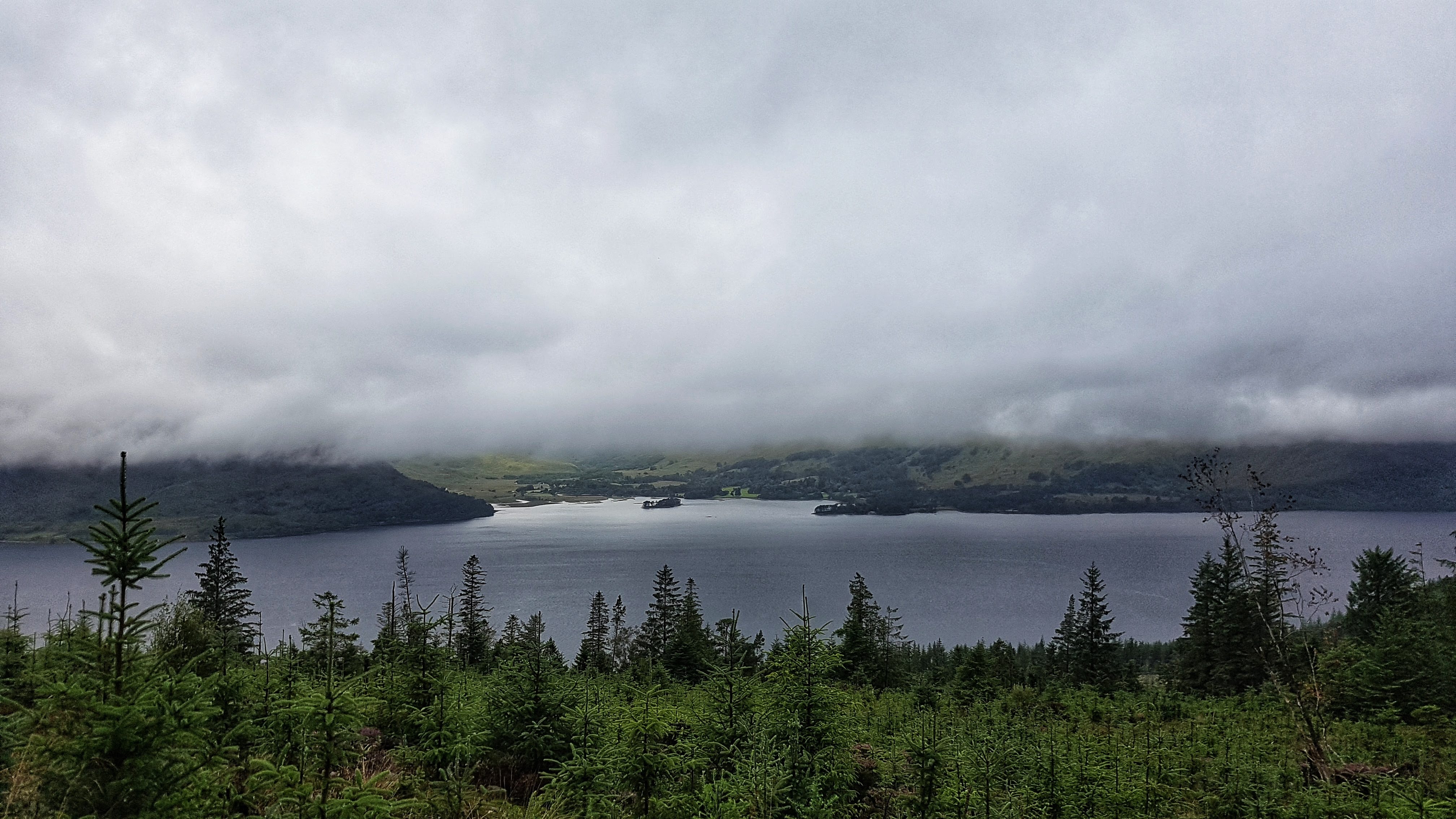
Loch Linhe from Glen Righ Forest – mountains obscured by pesky low cloud.
Once again the views were quite spectacular and I couldn’t help but stop two or three times to take some pictures and just take in the splendour, which would have been even greater were it not for the low cloud that continued to plague our stay in the Highlands.
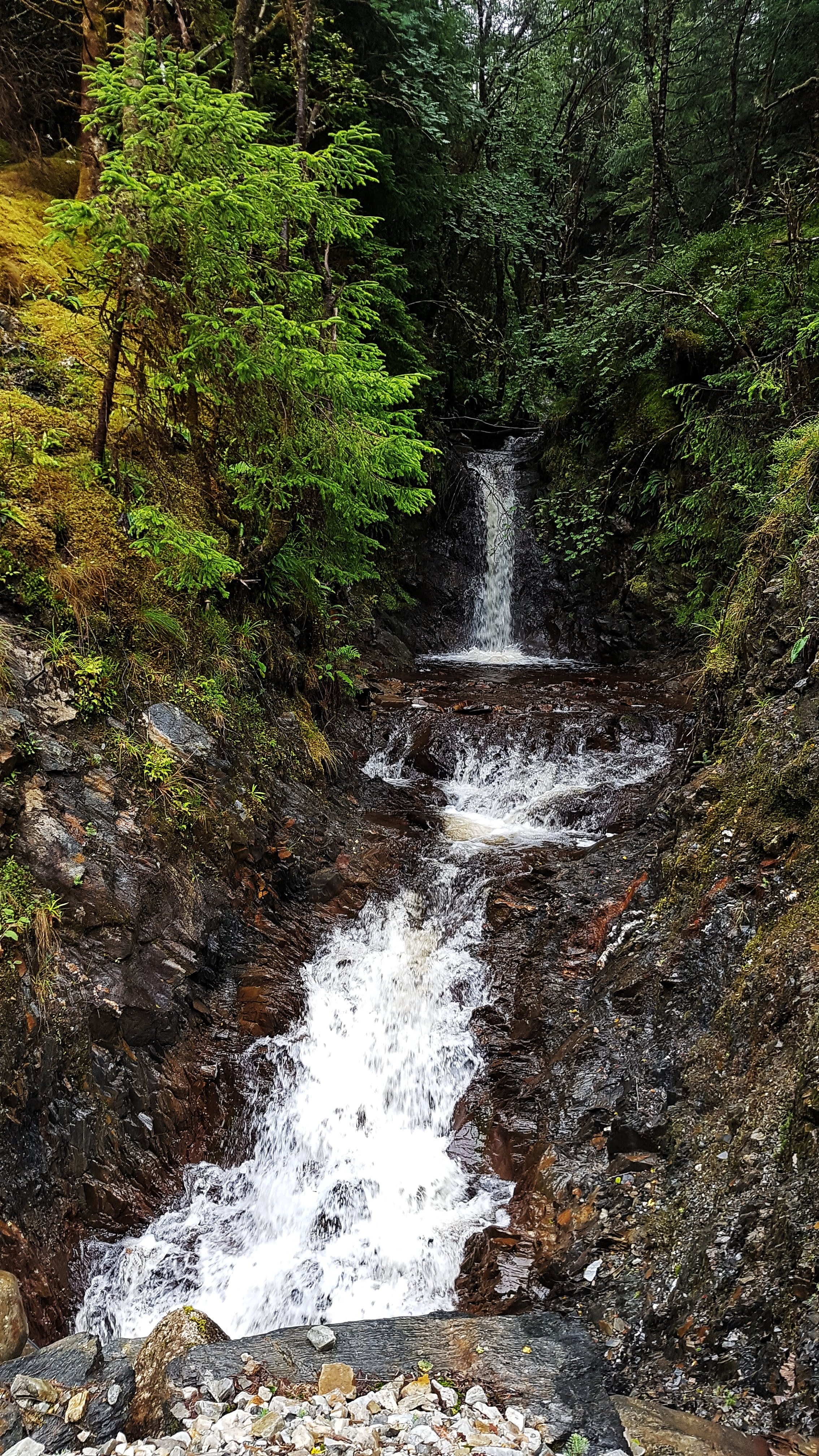
Just one of many small waterfalls in Glen Righ Forest.
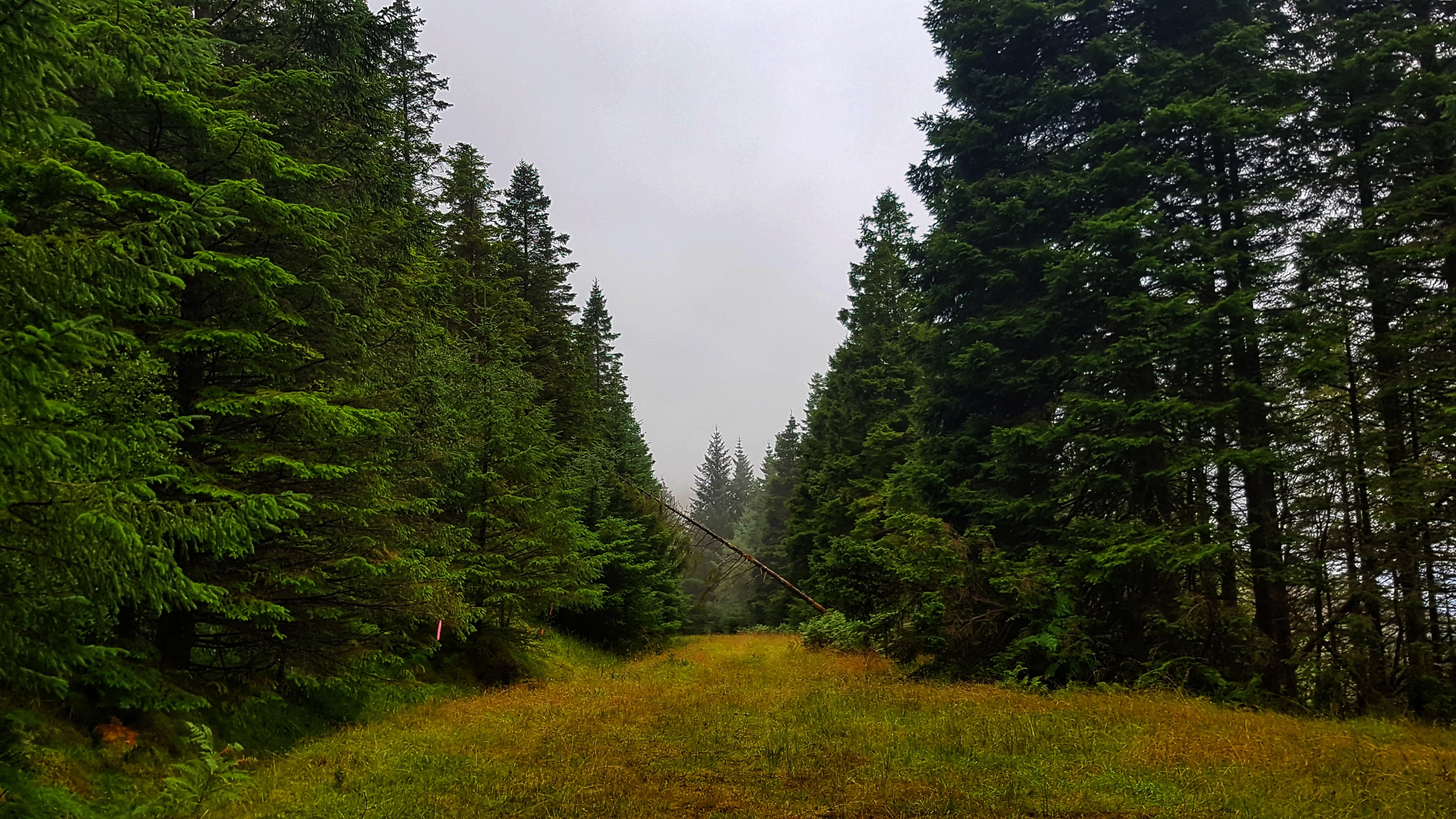
As I climbed the views were typical to those above – scenic Loch to the left of me, forest and numerous small waterfalls to the right. I didn’t want it to end but when the Garmin clicked to around 3.5 miles there was the tell tail signs that this track was not going to last for ever. The road levelled out for a little while followed by what I presume is a large turning circle for quarry vehicles cut into the rock face. Then the gravel track gradually faded to grass, not long after coming to a halt as forest untouched by humans stopped me in my path.
The end of the Road in Glen Righ Forest.
With no alternative but to turn around and head back, it was a more or less a case of relaxing and let gravity do its stuff as I began a long three mile plus descent back down to the A82: 6:26 for mile 5, then 5:49 and 5:38 for miles 6 and 7. As the gradient was not too severe it was an enjoyable descent as I took in the glorious scenery one final time – for I knew that tomorrow I would explore a different part of the forest.
Back on the A82 and with three miles left to fill I decided to do a bit of research for the next day’s run trying to find the forest path on Google Maps that went on much further than any of the other paths. First I headed back to the forest car park where I’d headed to the previous day and began to run towards the Inchree Falls before noting that the map didn’t think this was the right path. Going back on myself it then appeared to show the path cutting through a set of private holiday chalets which most definitely did not have a large track running through it.
Fortunately all this ultimately pointless exploring meant that once I’d returned to the caravan site and done a lap, or maybe two, the ten miles was covered – barely – just 0.03 miles over the required amount. A slightly frustrating end to a run that had begun so beautifully, but I knew there was always tomorrow and hopefully a run along the elusive path deep into the forest!
Best Strava Segment Performances: Gate to Quarry – 1st/21; To the end – 1st/11; From top to bottom – 1st/1(!); From A82 to Inchree Carpark – 1st/77.
Day 15 – Thursday 16th August 2018 – As far as I could go without a hard hat.
Our last day in the Highlands brought a slight change to the now conventional timetable where I would run in the morning before heading off somewhere with the family on my return. Because of the poor weather forecast we decided to head off early for our planned walk at Glen Nevis before returning in the afternoon for a run while the kids would be entertained with a film or two we promised they could watch as a reward for their walking efforts.
This plan backfired somewhat when the weather, as we drove to the Ben Nevis Visitor Centre, deteriorated rapidly with a heavy storm only abating 20 minutes or so after we had parked. We managed to enjoy a family walk where we only got quite wet. That was until the last mile or so when the heavens, once again, opened in quite spectacular fashion, leaving us all soaked to the bone and me heading off back to the car to rescue the others huddling under an inadequate tree!
After returning back to the caravan for lunch and a chance to dry off, I set off on my run at just after 4pm. Unlike the past two runs I knew exactly where I was heading. The previous afternoon we had enjoyed a short walk to the Inchree Falls back in Glen Righ Forest. On that circular walk I noted that at a junction in the forest tracks there was a road to the right that matched the long track on Google Maps I had failed to find on my run earlier that morning.
Inchree Falls – well worth another brief stop.
Heading once again to the Inchree car park and setting off on the relatively steep but not too technical path up to the Inchree Falls I had planned to carry on past them as I’d taken the liberty of photographing them the previous day to include on my Strava photos for the run. However, on reaching them with the skies partly cloudy but definitely with some sunshine, the waterfalls were far more photogenic than the day before, so there was an unplanned brief stop to capture their splendour once again.
The path from the waterfalls climbed a little further before reaching the junction, where I turned right and headed along the track to who knew where. From the walk the previous day I knew that it must lead to something for we were passed by a car or two heading from somewhere. The forest track, although unpaved was in good condition to be driven on and a cattle grid gave more clues that this was not exactly a relic from the past.
Heading to where? In Glen Righ Forest.
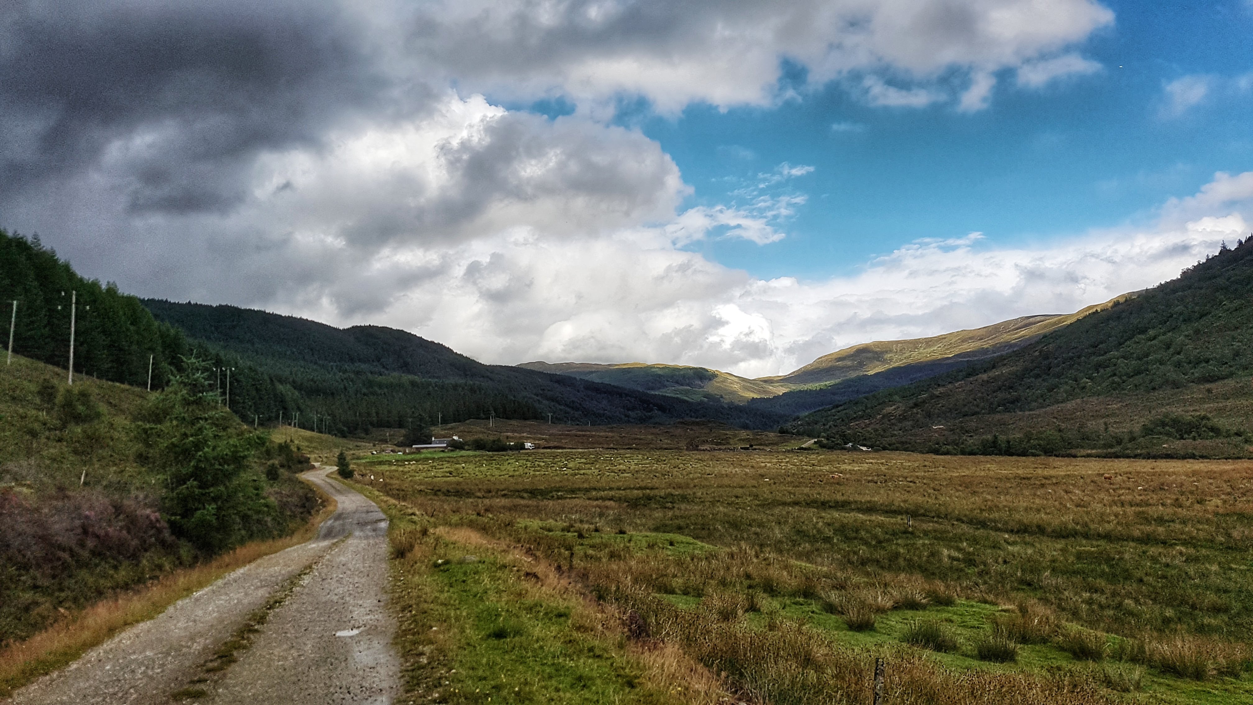
As I climbed as far as the road wanted to go I was presented with the view above – the hills and mountains mostly clear to see for the first time since arriving in the Highlands. To the right of me were wild Highland cattle enjoying the pastures. In the distance on the bend I could see a building or two which looked like it served an industrial purpose. As I passed this an LPG lorry squeezed past me. It was quite strange to experience traffic on a road which appeared to be heading deep into nowhere.
I continued running for another couple of miles, the pace very comfortable at around 6:40 a mile, the road twisting and turning gently, a parked car where a moderately sized river (presumably heading to Inchree Falls) hugged the track, a house or two – one long since derelict, the other clearly currently lived in. Then some noise of construction – off the track and in the forest covered hills a small hut and machinery seemingly clearing the trees from the hill and smoothing the ground on the hill itself.
The path took me away from this work for another mile or so when I approached a small bridge and a warning sign telling me in no uncertain terms that entry was forbidden by law unless you were wearing a hard hat. Quite what was beyond the bridge and sign I wasn’t totally sure, but I wasn’t going to risk life and limb to find out, especially as the Garmin had very conveniently just clicked over the five mile mark, making it very conveniently a ten mile out and back run in total if I retraced my steps to the letter.
Heading back to base after reaching as far as I could legally go in Glen Righ Forest.
Just as the photo above was taken the heavens opened once again that day and I was soon pretty wet, but with the legs feeling really good – perhaps the best they’d felt all holiday, and the scenery continuing to delight with every twist and turn, I didn’t mind the rain at all. The return miles back to the A82 were a 6:34, 6:24, 6:13, 6:21 and 6:02 – speeding up as the road began to head downhill for the final mile where I missed the waterfall path and continued on the main track back to the car park. It wasn’t all running however as it included a brief spell of enforced walking. The ten or so Highland cattle who were on the pastures had settled on the road and although the signs said they were fairly tolerant with humans, I didn’t want to stress them or have them testing their sizeable horns by running towards them in a speedy manner!
Crossing the A82 it was just a case of returning to the Caravan Park. Feeling great still the pace effortless gravitated towards 6 minute miles, but felt as if I was almost jogging. This run may have just have edged it as the most enjoyable on my Tour of Britain: very nearly road and traffic free but on a surface that was easy to run on; some stunning views with a the waterfalls, mountains and forests all looking amazing when the sun peeked through the clouds for the first time in days; an out and back run that forced a turnaround at just at the right moment; and legs that felt as if they were coming into some kind of good form rather than feeling exhausted like they should have been.
With the run done it was time to say goodbye to the Highlands and prepare for the long journey back into England!
Best Strava Segment Performances (all created by me post run – there were no segments at the time of running): From A82 to Inchree Carpark – 1st/77; To the Waterfall 1st/1 (bit surprised by this); Random Segment #1 – 1st/29; Back from the warning sign back – 1st/14; Drop back to the car park – 1st/49.
Leg Five Summary
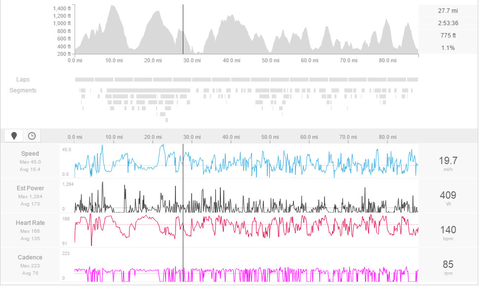
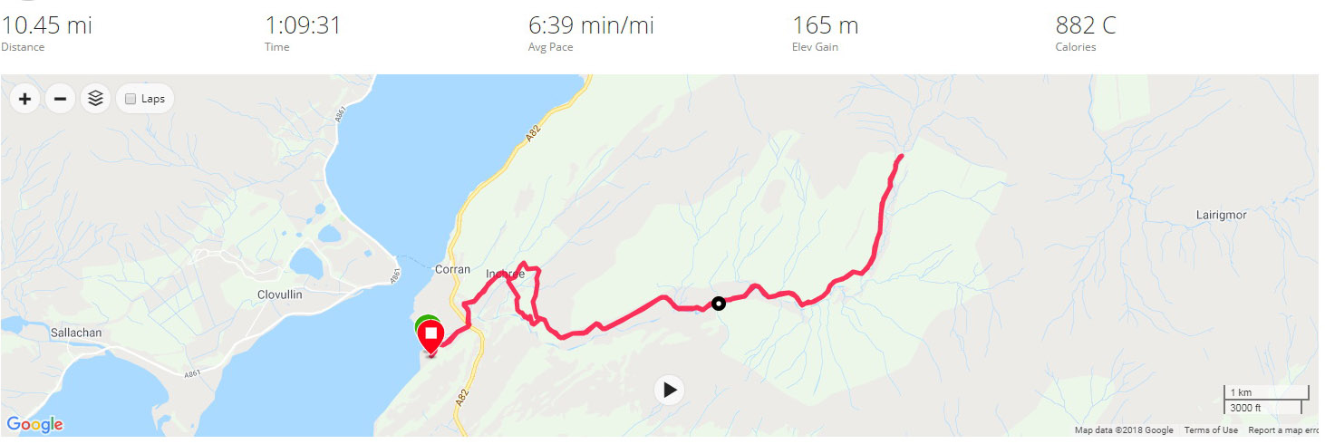
Distance Run: 30.7 miles. Average Pace: 6:48 per mile. Accumulated Time: 3:28:47. Average HR: 140; Total Ascent: 727 meters.
Compared to running races, where I have at least 136 recorded finishes to my name, I have a grand total of one cycle race and not many more sportives on my palmares. For those who are not aware of the difference between a cycle race and a sportive, whereas a race usually sees everyone departing at the same time with the goal to find a winner and losers, a sportive is basically a group ride on a course against the clock. For legal reasons to do with road closures (lack of, primarily) and the like, in the UK a sportive can award riders with things like gold medals or distinctions for completing a ride in a certain time. What it cannot do is give you a finishing position – although a lot of results are published in such a way to make it fairly easy to sort by time and then add a column with position if you are curious to see how your performed relative to others.
My first sportive was in November 2007 when I took part in the Exmoor Beast – a tough introduction to group rides, which I thoroughly enjoyed despite the severity of the climbs and suffering a heavy cold at the time. Six months or so later I took part in the Dragon Ride in Wales – a bigger, more famous event, but in my opinion quite an easy ride in comparison to the Beast at the time. Not long after my eldest daughter was born and with the sudden lack of time available to train given the demands of parenthood and my job requiring a lot of overseas travel, cycling pretty much went out of the window for a good number of years.
It was when I fractured my sacrum in 2014, now living in Grantham, when I rekindled my love of cycling that I’ve had, on and off, ever since I began cycling at three years of age. Unable to run, or walk, but strangely able to ride, I joined a cycling club, Witham Wheelers, my first since a very brief membership with Leamington Cycling and Athletics Club back in 1999, I began taking part in group Sunday rides for the first time ever. The following spring I began taking part in their time trials, did badly in my first and only TLI organised bike race, then took part in a small sportive in Yorkshire called the Bronte – where I snapped my chain on the first hill and somehow managed to finish using gears not designed for 20% climbs.
Since 2015 my cycling has slowly increased in volume but has continued to play second fiddle to running. My participation in Duathlons has meant I’ve had to practice the Time Trial more than any other discipline – an event I’m not particularly good at, but need to work on to improve my Duathlons. In 2016, in another busy summer, I took part in two sportives on consecutive days in mid-July: the Wiggle Stratford (Warwick really) Tempest Sportive (Epic) and the Tour of the Cotswolds Sportive (Epic).
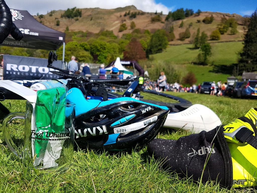
The current cycling boom has seen sportives transform from a fairly limited number of events often low in numbers to the current situation where there are literally hundreds of rides to choose from all over the country, some of the largest requiring a ballot to enter and having thousands of riders taking part. One such event is the Fred Whitton Challenge. A 112 mile ride in the Lake District which features 12,000 feet of vertical ascent and traverses some of the park’s most difficult climbs including – Kirkstone, Honister, Newlands, Whinlatter, Hardknott and Wrynose passes. The first Fred Whitton was in 1999 following the passing in 1998 of the Lakes Road Club Secretary whose name was given to the newly established event dedicated to his memory. It has now established itself as one of the largest sportives in the country, with over 2000 entrants, on the sportive calendar, and this year came under the indirect ownership of the ASO, organisers of the Tour de France no less.
I think I first became aware of the event back in 2007 when I was searching for my first sportive before settling on the Exmoor Beast. Back then the Fred was by the far the daddy of all British sportives, harder than any other and with a bigger reputation. Since then other sportives, such as the Prudential Ride London have become bigger in terms of participation and other sportives, such as the Tour of The Peak can rival the Fred Whitton in terms of the challenge on offer. But the Fred Whitton Challenge largely retains its position as one of the few must do sportives for any keen amateur cyclist.
I’d ducked out on entering in 2016 but entered the ballot in January 2017 for the ride taking place on May 7th. To my joy I was informed a few weeks into the year that my application was successful and I was taking part! One of the challenges of an early season event is that training for the event is not easy over the winter months. It’s more of an issue for myself in that the winter and spring months my training is heavily geared towards the London Marathon. So preparation for the Fred Whitton consisted of the Witham Wheelers Reliability Rides, spinning sessions at the gym and one specific training ride a month or so before the event – the 13 Hills of Belvoir Ride which took in the best of the local hills on a well know club route, done twice in one go. At 118 miles and 8,000 feet of elevation it wasn’t exactly the same as the Fred, but at least it was something.
Another issue was that Fred Whitton comes just two weeks after the London Marathon. I’d expect it will take around a month to fully recover from a marathon. I made the mistake of maybe over doing the running post marathon, acquiring a minor overuse injury, but more worryingly suffering deep fatigue over a week post marathon, which saw my watts drop noticeable on the bike and elliptical trainer, and saw me dropped literally very early on during a chain gang on the Thursday before Fred. I made do with an easy 30 mile ride instead and the reassurance I had two days where I could rest up and recover as best as possible.
Originally the plan had been for the family to head en masse after school on the Friday and spend the weekend in Kendal in the caravan before somehow getting the kids back to school on the Monday morning. Ten days out though the logistics of this through work for my wife in particular meant this idea had to be shelved. Instead I opted to stay in a B&B on the Saturday night and drive home directly after the event. Booking so close to the ride meant very little local availability, but I settled on a The Old School B&B in Tebay. This is around a 50 minute drive from Grasmere, the host town of the Fred Whitton, but I reckoned this would not be too much of an issue with a very early start on the Sunday morning.
I drove up to the B&B on the Saturday afternoon. It was a really easy journey up the A1 to Scotch Corner then along the A66 – roads pretty quiet, weather good. I arrived at the B&& at around 4:30pm. Being the last to book I had been assigned a small broom cupboard of a room, but it was fine – I had a shower, a kettle, a bed and supefast wifi to hook onto and literally catch the last five minutes of the Giro stage. There was no room for the bike, that would have to stay in the boot of the car, but it was well hidden from view on a very quiet road and I felt fairly confident it would still be there in the morning.
With that watched I thought I’d go and loosen the legs with a half hour walk or so. I’d hoped for something super scenic, alas I mostly followed the path of the neighbouring M6 as I walked along the surprisingly sandy footpath alongside the river below.
Avoiding the M6 in Tebay.
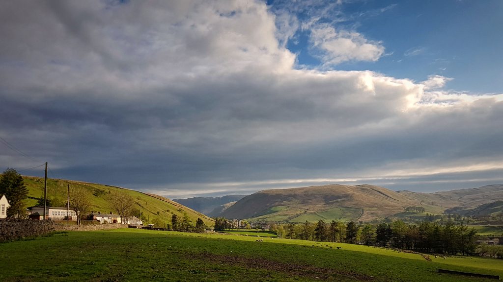
The walk duly loosened the legs a little stiff having spent the best part of three hours driving and worked up an appetite. Luckily I’d sourced a pub nearby which was serving food. The Cross Keys Inn has been around for 100s of years. It certainly has a lovely view which we were encouraged to enjoy from the beer garden.
View from the Cross Keys Inn
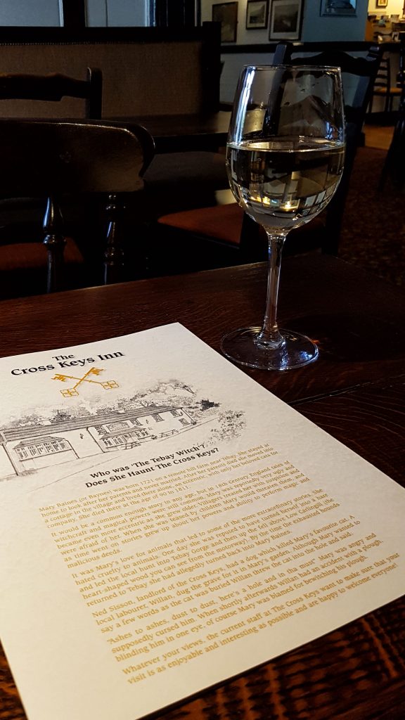
Alas it was a little too cold to be sitting outside so I had to make do with a pew inside, complete with a glass of wine to help unwind and hopefully send me to an early sleep. I turned up not long after 6pm hence the rather empty appearance of the pub. It wasn’t long after that the pub filled up quite nicely.
Pre ride drink!
Food ordered I reread the final ride instructions for the event, taking good note especially of where the hardest climbs and most dangerous descents were. Fortunately the weather forecast was looking dry and not too windy, even if it was set to be a bit chilly first thing in the morning. The food arrived – a pie, which if I was brutally honest, wasn’t the best I’d ever had, but it served a purpose. I treated myself to a sticky toffee pudding for desert, reckoning I’d be riding plenty long enough in the morning to justify the extra calorie intake.
With dinner done and dusted by before 8pm I took another short walk before heading back to my little room – the sun setting offered the opportunity for some nice light as I walked part way up a short, sharp hill. On another day I could have explored for longer, but being sensible I headed back to put my feet up for an hour or so before attempting to get to sleep at around 10pm.
The sun sets over Tebay.The sun sets over Tebay.
I’m not the best at sleeping in a strange bed, not the best at nodding off at an early hour, and not the best when the mattress is a little on the soft side. It took longer than I would have liked to finally get to sleep as I saw my clock tick over past 11pm, but it was better than it could have been. Paranoid that I wasn’t going to wake I set two alarms for 5am, as is fairly typical for me I woke up two minutes before the alarm went off…
I didn’t have long to get my groove on. The instructions said you could start from any time after 6am, with the last riders being allowed to leave at 8am. I had no intention of being one of the first off, but had plans of wanting to leave at around 7am. Back when I rode a sportive in Yorkshire and had my chain snap on me, I ran perilously close to being eliminated by the broom wagon as I’d set off late. I didn’t want to risk that again.
It was too early for the B&B to offer me any breakfast. I’d come prepared with oats and skimmed milk powder in a newly acquired food thermos. I got the kettle boiled, made myself a proper strong coffee, filled my oats with water and went about getting changed into my cycling shorts. I tried to eat a little breakfast but it was too early, so I packed it in my bag to eat at the start. I did though drink all my coffee before having one last check to make sure I’d not forgotten anything and headed to my car.
To my surprise on an early May morning the windscreen was covered in frost. The temperature read 2C! I hadn’t anticipated it being this cold! Luckily as I set off and headed to Grasmere the temperature soon increased to around 7C. Nippy, but much more comfortable to ride in than barely above freezing. That drive to Grasmere was glorious as the sat-nav avoided the M6 and I had a wonderful former A road all to myself. Even the run in from Kendal to Grasmere wasn’t too busy, albeit probably busier than it would be normally at 6:15am with tell tale bike racks aplenty.
As we approached Grasmere we were confronted by swarms of cyclists who had started the Fred Whitton. The adrenaline began to hit! Inexplicably rather than take the normal A road on the final miles to Grasmere, my SatNav took me the wrong way around the lake, taking in some pretty narrow, steep country lanes. Definitely not the fastest way, I breathed a sigh of relief that the only traffic I faced coming towards me were a couple of runners.
I arrived at the start at around 6:50. The makeshift car park was pretty packed already. Being so late I thought I’d be miles away from the HQ. As luck would have it I was guided in to a spot pretty much right next to the finish line!
Prime position to be parked for the start!Prime position to be parked for the start!
There was plenty to do in a short space of time. First off I went to collect my number and helmet tag at ride HQ. I passed the Bike Channel TV crew on the way who were preparing to put their first piece of the day to camera (The event was filmed to be shown at some point). Number collection done far faster than expected, I returned to the car.
Just about to get everything from the car. Breakfast takes priority!
Boot lid wedged with old trainer (The struts don’t work in cold conditions!) I got out the porridge and began to eat – a few spoons at a time while preparing the bike. Luckily there wasn’t much to do aside from putting the front wheel on the bike and pumping the tyres, turning on the bike computer and calibrating the power meter pedals. With that done I got changed into my cycling kit and headed to the portaloos where I had to take off my cycling kit to do what I had to do before putting it all back on again. One day I’ll remember that bib shorts are not as easy to deal with in such situations as running shorts…
With the load suitably lightened I had little more to do other than a final bike check, make sure I had everything I needed with me such as malt loaf, gels, compulsory rain jacket, money, phone, car key, inner tubes and so on. By fortune a small saddle bag I’d bought during the week had turned up earlier than expected on the Saturday so I was able to put my tubes and so on in there – otherwise I think I will have struggled to carry everything.
At the start we were offered a banana which seemed to good to resist. A guy wanted me to wait with him so we could ride the first miles together, but he was taking too long so I decided to go it alone. Unlike a running race there is not a lot of fanfare with a sportive start as riders set off when they like, solo or in small groups. I set off solo but within a couple of minutes I was caught by a couple of riders and we then caught three or four more.
The first miles on the A591 to Ambleside are an easy introduction to the ride, being gently undulating at worst. I was trying to conserve energy but with the adrenaline pumping the HR crept a little high for those first miles as we averaged comfortably over 20mph. What wasn’t high was the power meter reading which, despite me feeling I wasn’t riding full gas yet, was showing very low figures, often less than half what I’d expect having ridden with them for several months now. I thought at the time maybe the calibration was wrong, indeed later in the ride during a stop I re-calibrated them to no avail. This lack of power information was a bit annoying as I’d been planning my ride around hitting certain power limits on the climbs especially. On the flip side it meant I had to do what I’ve done for most my life and ride the climbs based on how hard it feels rather than sticking to a prescribed limit. This may or may not have helped me.
(Post ride I was pretty annoyed by this and assumed the pedals to be faulty. The following day I did a Google search, as you do, and found the answer to my lack of power issue. My bike computer has two bike profiles for a Cervelo and a Trek. Normally I just choose the Trek no matter what I ride as the crucial bike measurements are the same. On the morning of the Fred I chose the Cervelo profile, which I assumed I’d checked thoroughly for discrepancies. Sadly there was one and it’s crucial for my pedal based power meter. The crank length, which is a standard 172.5mm, had for some unknown reason changed to 110mm, which is probably an eight year old bike’s crank size. They say a 2.5 mm difference can cause a 20% discrepancy in power readings, my 6.5 mm difference explains why I reckon my average watts was down by around 100 on what I’d expect.)
We swept through Ambleside – a town I’m familiar with on my numerous holidays around Lake Windermere and onto the road where I saw all the riders swoop past me earlier in the morning. The majority of the field had certainly left earlier than I had – it was 7:30 before I finally set off. I knew from driving in that we’d soon turn left off the main road and up the first hill of the day.
That first climb was Holbeck Lane – the Strava segment has it at 0.9 mile at an average gradient of 7%, I took it fairly easy up the climb using it as a good opportunity to try and wake the legs. They didn’t feel brilliant but they did feel as though they could come to life later in the ride. Feeling in my element on the hills I soon left all but one of the riders I had ridden the opening miles with. I left him not long after the steepest bit of the hill which we both remarked on being a good wake up for the legs. I soon began picking off more riders making their way up the hill. This was what I had hoped for by setting off quite late, working off passing up riders to give me more encouragement.
The first climb done there was a little respite before the first major climb of the day – Kirkstone Pass. This was actually the only climb of the day I’d ridden before, albeit on the previous occasion I think I started the climb from a different road perhaps lower down. Just like back then I didn’t find the climb that difficult at three miles long at an average gradient of 6%. Then again, I didn’t ride it that hard, taking time part way up the hill to consume the first of seven small slices of malt loaf I’d planned to take every ten miles. It was on this climb I hooked up with a rider I stuck almost like glue to for the best part of the next 40 miles. Of eastern Asian appearance with what looked like a German inspired cycling jersey I assumed that if he’d traveled from at least Germany to ride he must be pretty good to follow. I actually think he was from Yorkshire, but I liked the idea of having a continental peloton to ride with.
The only real reminder that we had been climbing for the best part of 30 minutes was when we passed the famous Kirkstone Pass Inn – the third highest pub in the UK – and continued climbing, temporarily losing the brilliant blue skies as we rode literally into the clouds. The high point of the ride at 1,489 feet, I was grateful that I was wearing a base layer under my cycling jersey and had opted to ride with full gloves, knee and arm warmers as I felt the chill when climbing, let alone when we started descending.
The first major climb done was followed by the first big descent. The first part was tricky with a 25% initial descent with some tight bends, but it soon leveled out, relatively speaking, and became less twisty, making for an enjoyable drop back down to around 500ft above sea level. The next ten miles were pretty flat. I rode with my German / Asian / White Rosed cycling buddy taking it in turns to keep the pace semi-decent before being caught by two quicker riders. We both sensed an opportunity for a quicker ride at a reduced effort by jumping on their wheels. This proved a success with the pace comfortably averaging over 20mph, despite being held up for a while by a slow moving horse box which allowed an large group of very swift riders to catch us. Staying on this train proved to be hard work, but the speed benefit was worth it as we approached the next climb, especially as we were heading north and into a slight headwind.
We hit the climb to Matterdale End at dead on 20 miles which was unfortunate timing to take on the malt loaf, struggling to swallow and breathe hard at the same time. This large group had some really good riders, some of whom proved to be a little too hot to keep up with. Me and my buddy stuck together on the climb with the two others we had ridden with, which was now proving pretty difficult as there were scores of riders scattered pretty much all over the road. At 1.3 miles and averaging 7.0% this was a challenging climb in that it was steeper in places that it looked making it mentally challenging. That said I rode up it fairly well, especially when we passed the small car park at Aria Force, which I had visited with our family last year – spurring me on to statistically my best climb of the day, as I currently sit 19th for the year on Strava for the hill segment (I assume that most of those times were set on the Fred).
Past Matterdale End came another climb steep at averaging 10%, but only half a mile long so not a big challenge. This took us to Troutbeck and a left hand turn on to the A66. This is a busy main road, one I’d driven on just the previous summer. We were encouraged to use the refuge inside the white line if possible, but I know that riding on this part of the road is an invitation to attract a puncture, so I, like nearly everyone else, rode close to, but just to the right of, the white line. Avoiding the raised cat’s eyes did prove something of a challenge at times as the train gently meandered left and right like a slithering snake. We were advised by the police apparently to ride single file and for the most part this was respected by the riders. I’m not totally sure but I think I was somewhere near the back of a long train of bikes (perhaps 30 long) which may have had some of the quick riders I’d tried to stay with on the Matterdale End Climb.
We rode on the A66 for ten miles and although not entirely effort free, it will be some of the easiest miles I’ve ridden while averaging close to 25mph. Mostly gently downhill and aided with a slight tailwind and the long train of bikes, it was a good opportunity to recover, take on another bit of malt loaf, drink some energy drink and prepare myself for the harder miles that lay ahead.
The A66 journey ended at a large roundabout 34 miles into the ride where my Garmin Edge 810 decided to turn itself off. Normally this leads to a corrupt post ride FIT file and the prospect of having no evidence of my efforts. I was calm though as I’d prepared for this eventuality and was riding with my Forerunner watch which was also recording the ride and has, touch wood, been infallible when recording long bike rides. I turned on the Edge and it slowly came to life, taking around a mile or so to find the satellites and remember what ride it was meant to be following. The only real annoyance was that I didn’t know the overall distance of the ride, nor my average speed without referring to my watch, which I find hard when riding. No major issue, but something to stew over as we continued meandering along some flat to gently undulating roads alongside Derwent Water.
The large group had split up braking for the roundabout and I now found myself in a small group of around six riders, still including my original group of two club mates and Asian / German / Yorkshire buddy, who I never actually talked to, but felt comfortable enough in his bike skills to follow his wheel like glue, unlike some others who were sometimes a little erratic in their braking. At this point we were slowed quite a bit for around five miles by a double decker sightseeing bus who was struggling to get past slower riders further up the road. A few decided to take some major risks passing the bus on the twisty, narrow, main road. I and most of the others in a swelling group opted to suck it and accept that these obstacles are part and parcel of a sportive held on open roads.
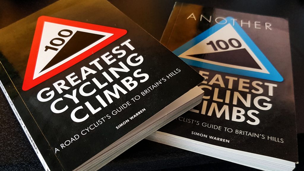
Thankfully we passed the bus when it stopped as we bid farewell to Derwent Water and we enjoyed our last few miles of easy terrain as we passed through Rosthwaite and Borrowdale. At 42 miles passing through Seatoller we had our third big climb of the day and by far the hardest so far in the ride – the Honister Pass. Like the Kirkstone Pass earlier in the ride we were riding up it in the opposite direction to what is recommended in my favourite cycling books 100 Greatest Cycling Climbs and Another 100 Greatest Cycling Climbs. Whereas Kirkstone Pass has a 7/10 for difficulty, Simon Warren rates Honister as 9/10 and the difference in difficulty was soon apparent (Incidentally for any Grantham based people reading this: for comparison, our most feared climb Terrace Hill, scrapes into the first 100 climbs, but is awarded a measly 1/10) . The Strava segments have the climb at 1.5 mile long averaging 10%, with the steepest 0.4 mile averaging a challenging 15%.
After an initial ramp of around 10% the climb soon got tough with a section of 25% to really test the legs. I was very thankful I’d invested in getting a 11-32 rear cassette on the bike – whereas in previous sportives I’ve been desperately trying to turn the pedals on a 25 sprocket, this larger cog at the back made it possible to keep the RPM at around 55 on the steepest sections as opposed to the 30 or less you can expect when trying to turn a bigger gear. It was here I said farewell to my continental / local friend as I pushed on, sticking to the wheel of the two club mates we had picked up way back at the descent of Kirkstone. With the sun shining for the first time I began to get a little warm in the kit I was wearing, but still not enough to justify stopping to strip off. The biggest issue now, aside from keeping going as the climb continued to alternate between stretches of anything from 8-25% was steering a path through the mass of riders all over the road trying to get up the hill with varying degrees of success. Add to that the odd car trying to creep down the hill to contend with and you had plenty on your plate trying to stay upright and in one piece.
I made it to the top, setting the 26th best time on the day for the steep bit on Strava, greeted by loads of spectators cheering us on. Plenty chose to stop and take a rest, I pushed on, albeit extremely carefully. The descent is described as the most beautiful of the lakes passes by Simon Warren when he was climbing it. It was frankly terrifying trying to tackle the 25% descents round hairpin bends on the opening section of the descent followed by technically an easier section made alarming by the huge slab boulders stuck randomly by the road side waiting to catch anyone who made the slightest error on the descent.
I followed the advice of the official instructions and began braking the moment I started to plummet and pretty much kept them on for the worst of the descent, briefly easing off to avoid too much heat build up on the rims. I was concerned by the number of bodies of fallen riders strewn by the side of the road, being tended to by concerned looking marshals and paramedics. I’m fairly sure I passed this poor chap who I believe, speaking to my car park neighbour after the ride, came to grief when his tyre exploded on the descent because of the brake rubbing tyre instead of rim (It may not have been the seriously injured man, but certainly someone crashed because of this on this descent).
My sense of mortality truly awakened by the descent I was relieved to finish the descent and have a fairly easy five miles as we passed through Gatesgarth and approached Buttermere. I heeded the advice of the instructions and took the opportunity to stop for a comfort break ahead of the first official feed station (although I used the trusted farmers’ gate rather than public toilets that I failed to see anywhere en route. My two club mates (Not my club mates but two riders who were probably mates who rode for the same club) had stopped for the same reason a little earlier on the road. I didn’t see them again. This break saw a two minute thirteen second pause as I also fiddled with my pedal calibration without joy, as noted previously above.
The first feed station was small in size, frantic with seemingly hundreds of riders milling around, but brilliantly organised by volunteers who had clearly manned at this point many times in the past. Unlike the Wiggle sportive last year where the first feed station saw a queue as long and as static as the M25 on any given Friday, we moved along the table packed with tempting morsels like an efficient factory conveyor belt. Acutely aware that we were less than half way into the ride and with much of the hardest miles yet to ride, I dived for the malt loaf, then took a piece covered with jam, took two pieces of flapjack, two jaffa cakes, a cheese and onion sandwich, two SIS energy bars, then one more piece of malt loaf and jam just for luck. I ate all of this except for the energy bars in the time it took me to walk back to my bike. I made the mistake of not bringing my empty bottle with me so had to return to have it filled with some electrolyte, costing me two or so more minutes. Removing my bike from the stone wall was a precision exercise as around 20 bikes were all relying one another to stay upright. Thankfully the rider next to me was leaving at the same time and we worked like a crack team to prise our bikes from the chain without mangling our or anybody else’s precious carbon. Six minutes seventeen seconds was the time taken at the first of two feed stations, which wasn’t too bad considering the business of the cramped venue.
As warned by the pre-race instructions, there was not a lot of time to keep down your food before the next big climb of the ride – Newlands Hause (#81 in the 100 Greatest Climbs). It was here that the organisers decided to stick in a KOM timed hill climb challenge. I didn’t get off to the best start when I was stuck behind some slower riders, but with them out of the way, i made really good progress, feeling like I made light work of the 8/10 ranked ride which Strava reckons averages 11% for the 1.2 mile ascent. The final results show I finished just outside the top 50 for the climb, which is pleasing in a field of over 2000. The organisers really went to town as we hit the steepest part at nearing the top of the climb with polka dot flags, music and enthusiastic supporters urging us on.
The five mile descent that followed was thankfully a lot less challenging and therefore pretty enjoyable once the steep opening section had been safely negotiated. By now I was largely riding solo, passing more riders than I was being passed by, although every now and then a small group of riders on another level ability wise would come shooting past me with no hope of me jumping on their wheel.
Immediately before the next climb there was a brief delay when another bus (Single decker this time) again struggled to thread its way through the oncoming traffic. Thankfully some highly efficient marshaling meant we our disruption was kept to a minimum and we could attack the next climb, #82 in the 100 Greatest Climbs – the Whinlatter Pass. This was probably my favourite climb of the ride. It only rates 5/10 in the good book which meant it was a challenging, but not overly taxing affair. I rode it well, feeling strong, buoyed on by the crowds of people who had been encouraged by the organisers to use this climb as a vantage point, and they did so, lining the road cheering us on like we were in the the Tour De Yorkshire or other less well spectated bike races, like the Tour De France.
With the descent that followed there was another five miles of fairly easy riding to the sixty mile point before the 20 mile section described amusingly on a Strava segment the shit bit. Whether this is a reference to the undulating terrain that begins to tax on a rapidly wearying body, or the relative lack of scenic surroundings compared to the majesty of the rest of the Lakes (we had a good view of Sellafield Nuclear Power Station by the Irish Sea at Calder Bridge) I’m not sure. Regardless I ploughed on, enjoying the challenges of such climbs as Fangs Brow at 65 miles and Burn Edge (#180 in Another 100 Greatest Climbs) at 75 miles. This one was a 6/10 and as Simon says, it’s a climb that cries wolf, appearing to end then going on again and again for what seems an eternity. It did end though, a gazebo with very loud music welcoming us with biscuits handed out on the fly if you were lucky enough to hold onto one (I managed, just).
That climb tackled there were a couple of tricky hairpins to contend with as we approached Calder Bridge and the second feed station at 82 miles. This was where my biggest mistakes of the day were made. I’d been feeding quite happily on the SIS Energy Bars, and still had a couple of bits of malt loaf and two Power Gels remaining. With 30 miles to go I should have just taken on more electrolyte, bagged another couple of energy bars, maybe a small piece of flapjack and been on my way. However I let the prospect of Hardknott Pass ten miles or so up the road interfere with rational thinking and so went on a ridiculous binge: a coffee while I returned to my bike to get the bottles I forgot again; I filled the bottles with electrolyte, then put the bottles back on the bike, to head back to the feed tables where I ate 3 or 4 bits of malt loaf with jam, three bits of flapjack, a couple of Jaffa Cakes, another cheese and onion sandwich, all stuffed down the gullet before I returned to my bike with another couple of energy bars stuffed into the back pocket. What with taking a minute to have some sun screen applied to the back of my neck (which I’d forgotten to do back at the B&B) and then removing the long fingered gloves and arm warmers, only to stop immediately after and put the arm warmers back on, I spent over eleven and a half minutes at the second feed station when I could have and should have spent a maximum of five, and could arguably have done without stopping at all.
Back on my way there was a brief section on the main coast road which wasn’t that pleasant before we headed onto a much more scenic road that would lead to Hardknott itself. Before then we had Irton Pike, which averaged 9% at it’s steepest part but wasn’t too troublesome. That tackled there was a section of four miles that was gently rising. It was here I began to feel the affects of taking on too much food. I felt distinctly queasy, nauseous, and at times quite dizzy. It was a little unsettling, the only thing I could be thankful for was that I was cycling and not running, so at least the stomach wasn’t being bounced around leading to inevitable, catastrophic, gastric distress.
We’d had warning signs a little way back that a road followed that should not be navigated by anything other than small, light vehicles, Then, in the distance I spotted a gap in the trees with a solitary red telephone box that I knew from The 100 Greatest Climbs meant the start of the hardest climb of the day – Hardknott Pass. Ranked as 10/10 for difficulty and described by Mr Warren as the king of climbs and arguably the hardest climb in the land. I’d seen the footage on Youtube and knew this was going to be tough – probably too tough with the way I felt right then, right now.
Past the telephone box and another set of severe warning signs there is a short steep climb through some woodland, over a cattle grid and out into the open where you are faced with the enormity of what awaits – a ribbon of narrow tarmac that just disappears off into the sky. Simon says the first switchbacks are 25% followed by a section of 30% before it levels off before it’s finale at the end where there is a section of some more 30% to battle up.
Sadly today I failed on the first 25% section. Feeling rubbish and swayed a little too easily by the pre-race instructions that suggested it’s almost more worthwhile walking than trying to cycle up, I unclipped at the first section of 25% and walked rather than risk grinding to a halt and falling off. At that moment the prospect of trying to ride up that hill seemed like the most ridiculously hard thing I’d ever been expected to do. So ridiculous, there was little point.
Detemined to minimise time lost I wasted no time in trying to walk up as quickly as you can up 1:4 and 1:3 roads in cycling shoes with their cleats pushing a bike and all that goes with it. It turned out that was almost as quick as trying to ride as many inched past me still in their saddles before I inched back past them feeling the strain in my calf muscles and hamstrings.
Once the road leveled a bit I was back on my bike, arm warmers down, jersey partially unzipped, working hard. Leveling though is a relative term with the gradient regularly in excess of 15%. The benefit of walking up the steepest bits was that, a bit fresher, I was able to re-pass a lot of the riders who had managed to ride past me and were now out of gas.
There was just the matter of the final kick of 30% to tackle. On another day with a happier digestive system and body that wasn’t having a blood sugar overload emergency on its hands, I would have given this climb a bloody good stab at riding the whole damned lot. With a compact crank on the front (that’s smaller chain rings attached to the cranks and the pedals) I would have definitely got up there. That’s why if you watch the video above some appear to be getting up with relatively little difficulty, whereas others are pedalling as though the cranks have been super glued, and others, like myself, have resorted to walking. The really sassy ones also fit mountain bike cassettes to their back wheel which means you can spin up 30% climbs with relative ease, not relatively quickly, but you look cool still on your bike as opposed to the failures who have resorted to walking.
So with those excuses put on the table – I walked the final section, along with around half those around me. I did though mount the bike before reaching the very top. The brutal part of a climb like this is that, unless, you stop and have a moment to compose yourself, you have to concentrate hard on the very dangerous descent that follows immediately after. There was no time to recover, it was full on pulling the brake levers as hard as I could just to keep the speed under check, let alone consider coming to a halt. There were moments I thought I wouldn’t be able to stop, like two guys just a few moments before me, who had just gone done and literally gone off the mountain, falling hard apparently onto some form of ravine.
There were cries from spectators for help, for medical assistance. It didn’t sound good. Other riders offered up to stop and assist but we were informed that there were already people down there trying to assist. Just like in London I felt I was in no position to help, so the best course was to try and get down avoiding the distinct possibility of joining them on the casualty list. (As far as I know those riders were not badly injured in the accident).
Thankfully just when I thought my upper body could not hold onto the brakes much longer, the steepness of the descent subsided and I was able to recover somewhat. In another moment of questionable tactics I stopped at Cockley Beck where someone was handing out bottles of water. I had a full 750ml bottle of electrolyte remaining which would have easily lasted the 15 or so remaining miles, but the preservation instinct kicked in and I spent the best part of two minutes slowly filling my bottle. When I got home and lifted my bike with and without the two nearly full water bottles (I didn’t take on much more liquid after Hardknott), I realised how much extra weight I was unnecessarily taking with me on the final hard climb of the day that immediately followed.
Wrynose is #85in the book, ranked 10/10 and described as the queen to it’s neighbouring king (Hardknott). This coming at nigh on 100 miles into the ride and so quickly after Hardknott meant it was a real beast. I knew it was coming and was warned, but much less is made of it than Hardknott. Mentally that made it easier, for although some of the gradients were in excess of 25% the climb, apart from the last little section (which I may or may not have walked – I genuinely cannot remember, although my cadence data suggests I walked 🙁 ) it wasn’t as taxing and I made it up with minimal distress, starting to feel a little less nauseous.
The final major challenge of the day was getting safely down Wrynose. Although not as steep as Hardknott, the section where near permanent braking is required is longer. My arms were by now killing me and I had to shout to myself to summon the energy to keep on braking. It’s a ridiculous situation where you are working nearly as hard downhill as you are uphill. The rather uncomfortable situation was amplified by some alarming squeals coming from the front brakes as I kept on plummeting down the hill while braking fully. Luckily just as I thought that something catastrophic was going to happen we had a long stretch of straight descent and I could release the brakes and allow them to recover. On inspection at the end of the ride I noticed they had worn significantly over the ride, but I think the squeal was more to do with heat build up than impending brake failure.
With 100 miles in the bag I knew from the instructions that the final 12 miles to the finish were relatively easy. On quite a technical descent I got on the back of two riders who encouraged me to join their train. This was quite beneficial as the lead rider seemed to have good knowedge of the roads and I could follow his quite fast lines fairly safely. I thought I would be able to hitch onto their train for the remainder of the ride but on the last little drag on the ride they slowed and then eased up to wait for a friend they had dropped.
Feeling quite fresh after the strains of the two previous passes I pushed on as best I could with a rider stuck firmly to my rear wheel (He thanked me at the end for the free ride, which was kind of him). Like many others arriving back into Grasmere at that time of day I lost a couple of minutes with slow moving traffic that had to be safely navigated. This made it impossible to give it full gas, thankfully any hopes of a super-sub-7 hour ride had long since passed and i was just riding to the finish.
That I did safely and relatively fresh after my uncomfortable section at 95 miles. My official time was 7:16. There are no finishing positions in a sportive, but a re-sorting of the results suggests I was around the 120th fastest rider on the day and I was awarded a First Class Distinction, a gold medal, so to speak, based on my finishing time. My Garmin time which takes out the stops, was 6:42:43, but I think that misses out a fair chunk of Hardknott when I walked and the computer auto paused. Still it means that the cherished sub 7 hour ride was within grasp, as it was for two guys who finished just behind me, almost in tears and hugging each other having cracked 7-hours on their tenth attempt. With knowledge of the course, more nouse at the feed stations and probably a compact crank, I think I can do it too. For the record only 10 riders broke the magic 6 hour barrier, the fastest Nick Williamson in 5:45.
A queue at the finish.An ultra-rare selfie at the finish.My reward at the finish.
There was a bit of a queue at the finish as riders stopped to collect their print out of the results and their commemorative pint glass – filled with Erdinger alcohol free beer if you so wished (I politely declined). I phoned my wife as soon as I returned to my car to let her know I had finished safely. Originally I planned to hang around and recover for an hour or two before driving home. However, after packing the bike and having a quick wander around (Where I picked up my finishing certificate), I realised that I was probably best off trying to leave the still pretty full car park before the majority of the field attempted to do so. There was little to stay for as the the queue for the free post race meal was horrendous and I felt like I would never have to eat again after the second feed station (It took until 10pm that evening before I felt like doing so).
I left shortly before 4pm. For reasons best known to my satnav, rather than take me on the easy, mostly dual carriageway route I took getting to the Lakes, it would take me on a tortuous run through to Bradford. before finally hitting the via the M62. It took over an hour to cover the first 12 miles, it would be four and a half long hours before I got home, almost more painful than the ride itself thanks to some sciatic pain.
To conclude…. An amazing ride, as hard and as brilliant as I thought it would be – Hardknott perhaps harder. The organisation is quite informal but quietly slick, the marshaling and signposting exemplary. I can see why it is still arguably considered the daddy of all the tough sportives we now have in this country. I will definitely want to do it again – an official sub-7 as enticing as a sub 2:45 marathon. Whether I’d do it in heavy rain or wind is another matter. It’s a hard and at times dangerous ride without those elements bringing more dangers. We were blessed with near perfect conditions, it was nearly a perfect ride. Damn you Hardknott and too much food!!!
I also would love to do the ride in a more informal manner, taking in the majesty of one of the my most favourite places in the world (Except when it is full of tourists, which is most of the time…), fully enjoying the breathtaking views and treating the feed stations more like relaxed coffee stops than the raids they turned into.
Thoroughly recommended, not for the novice cyclist, but a ride that any cyclist who likes their hills should be looking to complete.
Quite a bit like a parkrun, sitting a sportive in as a race report doesn’t entirely sit properly. To get around prohibitively expensive and quite probably impossible to attain road closures, sportives are at pains to stress that they aren’t races but merely events that are timed. Some offer medals based on your finishing time. To make the event even less like a race than a parkrun, finishing times are often not even displayed in a time based order.
The reason this fits in to the race section is that, unlike the handicap bike race I took part in a few weeks ago with Witham Wheelers, the Bronte Monster Sportive was undoubtedly one of the hardest sporting events I have ever taken part in. Its quiet unassuming nature; hardly any fanfare at start nor finish, belied the sheer enormity of the challenge packed into 88 miles.
It’s by no means the longest sportive on the calendar, most like to come in at over 100 miles to make the sense of achievement seem more significant. It’s not even that large an event, with only perhaps a couple of hundred taking part. What makes the event so tough is that in the heart of Yorkshire, it packs in over 22 hills (or Cotes as they are now more familiarly known in the area thanks to the 2014 Tour De France Grande Departe), most of which have percentages that average 8% minimum, many of them considerably steeper. Thanks to the Vale of Belvoir I have a fair few hills on my doorstep that could be used as a test run, but as it transpired the vast majority are mere mole hills in comparison to the sheer abundance of lung busting, leg breaking climbs in Yorkshire.
The sportive was based in Keighley and proceeds were going to the local Sue Ryder hospice – over £4000 was raised on the day. As I drove up from Grantham the poor weather became progressively worse. As I tried to navigate Bradford I could barely see out of the car windows the rain was falling so hard. I pity those who had chosen to leave at between 7:15 and 8:15, they would have experienced terrible conditions, apparently a fair few chose to abandon.
As it was when I arrived at 8:15 the rain chose to stop and the sun even attempted to make an appearance. I took around 45 minutes getting changed, making decisions on how much clothing to wear – I went nearly full spring spec, at the last moment electing to carry the long gloves and knee warmers in case the weather really deteriorated – and set off at just gone 9 o’clock.
The first couple of miles were easy enough as we left Keighley – I recognised the roads from our family holiday a year earlier when we made a couple of tricks to the Eureka! museum in Halifax. The issues I’d had with the gears not shifting properly I’d seemingly fixed with some lube and gentle manipulation – the changes were crisp and smooth – I felt quite proud of myself for this very small piece of mechanical proficiency. The first climb on the Halifax road was 1.6 miles long and a Cat 4 climb according to Strava. I felt comfortable up this, aware that I wanted not put in too much effort too early on.
A short downhill followed then we climbed up Bridgehouse Lane at Haworth (Famous for the Bronte Parsonage Museum) and took a dogleg left turn onto Main Street which is not only very steep, but cobbled. Despite the severity of the climb I was feeling fresh and making good progress. I was just passing two other riders on the steepest bit near the top when…. SNAP!!! I lost all drive from the pedals. I nearly went over the handlebars, my Garmin dismounting from its mount and onto the floor – thankfully without damage. A quick look down and I saw the chain, under considerable strain, had snapped at a seemingly weak link. Luckily I was able to unclip from my pedals and avoided a low speed topple. I walked the short distance to the top of the hill and thought the game was up. A long way to travel for just under four miles of cycling.
Eerily calm, I had a quick chat to the photographer at the top of the hill (Apparently the shot from that vantage spot was front page of The Times when the tour passed through twelve months earlier. I’d bought equipment for a puncture, but not for a chain snap (It has never happened to me before). There was an emergency number I could call, I assumed in this instance it would be to pick me up so I could make it back to the start and head home for an early bath.
To my great relief the voice on the other end of the phone stated that someone would be on their way and would try their best to get me back on the road. Around 20 minutes later salvation did indeed turn up in the form of one of the race organisers, complete with a large white van. Not safe to park at the top of this very narrow hill, he drove me a couple of hundred meters to a nearby car park – he said he wouldn’t report it to the commissaire, which was quite topical, as a rider in the Tour De France had been disqualified from the race the previous day for the exact same offence when his chain too broke.
It was not a quick fix, the broken chain link proving very stubborn to come out. However after 15 minutes or so the job was done and I waved the van off out of the car park. Ten seconds later I was trying to hail him back for after two pedal strokes the chain had snapped again! Slightly bemused I rang the organisers again and I was told a few minutes later my mechanic would be back just as soon as they’d rescued a rather lost competitor. Not too long after he returned; a few more chain links were removed and fixed. We made the wise decision to do a test lap of the car park to decide the chain was in good order. Thankfully it was and, after an eighty minute delay, I was back in the game.
After a few miles I almost wished the chain had been too damaged to fix. The climb out of Oxenhope (A third category climb on Strava, was very hard thanks to a stiff headwind. What made the ride more bearable was the plethora of hand written messages to Tour De France riders from the previous year, still clearly visible from the road. Indeed for 21 miles we followed last year’s stage two route and even if it could in no way compare to twelve months earlier, you could almost feel the fever still lingering a year on.
Having reached the high point of the Sportive early on (a shade over 1400ft) The long descent back down to 360 ft was fairly hairy thanks to some blustery winds. Indeed the wind was quite a factor during the ride – the next long climb up to over 1000ft, the well known Cragg Vale, which is apparently the longest continuous hill in the UK, was into a stiff head wind, which made the relatively shallow gradients feel all the harder. It was here I began to pass fellow competitors, I was no longer the last man on the road.
After the drop down from Cragg Vale we came to the first of three check points which doubled up as feed stations. I took on as much flapjack and chocolate I could muster, and with me also came a banana, half of which literally fell out of my mouth as I tried to eat it on a descent which quite quickly had me at 45mph.
Incidents were thankfully few and far between on the ride. We were warned at the checkpoint that at one hill the road had actually been closed at short notice for resurfacing. Thankfully we were permitted to use the footpath and after a short delay were back on our way. Miles 30 to around 65, which included another briefly visited checkpoint, were just a relentless succession of steep ascents followed by steep descents, the kind of which you can’t relax on as you hurtle out of control possibly just moments from imminent disaster.
Thanks to my chain issues I’d lost my two lowest gears on the big chain ring. Not a huge deal, but useful gears to have on some sections of the ride and a pain to accidentally engage at points and find the chain jamming. Despite this I felt I was riding quite strongly, indeed on Strava I was typically in the top three on the day for most of the climbs, but some way down on the descents where I was being quite cautious. There were even a couple of hills where I made the top thirty, and one the top ten, which I was quite proud of.
That said, by 60 miles I was beginning to suffer badly. Having the route loaded on Garmin was very useful in terms of navigation and the elevation profile handy for letting me know when hills were coming or if they were coming towards and end. By the 16th or so hill – each one marked on route at the beginning and end – and with a series of large spikes still to come, I wondered if I was going to make it, especially as my left knee was beginning to ache quite a bit thanks to a tight IT band. I would definitely have had to stop were it not for it being pain free when I stood on the pedals to cycle – which ended up being most of the way up the latter hills.
Shortly before the final feed station at around 67 miles, there was an option to cut the ride short and ride 72 miles. It was severely tempting – quite a few apparently had and many more were likewise enticed by the prospect of an early end to what had now become near misery. The stubborn fool that I am meant I decided I’d entered the 88 mile Monster and the 88 mile Monster was what I was going to finish.
A quick stop at the final feed station (only four or five more steep climbs I was cheerily told) and I was back on my way, only to be hit by a bout of severe stomach cramps which, if I was running would have been disastrous, but on a bike merely at times very uncomfortable. Still, I battled on. The third from last climb Netherghyll Lane was a 20% bastard – the cadence dropped to a point where pedals were barely turning, those ahead of me had given up and walked. I made it to the top only to be faced a couple of minutes later by the fourth category Dick Lane climb. At 1.8 miles and averaging 6%, on most rides for non Yorkshire folks it would be the killer climb. But after 20 or so of Yorkshire’s finest for practice, somehow I found this one relatively easy.
Climb finished and 80 miles into the ride, I’d thought we’d tackled all the climbs as we dropped down into Sutton-In-Craven, narrowly avoiding taking a wrong turn and returning to the correct route, even seeing a welcome sign post for Keighley, which we disappointingly were signposted to ride in the opposite direction from. A couple of miles later and we took an innocuous looking right hand turn into what looked like any modern day housing estate. This housing estate though was built on Burrows Lane which, leading to Redcar Lane, forms a 1.8 mile climb which Strava has classified as a third category climb.
According to my probably dodgy Garmin elevation data (but gives an idea of the climb), the initial ramp was around 12-15%, followed by a short section of 3-6% where I thought the climb was coming to an end. However a left hand turned revealed another ramp, this time more severe, with a short section over 20%. I’ve never had to climb off my bike on a hill before, but here I had to briefly admit defeat. I walked for 15-20 meters to a point where the hill’s severity lessened a touch, came to my senses and got back on my bike. Happily, although the climb continued for another mile and had a section of only 12%, I was able to recover sufficiently to make it to the top, bizarrely setting the 43rd best time out of 391 riders for the hill segment on Strava. I can only assume that walking was barely any slower than riding at the moment where I climbed off.
That hill done and with 86 miles covered, I knew now it would be downhill to the finish – and indeed it was. In a very understated way I came to the finish to be greeted by the man who came to my rescue when my chain snapped. He congratulated me on my efforts. I thanked him not only for helping me in my hour of need but for creating a truly brutal course which pushed body and mind to the limit. They offered a barbecue at the finish. My stomach overdosed on energy drinks, bananas, sweets, flapjack, chocolate bars and malt loaf, I politely declined the offer, but welcomed a nice cup of Yorkshire Tea.
My official finishing time, including the time taken for repairs and the small amount of time at checkpoints, was 6 hours 59 minutes, earning me a bronze medal. My Garmin time (which discounts any stops) was 5 hours 40 minutes, which was five minutes inside the time limit for a silver medal – which I would have come close to attaining had I not had the mechanical issues. The time though was largely irrelevant, it was an achievement just to finish. Each of the people I spoke to at the end said it was the hardest sportive they’d ever done.
I wasn’t going to argue with them.
Publishing my data – putting the doubters to rest 😉
Feeling pretty much recovered from the Folksworth 15 but mindful that the race will probably be in the system for at least a week, today was an exercise in trying to reign back the temptation to go full beans in respect of paying attention to the bigger picture.
The first run of the day was straightforward enough, done after walking the kids to school. The same 4.4 mile run as last Tuesday morning, up and around Great Gonerby hill and back. As with last week that hill up comes as a shock to the legs; once that was navigated the rest of the run felt easy in comparison.
I debated whilst picking the kids up from school whether I should do 10 steady miles at around 6:40 pace or take part in the club’s hills session, albeit not giving it 100%. In the end I opted for the latter, part of me felt my hills were a little weak on Sunday and I could do with the practice. I gave myself a strict instruction – not to give it everything and treat the right groin / abductor with caution.
So the session comprised of 3x 8x c.20 second sprints up a hill with jog down recovery and no rest at the bottom. At the end of each set of eight reps there was eight minutes of easy paced hilly loop to run. The first rep showed that I would have no problem in not giving it 100% – the legs felt fairly lifeless and there were some keen runners around me flying up the hill. By the sixth rep I managed to feel a little better and was better again during the eight minutes of hilly loop running.
The second set of eight again saw me well down for the first few reps, but then finding myself nearer the front and then, on the eighth rep, I gave it pretty much everything, climbing the hill first and clocking the quickest rep of the night. Interestingly the right groin, which had been grumbling, didn’t hurt during or after the rep.
From there I ran the next eight minutes comfortably in 7:01 miling. We had a two minute rest before the final set of eight reps, which saw the legs stiffen somewhat, It took until around the sixth rep for me to find my legs and I gave my second hard effort of the night in the final rep of the night.
A long warm down back to the club and back home followed. All in all 11.25 miles on the night, 15.6 miles of running for the day and around 8 miles of walking. Not a bad day.

 Heading to where? In Glen Righ Forest.