Returning from the Tour of Britain / holiday on Wednesday 21st August any thoughts of a relaxing couple of weeks with little or no running soon dissipated with the continuing good form compelling me to get out there and keep on running. The day after getting home I did a club run which included 4 miles of threshold pace which wound up being 5:43 mile average with the final two miles run at 5:25 and 5:23!
There was finally a day’s rest on the Friday before I headed to Belton House parkrun on the Saturday. With seven miles already in the legs I had little expectations of a fast time. However with a rabbit just ahead of me for much of the run and not paying any real attention to my lap splits (I don’t tend to reset the Garmin at the start of a parkrun) I had little idea until I got home that I’d run something quite quick and saw that I was one second off my parkrun best on Strava. The official time of 17:01 was indeed one second off my Belton House parkrun PB and again frustratingly close to that sub 17 clocking!
The next day I ran the Newton’s Fraction Half Marathon course with a mile and a half or so either side of the course. Pleasingly and with not much effort (Z2 HR on the flat Z3 on the two big hills) I averaged 6:37 for the 16 mile run. There was though some warning signs in a bit of a tight left hamstring which led to a tight calf so the following day it was a Zwift session only on the new Inssbruck course. The Tuesday saw the Witham Wheelers Hill Climb Championships. I rode 24 miles getting to Harby Hill and warming up, before going full gas for the three quarters of a mile effort. I went out far too hard too early and died a thousand deaths at the end. Slower than my effort a couple of years earlier I wound up third and a bit disappointed. The 19 mile ride home with Stephen was quite fun as the light rapidly disappeared and we raced as fast as possible to get back to Grantham before darkness totally fell!
After an easy run and Zwift on the Wednesday, Thursday saw more easy Zwifting in the morning followed by the Grantham Running Club Handicap 10K in the evening. I have no chance of winning, so I treated the event as a solid run – 5 miles at marathon HR and the final mile at half marathon HR or thereabouts. The result: 35:55 and 35 seconds quicker than in 2017. Pleasing! Friday and work saw an enforced rest before Belton House parkrun on Saturday. Again there was seven miles before doing the parkrun itself. Buoyed by the quick time seven days earlier I made more of a concerted effort to break 17 minutes. Despite a fair crack I fell a little short, clocking 17:06. I think this was partly due to coming first by around 90 seconds and having nothing to run or chase down. A steady three miles home and I clocked a half marathon distance in 1:24:03.
The following day was the Newton’s Fraction Half Marathon, rescheduled from it’s postponement back in March when the Beast from the East swept through Grantham town. Despite having an entry I was unable to officially take part – work on the Italian Grand Prix had to take preference. Thanks to the race organisers at GAC I was able to pick up my number and set off to run the course at 8:45, well ahead of the 10:30 start time. I ran the course steadily, picking up the effort a touch in the final miles but never putting in a full effort. I clocked 1:23:40 which, largely due to the rapidly rising temperatures, would have seen me finish in the top five in the race itself. I was somewhat grateful I was unable to race!
The week prior to the Two Counties Half Marathon did at least have something of a taper in mind, although I went into the race with the mindset that the target races would be the Great Eastern Half in October and the Leeds Abbey Dash 10K in November – so the mileage didn’t really drop much, although the intensity of effort did. There was Zwift in the morning on Monday, followed by a 12 mile club run in the evening, five miles run at a steady lick along the canal. Tuesday saw an easy ten miles in the morning with a Zwift race in the evening. Wednesday morning saw me running up the toughest climb in the area – Minnett’s Hill – in preparation for a hilly half. I didn’t go full gas, but it felt pretty easy, inspiring some confidence. Thursday had more Zwift racing in the morning followed by a 11 mile club run in the evening, where I ran hard down Casthorpe Hill to practice the start of the race on Sunday. Friday saw a day off and the beginning of a mild cold. It wasn’t severe enough to stop me doing parkrun on Saturday, which I ran progressively after a very easy start, picking up the pace and the places to finish third in 18:40 or so. I would have liked the heart rate to have been a touch lower and the chest a little less tight, but I was fairly confident the cold wouldn’t hinder me too much.
Back in 2016 on my first three week caravan holiday I attempted to run pretty much every day. I missed a run on the opening day thanks to problems with the car and then took two Fridays off. After ten days or so I aimed to run at least 10 miles, but for the first week, thanks to some injury issues and lack of established plan I had a few runs of less than 10 miles. I thoroughly enjoyed exploring the places we visited through running and also the challenge of finding three pictures to be uploaded to Strava to reflect what I saw on the run.
For our second three week caravan holiday in 2018 I formalised my running plans some time before I left. Quite simply I aimed to run a minimum of 10 miles a day for each of the 21 days I was on holiday. I could run where I wanted or at any pace, the only condition was I had to start and finish from wherever I was staying – no travelling by car to a possibly more preferable venue. As in 2016, I also had to upload three pictures to Strava that told the story of the run.
We stayed at seven caravan parks on our three week family holiday, spending three nights at all of them except the last, where we spent two nights, but I would attempt three runs.
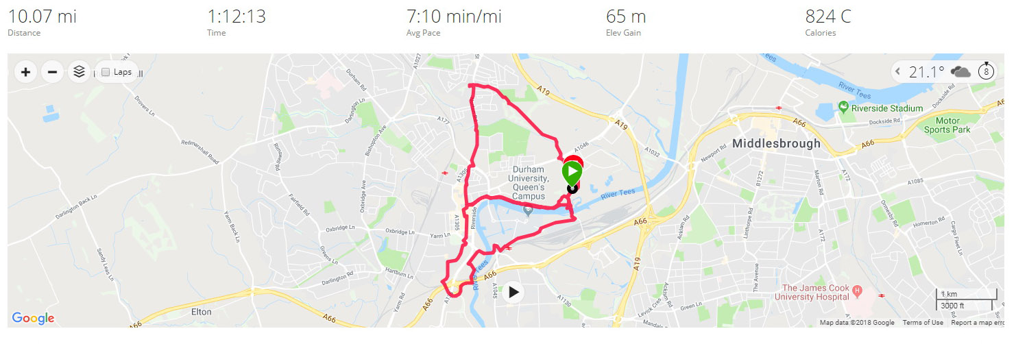
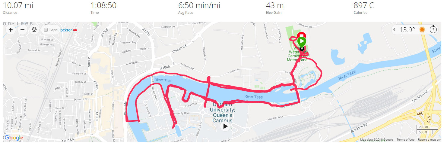
A note about the data used for the reports of the runs: the mile splits in the written reports, distances, times of runs and Strava segments come from Strava. The Split Summary at the bottom of each day’s run and the Leg Summary comes from FetchEveryone, with the exception of the Total Ascent, which comes from Garmin Connect with, in most instances, the elevation corrected as the altimeter/barometer on the Garmin Forerunner 935 leaves a little to be desired.
Leg One – Stockton-on-Tees
The Water Sports Centre
Stockton is a market town on the River Tees with a population of 105,000 and closely neighbours the better known Middlesborough.
The Tees Barrage
Staying at the Tees Barrage Caravan Site we were impressed by the water sports centre.
The Water Sports Centre
We also thoroughly enjoyed the Stockton International Riverside Festival which, by pure coincidence, began the day we arrived in Stockton.
The Stockton International Riverside Festival
Day 1 – Thursday August 2 2018 – Stockton to Middlesborough & Back
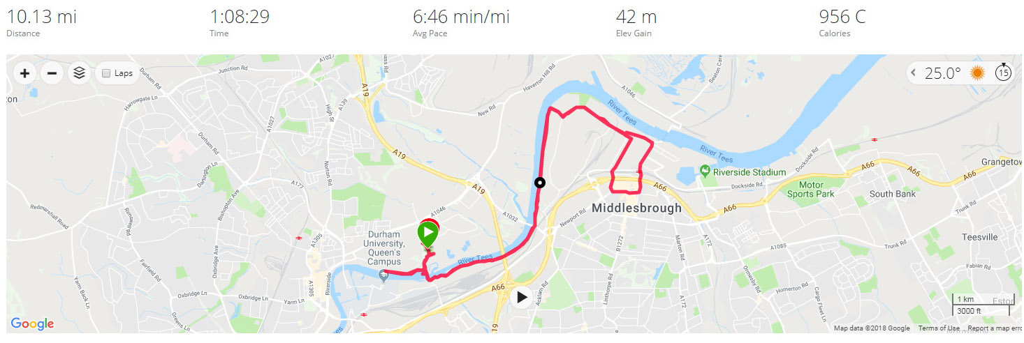
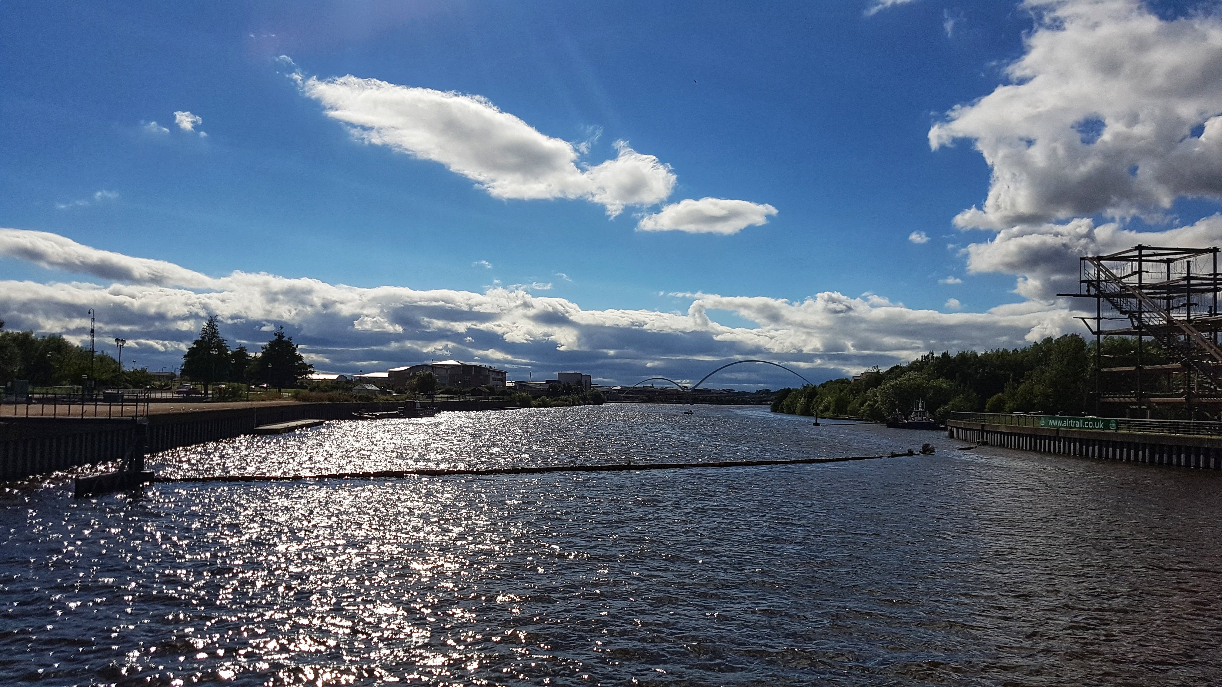
The first run of the Tour took place, not long after arriving in Stockton-on-Tees at the warmest part of the day (4pm) and what would be the warmest run of the holiday at 25C and pretty humid. The run was a simple out and back affair to Middlesborough town centre and back. I used the cycle path that runs along the River Tees for the most part. This section was quite enjoyable – the bit through some industrial zone in and around Vulcan Street was less pleasant with some reminders that this is not the most affluent area in the country.
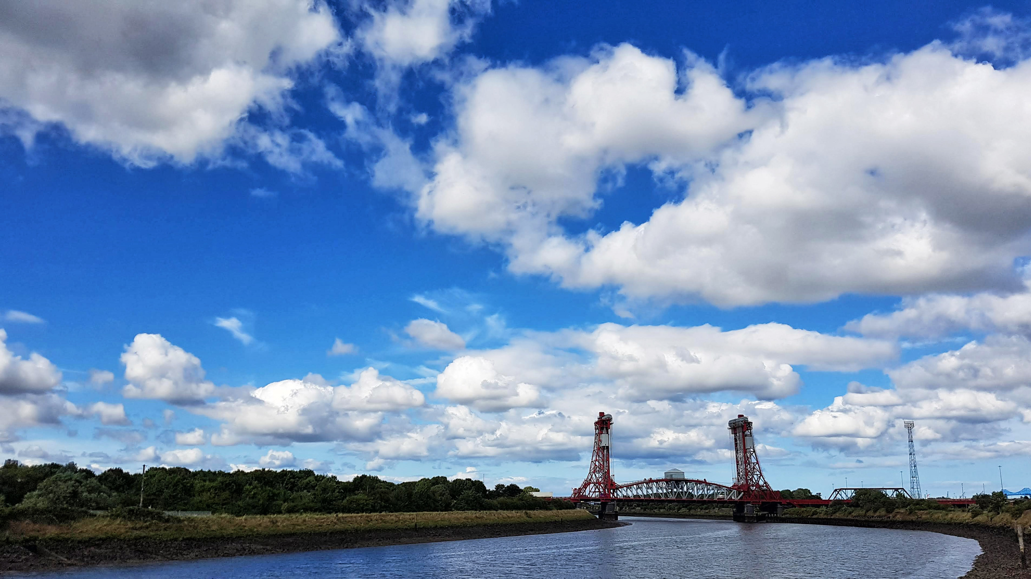
A Bridge on the River Tees
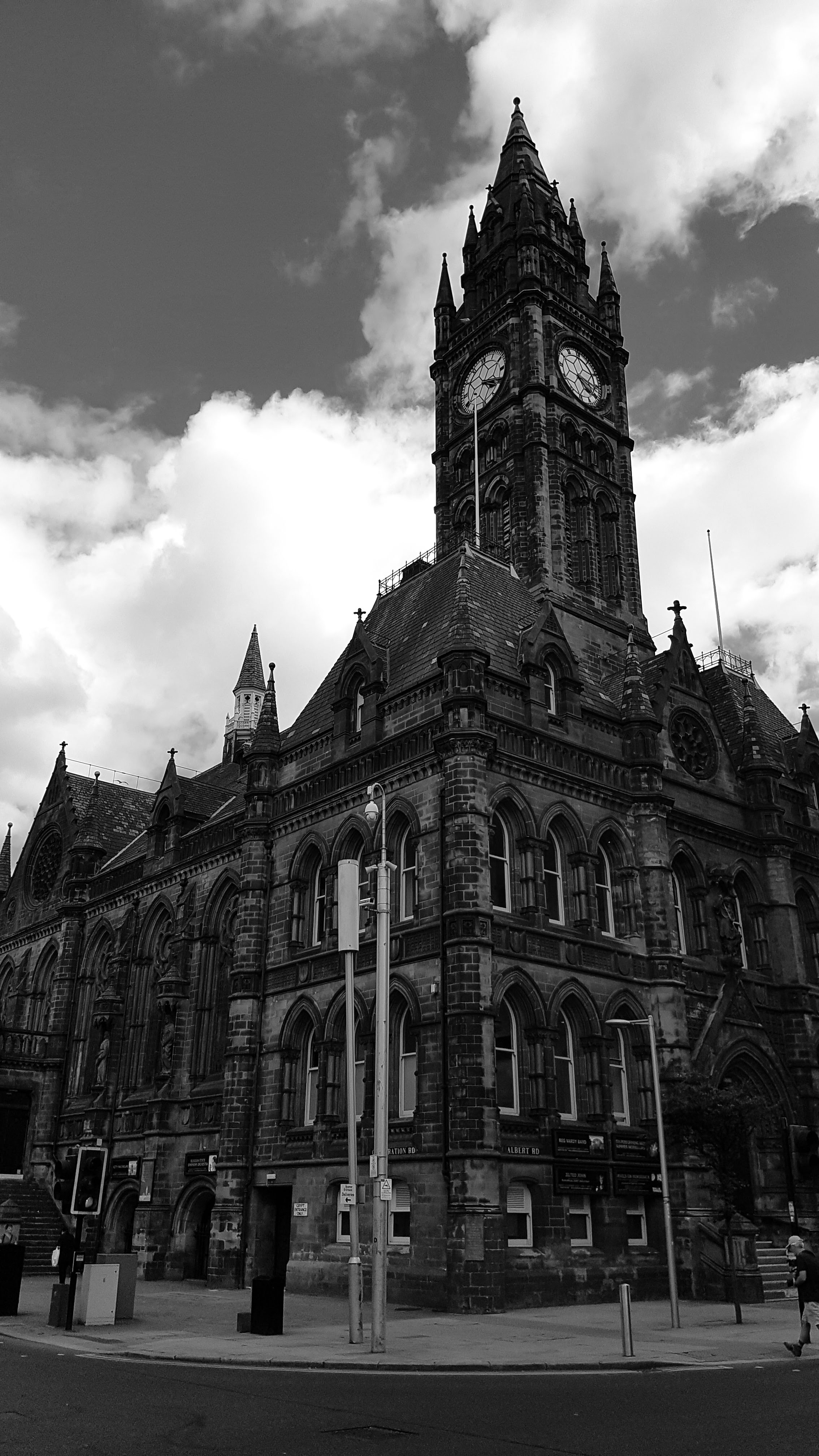
Once in Middlesborough I looked for some decent buildings to take a photo of. This proved a bit of a struggle and I resorted to black and white to make things look a bit more impressive.
Middlesborough Town Centre
A struggle too was the actual run itself. I’d left Grantham feeling sub-par with some mild virus which affected me badly on a cycling TT just two days earlier. Added to that the right Achilles was grumbling and not enjoying the warm weather – plus I picked up some weird sharp pain in the left foot at just after halfway which led to me removing trainers and socks expecting to find a thorn or something equally sharp, but finding nothing. The pain soon went and did not return.
View from Stockton Tees Barrage Bridge
All that said, 10 miles at 6:46 pace was a solid start to the campaign.
Best Strava Segment Performance: Forty Foot Teesaurus – 24th/334
Day 2 – Friday 3 August 2018 – Stockton Loops
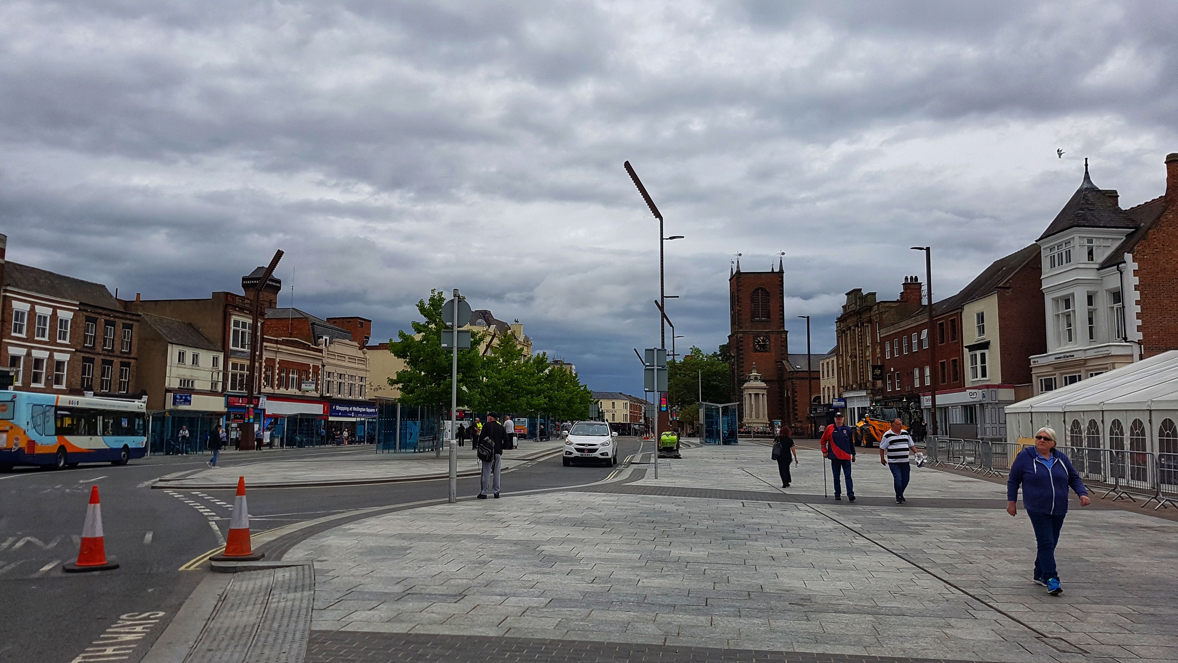
Not beginning the run until 11am meant that I was unable to use the Caravan site toilets (They were closed for cleaning) which meant the first couple of miles was spent trying to find a public convenience, which I eventually found in the Stockton Shopping Centre.
Stockton Town Centre, looking for toilets.
Once that had been sorted the rest of the run was trying to explore Stockton without resorting to an out and back effort. The town centre was all geared up for its Riverside Festival (Which we enjoyed the following day). The first half saw me try to follow the River Tees unsuccessfully, making my way through the Durham University Campus and back to the Tees Barrage where I was staying.
A Cycle Path on the Second Loop, close to a prison apparently.
The second half had me following a Cycle Path around the back of the Caravan Site. This proved fruitful literally in the discovery of a bounty of early ripened blackberries which the kids returned to later that day to harvest. This path went past the Asda I had spent ages trying to find by car the day before (It was around half a mile away if you walked, rather than drove, which was nearer 3-4 miles). It then went over some barren land around the back of the prison with a path which looked like it served some other purpose years ago.
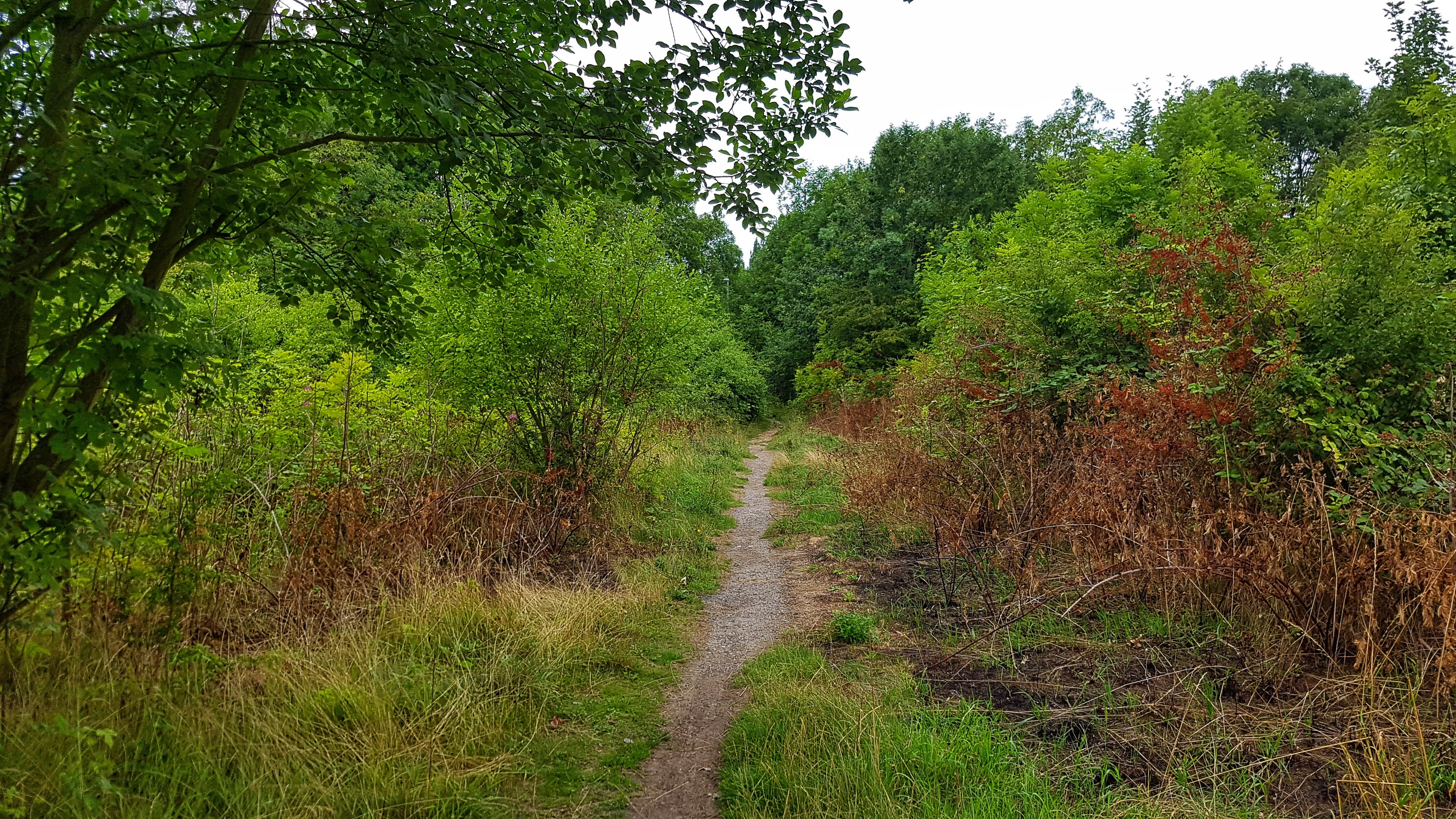
A Foot Path on the Second Loop
The cycle path briefly degenerated to a footpath before once again becoming a fully fledged cycle path. I could have followed this for ages but with over 10K covered I opted to head back into town on a main road before returning again on the Tees cycle path and back to the caravan park with a loop or two of the site to bring myself over 10 Miles.
As with Day One I was still feeling a little sub-par with the right Achilles hurting a fair amount. Some hamstring stretching appeared to be helping though. The photos too were struggling for inspiration…
Best Strava Segment Performance: Dubliners to Barrage – 11th/115
Day 3 – Saturday 4th August 2018 – Tees Barrage parkrun
It took a lot of convincing that it was a genuine coincidence that the first caravan site of the holiday was literally less than 400 meters from the start of Tees Barrage parkrun. I only caught wind of it a few weeks before the holiday, but was unsure of the route. It was only when I arrived in Stockton that I guessed this would not be your typical parkrun as none of it actually takes place in a park.
Setting off at 8am, an hour before the start, the first mile or so had me wondering whether I’d be able to complete the 5K course – the legs felt dreadful! It took at least three miles before the legs felt anywhere near half decent and even by the time I’d run 5.5 miles (Mostly covering sections that I thought were on the course) I held little hope for a respectable performance.
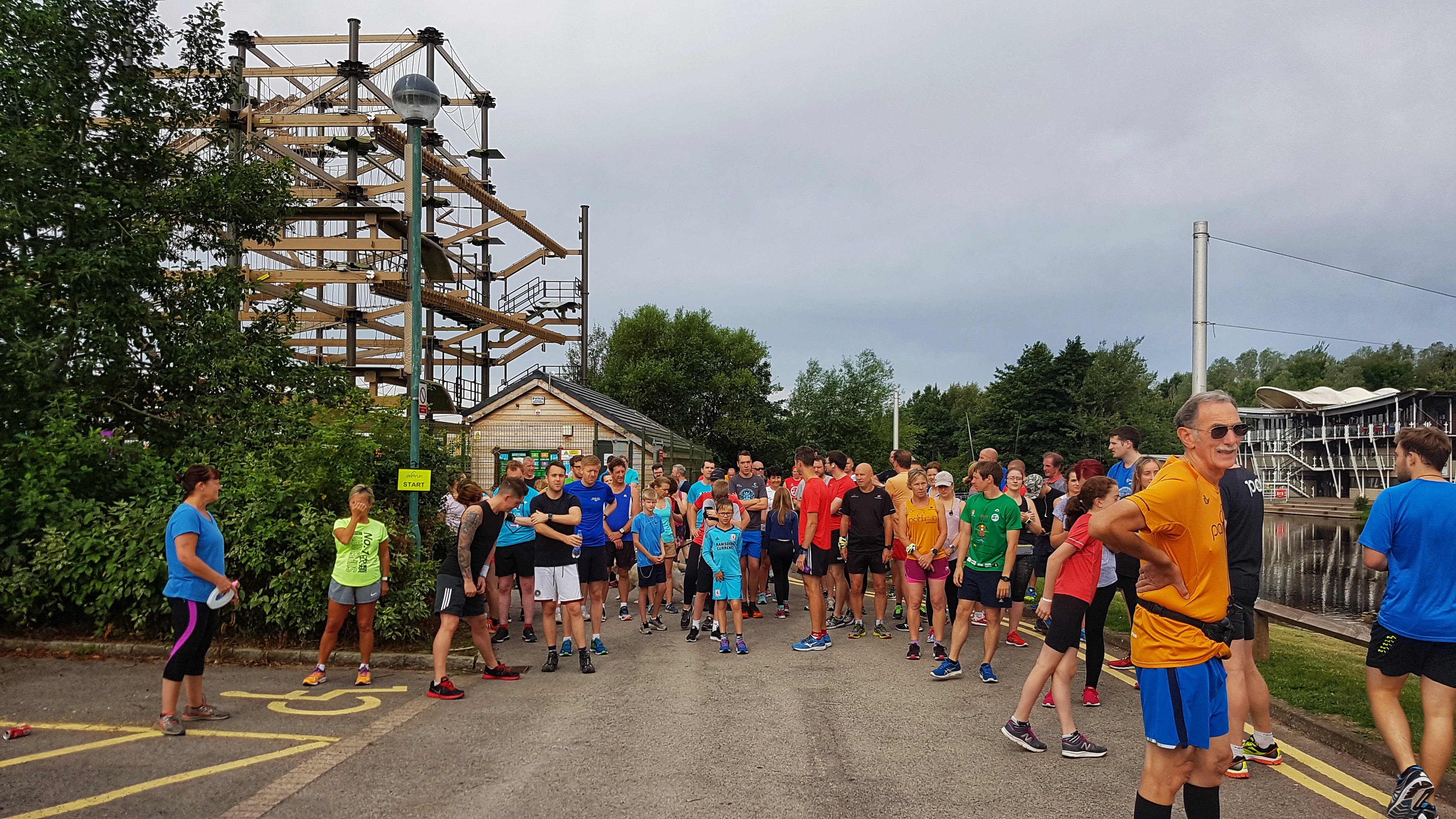
Pre parkrun at the start line five minutes before the off.
The pre-run guide to first timers was the best I’ve experienced so far at a parkrun – they had printed a large laminated map of the course and told me, as someone hoping to run around 18 minutes, to take a good look at it! I tried as best as possible to memorise it, but wasn’t totally convinced I knew where to go.
When the traditional question of whether any tourists were taking part, by coincidence I was stood next to a pair of runners who came for Holme Pierrepont Running Club, which is based in Nottingham – the closest city to Grantham. Talking to them further after the run, if this wasn’t coincidence enough it transpired they had taken part in the Belton House parkrun the week before and had spotted me running to the start of that parkrun along the A607. They also pointed out that I was wearing the same 2017 London Marathon finishers’ T-Shirt as I did at Belton House. They also noted that I finished first at Belton House. Would I repeat the feat 105 miles or so further North?
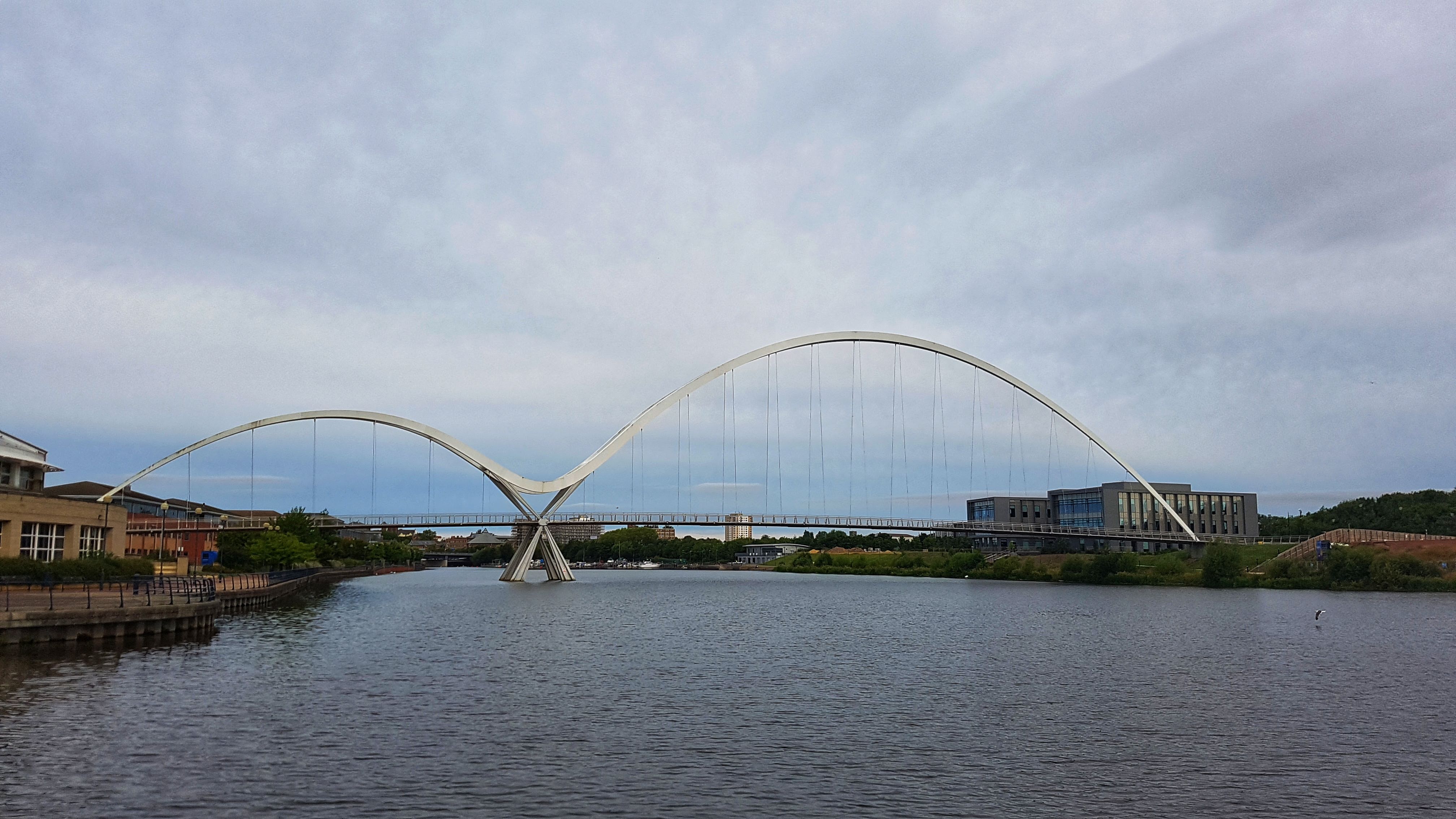
The Millennium Bridge – which we only covered once, thankfully!
I made my usual fairly cautious parkrun start, that is to say I didn’t set off at a pace I couldn’t sustain. After 200 meters or so I found my legs were working quite well all of a sudden and I soon eased to the lead, eking out a 20 meter gap as we headed to the Millennium Bridge. As I’m really not a fan of bridges over water, especially when on foot or on bike, I went a bit more conservatively than those behind me and I was caught by a small group which soon became a group of myself and one other runner. We were running relatively swiftly, enough to ease ahead of the following pack, and as I wasn’t totally sure where I was running, I decided to stick on his shoulder and let him, for the most part, lead the way, only moving ahead when I felt the pace was slowing too much.
The canal section of the parkrun course (this photo wasn’t used on Strava).
As the course traversed canal paths, bridges and rivers, it soon become apparent why this is not a particularly quick parkrun course. Despite being pretty flat there are numerous sharp 180 degree turns and a fair number of steps to be climbed too. I’d overheard a runner at the start saying that once we’d crossed the third bridge it was a mile to the finish and mostly free of any twists and turns. I took this as an opportunity to put the hammer down and picked up the pace. If you believe the Strava segment I ran the final mile and a bit at 5:06 pace, which I find surprising, but could explain why I pulled out 24 seconds on second placed James by the finish, which came all of a sudden and a bit sooner than expected!
The finish of the parkrun.
18:11 was a pleasing time given how bad the legs felt when I first started running, and has me 24th all time currently at the time of writing. After a good chat with the Holme Pirerrpont runners it was merely a case of an easy 1.5 miles warm down and a couple more loops of the Caravan Park to take the mileage just over the 10 miles.
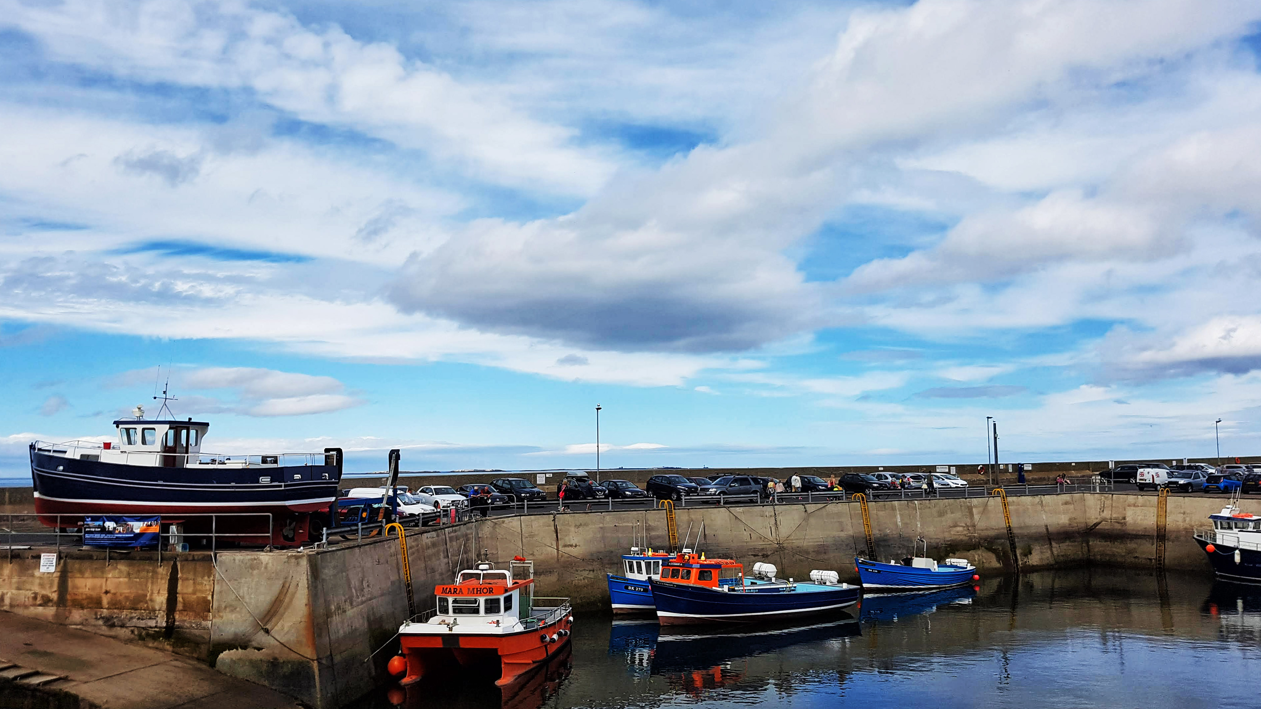
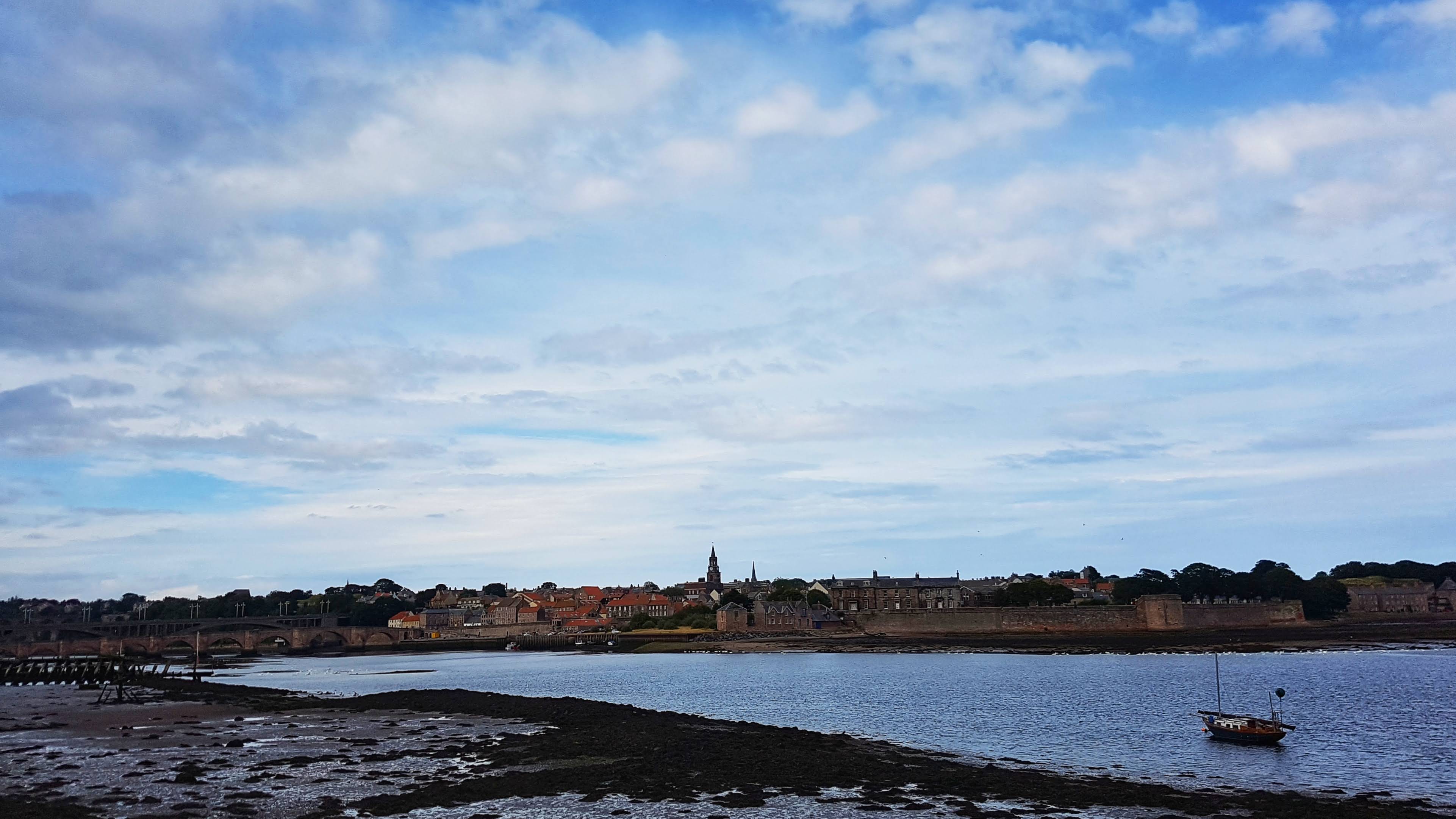
Berwick-upon-Tweed is the northernmost town in England, so close to the border with Scotland that it has changed country allegiance on more than one occasion (The football team plays in the Scottish Second Division) and has been fortified to protect itself from attack over the generations.
Spittal taken from the Caravan Park.
Famous for its castle, its walls and its impressive railway bridge, we didn’t actually spend any time in Berwick itself, staying at the Caravan Site in the town of Spittal (across the Tweed from Berwick).
Seahouses harbour.
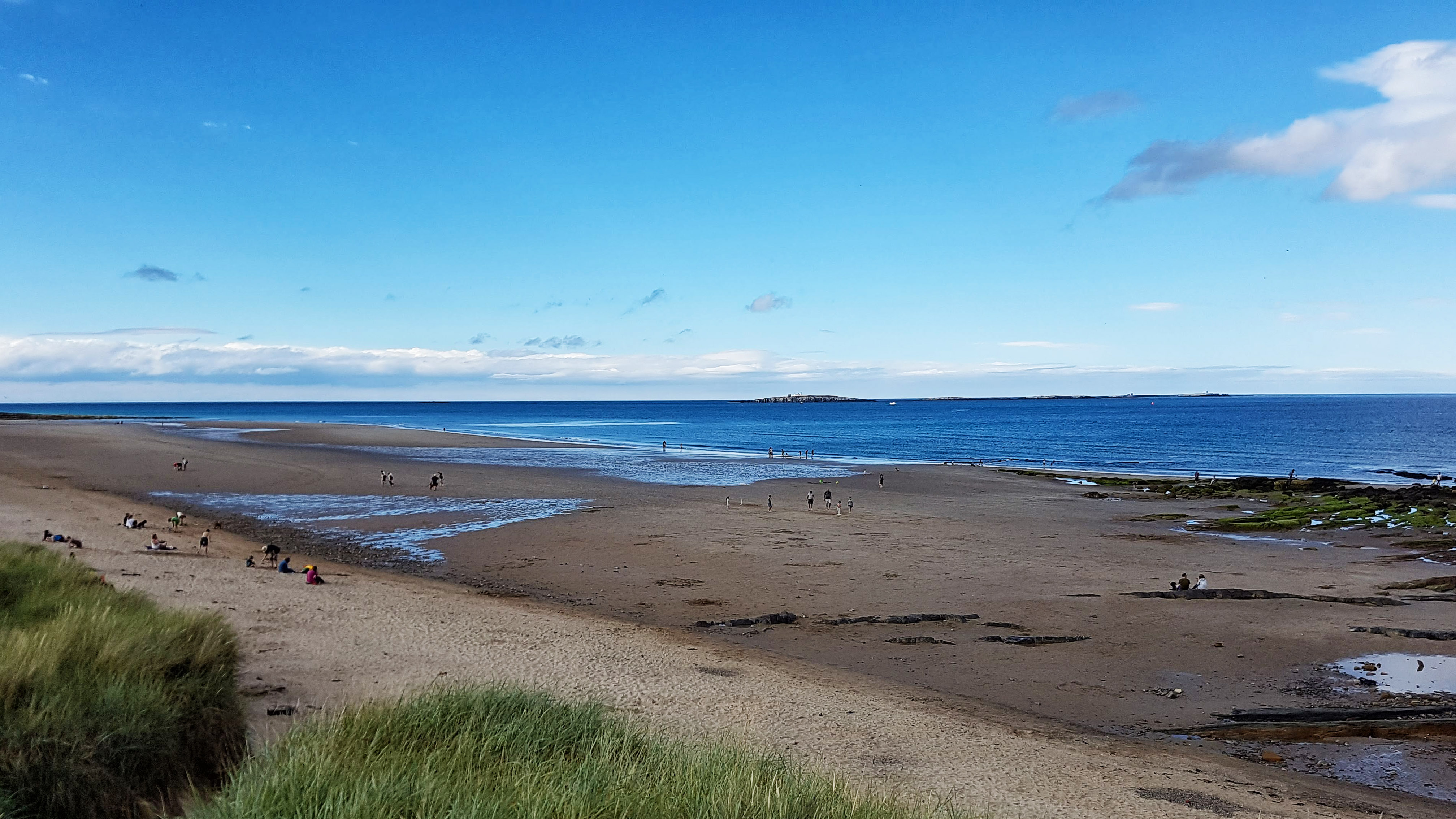
We spent our leisure time south of Berwick itself, enjoying the famous Barter Book Shop in Alnwick, the beach at Seahouses and the Holy Island of Lindisfarne.
The multiple benches configuration at Seahouses harbour.
Having stayed near Alnwick on our previous visit we passed on the opportunity to revisit the impressive Alnwick and Bamburgh Castles.
Seahouses beach.
Day 4 – Sunday 5th August 2018 – Exploring Berwick
Spittal Beach
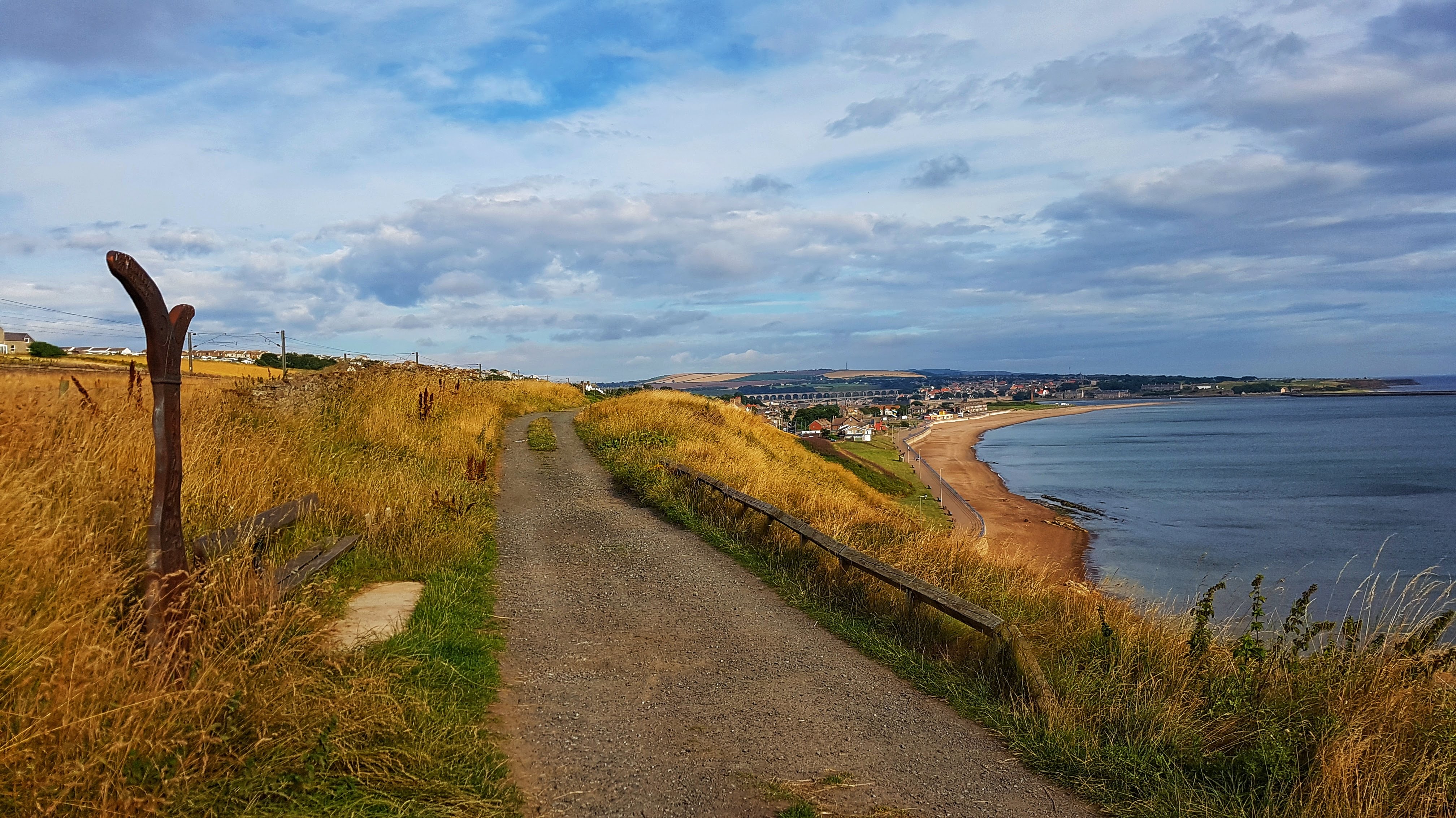
Sunday morning saw us travel north along the A1 to Berwick-upon-Tweed, which is just about as far north as you can get in England before entering Scotland. I expected a tough run on tired legs but, surprisingly, I felt pretty fresh and blissfully free of Achilles pain after a calf stretch on some railings early in the run at Spittal promenade.
Berwick-on Tweed – inspired by Lowry.
I headed to the historic town of Berwick, stopping frequently to take photos, some of which inspired (poorly) by the work of Lowry, who apparently loved the place and painted numerous scenes around the town.
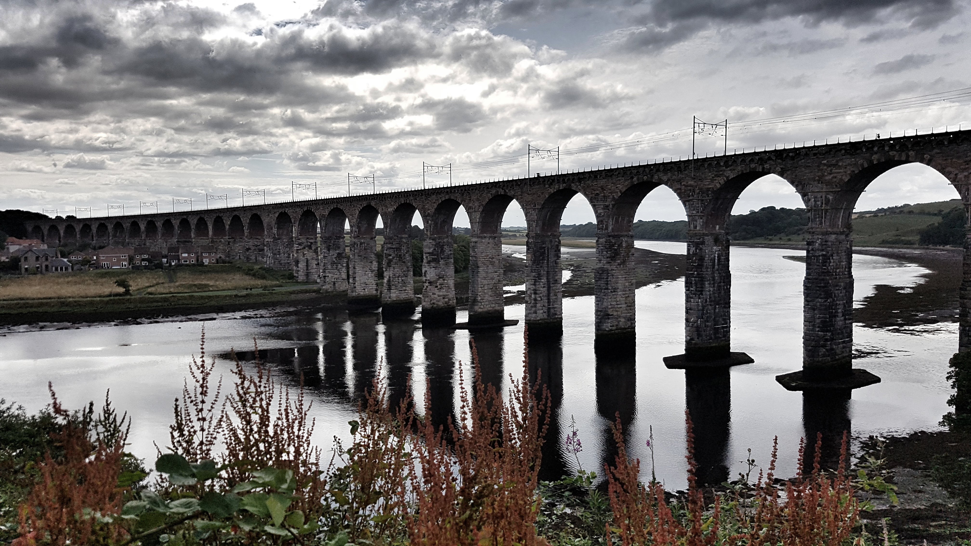
The Royal Border Bridge
I found the viewpoint for the spectacular River Border Bridge, which carries the same trains that run through Grantham, albeit more grandly than the all too low bridges that are the curse of Grantham lorry drivers. From there I found a shared cycle path (Route 1 if I remember correctly – a favourite from my 2016 holiday, which runs from Dover to Shetland) and headed along the riverside for a mile or so before heading on more dedicated cycle lanes which brought me tantalisingly close to, but not quite at, the Scottish border.
At the top of the main climb for the day I checked Google Maps in the hope of making a loop of the run rather than an out and back. There were a couple of options but as they included running alongside the A1 I decided to play it safe and returned the way I came to Berwick. Feeling good I picked up the pace quite a bit back along the river path where I felt sure there would be a Strava segment to contest. To my disappointment there wasn’t, but I made a mental note that this would be one of many segments that I would have to create when I returned home and had access to a computer (And some decent internet). Alas I was only 4th.
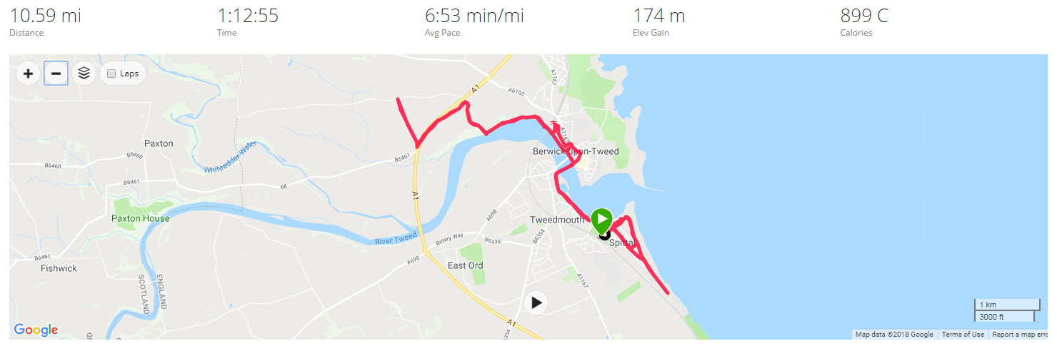
From there it was a continued tempo effort back to the Spittal promenade and along that for a segment attempt (This did have an existing segment – only 9th best for me) before returning back to the caravan site – 10.6 miles bagged.
Best Strava Segment Performance: Just a Climb – 1st/7*
* A segment I created.
Day 5 – Monday 6 August 2018 – Cows and Cliffs
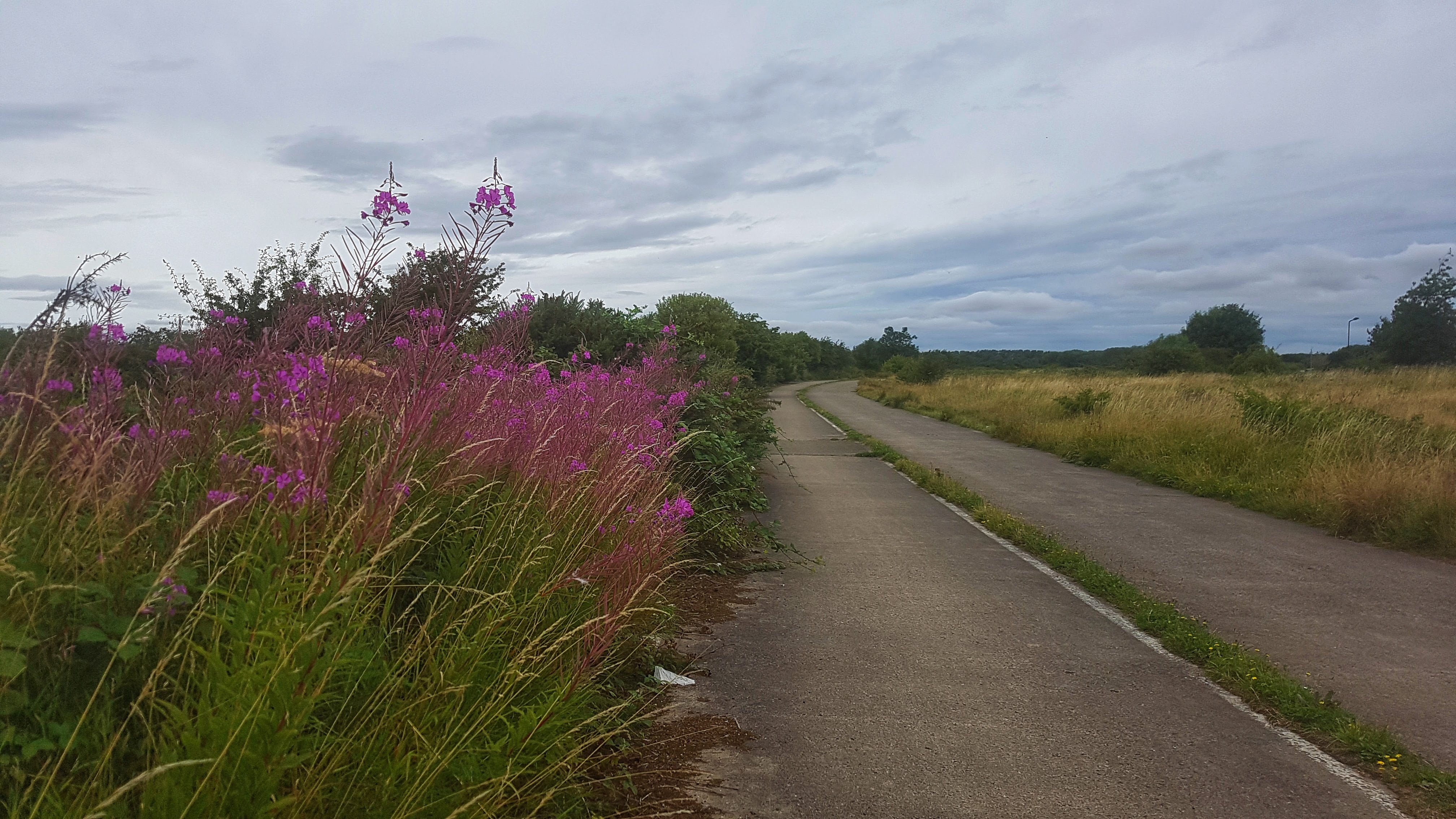
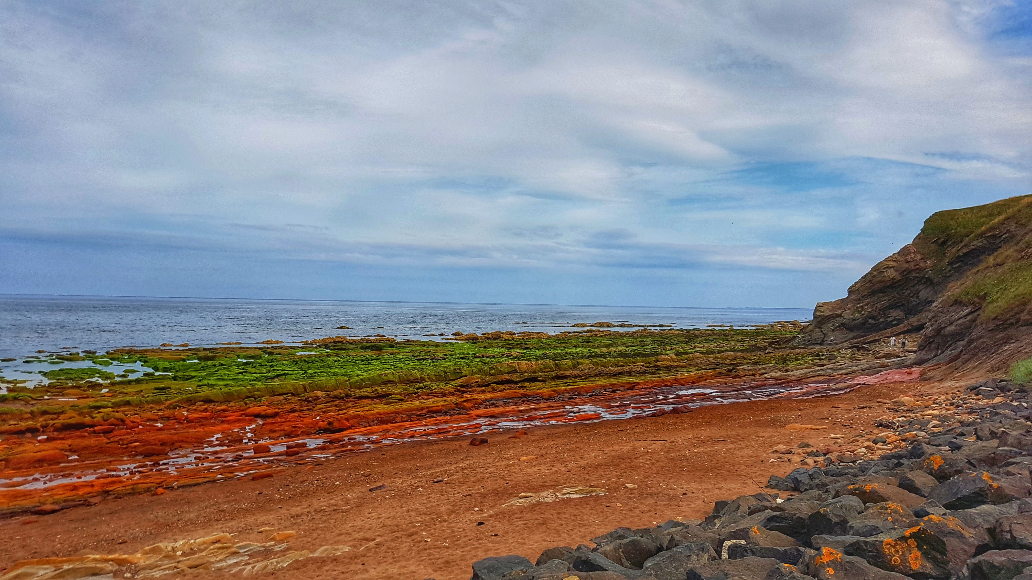
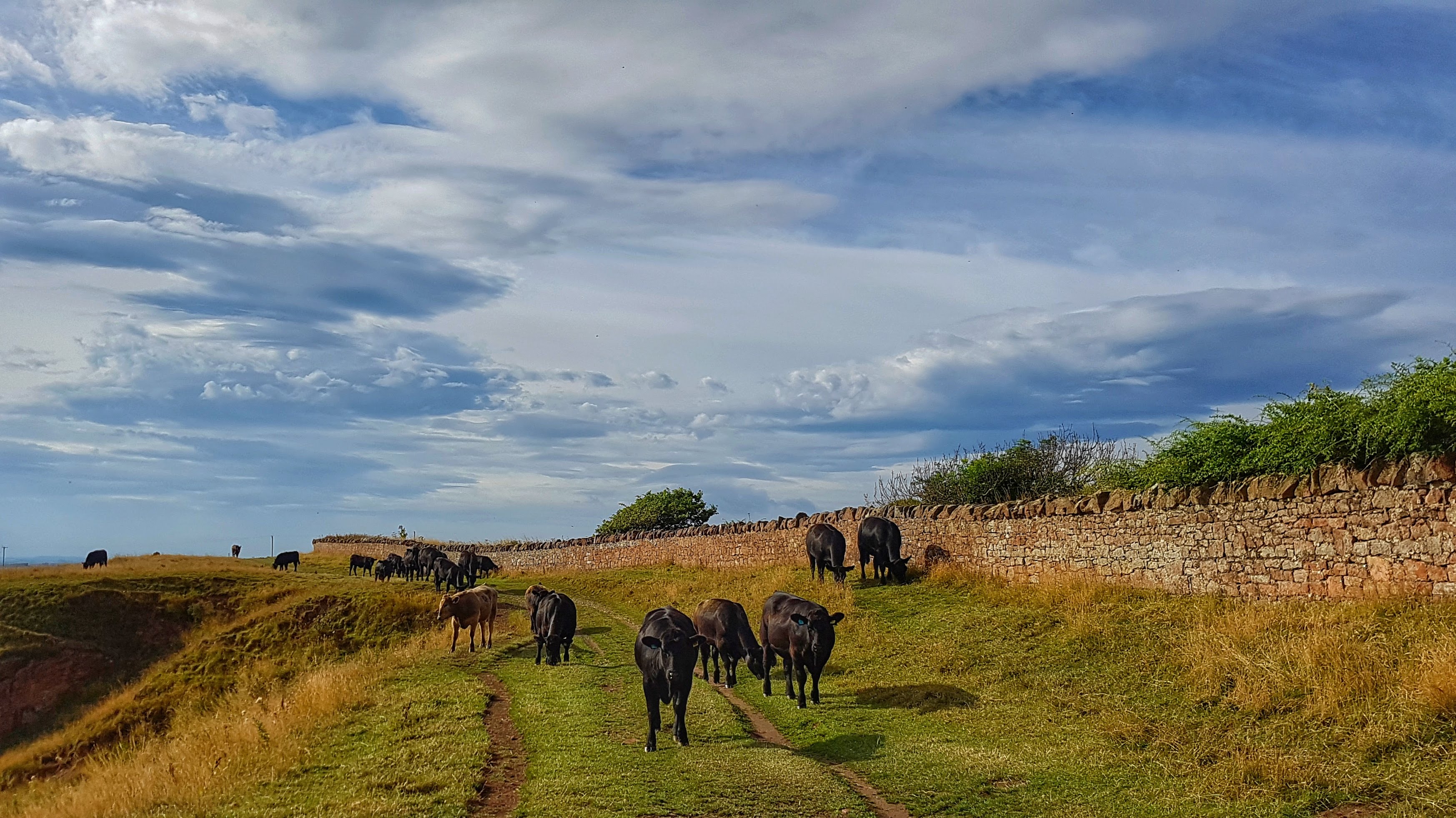
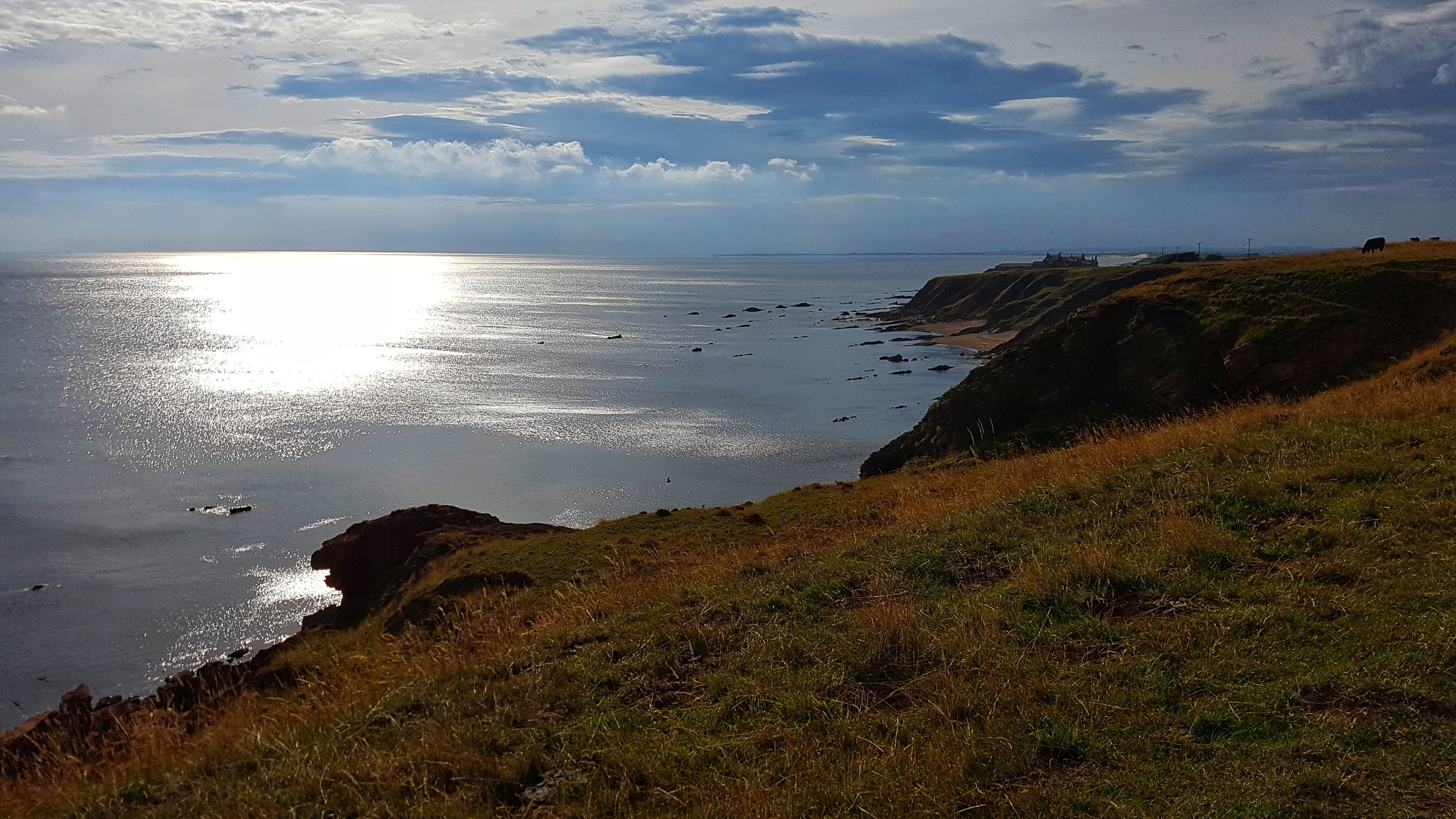
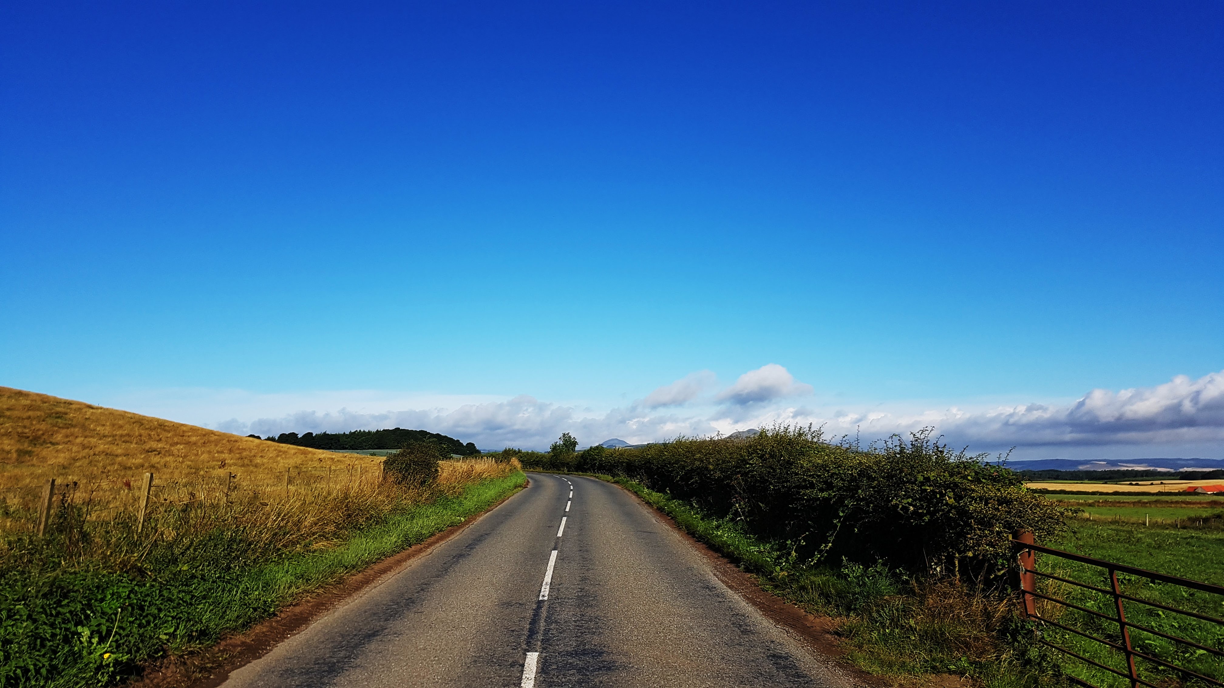
I’d spotted on Sunday’s run that Cycle Path Route 1 continued its way past Spittal promenade and along the coast southwards. On Monday morning I decided to run along this path on a straightforward out and back – making it just past the small village of Cheswick before turning around and returning.
The cycle path looking to Spittal.
As it was a cycle path – off road in parts, the terrain was never particularly demanding and not at all technical, which made for a pleasant, mostly trouble free run, where the emphasis was on recovering from the hard efforts of the previous two days. The coast line was at times stunning, other times obscured by the grass in the dunes of Cheswick Sands. I thankfully had a side wind for the entirety of the run – when I met it briefly head on near the turnaround point, it certainly did its best to stop me in its tracks!
Cows on the cliff!
The only drama of the run came in the form of a fairly large herd of cows who had made themselves comfortable by the cliff’s edge on the cycle path fairly early on in the run and later on when I returned. I’m not a huge fan of cows and not at my best by the edge of cliffs – so the two combined made for rather interesting moments as I briefly stopped the Garmin and walked through the herd as unobtrusively as possible. Thankfully the cows seemed largely disinterested in me and more concerned with gorging themselves on the grass, and I was able to continue on my run, which ended just as the Garmin accumulated 10 miles entering the Caravan Park. I was disappointed to see there were no meaningful Strava Segments created so, once again, a note was made to, at a later point, create some of my own.
Best Strava Segment Performance: Quiet beaches to be found* – 4th/87
* A segment I created.
Day 6 – Tuesday 7 August 2018 – A Bit of Everything in Berwick-upon-Tweed
A Lowry Rip Off!
On a very overcast morning for the last run in Berwick, I was in the mood for exploring! Back it was into Berwick, running along the castle wall and ramparts; mimicking the work of Lowry and generally trying to see as much of the town as possible.
Cliffs In Berwick – a bit too much for me!
This exploration took me on a path around the back of the golf course and a holiday path. This was all well and good and I opted at a footpath junction to try and head to Marshall Meadows Bay. The path became increasingly technical, increasingly narrow and increasingly closer to the cliff’s edge. This was the explanation behind the slowest mile of the holiday at 10:09! – It wasn’t long before I abandoned this increasingly perilous idea and returned to the safety of the A1167 and the less scenic, but more comforting sights of a McDonalds drive thru and a Morrisions. This slow mile and the stop-start affair of the opening miles meant that this would be the slowest run, on average, of the Tour at 7:41 per mile.
Returning to Spittal it was clear I had to make up some miles to get to and beyond 10. So it was then a climb up the old A1, down Cow Road, over a Level Crossing, back through Spittal and a lap and an extension of the Caravan Park to bring it home in a smidge over 10 miles.
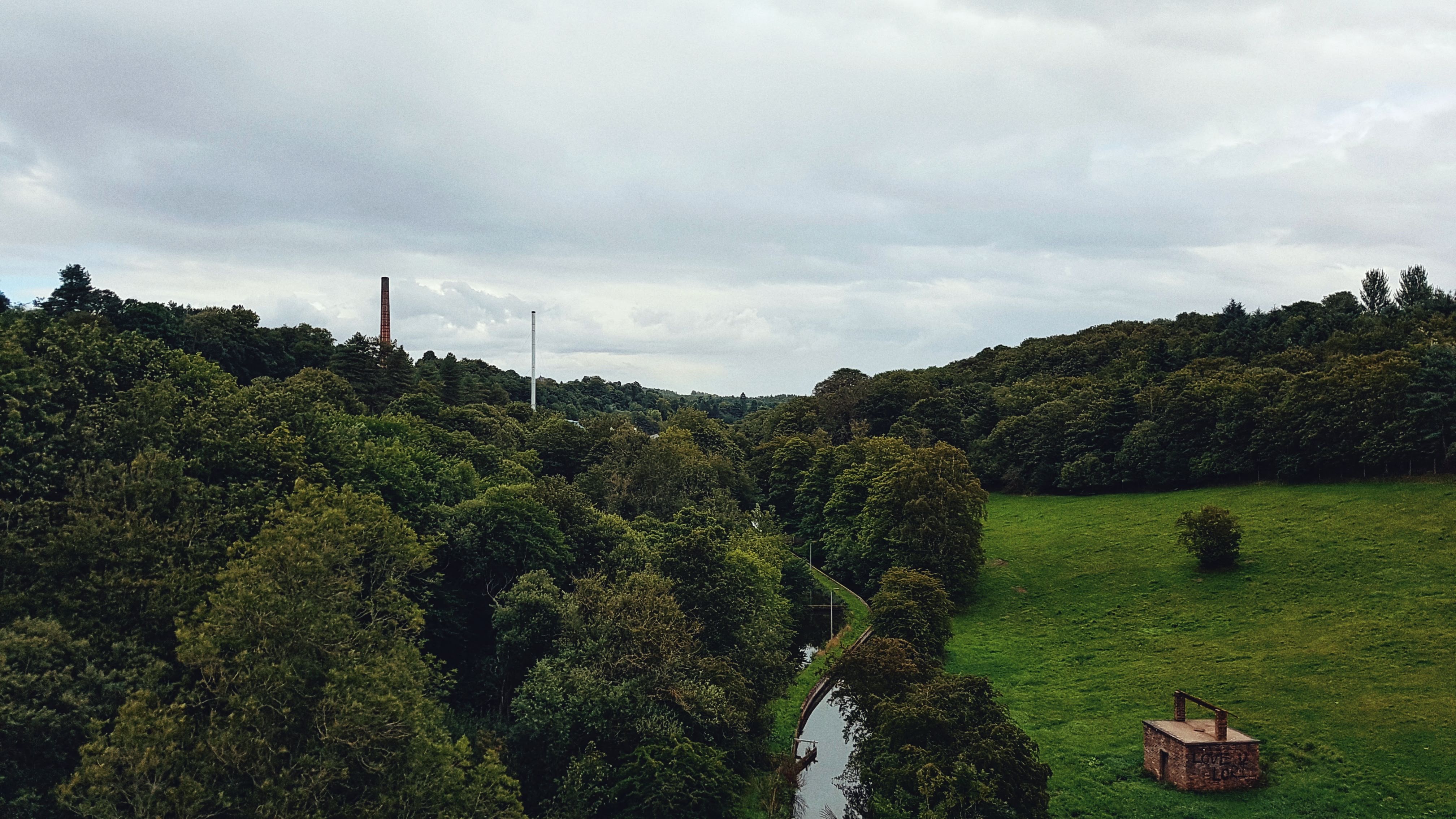
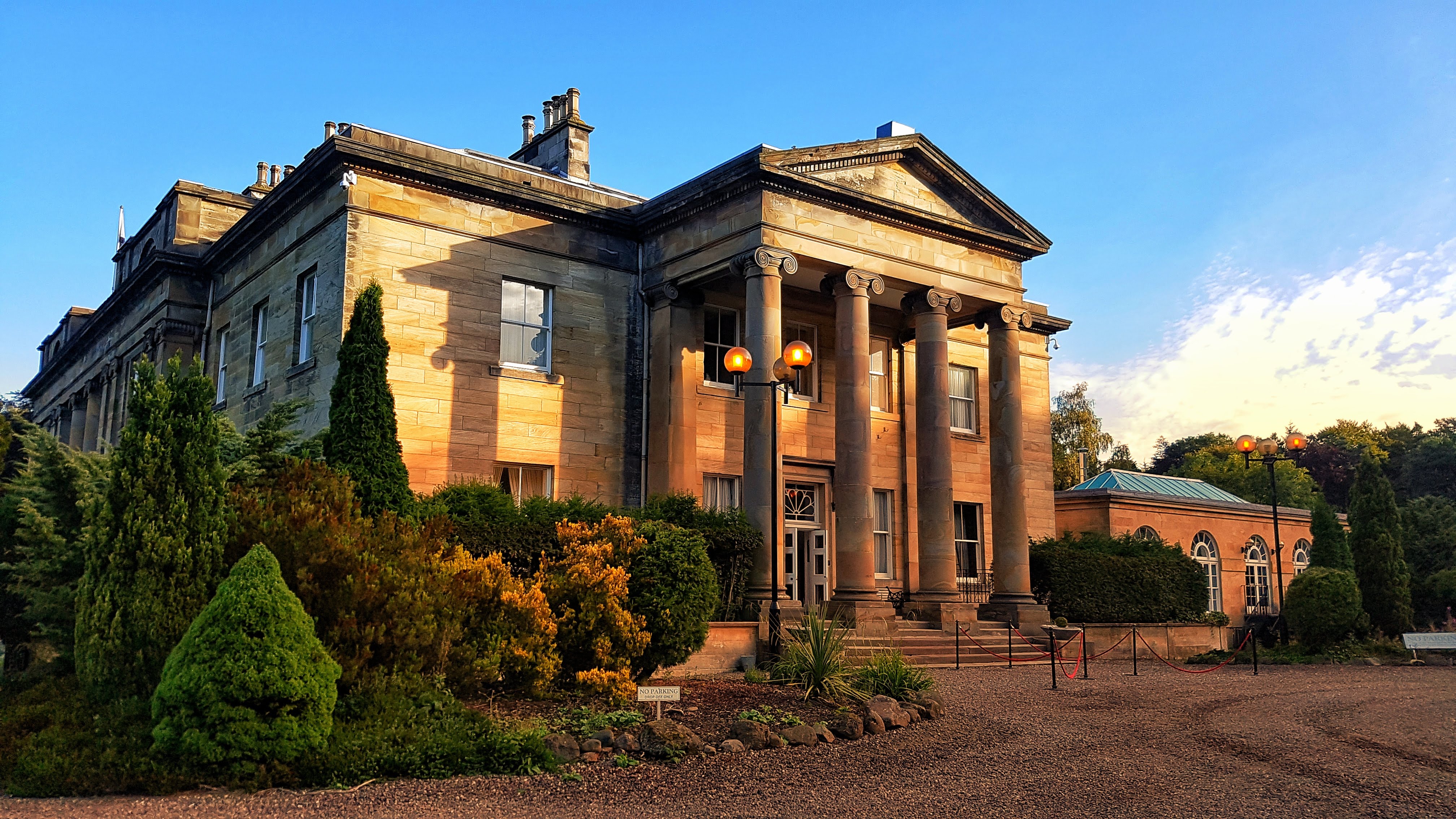
Markinch is a small town in Fife, Scotland, with a population of around 2,500 and lies to the east of the administrative centre of Fife – Glenrothes. It’s history is apparently much unknown, but relics of its past are said to date back to around 3000 BC.
Lomond Hills Regional Park.Edinburgh with the throngs heading to the Festival.
Thanks to its train connections we were able to enjoy the Edinburgh Fringe Festival and with a short car journey the following day the Lomond Hills Regional Park – where the rain well and truly hit us and would plague us for much of the remainder of the holiday!
More of Edinburgh.
The Balbirnie Golf Course, where we stayed next to in its Caravan Park, provided traffic free running with its well signposted network of footpaths.
Lomond Hills Regional Park.
Day 7 – Wednesday 8th August 2018 – If You’re Fond of Bike Lanes and Rainy Air….
The route for my first run in Markinch came about by the need to check out where the train station was for our planned visit to the Edinburgh Fringe Festival the following day.
One of many cycle paths in Glenrothes.
Once there I noted a bike path that looked interesting and so I followed it. That was around a mile and bought me out in a modern housing estate where not long after it split into two further cycle paths and then two more. I had choices on which one to take and so I chose the one that said Leslie – for no other reason than it was marked as being around 3 miles away which would be perfect for a 10 mile out and back run.
Another cycle path in Glenrothes – it even has a proper junction!
So what followed was not the most scenic run I’ve ever done in not the greatest weather (a bit rainy, not that warm) but what it was was a great example of a decent network of bike paths (I believe my path was a former railway line converted to become a cycle path) that kept the run blissfully traffic free.
View of the viaduct at Leslie.
Skirting to the south of Glenrothes I arrived at a large viaduct where a photo was required as I entered Leslie itself. A quick run up to the main high street and a look around before turning around and running back from whence I came. As I’ve often done on these type of runs over the years I tried to pick up the pace a bit for the return leg, suspecting there may be a Strava segment or two to target. I put particular effort into the run back to Markinch train station and was rewarded for with my first crown on an existing segment of the holiday.
Once I’d made my way back to the Caravan Park and uploaded my run to Strava it transpired that the Glenrothes area has a thriving Strava community with a plethora of segments, particularly on the cycle paths, including the semi official Boblingen Way Mile. I was tempted to return to have a proper stab at that section and others but the lure to explore other areas was too great!
Best Strava Segment Performance: Haig heave up ‘ta station – 1st/253
Day 8 – Thursday 9th August 2018 – Pre Edinburgh Festival Warm Up.
Thursday was the day earmarked for a full day of family fun at the Edinburgh Fringe Festival so Day 8 saw me having to get my sh*t together and be up an out of the caravan door as early as possible. I managed 7:40am, which by many others standard is fairly rubbish, but for me is pretty early!
Balbirnie Park Golf Club, resplendent in the ‘early’ morning light.
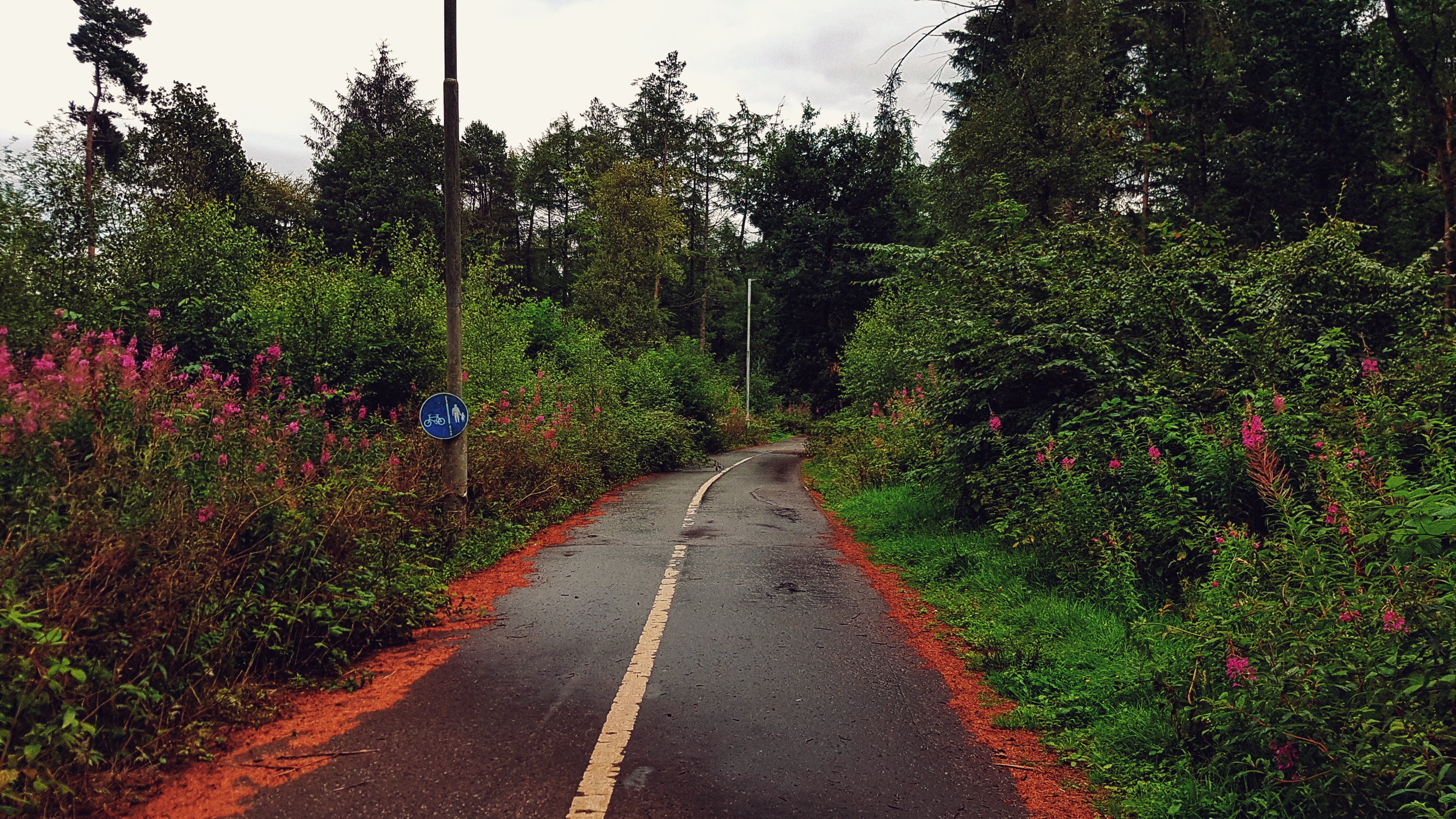
This early start meant more of a shuffle in the opening stages than usual, especially as much of the opening mile was a steady drag up the main road of the Balbirnie Golf Course grounds. Once up and out of the park I had options on where to attempt to run. The bridle paths I could see looked a touch too technical; the A92 a bit overwhelming with traffic. My options looked limited, but I saw a sign directing me to Star, which seemed an intriguing place to visit. Moreover, once I’d tackled a short stretch of Stob Cross Road I could take a left onto a road with no name marked as a cycle route, which I assumed would guarantee near traffic free seclusion.
Sadly, while I am sure this road is probably very quiet for the most part, running on it at the height of rush hour proved to be a somewhat traumatic affair. With numerous undulations, tight bends and blind spots aplenty, it was a case of trying as hard as possible to stay on the correct sight of the road to allow car drivers as much time to see me as possible. Alas on one bend I was stuck between a rock and a hard place with cars approaching from both directions and I must of given one of the drivers a bit of a scare for she chose to beep her horn for a good 5-10 seconds after she passed. All I can do is apologise for any distress concerned, but there was little I could do.
Thankfully this dangerous section only lasted a mile or so before I could take a left into the much quieter road running through Star. This village failed to live up to its grand sounding title, for while it looked pleasant enough, it was just a small village in Fife. Before long I had run through it and found myself back on the busy road a little further on.
The road from Star to Markinch – at times busier than anticipated!
Thankfully although there was more traffic than desired, including a bus and a heavy goods vehicle looking a little lost, there was no repeat of the earlier passing car dramas and I was able to make it back to the outskirts of the golf course unscathed.
I had though only covered around 6.5 miles so had to try and find another 3.5 miles to run. This involved me running back through the golf course with an unsuccessful attempt to follow the path that looped much of the Balbirnie Park grounds.
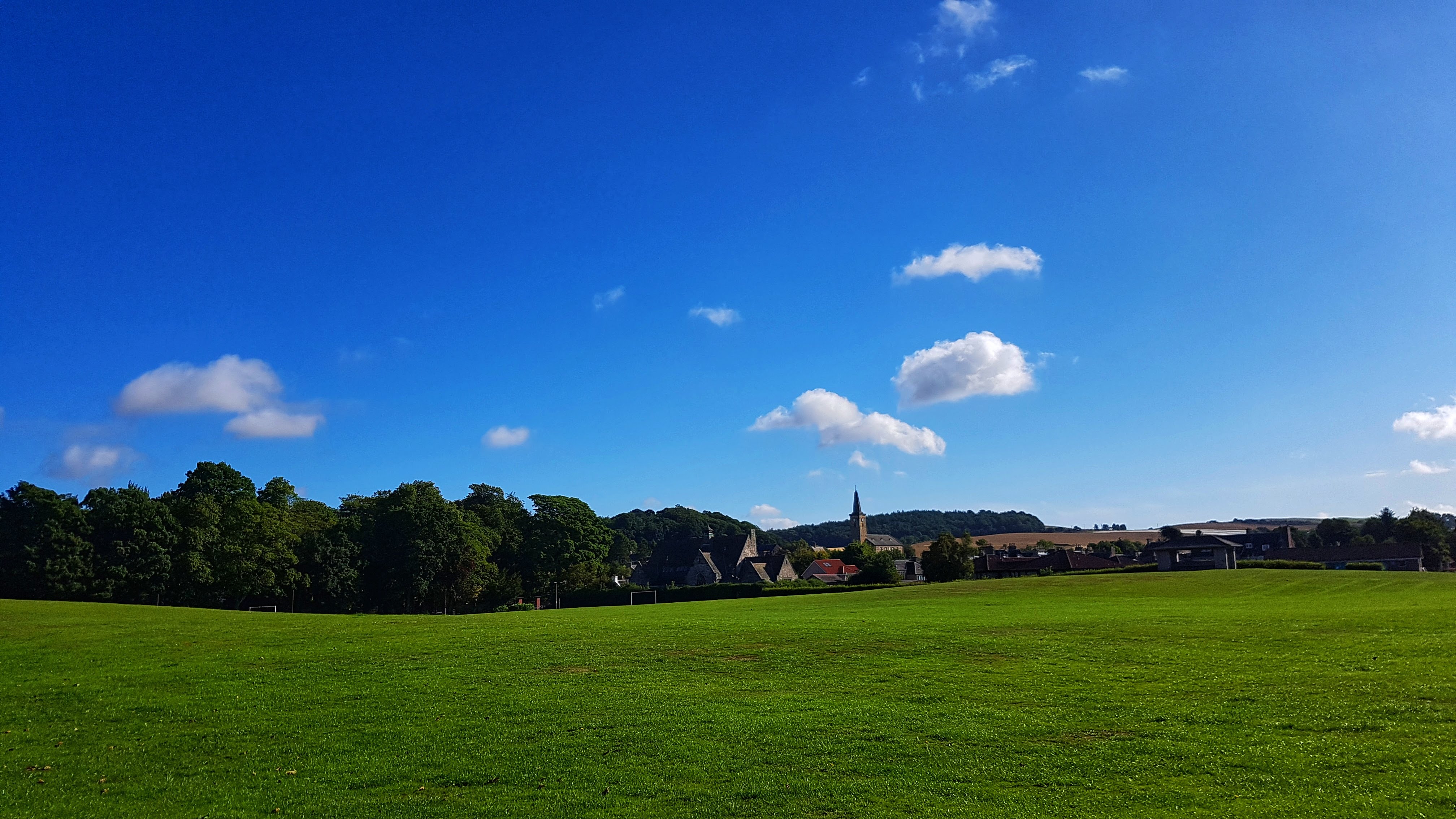
Markinch Park.
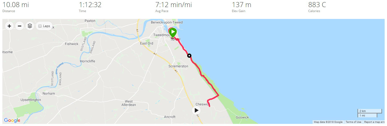
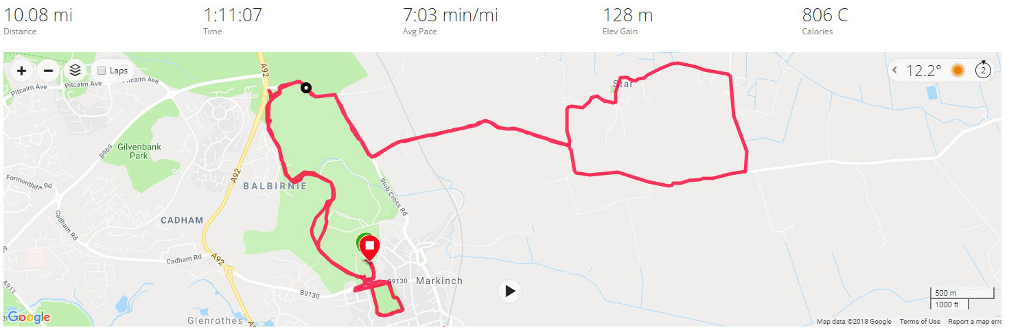
With a couple of miles still required I headed to Markinch Park which I looped twice, once reasonably quickly in the hope of grabbing any Strava segments set up. I managed to claim fourth. This was though a good day for Strava, with four first places secured on existing segments – not bad considering that for the most part it was a pretty low effort performance after the quicker efforts on the footpath the previous afternoon.
With the park run done, it was just a case of heading back to the caravan park, watching as the Garmin clocked over ten miles, stopping at 10.08, and changing quicker than a Mercedes AMG F1 pit stop to get to the train station in time for Edinburgh!
Best Strava Segment Performances: Star Escape – 1st/19; Balbirnie edge brow dual run – 1st/42; Brow Bash Blast – 1st/36; Golf drive to wall – 1st/92.
Day 9 – Friday 10th August 2018 – Cobbled together a loop with only a couple of wrong turns.
It was another relatively early start for the final run in Markinch, setting off at just after 8 am and heading again to the nearby Balbirnie Golf Club for an attempt at following the bridle path that circulates around the perimeter of the golf course.
A bridle path in Balbirnie Park Golf Club.
The first mile was pretty technical and a stop/start affair as I lost the path on several occasions and had to resort to Google Maps to work out where to run. Once the painfully slow opening mile (8:44) was out of the way the legs loosened up nicely and I settled down into running fairly comfortably under 7 minutes per mile for the remainder of the run. I had left the Golf Club accidentally after a mile and a half and soon found myself in new housing estate a cul-de-sac. This time I didn’t rely on Google Maps but my eagle eyes to spot a footpath that took me out onto the busy A92, which thankfully had a decent pavement to let me run south, skirting past Glenrothes – the town centre of which I never did get to see.
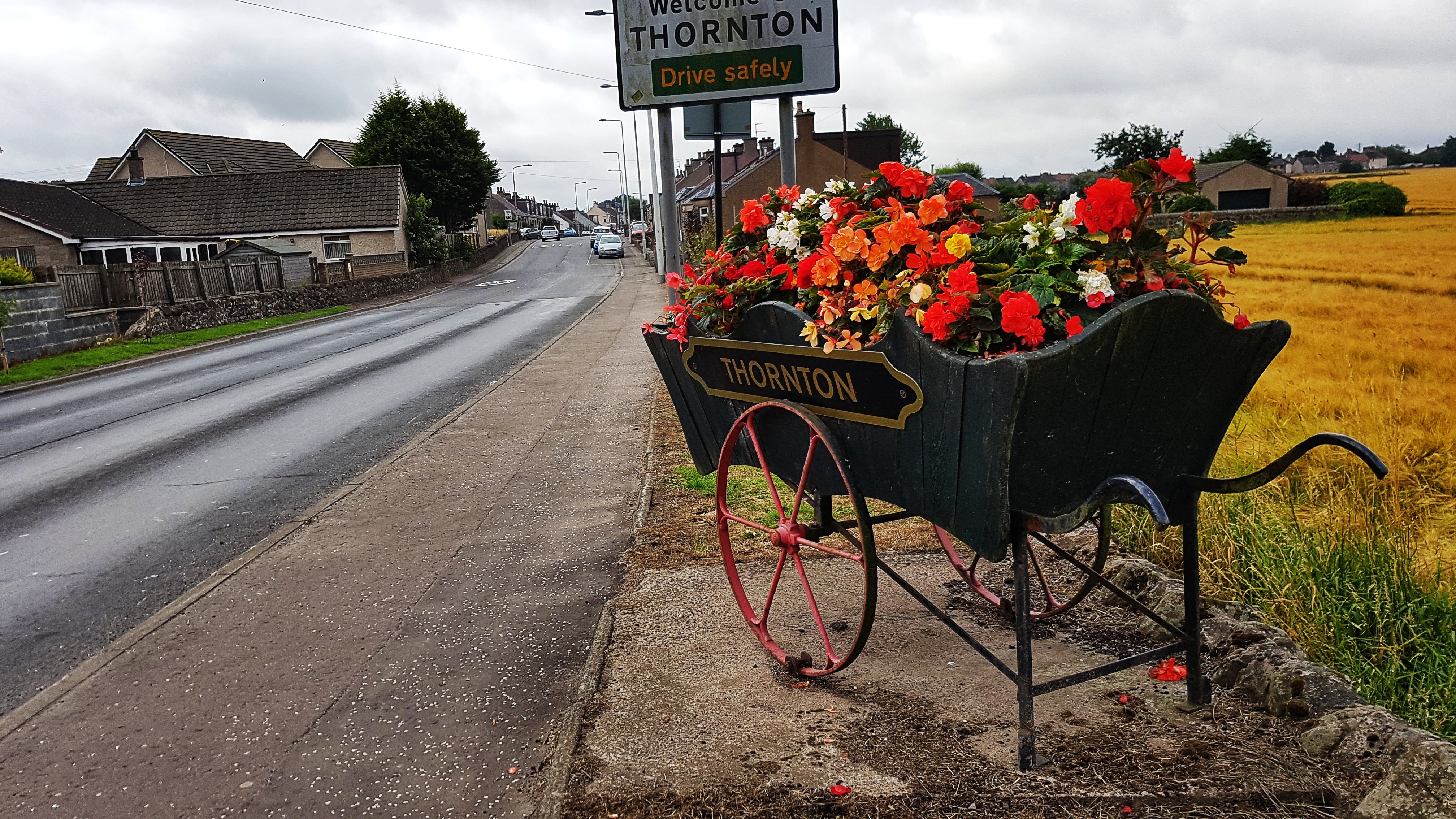
Thornton – the flower display was the highlight.
I left the A92 to hit the much quieter B9130 which took me to Thornton, a town whose flower display in a wheelbarrow above was probably its highlight. With six miles covered I was very keen to make the run a loop rather than an out and back affair and so consulted the Google Maps to try and chart a run back. A network of roads that took me north past the fantastically literal sounding Coaltown of Balgonie and back towards Markinch looked the order of the day so I headed to them.
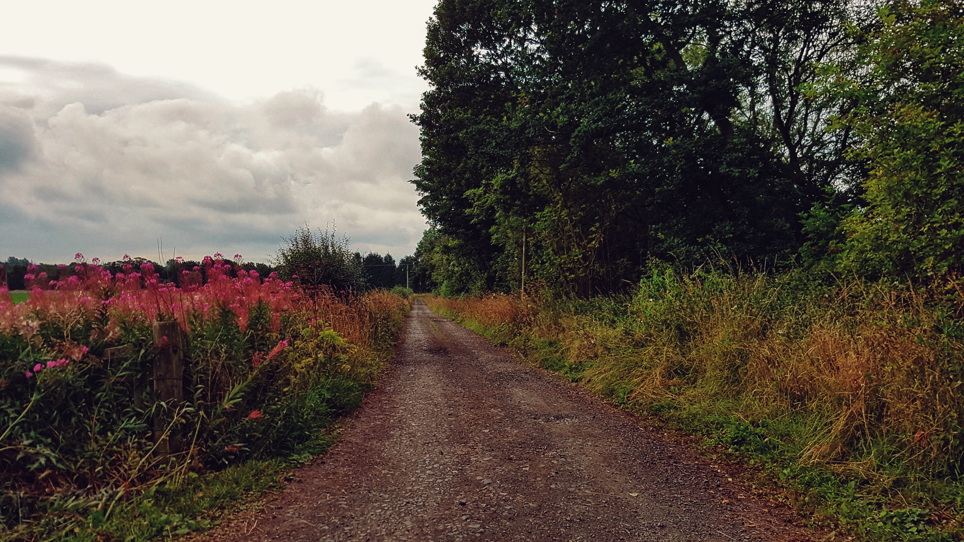
I very nearly missed these roads before I realised that they were in fact a series of gravel paths, not dissimilar to many found on a run in England, but slightly more unusual in that they clearly fed some traffic as there were quite a few houses en route.
A gravel road heading out of Thornton.
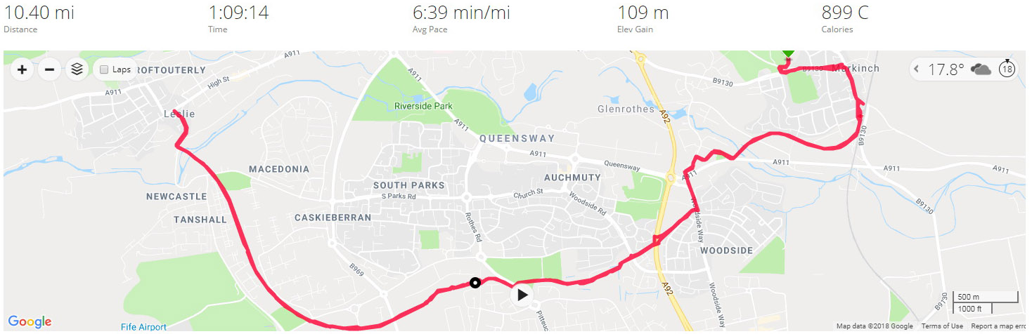
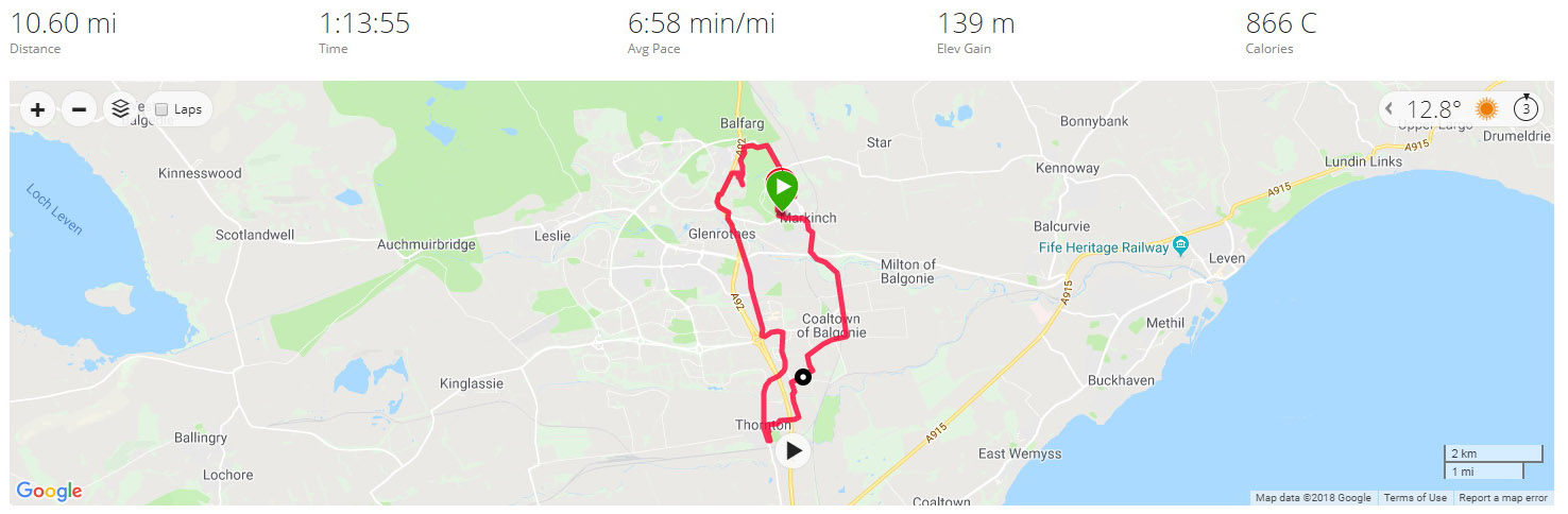
Nearly two miles later and I was back onto normal roads and a simple run back into Markinch made slightly tougher with a 2/3s mile climb averaging 3%. By the time I’d made it back to the Caravan Club I’d clocked 10.6 miles in a smidge under 7 minute mile average. With Leg 3 done and dusted it was onwards and upwards into the Highlands!
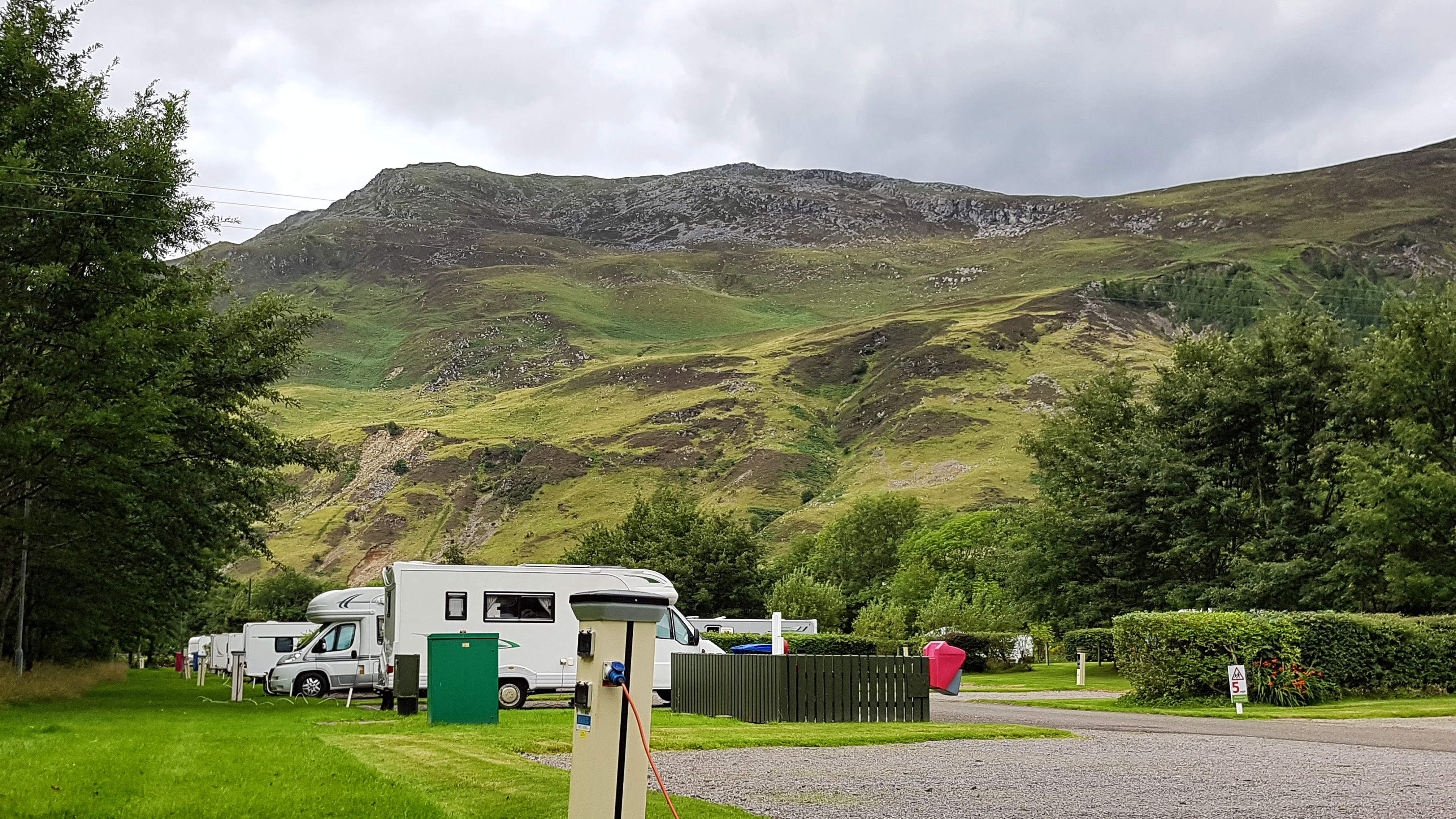
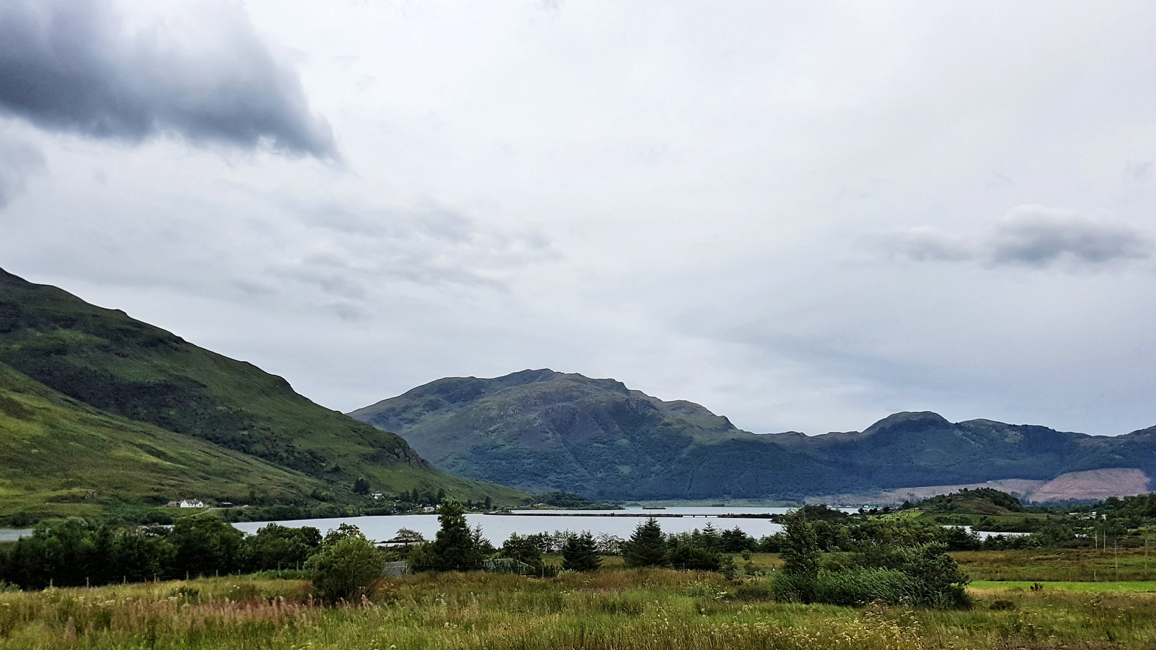
Morvich is a very small highland settlement within land owned by the Scottish National Trust consisting of no more than a few houses, a youth hostel or two, a mountain rescue centre and a Caravan Park in the Highlands of Scotland on the southern edge of Loch Duich.
Loch Duich from the village of Morvich.
Morvich is very close to the A87 which heads north to the Isle of Skye and other popular tourist destinations. it is also a popular base for hiking.
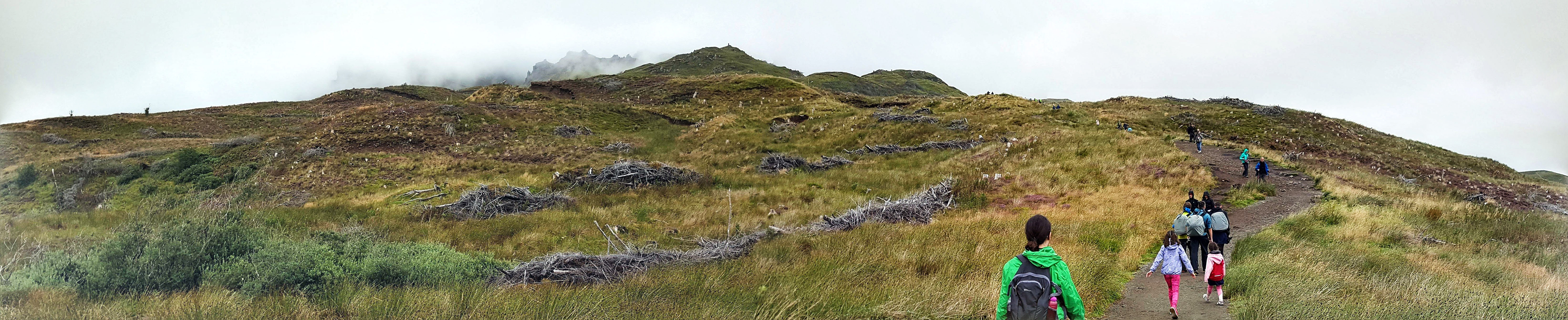
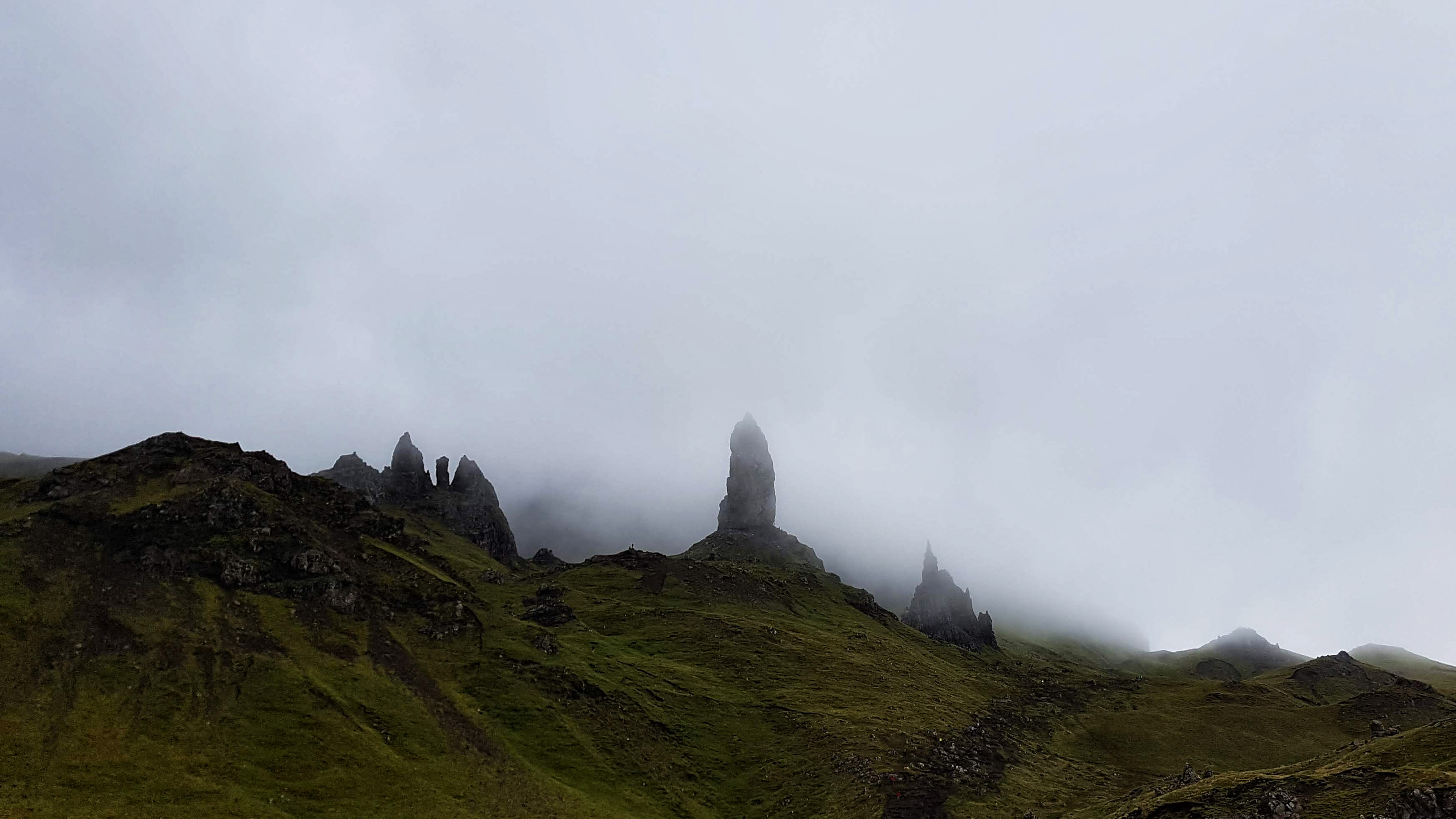
Heading to the The Old Man of Storr on the Isle of Skye.The Old Man of Storr on the Isle of Skye – the best we saw of it on a very cloudy day.
The Highlands is renowned for its climate that helps keep the grass lush and green and the lochs full of water. While it was noticeable how scorched much of the grass looked and how low the lochs appeared, the weather was mostly cloudy and sometimes wet on our visit – which is what we half expected, but was a touch disappointed nonetheless.
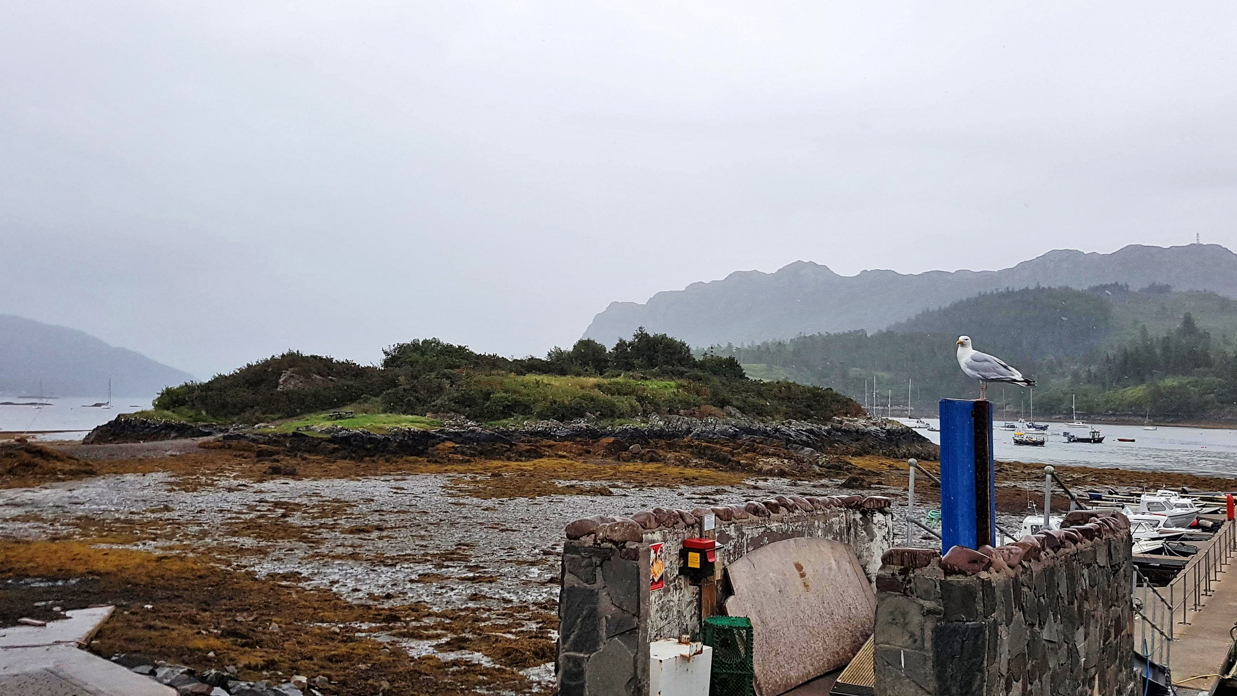
Plockton on a wet, drab afternoon.
Day 10 – Saturday 11th August 2018 – Almost Solitude 👌
This was a run I was fearing and looking forward to in equal measure. The opportunity to run in the spectacular surrounds of the Highlands was a thrilling prospect. The thought of having to get my body up and active after a 180 mile drive towing a caravan on some of the more demanding A roads on these isles was less than attractive. Having done the drive, set up the caravan and had lunch I was ready to collapse. But there was a run to be done and so I changed into my kit and off I headed.
I’d already decided for my first run in the Highlands I was going to do an out and back on a track that appeared to run for several miles to nowhere in particular except for a building that was marked on Google Maps. Fearing some really tired legs I was pleasantly surprised that the opening mile was a not too slow 7:35. I was a touch disappointed to see the road turn into a gravel track (as I predicted) and then stop at a cul-de-sac of two houses. A quick inspection on the Google Maps showed that the track I wanted I’d missed (It was a gated bridle path I’d ignored a little while earlier). Heading back I felt my guts churn in a not pleasant way so I opted to head back to the Caravan Park to use the facilities and begin the run afresh.
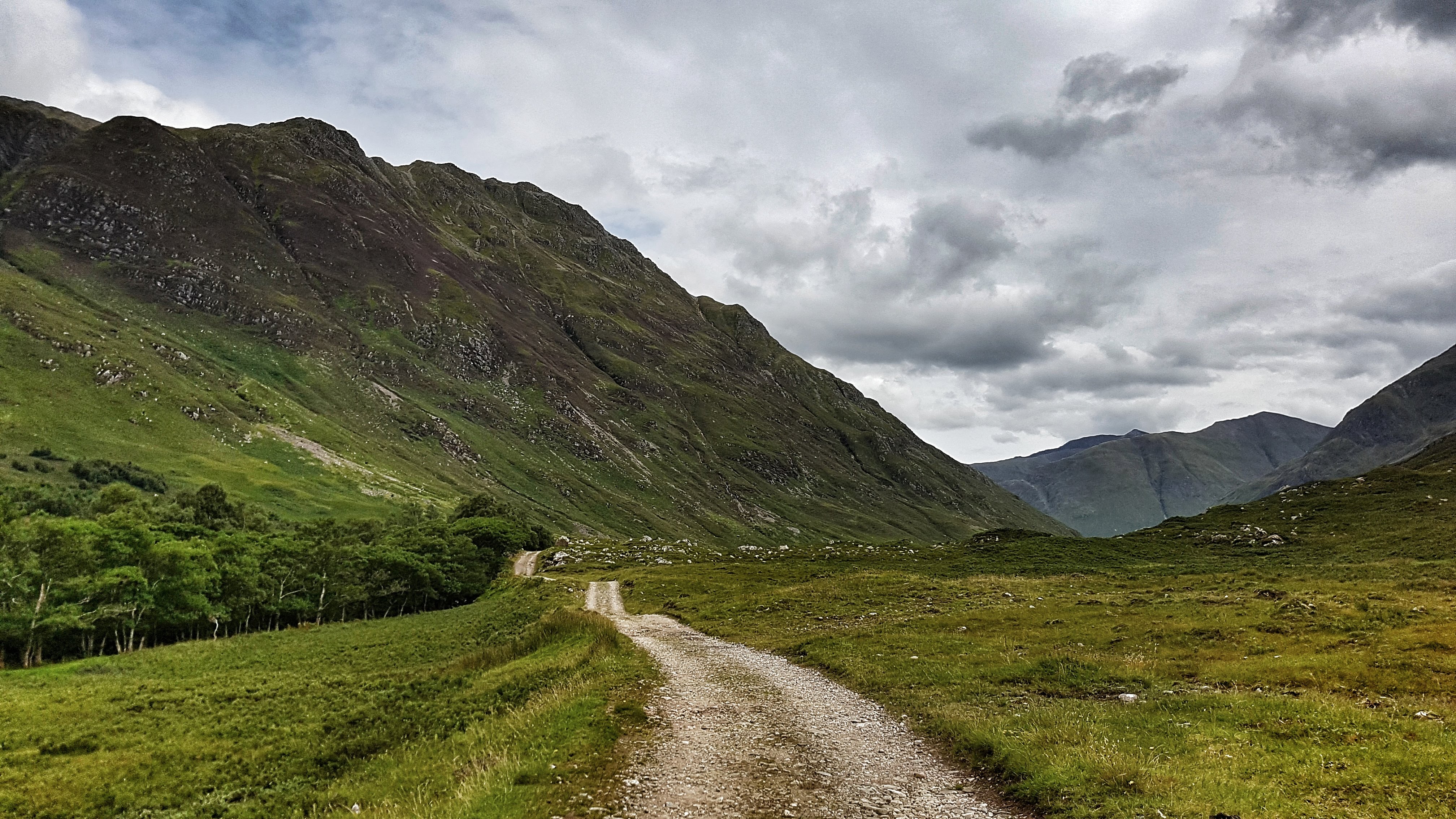
The beautiful trail running from Morvinch.
Feeling much better and a little lighter I resumed the run. Mile two was a 6:39 which was really quite unexpected. Finding the correct bridle path this time I set off on what turned out to be three and a half miles of almost pure solitude and pure bliss.
Spectacular views on the trail from Morvich. (Not a Strava picture)
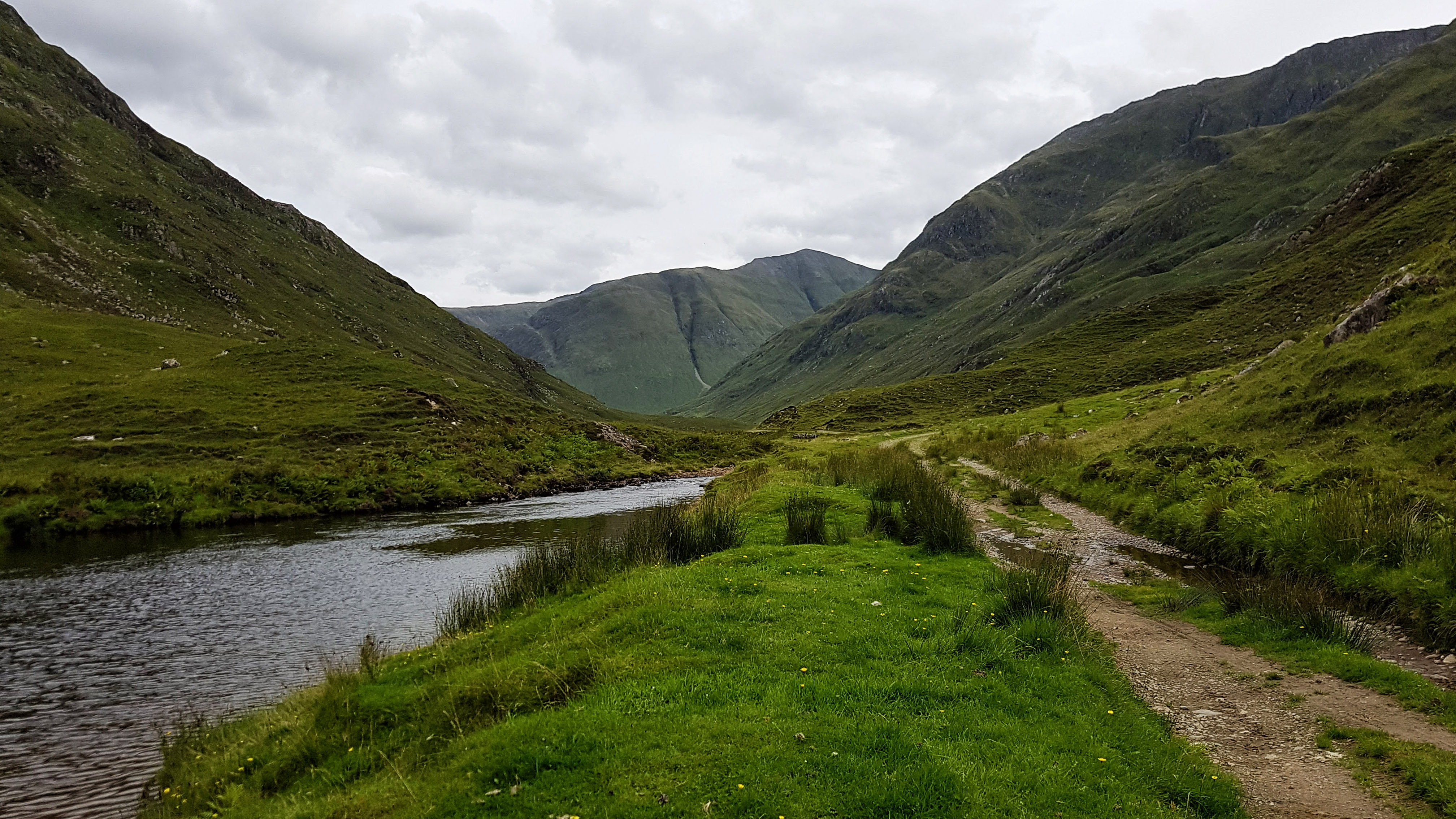
Hugging the River Croe the path offered constantly changing views of the multitude of surrounding hills and mountains knwn as the Five Sisters of Kintail. The run out was a start / stop affair as I spent almost as much time admiring the scenery and taking photos as I did running.
Spectacular views on the path from Morvich (Also not a Strava picture).
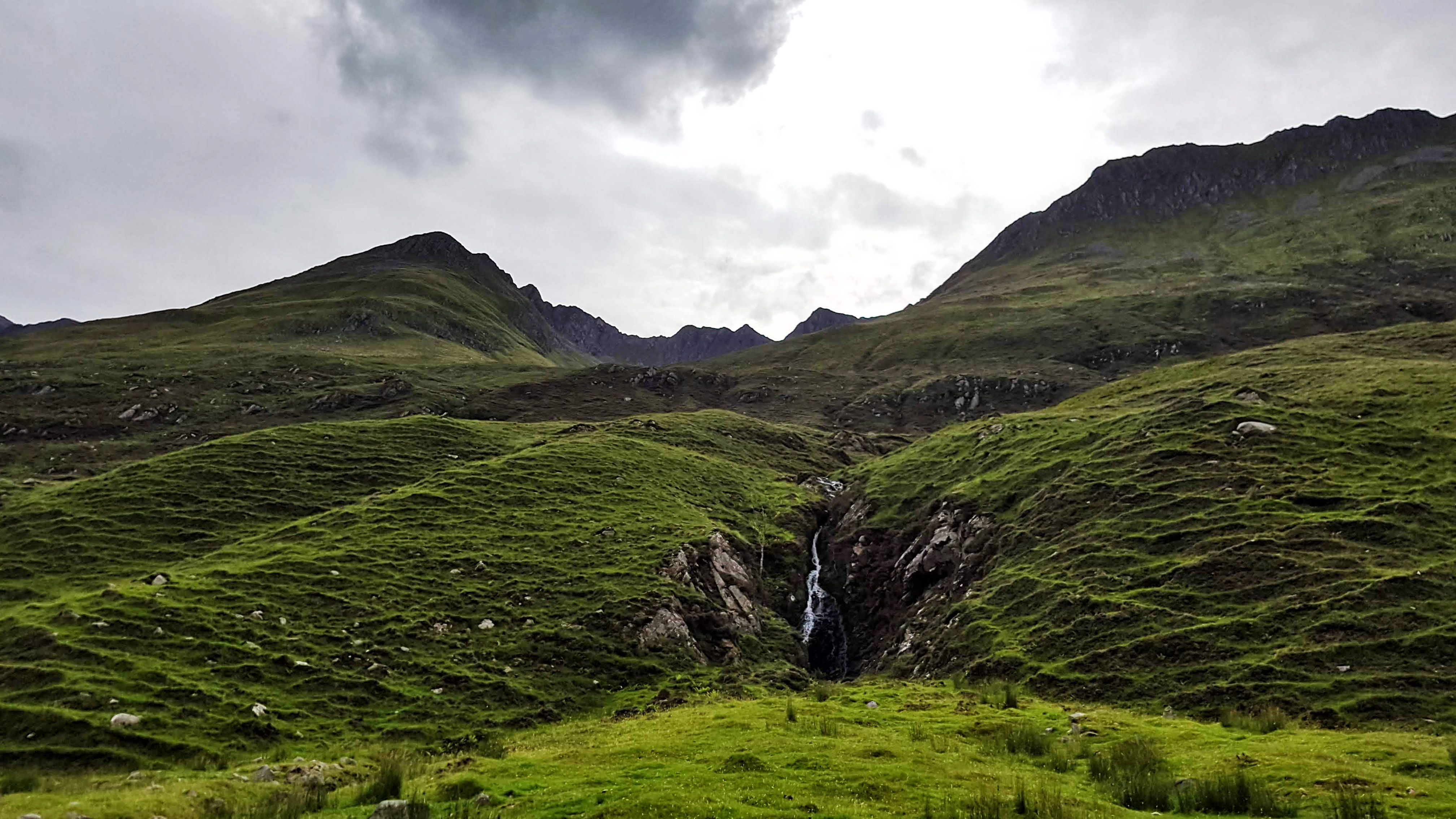
The path was easy to run on at first but as the minutes passed the gravel began to get bigger and more of the path took on the form of small rocks, which were tricky to run on and required a good deal of concentration to avoid trips and potential ankle sprains.
The beautiful trail running from Morvinch – the sheep nearly the only company I found.
Despite the lack of recent rain there were also quite a few small streams to cross, most of which had rocks handily placed to tip toe across. I imagine in wetter times this run would have been far more challenging. It was at such a stream I encountered pretty much my only company for the day – a flock of sheep. The solitude was further broken a little while later when I passed a small group of young trekkers who looked distinctly weary. I passed them on the way back and rather creepily perhaps (for them) twice more on future runs as they were staying in the same caravan park.
A lone inhabited building in the middle of nowhere.
Having run a couple of miles before hitting the path I knew it would be around six miles before I hopefully spotted the lone building. Sure enough I crested a small rise and spotted it in the distance. As I passed it I had to stop and wonder how it must feel to live in a house as secluded as this and what fate befell the owners of a very derelict house next to it.
A derlict lone building on the trail (Another picture that failed to make the Strava cut).
Just a short way past the house was a bridge which I crossed and continued running for just a short way before I sensed it was going to get very technical very quickly as it narrowed and steepened. I turned back around and headed to the bridge – stopping for a minute or two to enjoy the tranquillity.
The view from the bridge (Not on Strava either).
With the sightseeing over it was a case of running the next four and a bit miles back to base. There was no stopping now as I enjoyed the moderately technical nature of the path which was by now really working the muscles in the feet and legs far more used to running on roads and fairly level terrain.
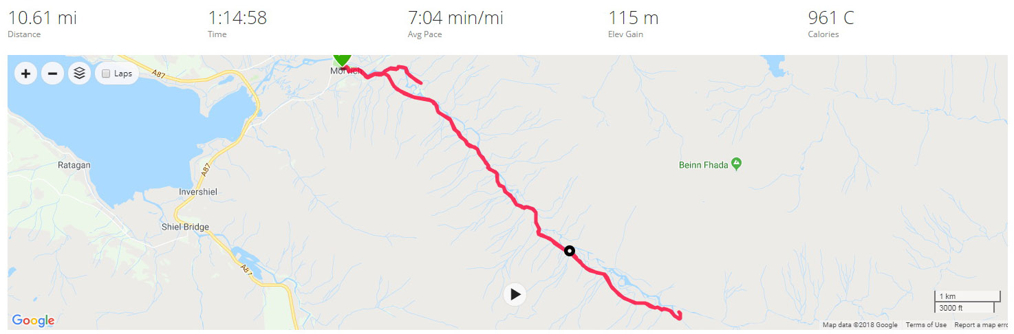
I wasn’t particularly interested in the pace of the run but was pleased to have covered the 10.6 miles in 7:04, especially given how tired I was after the long journey into the Highlands.
Once I’d uploaded my run, I noted there was a Strava segment that looked like it was for a race that takes place in the area. I had no chance of claiming that as I had stopped many times to take pictures. On my return home I did though create a similar segment for the return back to Morvinch which I was pleased to have claimed top spot! This though was not a run about segments but about soaking in the stunning scenery that this part of the world has to offer.
Best Strava Segment Performance: Back to Morvich – 1st/79
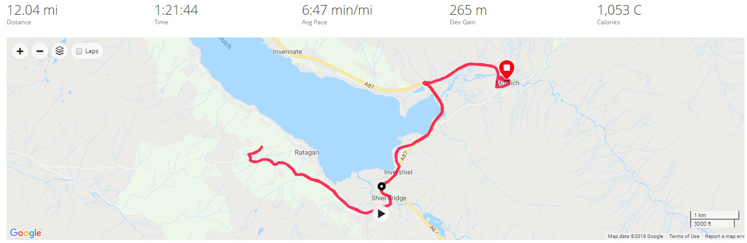
Day 11 – Sunday 12th August 2018 – Mam Ratagan and Back
The second run in Morvich and I decided to attempt to take to the only road I could relatively safely tackle in the area. The A87 has a section with a pavement as it heads to Inverinate but much beyond that and it is no place for a runner to be, especially in the month of August with the multitude of caravans and motorhomes flying along the twisting road.
The road I had to play with was the Old Military Road, which runs on the opposite side of Loch Duich and is signposted as a tourist route alternative to the A87 and the Isle of Skye via a ferry. While it was unlikely to be traffic free I was confident that the A87 would take the vast majority of the through traffic and it would be no more risky than many other country roads I have run on.
Heading off at 8:30am the run was immediately compromised by a landslide (which had occurred some time before we had arrived) on the most direct route out of Morvich to the A87. I had no alternative but to take the diversion onto the A87 and over the causeway and bridge that was built to bypass the A87 away from Morvich itself. This added around a mile each way to the run, but thankfully at least there was a pavement to run on.
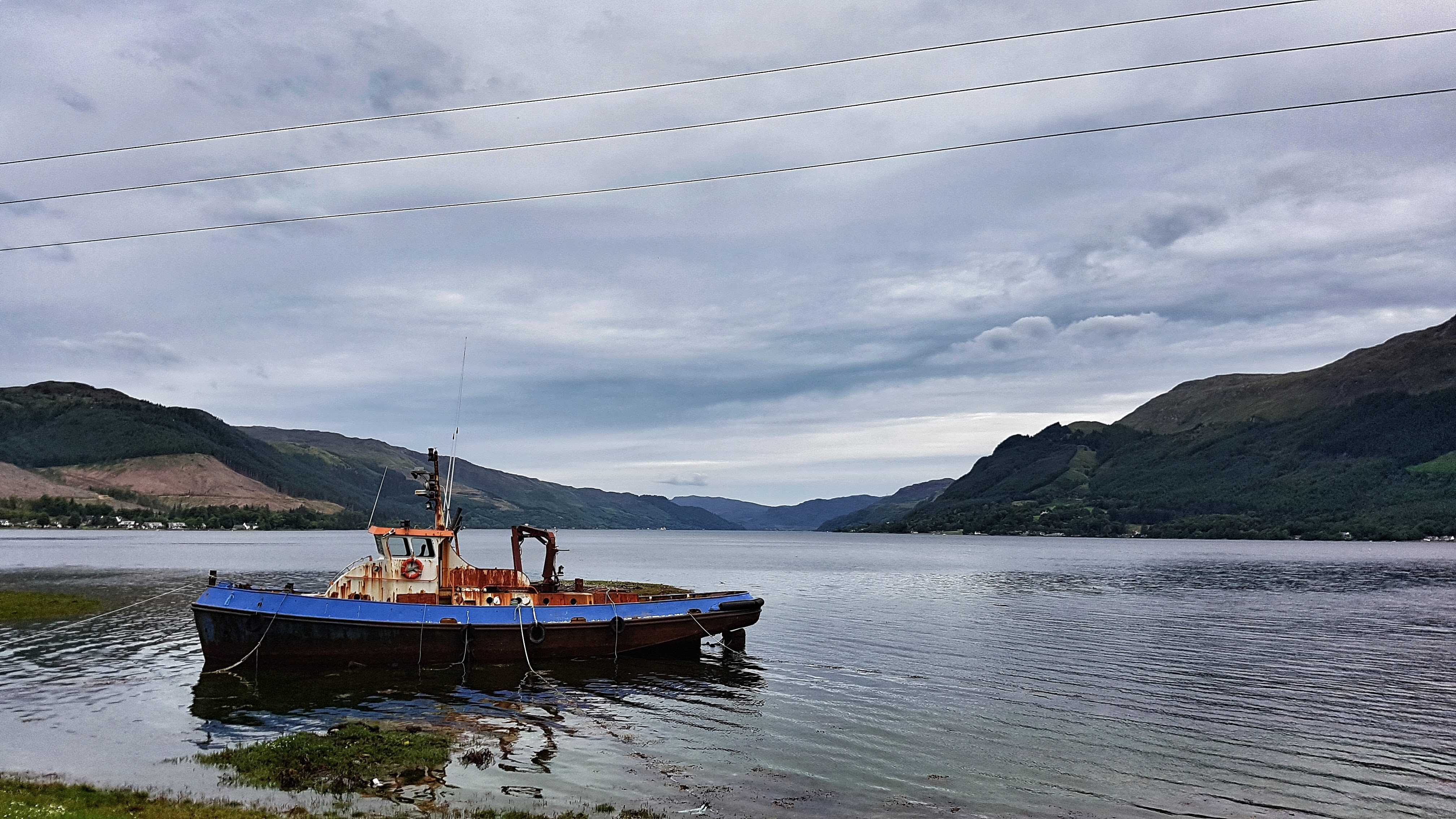
Loch Duich at Shiel Bridge.
Once over the bridge the pavement left the main road briefly to a quiet footpath before rejoining the A87 at Shiel Bridge. Just as the pavement ran out I could take the right turn over Shiel Bridge and onto the Old Military Road. This road was originally built in the 1750s before being rebuilt in the 1820s taking a route from Fort Augustus to Bernera. Having perused the road on Google Maps I fancied a run up to the Mam Ratagan viewpoint a few miles literally up the road.
My legs were not too bad after the day before – after the customary steady opening mile (7:34) I slipped into a comfortable pace of around 6:50 for miles 2 to 4. I then began the near two mile long climb which only averaged 5% but held some surprises along the way. Part of the Highlands experience has to be running some proper hills, so I was, in a perverse way, looking forward to the challenge.
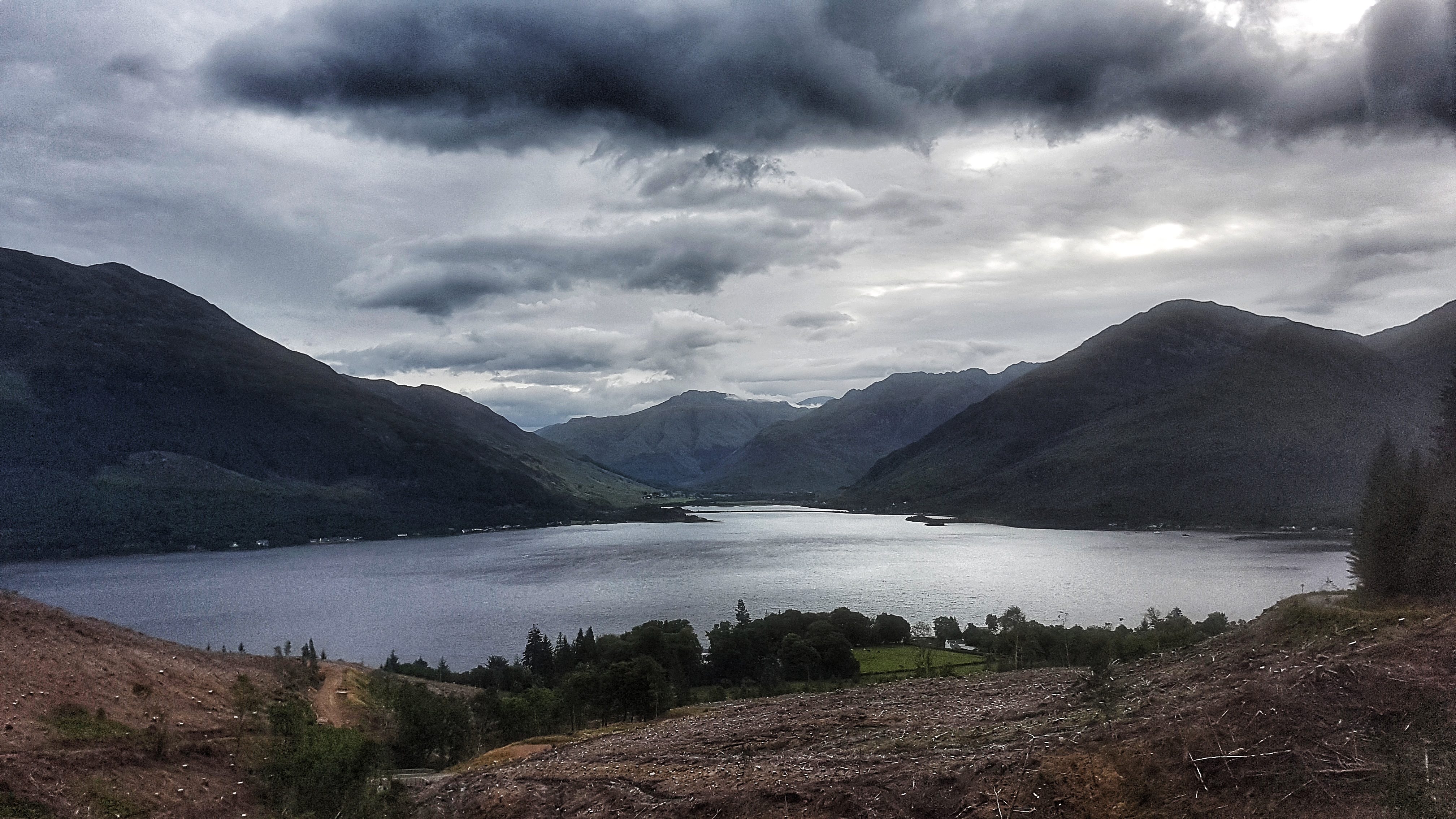
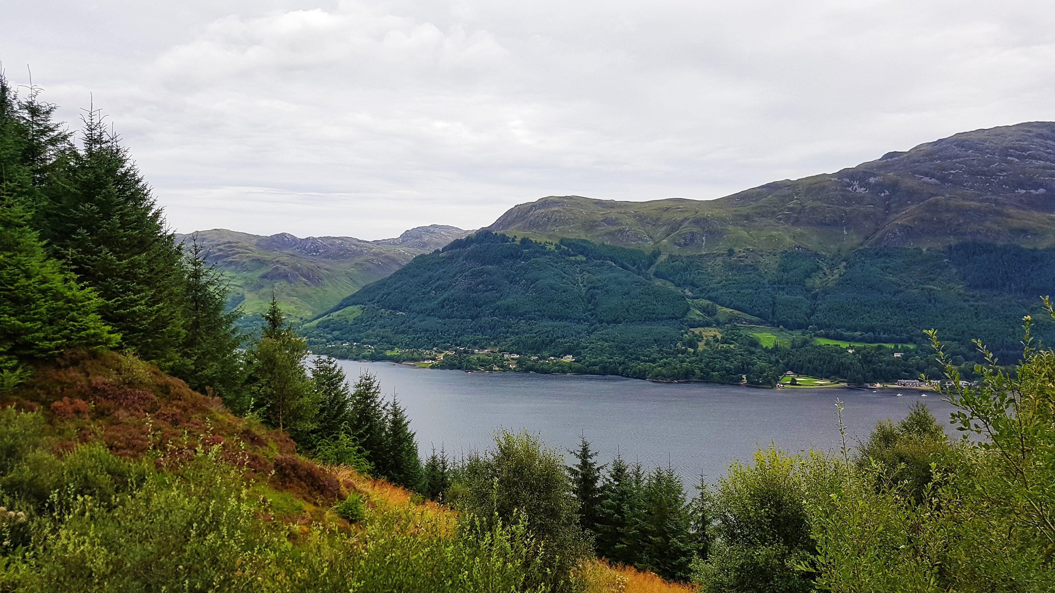
Loch Duich running up Mam Ratagan.
It began as a drag and then as I worked my way further and further up it began to steepen: 8%, then 10% then, as it approached where I assumed was the top it was signposted as 18% average but in places felt much steeper – not quite the 30% the Strava segment suggests, but probably short sections were around 20-25%.
Slowly making my way up I stopped briefly to take a photo before taking on the final onslaught via a set of steep hairpin bends which made my running feel like a crawl to the extent where walking felt like it could have been a quicker option.
View from Mam Ratagan.
With one final effort I finally reached the Mam Ratagan viewpoint. I stopped briefly to take in the scenery and to take a photo, but as I was sharing the experience with a young couple who had clearly slept the night there in their car (A common occurrence in Scotland where laws on where you can stay overnight are different from the rest of the UK) were thankfully doing nothing more than brushing their teeth, I kept the visit short. While the view there was good, the abundance of growing trees at this point, made the vista slightly lower down the hill, in my opinion, slightly superior.
A little later on in the day, it was a surprise when I uploaded my run to the world that I had claimed both the Old Military Road Climb segments on Strava despite at least one stop to take photos. That said, the road is not exactly over frequented by runners, based on the single digit numbers of those who have uploaded to Strava and covered the segment. It may though be more popular with cyclists as it features in the Scotland edition of the seminal Britain’s Greatest Cycling Climbs. I only discovered this by chance from a club mate who noted my effort on Strava and wondered if I’d deliberately targeted it. I was a bit disappointed to find out that I never quite made it to the top of the climb as described in the book. It’s a long way to go back to finish the job!
The out section of the run covered with just under six miles on the Garmin I knew it was going to be run closer to 12 miles than the customary 10. As I plunged down the steepest section of the climb I had some severe pains in the quads which normally precedes a bout of debilitating cramp. I tried my best to relax and not tense the legs and was relieved when the gradient reduced a little and the pains subsided, not to the point of them disappearing, but enough for it to not affect the remainder of the run.
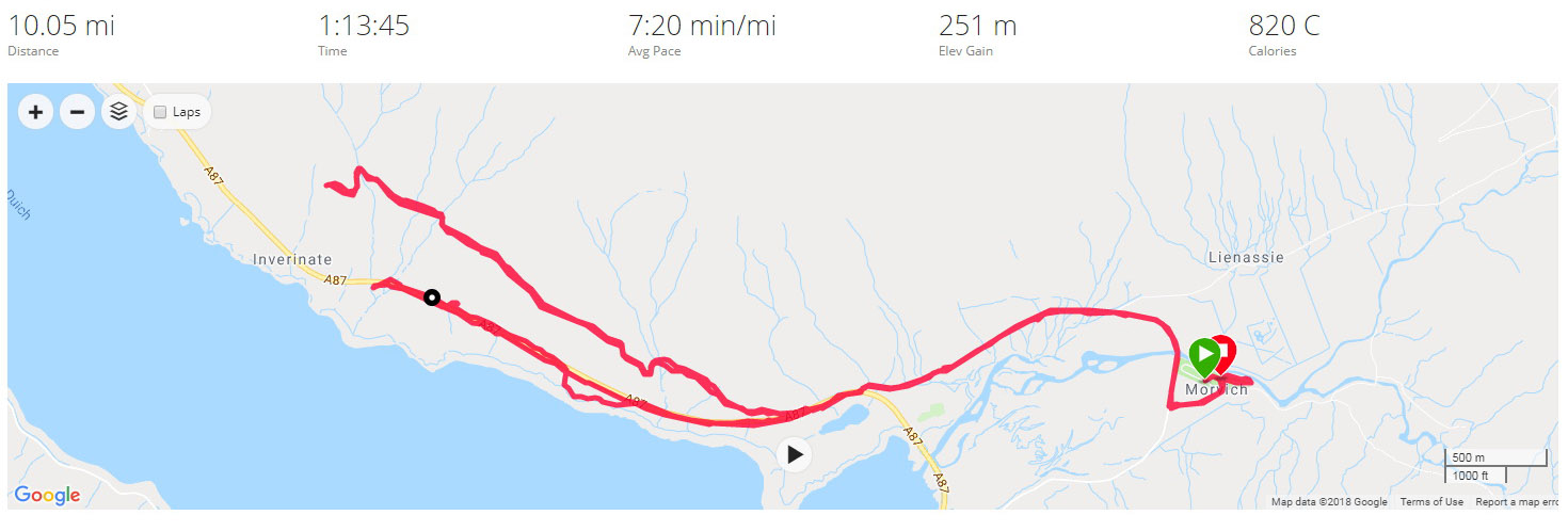
Having taken a hit with the uphill (a 7:05 and a 7:59 mile, although Strava GAP has them both as sub six minute miles) the average pace for the run recovered as I continued the 2.4 mile downhill run back to Shiel Bridge, running 5:58, 6:15, and 6:28 for miles 7-9. Back on the A87 I decided that it was probably best to continuing pushing rather than easing up as far as the quads were concerned, so continued with 6:37, 6:30 and 6:29 miles, not stopping at any point of the run, to end the 12 miles in 1:21:43 at an average of 6:47. This was pretty pleasing considering the severity of the climb I’d run as I passed the halfway mark in the Tour of Britain.
Best Strava Segment Performance:s Old Military Road Climb – 1st/12; Old Military Road Climb – 1st/7; Down Old Military Road to Shiel Bridge – 1st/2; Keeping Safe on the A87 – 1st/72; From the A87 to Morvich – 1st/28
Day 12 – Monday 13th August 2018 – Loch Duich – high and low
Having tackled the only obvious footpath on the Saturday and the only real safe road on the Sunday, I must admit I was wondering where I was going to run for the third and final run in Morvich. It was only when I was driving back along the A87 near Inverinate with the family from a trip to Kyle of Lochalsh and a rainy Plockton, that I spotted on the side of the road a sign for a footpath into woodland. This looked as though it could be just what I needed!
A long journey to the Isle of Skye was planned for later in the day so it was out of the caravan fairly early at 8 am for the Monday morning run. The first mile was fairly slow and tortuous while the legs struggled to wake up on the road out of Morvich. I wasn’t long on the A87 when I spotted a different path to the woodland than the one I’d seen the day before, and grabbed the opportunity to explore without hesitation.
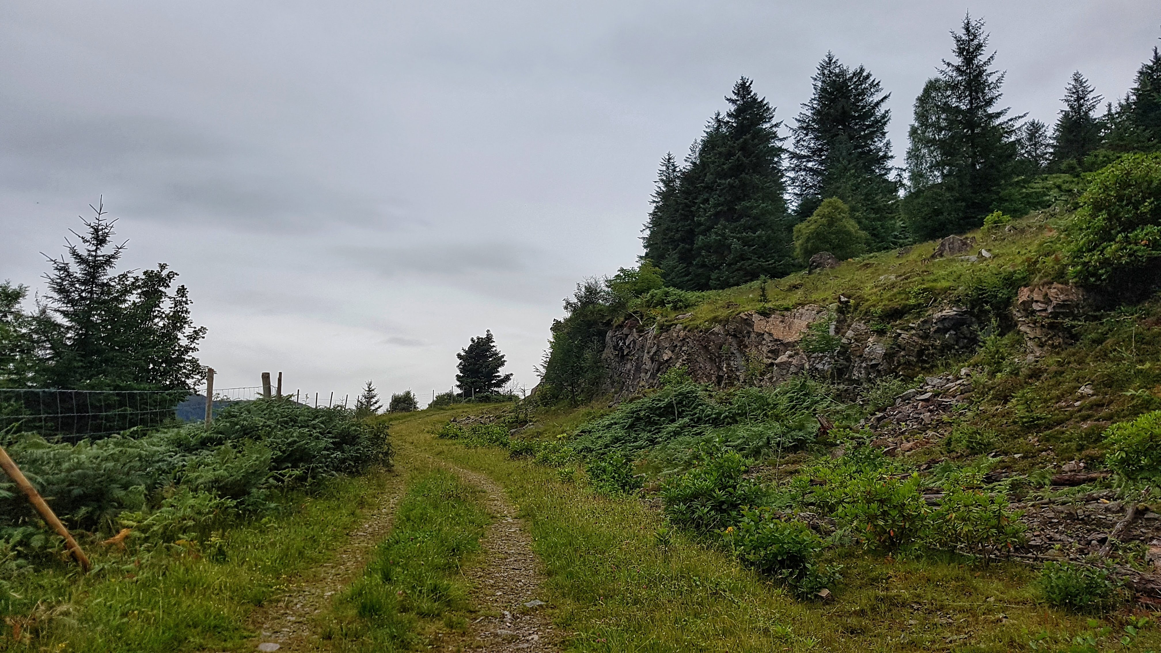
A woodland path heading towards Inverinate.
I soon began heading upwards: rocks, trees, and the occasional stream to the right of me, trees, trees, and more trees to the left. It was quite hard work as I climbed a not especially steep gradient, the legs still a little unwilling to activate. Mile three was a pedestrian 9:01, although Strava GAP reckons it was worth a 6:45 once the elevation is taken into account.
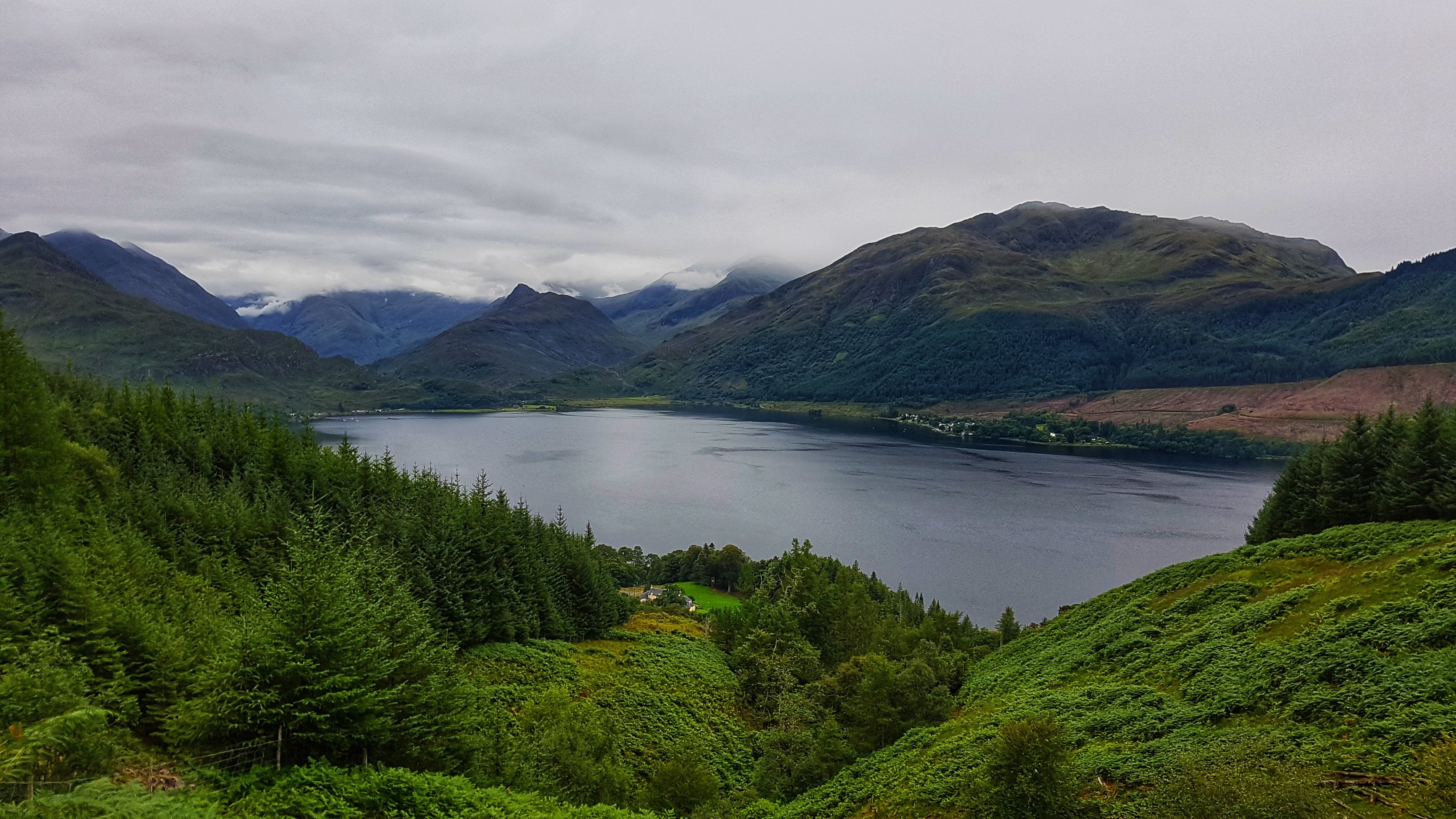
After a mile and a half of climbing the hill levelled off and there was quite a rock formation to the right of me and quite a remarkable view to the left of me, with a splendid vista of Loch Duich around 200 feet below me. I stopped to reel off some photos and take stock of the view before carrying on along the track. Alas as the track became less pronounced and the abundance of grass more apparent I feared the end was nigh and indeed it was that the path came to an abrupt end.
Loch Duich – high.
There was little else to do but turn around and head back from where I came – this time quicker thanks to gravity but not especially fast – this was not a day where any world records would be set. Two thirds of the way down I spotted what looked like an alternate route but reckoned it would be prudent to stay on the path I knew. This took me back on the A87, but with only just over five miles covered, I knew I had to do some more exploring to make up the distance.
So I headed up the A87 back towards Inverinate, knowing there was a pavement beside it for a good deal of the way. I passed some houses and a small primary school; once the houses ceased a fairly long uphill drag commenced. I spotted the gate to the woodland path I’d spotted in the car the day before and tried to get in. However I couldn’t get the gate to open and the sight of an unleashed dog staring at me with angry eyes in the distance made me think better of this route and went back to the main road.
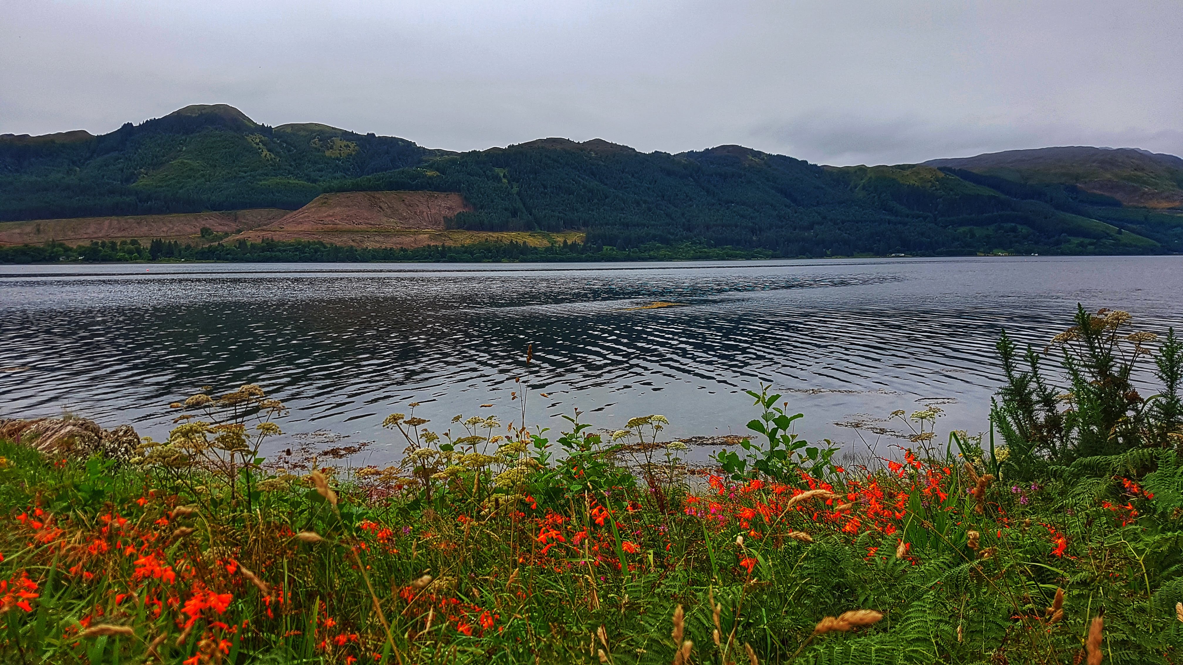
Loch Duich – low.
After a mile and a half or so I reckoned I could turn around and head back and clock 10 miles by the time I reached the Caravan Park. This I did via a small diversion from the A87 down a small footpath and a quiet road where the select group of residents could enjoy a most tranquil view of Loch Duich each and every morning. Buoyed on by quite a long gentle down hill run I was able to maintain a good steady pace for the remaining couple of miles in 6:35 and 6:25 respectably. This couldn’t prevent however, at 7:20 per mile, this run being the fourth slowest of the Tour. But what it lacked in pace it made up with one of the most memorable Surprise Views of the holiday.