The ‘2018 Tour of Britain’ Leg One – Stockton

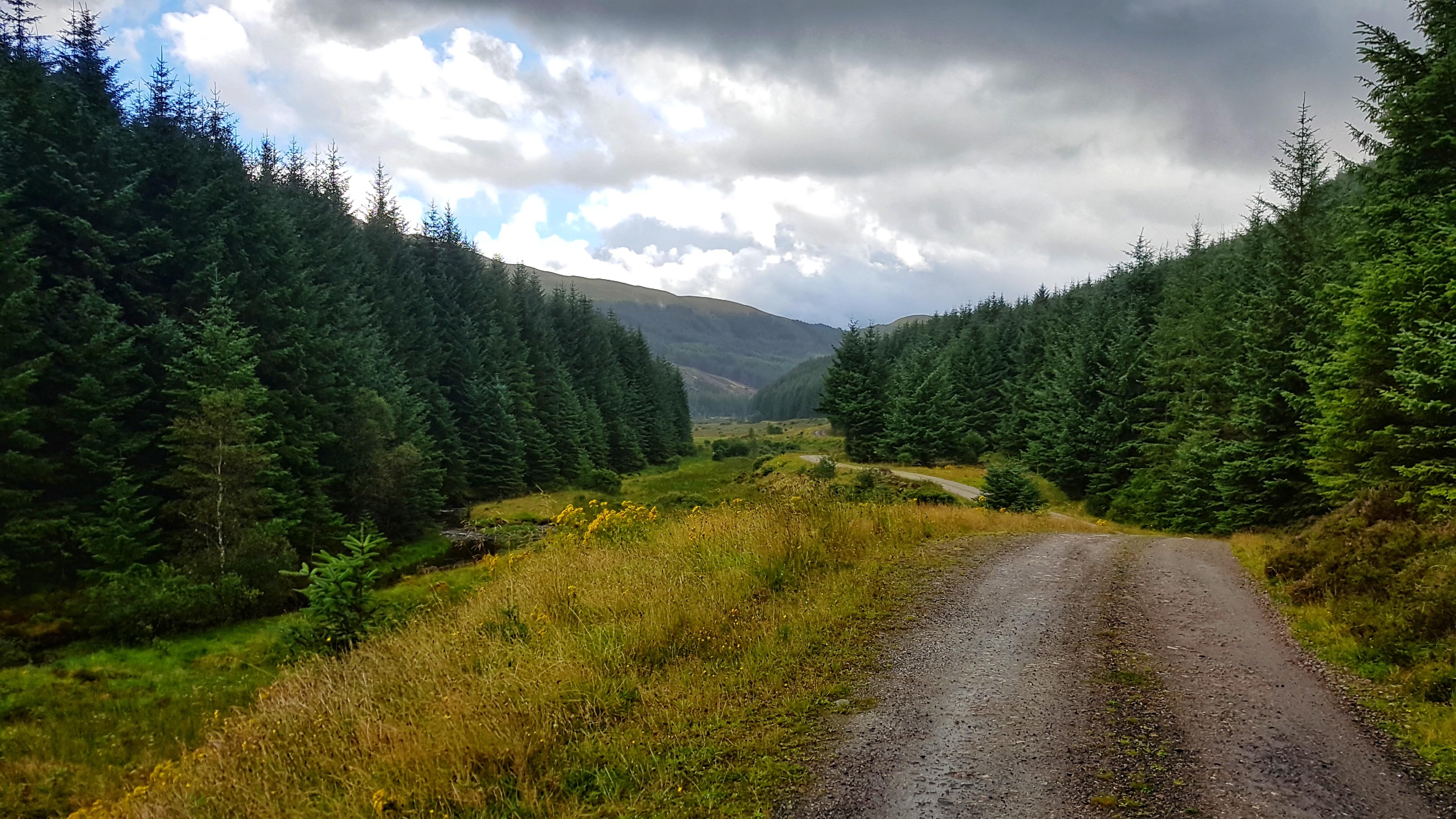
The ‘Tour of Britain’ – An Explanation

Back in 2016 on my first three week caravan holiday I attempted to run pretty much every day. I missed a run on the opening day thanks to problems with the car and then took two Fridays off. After ten days or so I aimed to run at least 10 miles, but for the first week, thanks to some injury issues and lack of established plan I had a few runs of less than 10 miles. I thoroughly enjoyed exploring the places we visited through running and also the challenge of finding three pictures to be uploaded to Strava to reflect what I saw on the run.

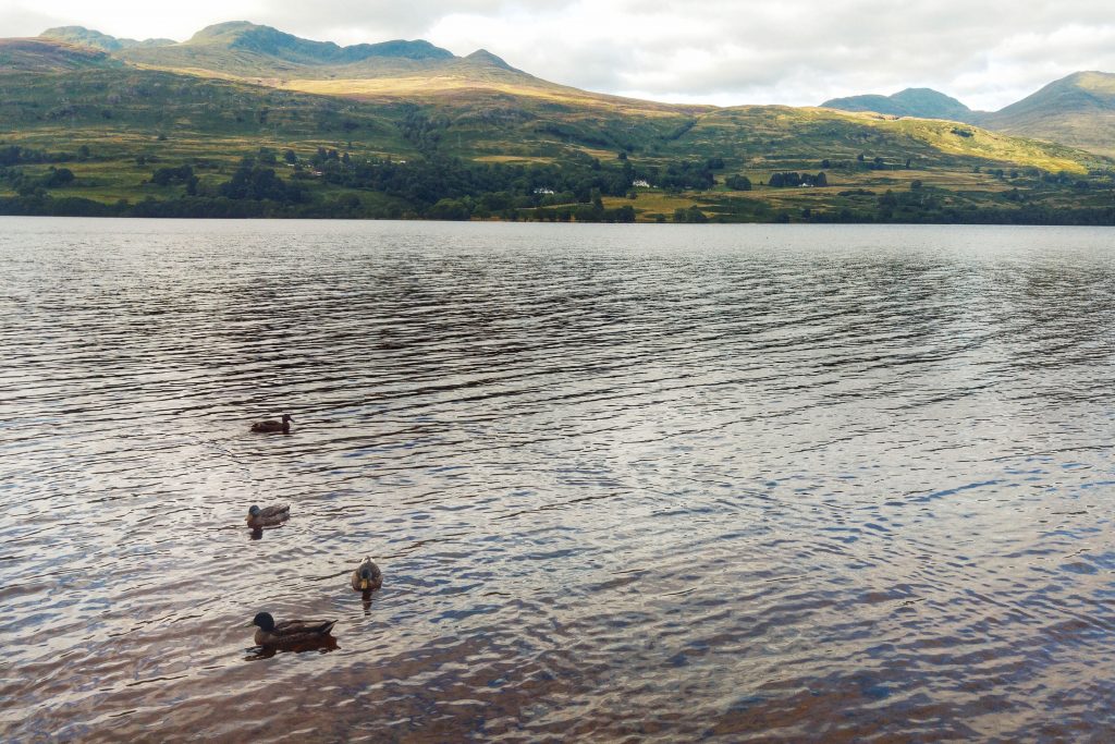
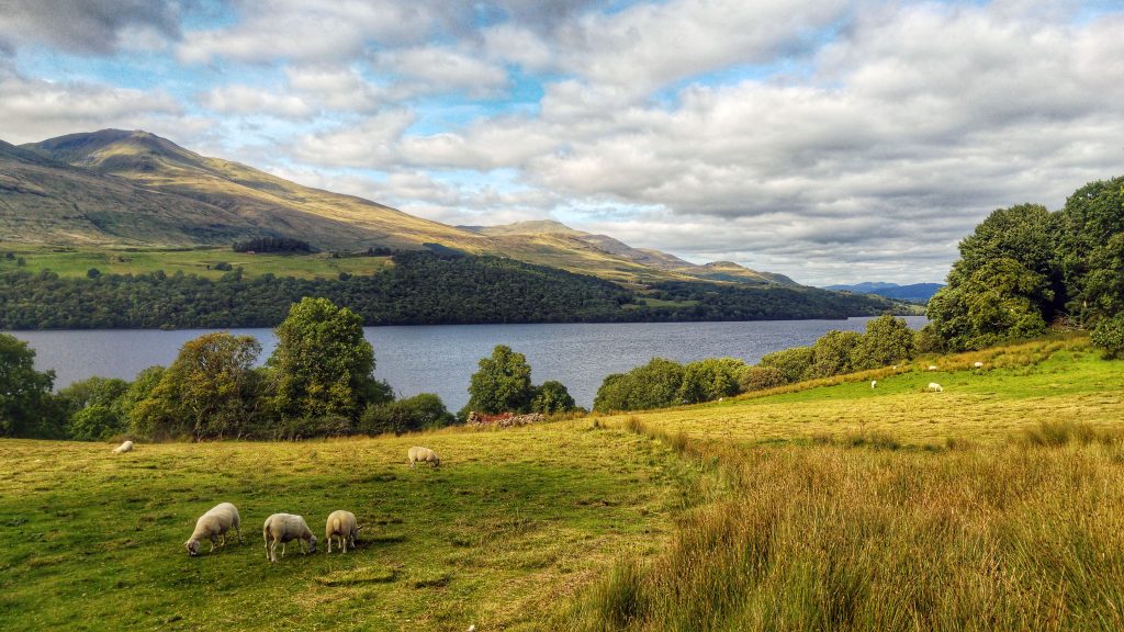
For our second three week caravan holiday in 2018 I formalised my running plans some time before I left. Quite simply I aimed to run a minimum of 10 miles a day for each of the 21 days I was on holiday. I could run where I wanted or at any pace, the only condition was I had to start and finish from wherever I was staying – no travelling by car to a possibly more preferable venue. As in 2016, I also had to upload three pictures to Strava that told the story of the run.

We stayed at seven caravan parks on our three week family holiday, spending three nights at all of them except the last, where we spent two nights, but I would attempt three runs.

A note about the data used for the reports of the runs: the mile splits in the written reports, distances, times of runs and Strava segments come from Strava. The Split Summary at the bottom of each day’s run and the Leg Summary comes from FetchEveryone, with the exception of the Total Ascent, which comes from Garmin Connect with, in most instances, the elevation corrected as the altimeter/barometer on the Garmin Forerunner 935 leaves a little to be desired.

Leg One – Stockton-on-Tees

The Water Sports Centre

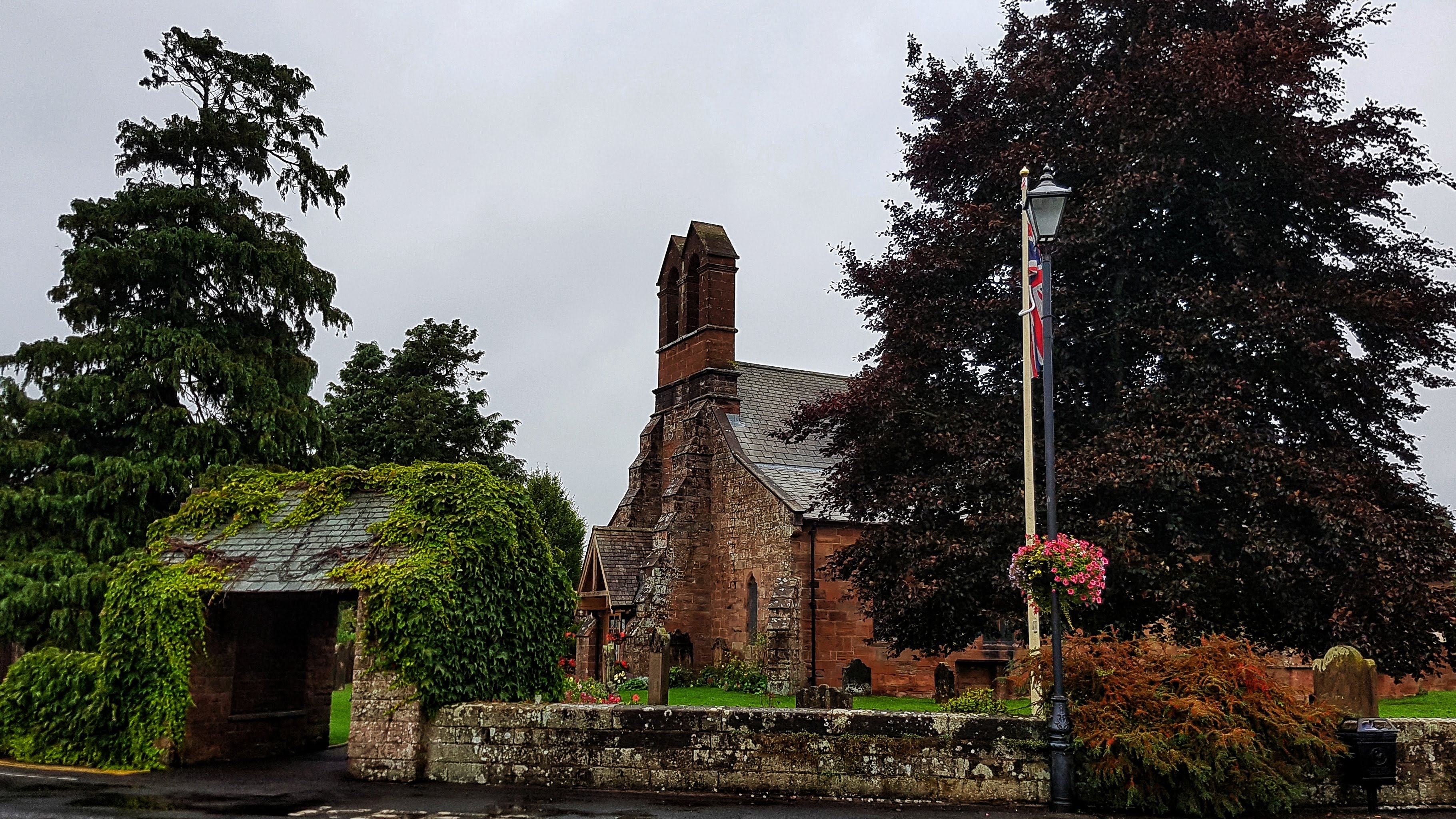
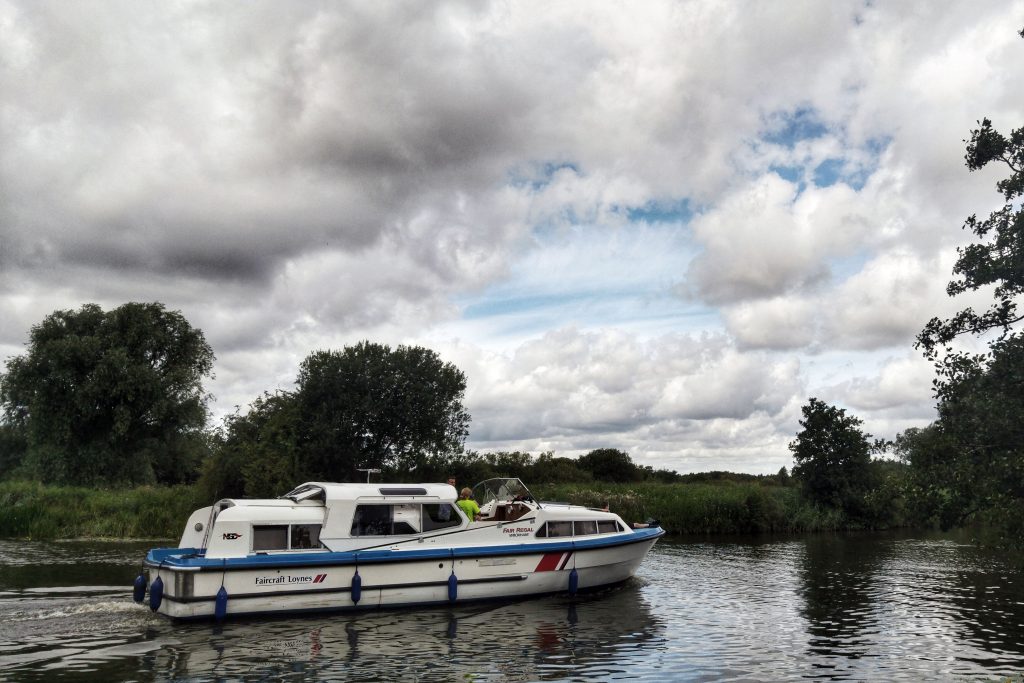
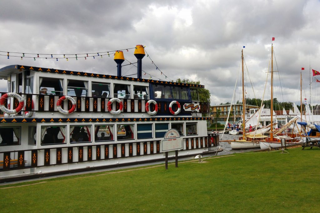
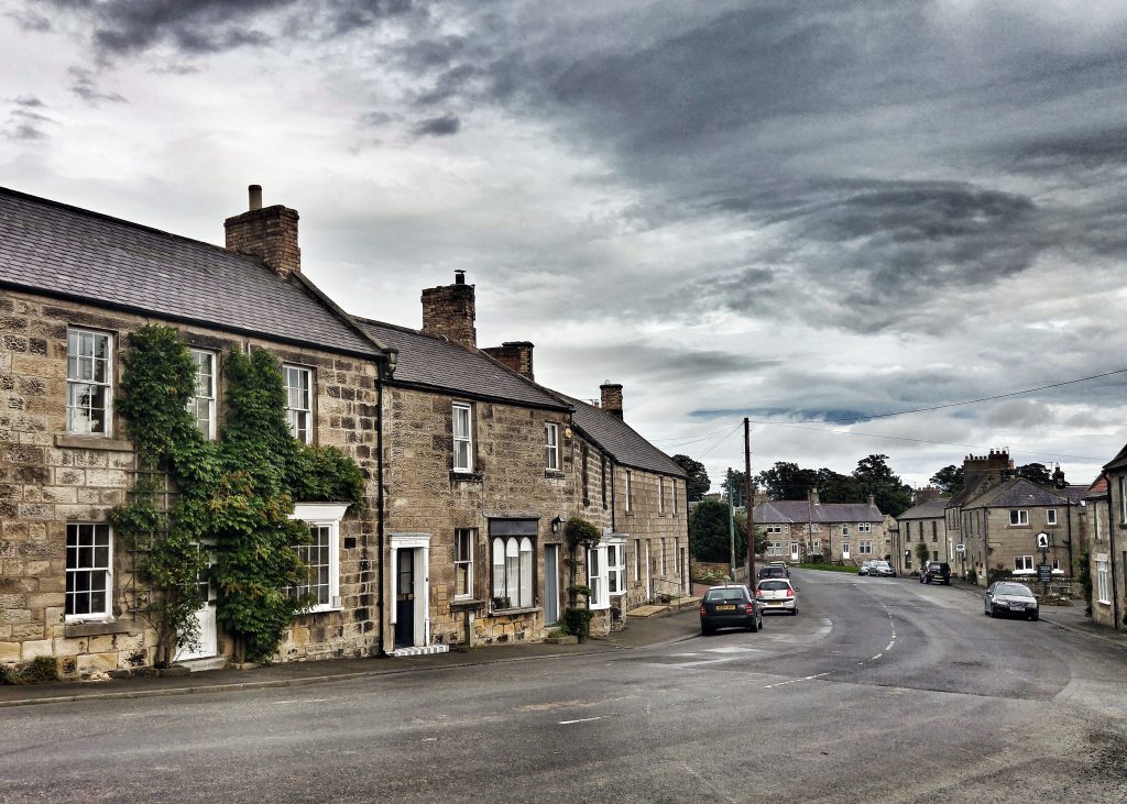
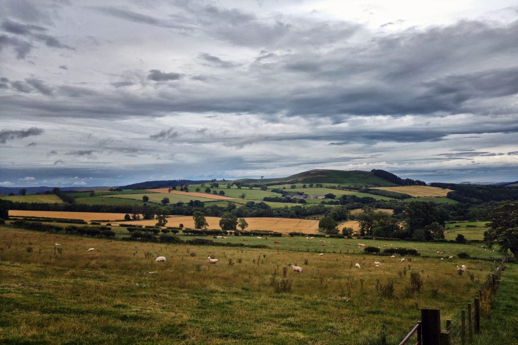
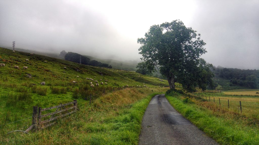
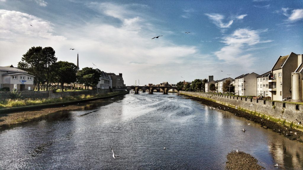
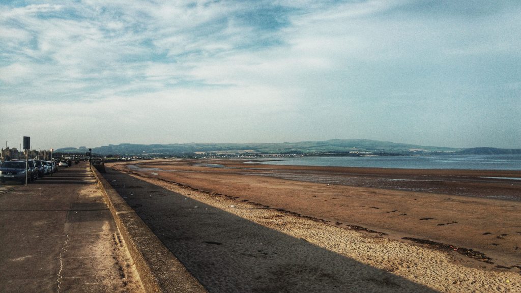
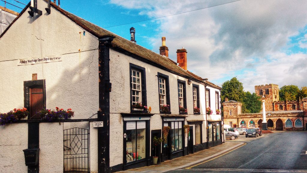
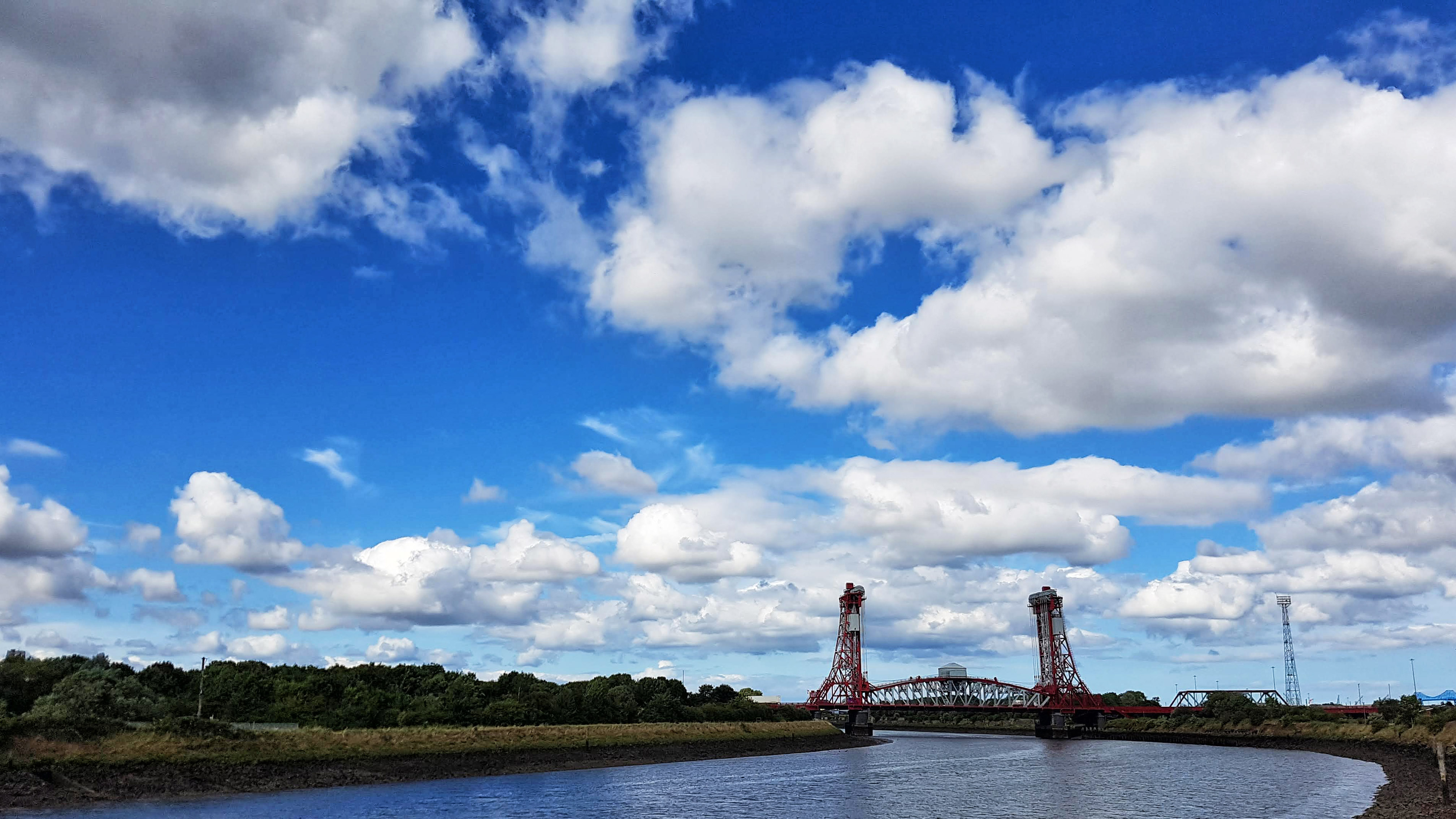
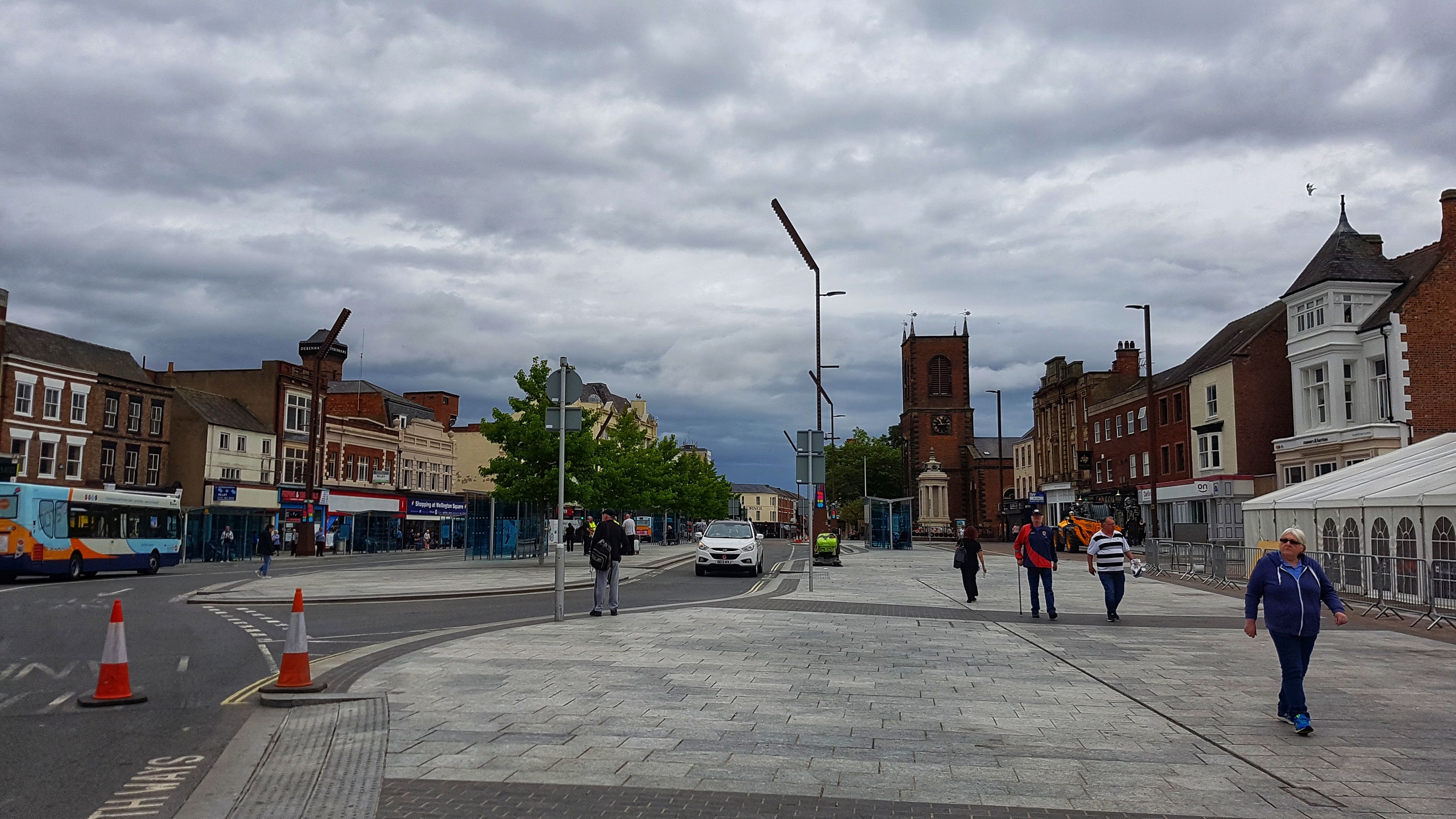
Stockton is a market town on the River Tees with a population of 105,000 and closely neighbours the better known Middlesborough.

The Tees Barrage

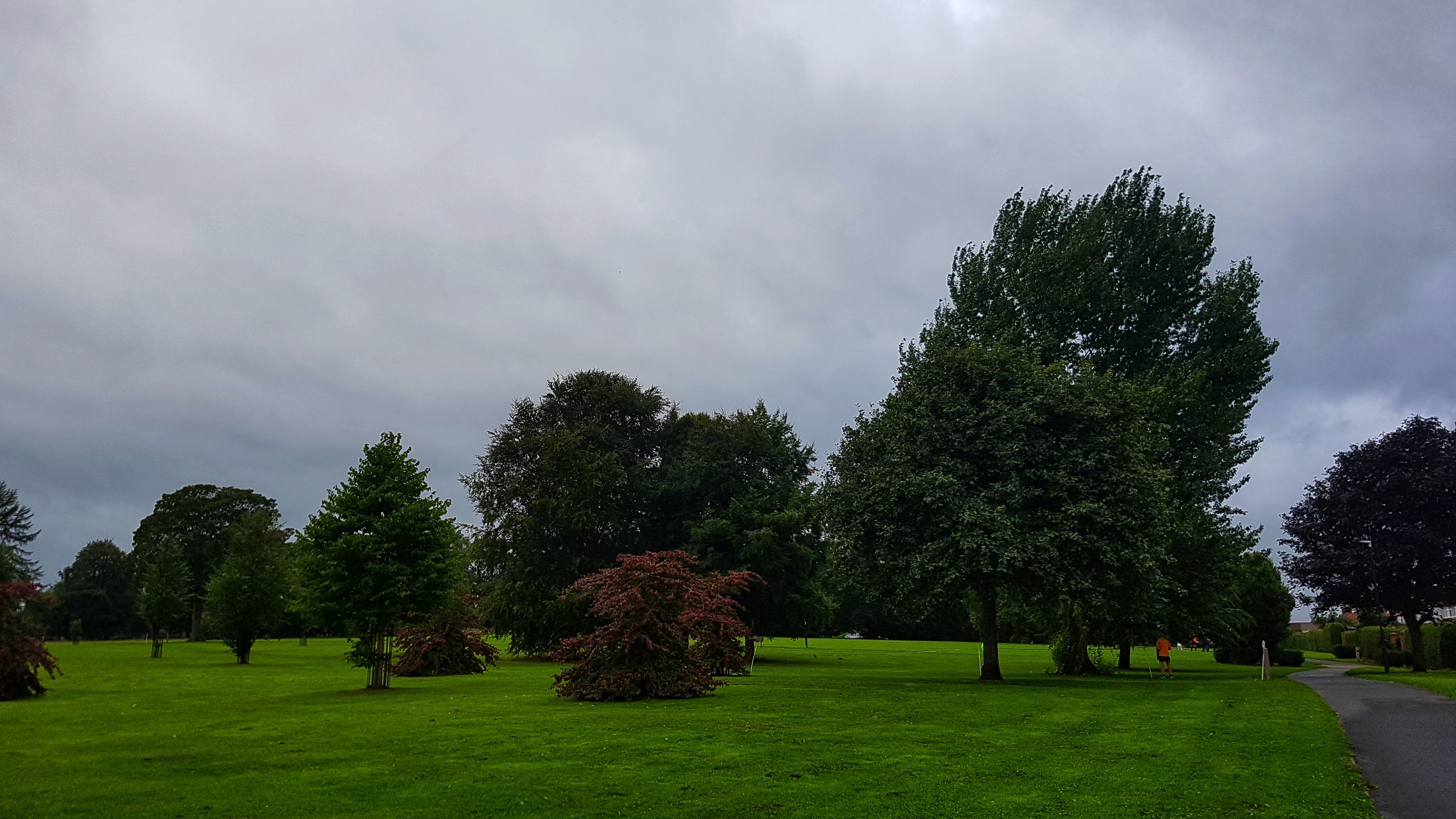
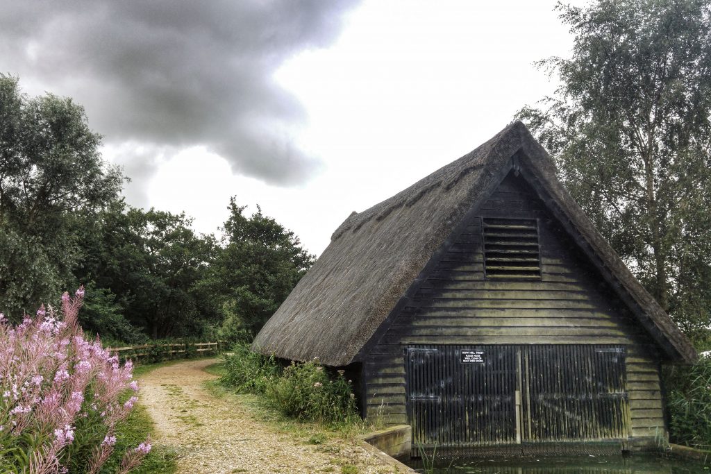
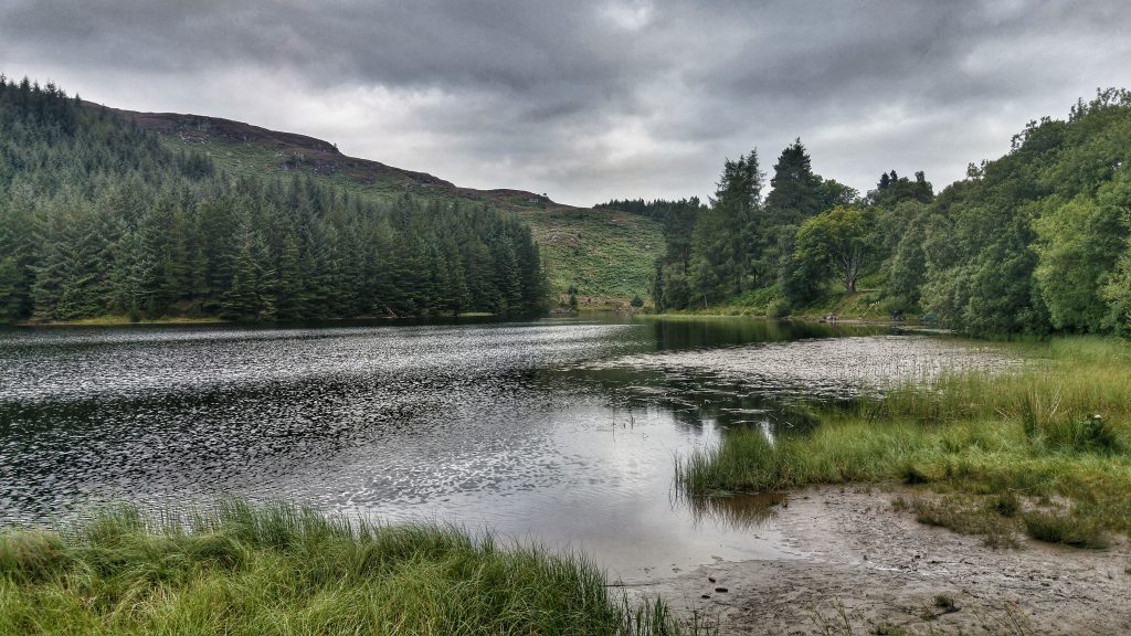
Staying at the Tees Barrage Caravan Site we were impressed by the water sports centre.

The Water Sports Centre

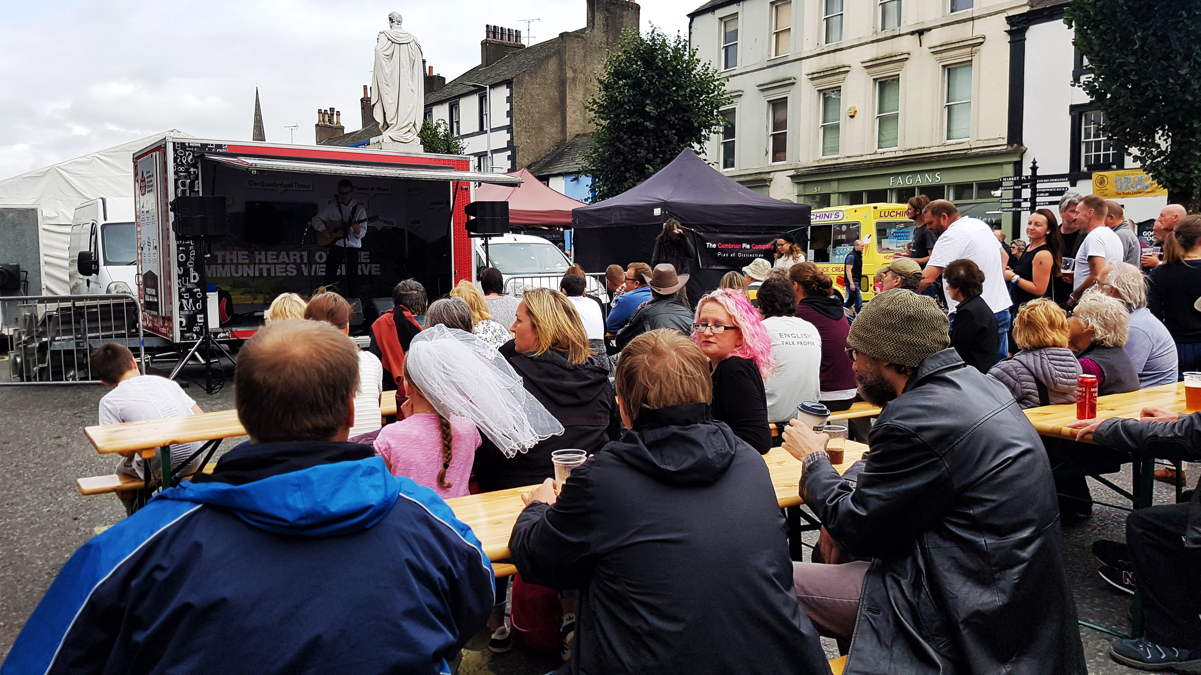
We also thoroughly enjoyed the Stockton International Riverside Festival which, by pure coincidence, began the day we arrived in Stockton.

The Stockton International Riverside Festival

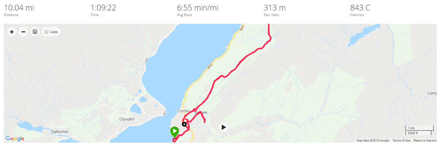
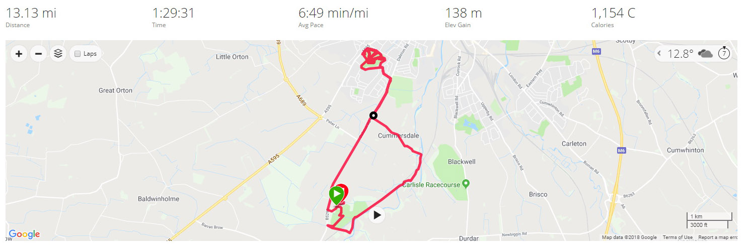
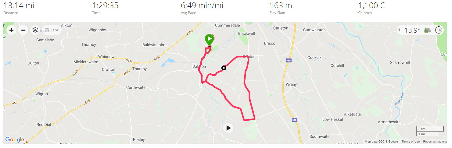
Day 1 – Thursday August 2 2018 – Stockton to Middlesborough & Back

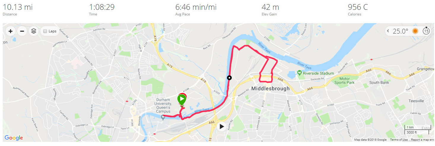
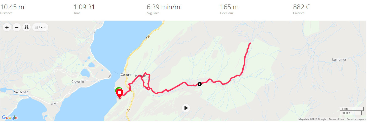
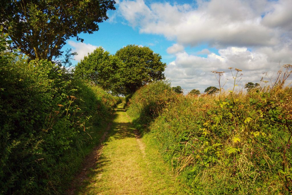
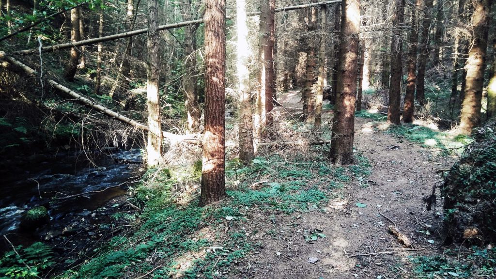
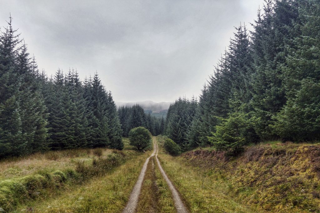
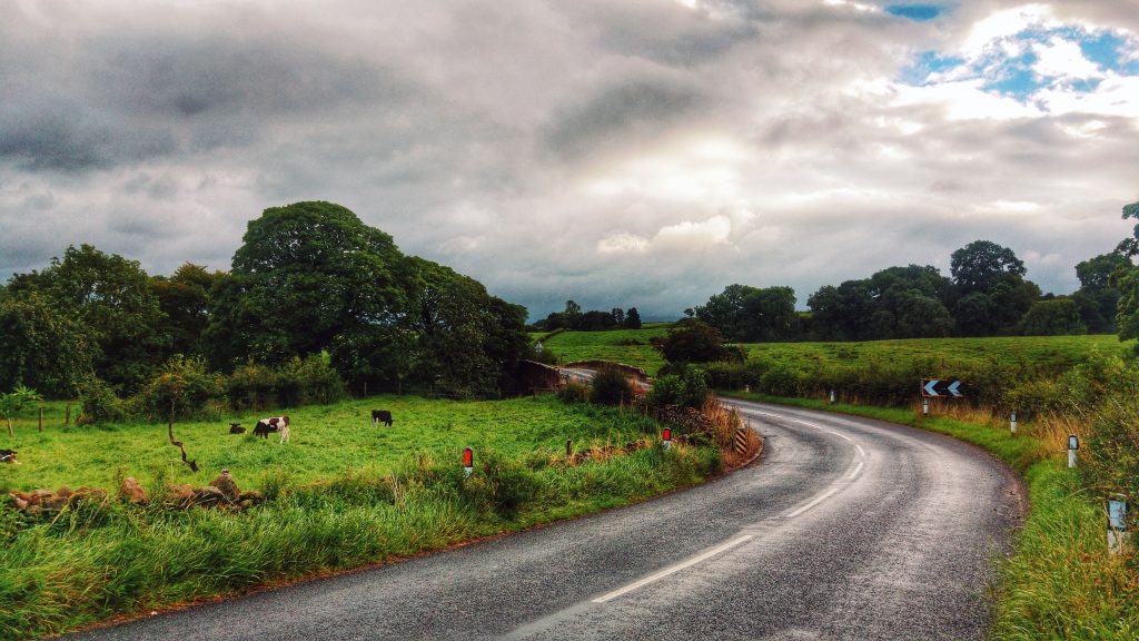
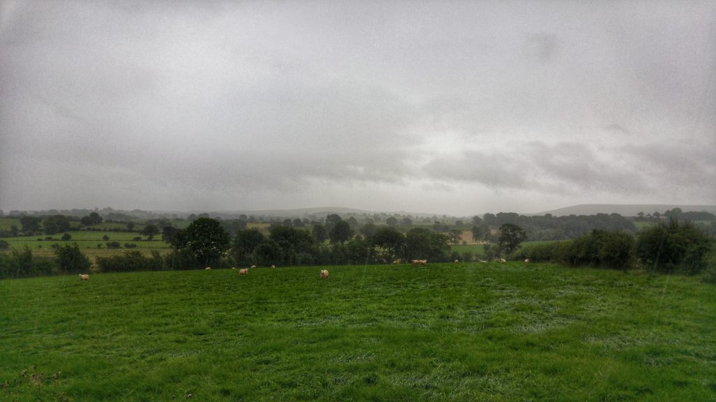
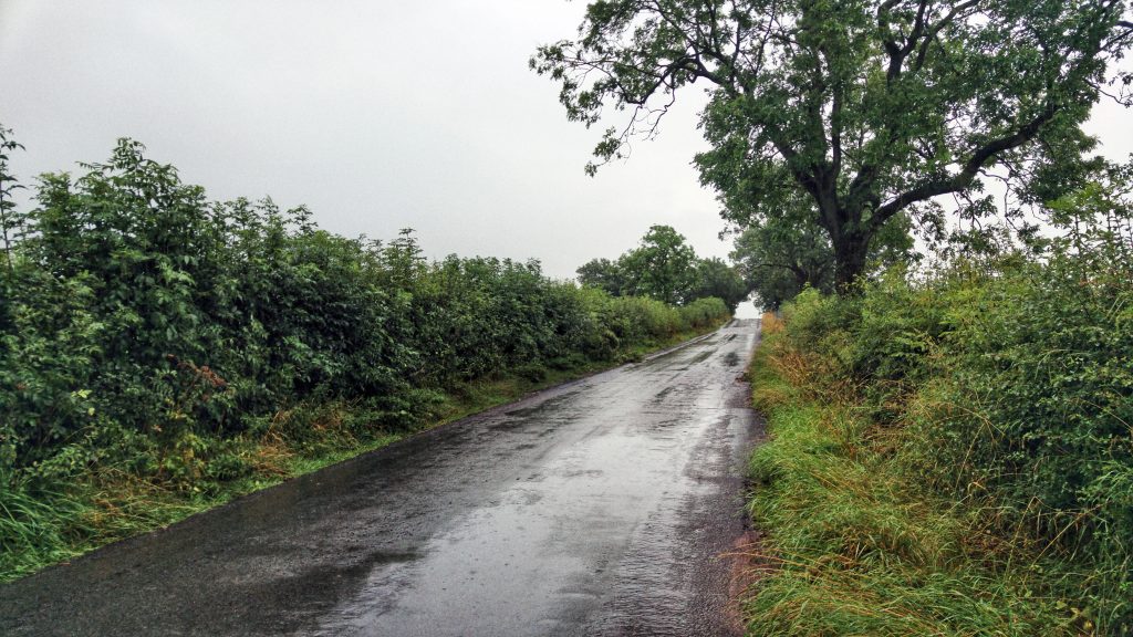
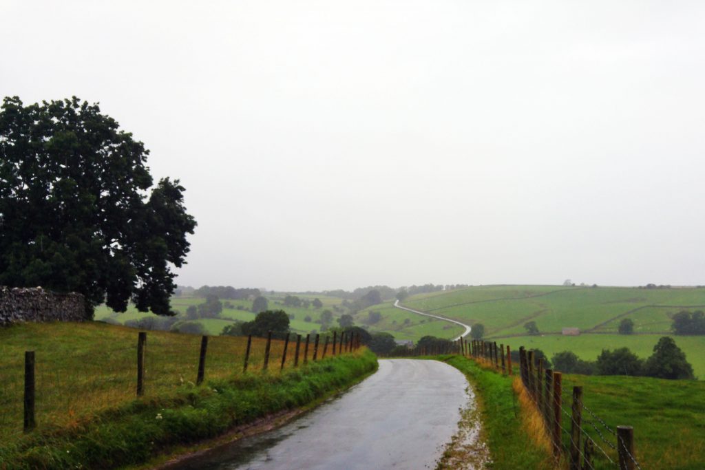
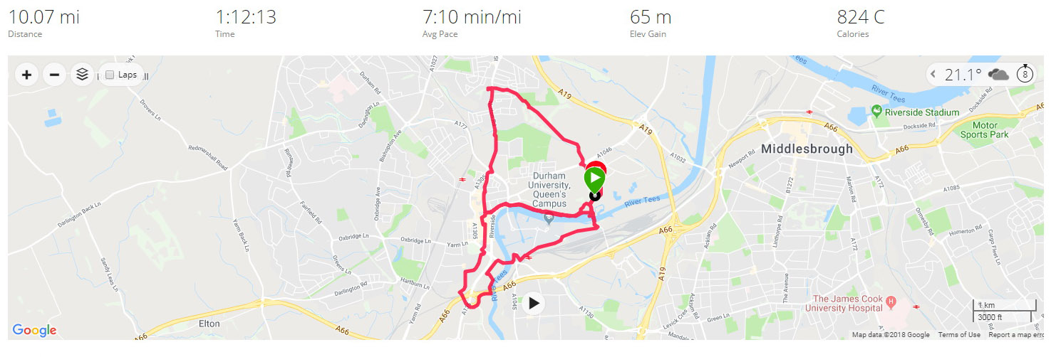
The first run of the Tour took place, not long after arriving in Stockton-on-Tees at the warmest part of the day (4pm) and what would be the warmest run of the holiday at 25C and pretty humid. The run was a simple out and back affair to Middlesborough town centre and back. I used the cycle path that runs along the River Tees for the most part. This section was quite enjoyable – the bit through some industrial zone in and around Vulcan Street was less pleasant with some reminders that this is not the most affluent area in the country.

A Bridge on the River Tees

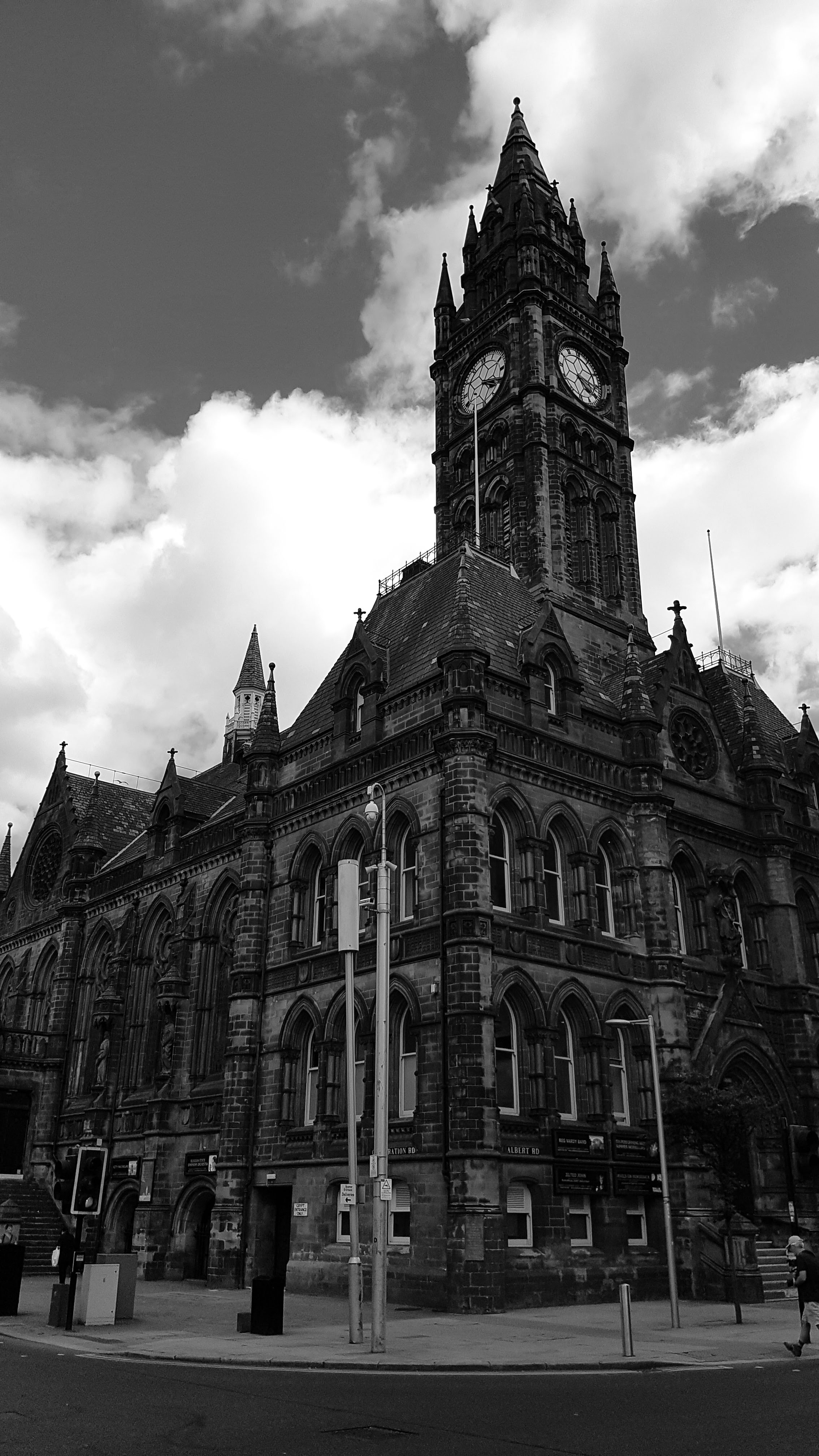
Once in Middlesborough I looked for some decent buildings to take a photo of. This proved a bit of a struggle and I resorted to black and white to make things look a bit more impressive. 

Middlesborough Town Centre

A struggle too was the actual run itself. I’d left Grantham feeling sub-par with some mild virus which affected me badly on a cycling TT just two days earlier. Added to that the right Achilles was grumbling and not enjoying the warm weather – plus I picked up some weird sharp pain in the left foot at just after halfway which led to me removing trainers and socks expecting to find a thorn or something equally sharp, but finding nothing. The pain soon went and did not return.

View from Stockton Tees Barrage Bridge

All that said, 10 miles at 6:46 pace was a solid start to the campaign.

Split Summary
===
1) 1m – 7:24(7:24/m) 133/148bpm 94cal 8.11/9.02mph
2) 1m – 6:37(6:37/m) 143/157bpm 92cal 9.06/9.64mph
3) 1m – 6:40(6:40/m) 152/156bpm 100cal 9.01/9.98mph
4) 1m – 6:36(6:36/m) 153/158bpm 99cal 9.08/9.43mph
5) 1m – 6:53(6:53/m) 146/157bpm 90cal 8.72/9.46mph
6) 1m – 6:48(6:48/m) 146/155bpm 89cal 8.83/10.18mph
7) 1m – 6:48(6:48/m) 152/158bpm 98cal 8.81/9.29mph
8) 1m – 6:39(6:39/m) 153/159bpm 97cal 9.03/9.68mph
9) 1m – 6:44(6:44/m) 152/158bpm 91cal 8.91/9.35mph
10) 1m – 6:32(6:32/m) 154/161bpm 94cal 9.18/10.08mph
11) 0.13m – 48(6:03/m) 158/162bpm 12cal 9.92/9.96mph

Best Strava Segment Performance: Forty Foot Teesaurus – 24th/334

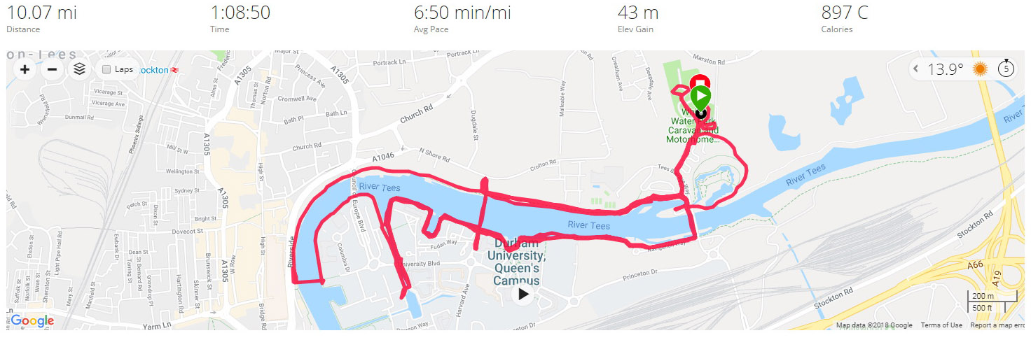
Day 2 – Friday 3 August 2018 – Stockton Loops

Not beginning the run until 11am meant that I was unable to use the Caravan site toilets (They were closed for cleaning) which meant the first couple of miles was spent trying to find a public convenience, which I eventually found in the Stockton Shopping Centre.

Stockton Town Centre, looking for toilets.

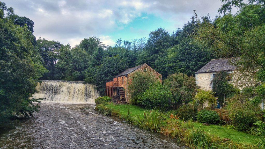
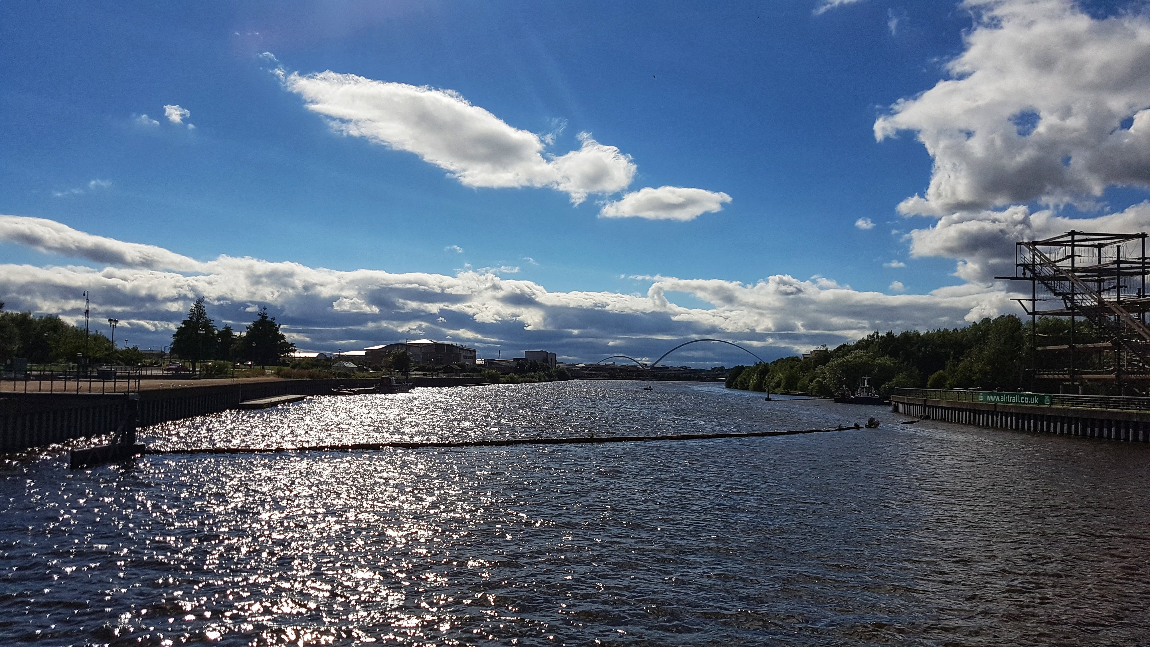
Once that had been sorted the rest of the run was trying to explore Stockton without resorting to an out and back effort. The town centre was all geared up for its Riverside Festival (Which we enjoyed the following day). The first half saw me try to follow the River Tees unsuccessfully, making my way through the Durham University Campus and back to the Tees Barrage where I was staying.

A Cycle Path on the Second Loop, close to a prison apparently.

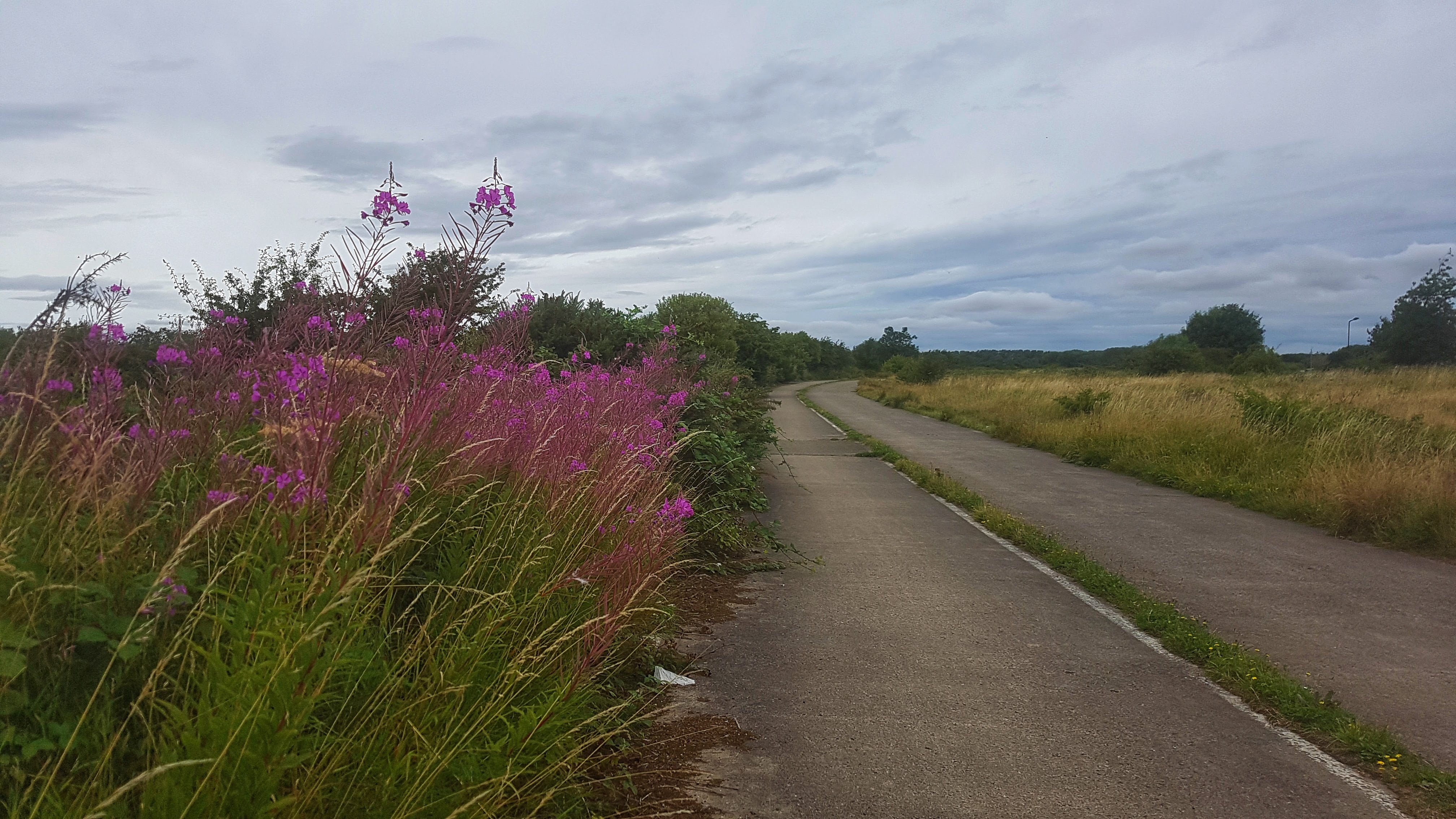
The second half had me following a Cycle Path around the back of the Caravan Site. This proved fruitful literally in the discovery of a bounty of early ripened blackberries which the kids returned to later that day to harvest. This path went past the Asda I had spent ages trying to find by car the day before (It was around half a mile away if you walked, rather than drove, which was nearer 3-4 miles). It then went over some barren land around the back of the prison with a path which looked like it served some other purpose years ago.

A Foot Path on the Second Loop

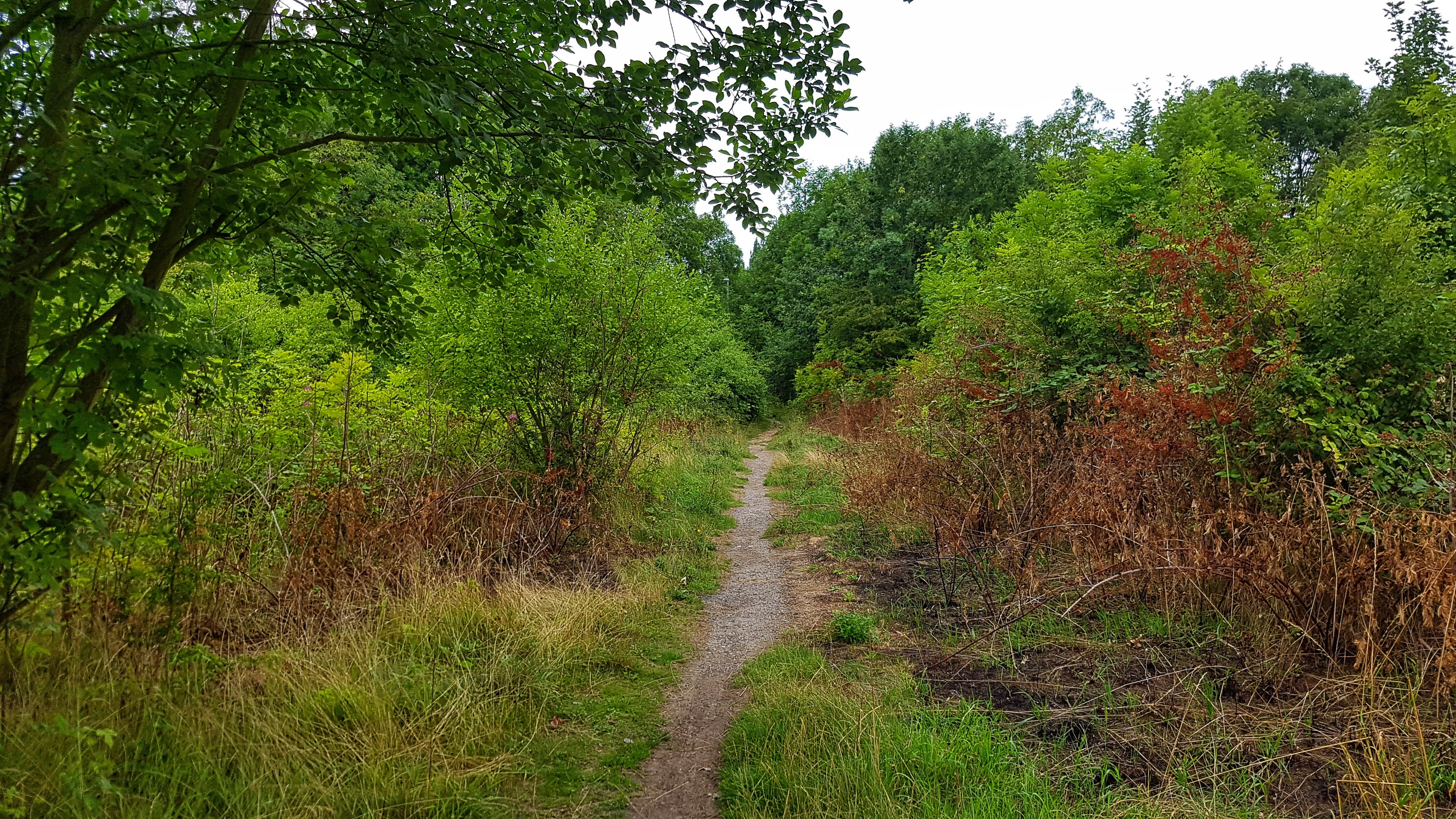
The cycle path briefly degenerated to a footpath before once again becoming a fully fledged cycle path. I could have followed this for ages but with over 10K covered I opted to head back into town on a main road before returning again on the Tees cycle path and back to the caravan park with a loop or two of the site to bring myself over 10 Miles.

As with Day One I was still feeling a little sub-par with the right Achilles hurting a fair amount. Some hamstring stretching appeared to be helping though. The photos too were struggling for inspiration…

Split Summary
===
1) 1m – 7:54(7:54/m) 123/138bpm 85cal 7.59/8.72mph
2) 1m – 7:53(7:53/m) 128/140bpm 87cal 7.61/8.35mph
3) 1m – 7:18(7:18/m) 134/144bpm 91cal 8.22/8.87mph
4) 1m – 7:05(7:05/m) 136/141bpm 88cal 8.48/9.25mph
5) 1m – 7:06(7:06/m) 139/148bpm 89cal 8.45/8.93mph
6) 1m – 6:59(6:59/m) 132/141bpm 71cal 8.58/10.54mph
7) 1m – 6:49(6:49/m) 134/141bpm 72cal 8.79/9.48mph
8) 1m – 7:02(7:02/m) 136/145bpm 76cal 8.53/9.83mph
9) 1m – 6:49(6:49/m) 140/148bpm 81cal 8.8/9.5mph
10) 1m – 6:51(6:51/m) 140/148bpm 79cal 8.76/9.52mph
11) 0.07m – 26(6:33/m) 141/142bpm 5cal 9.15/9.46mph

Best Strava Segment Performance: Dubliners to Barrage – 11th/115

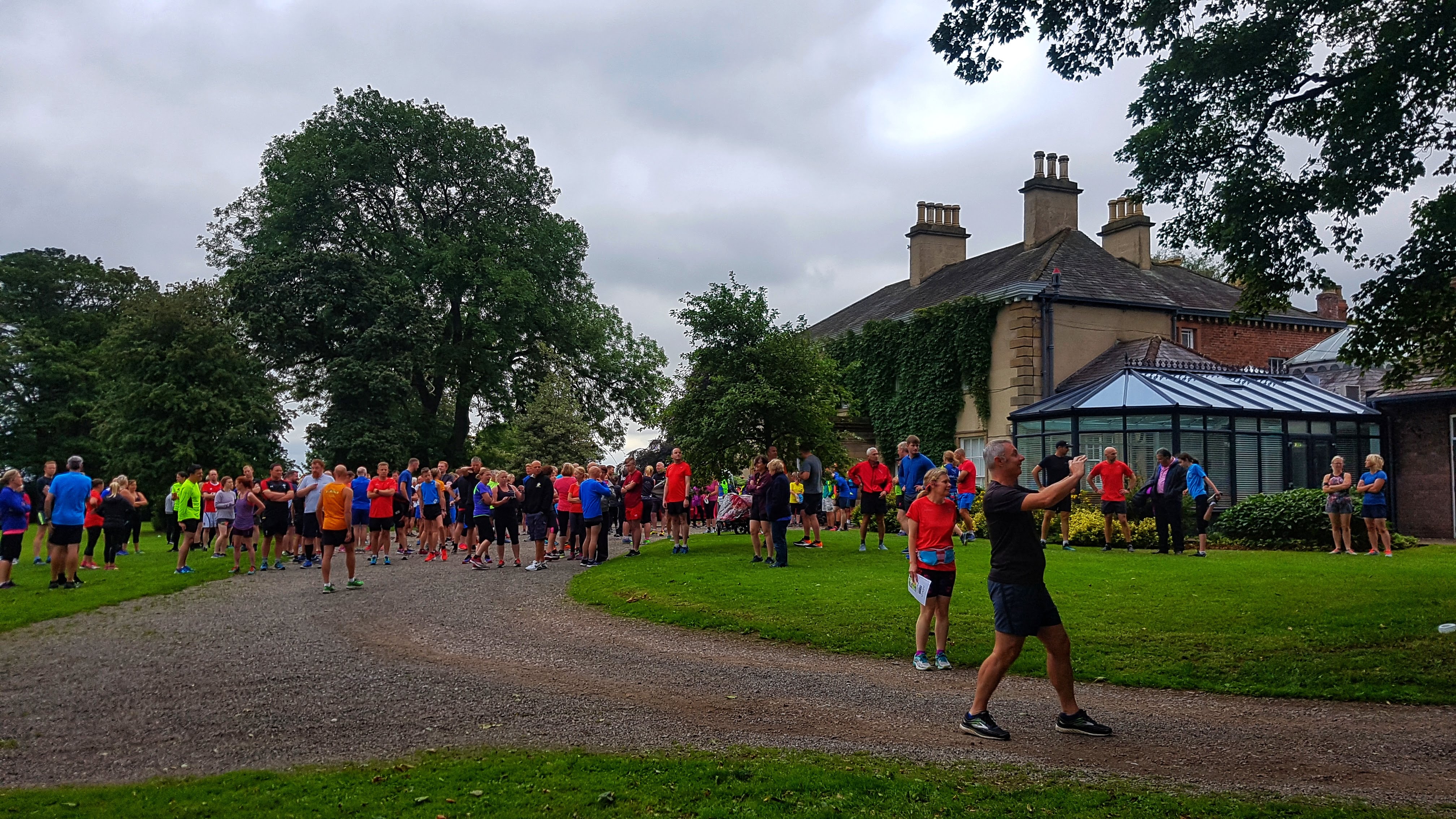
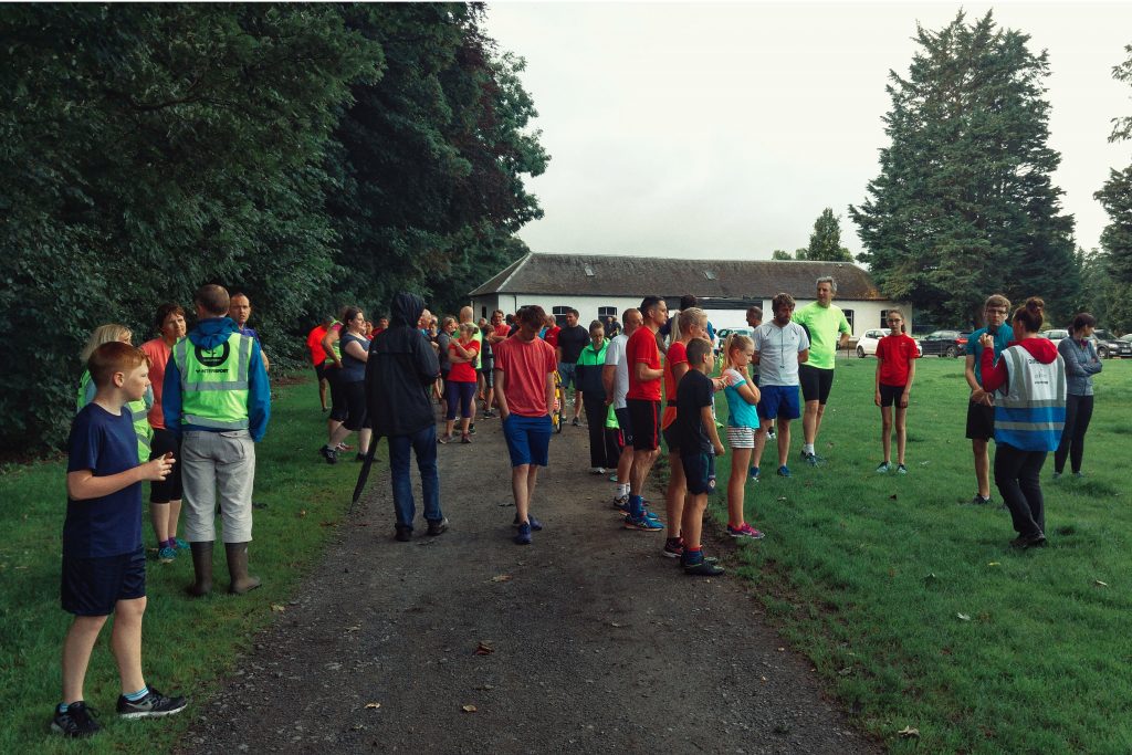
Day 3 – Saturday 4th August 2018 – Tees Barrage parkrun

It took a lot of convincing that it was a genuine coincidence that the first caravan site of the holiday was literally less than 400 meters from the start of Tees Barrage parkrun. I only caught wind of it a few weeks before the holiday, but was unsure of the route. It was only when I arrived in Stockton that I guessed this would not be your typical parkrun as none of it actually takes place in a park.

Setting off at 8am, an hour before the start, the first mile or so had me wondering whether I’d be able to complete the 5K course – the legs felt dreadful! It took at least three miles before the legs felt anywhere near half decent and even by the time I’d run 5.5 miles (Mostly covering sections that I thought were on the course) I held little hope for a respectable performance.

Pre parkrun at the start line five minutes before the off.

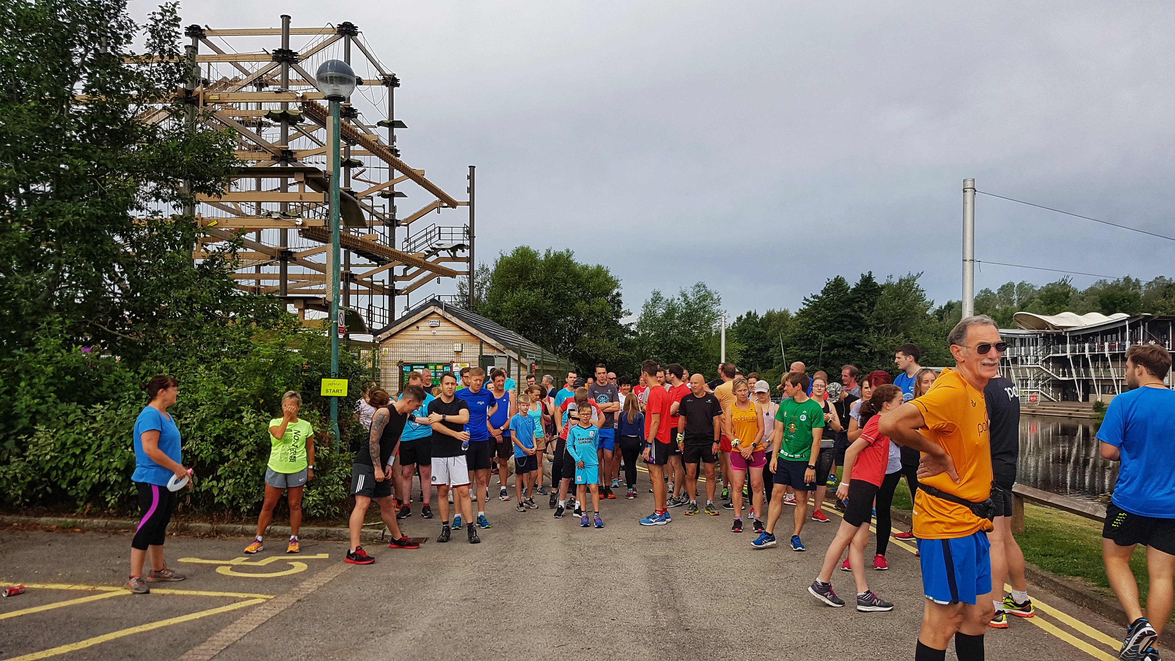
The pre-run guide to first timers was the best I’ve experienced so far at a parkrun – they had printed a large laminated map of the course and told me, as someone hoping to run around 18 minutes, to take a good look at it! I tried as best as possible to memorise it, but wasn’t totally convinced I knew where to go.

When the traditional question of whether any tourists were taking part, by coincidence I was stood next to a pair of runners who came for Holme Pierrepont Running Club, which is based in Nottingham – the closest city to Grantham. Talking to them further after the run, if this wasn’t coincidence enough it transpired they had taken part in the Belton House parkrun the week before and had spotted me running to the start of that parkrun along the A607. They also pointed out that I was wearing the same 2017 London Marathon finishers’ T-Shirt as I did at Belton House. They also noted that I finished first at Belton House. Would I repeat the feat 105 miles or so further North?

The Millennium Bridge – which we only covered once, thankfully!

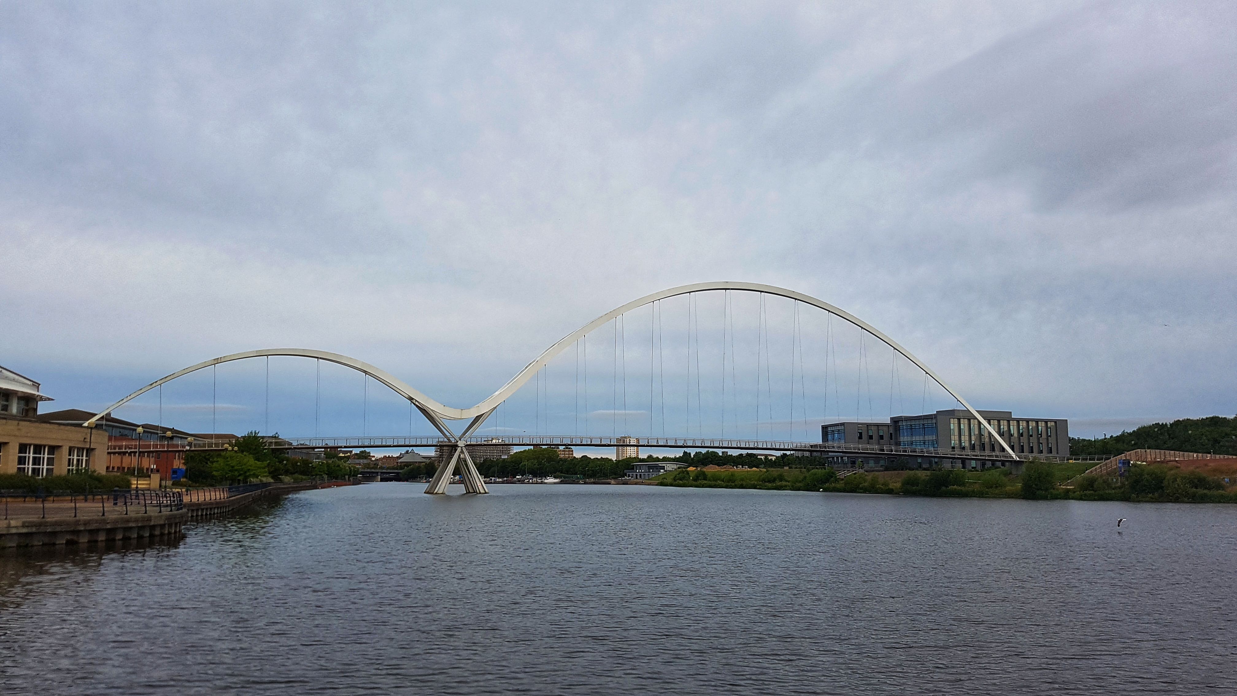
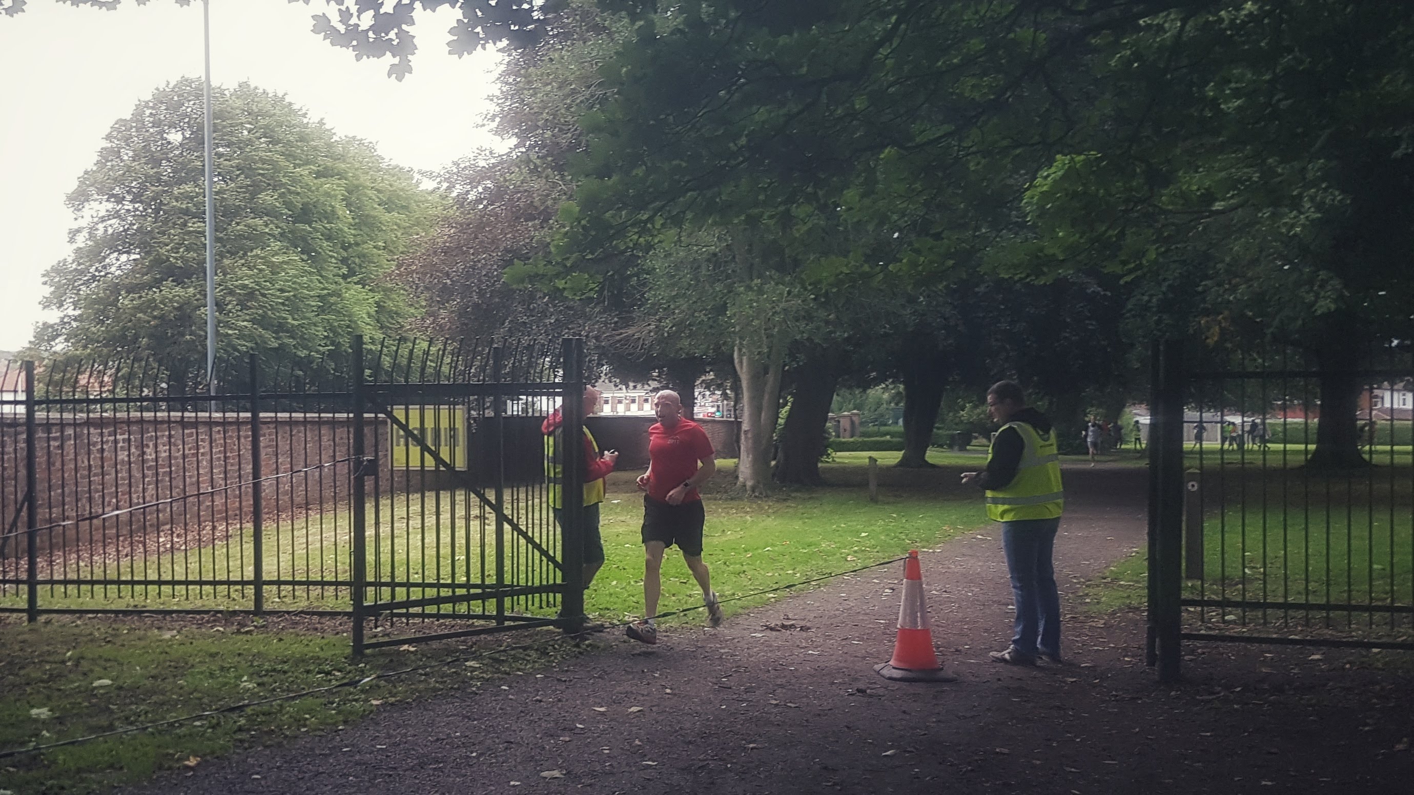
I made my usual fairly cautious parkrun start, that is to say I didn’t set off at a pace I couldn’t sustain. After 200 meters or so I found my legs were working quite well all of a sudden and I soon eased to the lead, eking out a 20 meter gap as we headed to the Millennium Bridge. As I’m really not a fan of bridges over water, especially when on foot or on bike, I went a bit more conservatively than those behind me and I was caught by a small group which soon became a group of myself and one other runner. We were running relatively swiftly, enough to ease ahead of the following pack, and as I wasn’t totally sure where I was running, I decided to stick on his shoulder and let him, for the most part, lead the way, only moving ahead when I felt the pace was slowing too much.

The canal section of the parkrun course (this photo wasn’t used on Strava).

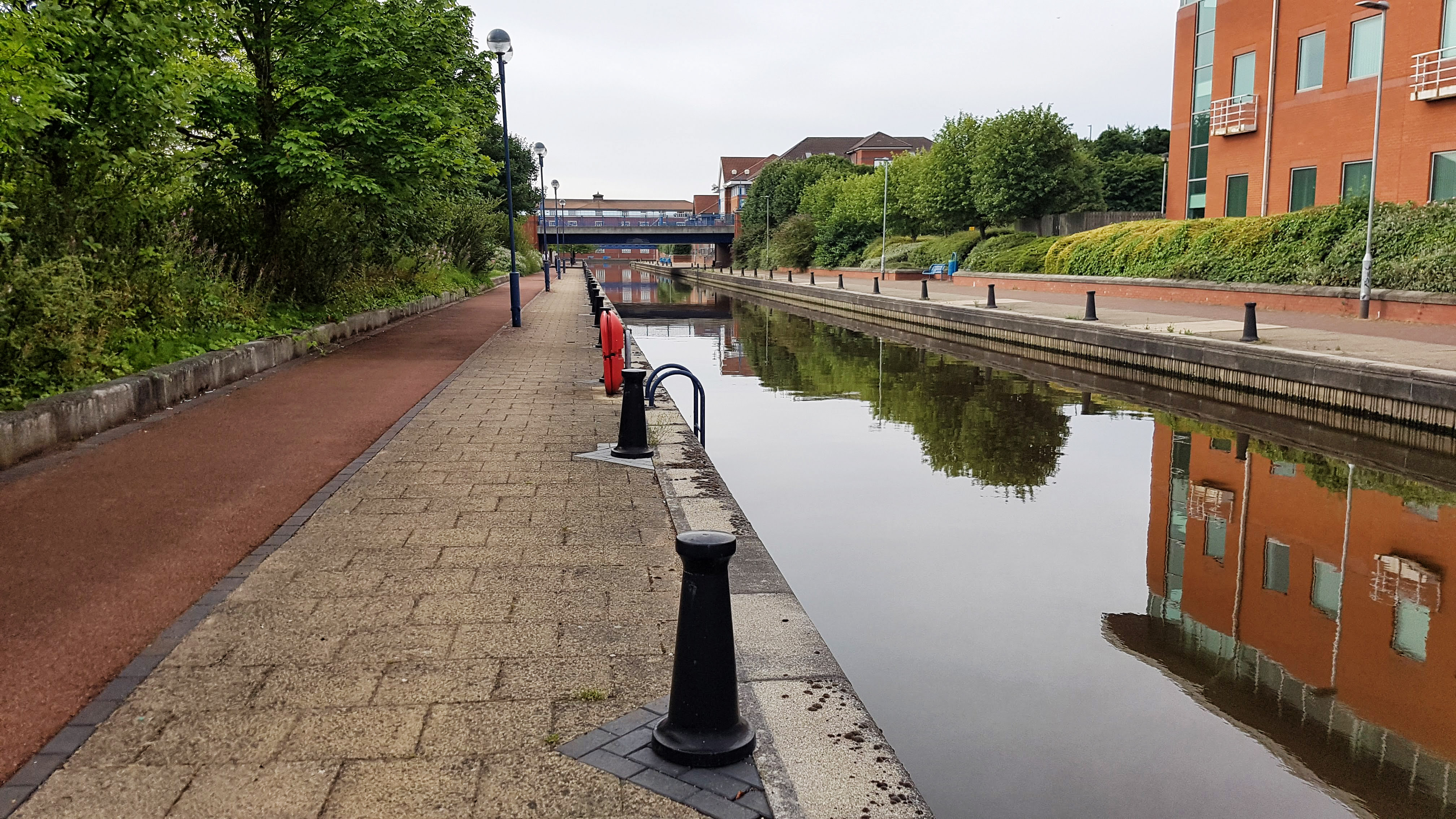
As the course traversed canal paths, bridges and rivers, it soon become apparent why this is not a particularly quick parkrun course. Despite being pretty flat there are numerous sharp 180 degree turns and a fair number of steps to be climbed too. I’d overheard a runner at the start saying that once we’d crossed the third bridge it was a mile to the finish and mostly free of any twists and turns. I took this as an opportunity to put the hammer down and picked up the pace. If you believe the Strava segment I ran the final mile and a bit at 5:06 pace, which I find surprising, but could explain why I pulled out 24 seconds on second placed James by the finish, which came all of a sudden and a bit sooner than expected!

The finish of the parkrun.

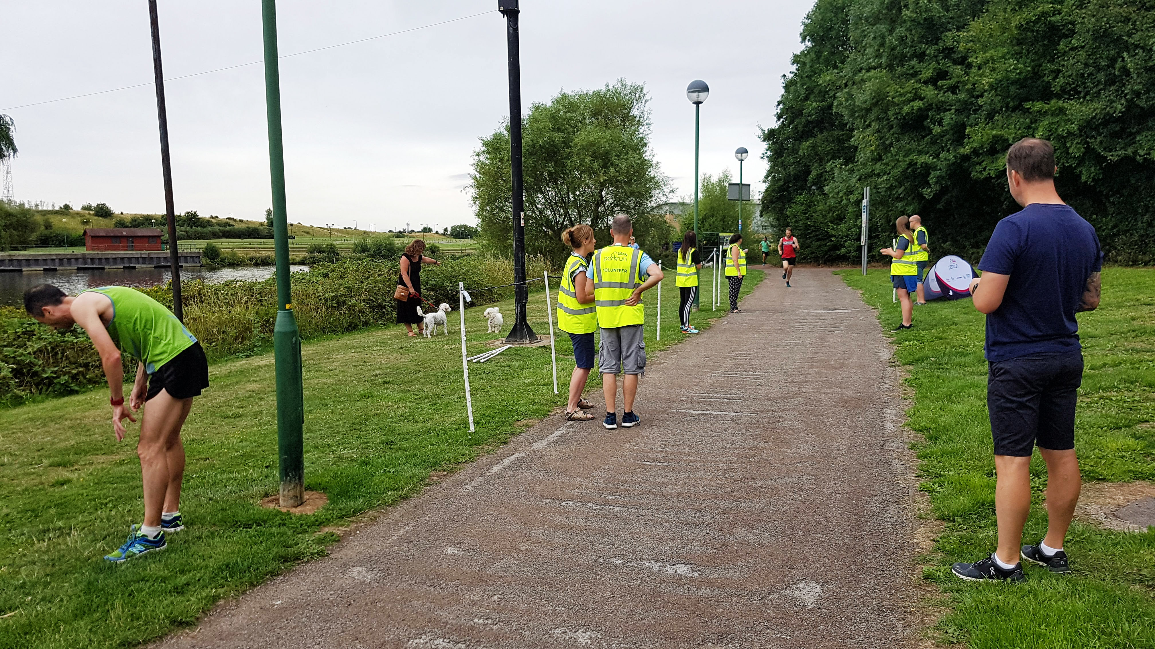
18:11 was a pleasing time given how bad the legs felt when I first started running, and has me 24th all time currently at the time of writing. After a good chat with the Holme Pirerrpont runners it was merely a case of an easy 1.5 miles warm down and a couple more loops of the Caravan Park to take the mileage just over the 10 miles.

Split Summary
===
1) 1m – 8:15(8:15/m) 118/134bpm 83cal 7.28/9.04mph
2) 1m – 7:31(7:31/m) 132/137bpm 94cal 7.97/8.37mph
3) 1m – 7:26(7:26/m) 134/142bpm 91cal 8.06/8.77mph
4) 1m – 6:56(6:56/m) 141/145bpm 94cal 8.65/9.06mph
5) 1m – 7:28(7:28/m) 136/147bpm 87cal 8.04/9.46mph
6) 1m – 6:04(6:04/m) 152/168bpm 85cal 9.89/13.3mph
7) 1m – 5:48(5:48/m) 166/169bpm 96cal 10.35/10.96mph
8) 1m – 5:50(5:50/m) 170/176bpm 99cal 10.29/11.33mph
9) 1m – 6:08(6:08/m) 156/175bpm 85cal 9.79/11.4mph
10) 1m – 6:55(6:55/m) 140/149bpm 78cal 8.67/9.5mph
11) 0.07m – 28(6:27/m) 142/144bpm 5cal 9.3/9.18mph

Best Strava Segment Performance: Difficult 4th km – 7th/1966

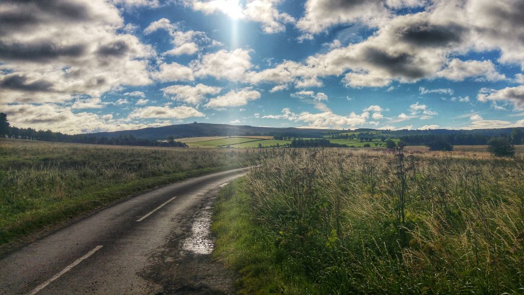
With the third run completed it was onwards and upwards to Berwick!

Leg One Summary

Distance Run: 30.3 miles. Average Pace: 6:55 per mile. Accumulated Time: 3:29:32. Average HR: 142; Total Ascent: 150 meters.

The ‘2018 Tour of Britain’ Leg Five – Bunree (Onich)


Bunree Caravan Club Site – probably the best backdrop we’ve stayed at (And the poorest weather!)

Bunree lies just north of Onich on the eastern shore of Loch Linhe and consists of little more than a few houses and a Caravan Site. With the A82 nearby however it is only a few miles from Glencoe and Fort William – which is the main town in this part of the Scottish Highlands and just a few miles from Ben Nevis.

Glen Nevis before the rain again came down!

While the views are undoubtedly spectacular, poor weather for the majority of out three day stay meant our tourist exploits were limited to an afternoon in Fort William, a very wet walk in Glen Nevis, and an enjoyable short walk up to Inchree Falls – just a mile or so away from where we were staying – where we were also able to spot some red squirrels!

Day 13 – Tuesday 14th August 2018 – Lost the woodland trail so played it safe on the A82…

Not long after arriving at the spectacular Bunree Caravan Site I was reading the welcome brochure over lunch and it soon became clear that the place to head to for my first run was the nearby Glen Righ Forest, which promised miles of paths and tracks – ideal for walking and mountain biking. They didn’t specify running per se but I knew that this could be a runner’s playground!

It was a wet and wild afternoon in the Highlands so I was a little delayed heading out as the caravan’s awning was doing it’s best impression of being a sail as we struggled to attach it to the caravan and peg it down before it blew away.  Finally at 3:40 pm I was on my way – thankfully the rain had stopped and the wind began to die down, the sun even threatened to make an appearance!

Half a mile of single track road later and I was on the busy A82, but it was just a case of crossing it and heading onto a small road that took me through the small village of Inchree and on to the Glen Righ Forest car park. There was an information board which offered up two circular walks – one was to the Inchree Falls, the other called Wades Road Walk, named after the Military Road.

I wanted to save the waterfalls experience as a family one so I opted for the Wades Road Walk, which was advertised as 3.8 km long. I set off along a trail which was narrow but very well maintained and not that technical as it made it’s way rapidly deep into the heart of the forest.

The photo doesn’t do justice to the colours in this forest (and the severity of the climb!)

The trail may not have been technical, but boy was it steep! My first mile, that took me to the car park, was a 7:34, my second mile 9:01, but Strava GAP rates it as a 6:12, having climbed 440 feet in just over 3/4s mile at an average of 9%, with a savage section of just 0.13 mile which averages 17% on the Strava Segment. I’m not sure the steepest bit of it is 72.7% as Strava claims, but I reckon it was around 33% for around 20 seconds of running. Given that I did this section at 10:47 per mile pace, yet sit third in the Strava segment gives an idea of its severity. The amusingly spoonerised segment for the entire climb Hairway to Steven has me second, a minute off the leader, which would have been less had I not stopped to take the photo above!

Arguably the most scenic half mile of running on my Tour in Glen Righ Forest.

Just as I felt like my legs would give up completely, thankfully the climb fizzled out as I presumably joined the Old Military Road. Following the coloured post I took a left turn or two and began to drop back down the hill I had just risen. It was probably a combination of the adrenaline still coursing through me after the hill as I began to hurtle downhill, the sun just attempting to break through after four days of thick cloud cover and the stunning scenery, with views of the forest, the mountains and the Loch below, but this half mile of running (as shown in the photo above) was perhaps the most enjoyable and scenic of the entire Tour.

Alas the views were not to last forever as the descent got steeper and steeper and dropped back into the forest, round some pretty tight alpine style hairpin bends. I think I missed the turning back to the car park for I continued to drop, quite quickly (a 6:22 third mile) past some holiday lodges and suddenly onto the A82. I had to rely on Google Maps to advise me that I had popped out around a third of a mile north from where I had last seen the popular A road.

Luckily for me, although the overwhelming majority of the A82 has no pavement and is wholly unsuitable for running on, this section did in the form of a shared cycle path. Even more fortunate was the presence of an information board just a little way along the road which explained that this cycle path ran from North Ballachulish to Fort William, using the Corran Ferry and the continuation of the path on the A861 to offer cyclists especially an alternative route to Fort William, avoiding the busy A82.

The Corran Ferry – one of the few remaining ferry services in the Highlands – taking passengers from the A82 to the A861.

With less than four miles covered I knew that I would have to do plenty of exploring to make up the ten miles. I had wanted to spend longer on the forest tracks, but didn’t really fancy another long climb up. Instead I first turned right onto the A82 and headed down to the Corran Ferry crossing, which had a boat just about to depart. Free to foot passengers, I briefly considered taking the short journey across the water but, thought the better of it given that my stomach was giving a few distress signals.

I decided I would instead head back initially to the caravan site to use the toilet facilities before using the cycle path on the A82 towards North Ballachulish to make up the distance. Relieved of stomach cramps I was soon back on the main A82, enjoying a cycle path that was, at that time, used by no-one other than myself.

There was around a mile of running to take me from Bunree to the more populated village of Onich, which sits mostly on the A82 and features a large number of B&Bs, which offer splendid views of, and easy access to the shores of Loch Linhee, which when I dived briefly off the road to take a photo, felt and smelled far more like a sea beach than the side of a lake.

I ran along a bit further, the cycle path looking a lot more like a pavement and barely suitable as a means of taking bikes along. I got to within 3/4s mile or so of Ballachulish Bridge – fortunately for me as someone who really does not like crossing bridges, it was time to turn around and head back to keep the run at 10 miles. The pace had picked up by itself almost without effort, the final three miles 6:21, 6:22, and 6:11 as I enjoyed the relatively flat terrain and good surface underneath me.

All that was required once returning to the Caravan Park was a quick lap of the site to ensure the run came in at over 10 miles, taking in the fine views around us and making it over to the laundry room to deposit my well worn running clothing!

Split Summary
===
1) 1m – 7:35(7:35/m) 121/139bpm 81cal 7.92/8.75mph
2) 1m – 9:01(9:01/m) 149/162bpm 134cal 6.65/8.87mph
3) 1m – 6:22(6:22/m) 131/144bpm 68cal 9.43/9.87mph
4) 1m – 6:56(6:56/m) 126/147bpm 63cal 8.66/9.29mph
5) 1m – 6:51(6:51/m) 135/143bpm 81cal 8.76/9.54mph
6) 1m – 6:37(6:37/m) 144/147bpm 92cal 9.07/9.48mph
7) 1m – 6:31(6:31/m) 140/147bpm 81cal 9.2/9.73mph
8) 1m – 6:20(6:20/m) 148/155bpm 90cal 9.47/10.21mph
9) 1m – 6:23(6:23/m) 153/159bpm 96cal 9.41/11mph
10) 1m – 6:10(6:10/m) 153/158bpm 92cal 9.72/10.4mph
11) 0.18m – 1:09(6:29/m) 132/153bpm 9cal 9.26/9.89mph

Best Strava Segment Performances: Hairway to Steven  2nd/90; Onich to Keppanach – 2nd/51.

Day 14 – Wednesday 15th August 2018 – More time in Glen Righ Forest

With road based options limited, unless I wanted to catch a ferry, the nearby Glen Righ Forest with the promise of miles and miles of forest tracks and footpaths was bound to be the spot at which I would spend the vast majority of my time at Bunree running. After a wet and wild night that made sleep difficult in the caravan, it was a fairly tardy 8:40 am before I set off for the Day 14 in the 21 day run challenge.

I decided I would head initially on the forest track I exited the forest from the afternoon before and carry on running to see where it would take me. This route up to the quarry was not as severe as how I made my way up to the same place the day before, but it was still a mile and a half or so of climbing at an average of 6% which, with legs that had not fully woken up, was something of a challenge. It was surprising to see on my return that I had bagged the existing Strava segment for the climb as I didn’t think I was running particularly fluidly and had clocked a 8:15 mile after an initial 8:13 mile. The devil was in the detail though as I had climbed nearly 600 feet.

Following a brief plateau there was a choice of paths to take. I consulted Google Maps and took the one that appeared to go on for the longest distance.  On I climbed for another mile and a half or so, still heading uphill, but not quite so slowly now the gradient had eased to a more manageable 4% average.

Loch Linhe from Glen Righ Forest – mountains obscured by pesky low cloud.

Once again the views were quite spectacular and I couldn’t help but stop two or three times to take some pictures and just take in the splendour, which would have been even greater were it not for the low cloud that continued to plague our stay in the Highlands.

Just one of many small waterfalls in Glen Righ Forest.

As I climbed the views were typical to those above – scenic Loch to the left of me, forest and numerous small waterfalls to the right. I didn’t want it to end but when the Garmin clicked to around 3.5 miles there was the tell tail signs that this track was not going to last for ever. The road levelled out for a little while followed by what I presume is a large turning circle for quarry vehicles cut into the rock face. Then the gravel track gradually faded to grass, not long after coming to a halt as forest untouched by humans stopped me in my path.

The end of the Road in Glen Righ Forest.

With no alternative but to turn around and head back, it was a more or less a case of relaxing and let gravity do its stuff as I began a long three mile plus descent back down to the A82:  6:26 for mile 5, then 5:49 and 5:38 for miles 6 and 7. As the gradient was not too severe it was an enjoyable descent as I took in the glorious scenery one final time – for I knew that tomorrow I would explore a different part of the forest.

Back on the A82 and with three miles left to fill I decided to do a bit of research for the next day’s run trying to find the forest path on Google Maps that went on much further than any of the other paths. First I headed back to the forest car park where I’d headed to the previous day and began to run towards the Inchree Falls before noting that the map didn’t think this was the right path. Going back on myself it then appeared to show the path cutting through a set of private holiday chalets which most definitely did not have a large track running through it.

Fortunately all this ultimately pointless exploring meant that once I’d returned to the caravan site and done a lap, or maybe two, the ten miles was covered – barely – just 0.03 miles over the required amount. A slightly frustrating end to a run that had begun so beautifully, but I knew there was always tomorrow and hopefully a run along the elusive path deep into the forest!

Split Summary
===
1) 1m – 8:14(8:14/m) 125/146bpm 94cal 7.29/8.41mph
2) 1m – 8:15(8:15/m) 149/155bpm 125cal 7.27/8.01mph
3) 1m – 7:41(7:41/m) 143/157bpm 103cal 7.82/8.66mph
4) 1m – 7:14(7:14/m) 139/156bpm 88cal 8.3/8.58mph
5) 1m – 6:26(6:26/m) 133/142bpm 66cal 9.33/10.29mph
6) 1m – 5:49(5:49/m) 143/150bpm 77cal 10.32/11.37mph
7) 1m – 5:38(5:38/m) 142/149bpm 72cal 10.64/12.06mph
8) 1m – 6:45(6:45/m) 143/152bpm 84cal 8.89/10.48mph
9) 1m – 6:48(6:48/m) 134/148bpm 60cal 8.83/10.14mph
10) 1m – 6:19(6:19/m) 140/150bpm 72cal 9.5/10.08mph
11) 0.04m – 15(6:18/m) 140/140bpm 2cal 9.52/9.58mph

Best Strava Segment Performances: Gate to Quarry – 1st/21; To the end – 1st/11; From top to bottom – 1st/1(!); From A82 to Inchree Carpark – 1st/77.

Day 15 – Thursday 16th August 2018 – As far as I could go without a hard hat.

Our last day in the Highlands brought a slight change to the now conventional timetable where I would run in the morning before heading off somewhere with the family on my return. Because of the poor weather forecast we decided to head off early for our planned walk at Glen Nevis before returning in the afternoon for a run while the kids would be entertained with a film or two we promised they could watch as a reward for their walking efforts.

This plan backfired somewhat when the weather, as we drove to the Ben Nevis Visitor Centre, deteriorated rapidly with a heavy storm only abating 20 minutes or so after we had parked. We managed to enjoy a family walk where we only got quite wet. That was until the last mile or so when the heavens, once again, opened in quite spectacular fashion, leaving us all soaked to the bone and me heading off back to the car to rescue the others huddling under an inadequate tree!

After returning back to the caravan for lunch and a chance to dry off, I set off on my run at just after 4pm. Unlike the past two runs I knew exactly where I was heading. The previous afternoon we had enjoyed a short walk to the Inchree Falls back in Glen Righ Forest. On that circular walk I noted that at a junction in the forest tracks there was a road to the right that matched the long track on Google Maps I had failed to find on my run earlier that morning.

Inchree Falls – well worth another brief stop.

Heading once again to the Inchree car park and setting off on the relatively steep but not too technical path up to the Inchree Falls I had planned to carry on past them as I’d taken the liberty of photographing them the previous day to include on my Strava photos for the run. However, on reaching them with the skies partly cloudy but definitely with some sunshine, the waterfalls were far more photogenic than the day before, so there was an unplanned brief stop to capture their splendour once again.

The path from the waterfalls climbed a little further before reaching the junction, where I turned right and headed along the track to who knew where.  From the walk the previous day I knew that it must lead to something for we were passed by a car or two heading from somewhere. The forest track, although unpaved was in good condition to be driven on and a cattle grid gave more clues that this was not exactly a relic from the past.

Heading to where? In Glen Righ Forest.

As I climbed as far as the road wanted to go I was presented with the view above – the hills and mountains mostly clear to see for the first time since arriving in the Highlands. To the right of me were wild Highland cattle enjoying the pastures. In the distance on the bend I could see a building or two which looked like it served an industrial purpose. As I passed this an LPG lorry squeezed past me. It was quite strange to experience traffic on a road which appeared to be heading deep into nowhere.

I continued running for another couple of miles, the pace very comfortable at around 6:40 a mile, the road twisting and turning gently, a parked car where a moderately sized river (presumably heading to Inchree Falls) hugged the track, a house or two – one long since derelict, the other clearly currently lived in. Then some noise of construction – off the track and in the forest covered hills a small hut and machinery seemingly clearing the trees from the hill and smoothing the ground on the hill itself.

The path took me away from this work for another mile or so when I approached a small bridge and a warning sign telling me in no uncertain terms that entry was forbidden by law unless you were wearing a hard hat. Quite what was beyond the bridge and sign I wasn’t totally sure, but I wasn’t going to risk life and limb to find out, especially as the Garmin had very conveniently just clicked over the five mile mark, making it very conveniently a ten mile out and back run in total if I retraced my steps to the letter.

Heading back to base after reaching as far as I could legally go in Glen Righ Forest.

Just as the photo above was taken the heavens opened once again that day and I was soon pretty wet, but with the legs feeling really good – perhaps the best they’d felt all holiday, and the scenery continuing to delight with every twist and turn, I didn’t mind the rain at all. The return miles back to the A82 were a 6:34, 6:24, 6:13, 6:21 and 6:02 – speeding up as the road began to head downhill for the final mile where I missed the waterfall path and continued on the main track back to the car park. It wasn’t all running however as it  included a brief spell of enforced walking. The ten or so Highland cattle who were on the pastures had settled on the road and although the signs said they were fairly tolerant with humans, I didn’t want to stress them or have them testing their sizeable horns by running towards them in a speedy manner!

Crossing the A82 it was just a case of returning to the Caravan Park. Feeling great still the pace effortless gravitated towards 6 minute miles, but felt as if I was almost jogging. This run may have just have edged it as the most enjoyable on my Tour of Britain: very nearly road and traffic free but on a surface that was easy to run on; some stunning views with a the waterfalls, mountains and forests all looking amazing when the sun peeked through the clouds for the first time in days; an out and back run that forced a turnaround at just at the right moment; and legs that felt as if they were coming into some kind of good form rather than feeling exhausted like they should have been.

With the run done it was time to say goodbye to the Highlands and prepare for the long journey back into England!

Split Summary
===
1) 1m – 7:15(7:15/m) 127/141bpm 86cal 8.27/9.6mph
2) 1m – 7:57(7:57/m) 143/159bpm 110cal 7.55/9.77mph
3) 1m – 6:39(6:39/m) 138/150bpm 84cal 9.03/9.71mph
4) 1m – 6:43(6:43/m) 141/147bpm 89cal 8.94/9.33mph
5) 1m – 6:36(6:36/m) 144/149bpm 91cal 9.08/9.52mph
6) 1m – 6:33(6:33/m) 137/149bpm 74cal 9.15/10.6mph
7) 1m – 6:24(6:24/m) 144/147bpm 85cal 9.37/9.77mph
8) 1m – 6:13(6:13/m) 145/150bpm 81cal 9.65/10.12mph
9) 1m – 6:20(6:20/m) 145/156bpm 79cal 9.47/10.35mph
10) 1m – 6:02(6:02/m) 141/154bpm 67cal 9.93/10.73mph
11) 0.45m – 2:47(6:13/m) 147/152bpm 36cal 9.64/10.5mph

Best Strava Segment Performances (all created by me post run – there were no segments at the time of running):  From A82 to Inchree Carpark – 1st/77; To the Waterfall 1st/1 (bit surprised by this); Random Segment #1 – 1st/29; Back from the warning sign back – 1st/14; Drop back to the car park – 1st/49.

Leg Five Summary

Distance Run: 30.7 miles. Average Pace: 6:48 per mile. Accumulated Time: 3:28:47. Average HR: 140; Total Ascent: 727 meters.


The ‘2018 Tour of Britain’ – Leg Six – Dalston (Carlisle)

For our penultimate stop on our grand tour of northern Britain we headed 200 miles south from the Highlands via the mostly beautiful, at times challenging, A82, and the less scenic but undeniably easier to drive M74, which magically became the M6 as we returned to England and stayed at Dalston Hall Caravan Site, where a misjudgement over the height of the barrier very nearly wrote off our caravan!

Dalston is a large village around 4 miles southwest of Carlisle. Home of a Nestle factory ‘which has been on the outskirts of the village since 1952, processing 65 million litres of milk each year, and almost one billion sachets of Nescafe Cafe Menu products’ there was also a very nice fish and chip shop which we visited on the Saturday night!

A festival in Cockermouth.

Lying north of the Lake District, there was no shortage of places to visit on our short stay. We enjoyed Wordsworth’s house in Cockermouth, which happened to have a festival on that day (Our third on our trip!).

Keswick high street – Pedestrianised since our last visit nearly ten years ago!

We visited Keswick for perhaps the fifth time – we really enjoyed the Puzzling Place – a museum crammed with mind bending illusions and puzzles.

Moss Force at Newlands Hause.

From there we headed to Moss Force and Knott Rigg on Newlands Pass near Buttermere for some enjoyable Lake District hill scrambling and challenging driving. Carlisle provided a welcome playground for the kids who were beginning to tire of daily walks and we left Carlisle thinking that we definitely need to return to the Lake District again for a longer than three night stay.

Knott Rigg with Newlands Pass and Buttermere in the distance.
Knott Rigg.

Day 16 – Friday 17th August 2018 – Into Carlisle and Out Again

After the long drive south back into England I wanted little more than a simple, uncomplicated afternoon ten mile run with perhaps the odd sight or two to enjoy. The first issue was that the road on which the Caravan Park lay,  was a fairly busy, fast B-Road, with plenty of traffic heading out of Carlisle towards somewhere. I wanted to head to Carlisle itself but didn’t fancy running on the road. Thankfully the owner of the caravan park told me there was a footpath that ran to a cycle path that ran all the way to Carlisle and beyond.

The footpath on Dalston Manor Golf Course I became pretty familiar with.

Cycle paths are great for uncomplicated running I thought, so at a few minutes before 4 pm I headed off, under fairly leaden skies but, for the time being, dry. The route to the cycle path was quite a fun affair – across a golf course, down through some woodlands, along a well manicured grass path in a field, through another section of woodland before popping out on the main B Road just before Dalston, but right next to a private road which, if you headed along, through the self operated level crossing (a first for me!) headed to the long awaited cycle path. This sounds simple but required a fair amount of stopping and Google Map checking to assure myself that I was going in the right direction.

All this twisting and turning meant, at 8:02, the first mile was pretty slow, but once on the cycle path the pace naturally lowered to or just under 7 minute miles. I was though, having discovered that day there was a parkrun in Carlisle taking place on Saturday morning, taking it deliberately easy.

The cycle path running close to the railway.

The path ran alongside a fairly quiet railway, at times it got very close to the railway – close enough to almost be able to touch a passing train if you were to be so stupid. I wasn’t so I carried on running.  Arriving at the small village of Cummersdale I was briefly running on road before joining another path that was a little more undulating having left the path of the railway and instead copying the path of the River Caldew.

Cummersdale Holmes cycle path in Carlisle (Not a Strava picture).

After five miles of running I was beginning to wonder if I’d ever reach Carlisle, but the welcoming sight of a signpost for Carlisle Castle assured me that I was indeed in the heart of the city.

Carlisle Castle.

Crossing a pedestrian bridge I stopped briefly to take a photo of the outside of the castle. Behind me was a the busy A595 which didn’t look to fun to run along so with some more Google mapping I cut into the heart of Carlisle, passing the Cathedral and through the pedestrianised shopping centre.

Carlisle Cathedral – just before the rain came.

I then got a little lost trying to get myself on the Dalston Road which I figured may just take me back to Dalston where I was staying. Things weren’t helped by a squally shower making things decidedly unpleasant for a while before things calmed down, but didn’t exactly brighten up.

I ran along Dalston Road for a couple of miles, where in total I managed to notch up a trio of 7:11 miles. At a set of roadworks I noted that I could take a quiet road back to the small village of Cummersdale where I reckoned I could rejoin the cycle path back to the Caravan Park rather than face running on the busy main road back during the heart of a Friday evening rush hour.

Once I’d worked out that I could follow the road down to the main cycle path and ignore the foot paths across muddy fields, it was with some relief that I was back on the cycle path, where I knocked out a couple of easy six fifty something miles to bring me back to to the Caravan Park via the twists and turns of the unofficial footpath of the golf course. A ten and a third mile done with the minimum of energy expenditure followed by the plushest showers I’ve ever used at a Caravan Park! Happy Days!

Split Summary
===
1) 1m – 8:02(8:02/m) 113/133bpm 74cal 7.47/8.72mph
2) 1m – 6:57(6:57/m) 127/141bpm 80cal 8.64/9.08mph
3) 1m – 6:50(6:50/m) 136/144bpm 90cal 8.78/9.27mph
4) 1m – 6:52(6:52/m) 135/148bpm 84cal 8.75/9.33mph
5) 1m – 7:11(7:11/m) 131/145bpm 75cal 8.35/9.29mph
6) 1m – 7:10(7:10/m) 130/145bpm 73cal 8.36/10.27mph
7) 1m – 7:11(7:11/m) 142/148bpm 97cal 8.35/9.1mph
8) 1m – 6:54(6:55/m) 131/147bpm 64cal 8.69/9.89mph
9) 1m – 6:51(6:51/m) 143/148bpm 91cal 8.76/9.33mph
10) 1m – 7:01(7:01/m) 143/148bpm 91cal 8.54/9.73mph
11) 0.33m – 2:39(7:58/m) 148/154bpm 37cal 7.53/8.95mph

Best Strava Segment Performance:  Richie to pirelli lane – 36th/490

Day 17 – Saturday 18th August 2018 – Five miles then Carlisle parkrun (1st, 17:59), five miles to end it.

Unlike the Tees Barrage parkrun in Stockton that I was aware of in advance of us setting off on holiday, I genuinely wasn’t aware that there was a parkrun in Carlisle until a day or so before arriving at Dalston. I really don’t know why I didn’t think there would be a parkrun in a city, but it never crossed my mind.

Once I knew there was, there was the logistics of trying to get to it by running and not driving. Fortunately it was only three and a half miles away – as long as I ran on the busy B road from Dalston into Carlisle, a mile or so would have me running on the road. I reckoned that, at just after 8 am,  the traffic would not be so bad and thankfully I was proved correct, with less than a handful of cars passing me, all able to give me plenty of space as they passed.

Chance’s Park, home of Carlisle parkrun.

Considering I had to run through some back streets to make it to the park, I got to Chance’s Park, venue of Carlisle parkrun, relatively smoothly. I did double check with a pair in high-vis bibs that I was in the right place, they assured me I was and I relaxed somewhat. I chatted briefly to another pair of parkrun tourists, our paths would cross later, before heading off for a couple more miles or so working my way around the park, using the toilet facilities, and generally trying to kill half an hour or so before the 5K run began. The pre-parkrun miles were all run at a relaxed pace, the slowest 7:40, the quickest a 7 flat as I ended with a few strides to try and wake the legs.

The pre-run brief for first timers to Carlisle was far briefer than the one I enjoyed at Stockton. There was no map, no real information on where the course went other than it was three laps and we were shown where it began and finished. I had a fair idea of where we went, but I thought it would be prudent, whatever the pace, to not attempt to lead (if such a thing was possible) until the end of the opening lap. There was an intriguing aside from the marshal who pointed out that a lot of the Strava uploads from the parkrun showed the course to be 3.2 miles (5K is 3.1 miles), but was confident that the course was indeed exactly 5K. (I also overheard a couple of regulars who said the course was definitely long as it had been changed slightly from what it was originally).

Before the start of Carlisle parkrun.

At a few minutes past nine I lined up at the front of the 260 odd strong field and waited for the next pre-run biref to commence and finish. Finally at around 9:05 we were on our way. There was the usual surge of runners to the front, I was probably only just in the top ten after 300 meters, but slowly worked my way through to sit fourth at the back of a group of four.

The three lap parkrun was a twisty affair, partly run on grass, partly on footpaths, fairly constantly undulating and for today, pretty windy. It was reminiscent of a cross country course minus mud and spikes and with more tarmac – for which I was grateful. It was a good example of a parkrun in a regular kind of park. After all the definition of what constitutes a park has been stretched somewhat over the years to allow a parkrun to take place.

I stayed fourth until we reached the bottom of the park and made a hairpin bend that took us climbing back up a longish drag. I was confident I knew where the course went from here and felt the pace slow a touch so I pushed on and took the lead near the top of the hill, enjoying the immediate gradual downhill run following a hairpin which meant the pace naturally picked up. I went through a mile in 5:43, which I was pleased with given the undulating twisty nature of the course.

As I turned again sharp left to begin the second lap I tried my best to relax and enjoy the run. Halfway around the second lap before tackling the main climb again, I reckon I only had a few seconds on the second placed runner, by the time I reached the top it had pushed out to 15 or so and I knew that, barring disaster, first place was assured. The second mile was 5:35 and my legs felt great, bounding with confidence and purpose.

The final lap was much the same as the second, I was strongest of the field on the climb and extended my lead further. By now the biggest issue was back markers, of which there were many on a three lap course and on narrow pavements were tough to navigate at times. The third mile was a 5:36 and it was a very long 0.1 of a mile (as it was 0.2) of slightly uncomfortable slightly uphill running to the finish line. I finished first in 17:59, 38 seconds clear of the second placed runner. Given my splits I expected a bit quicker time but, I do believe the course was indeed a touch long.

The end of Carlisle parkrun.

I hung around a few minutes to clap some of the runners behind me home. The tourists I met earlier in the morning came home in a low 20 minutes, which for the girl as a 15-17 junior was very impressive – especially on her first parkrun attempt. She did however feel she was robbed of a position by another runner and I decided to leave before the argument got potentially heated.

Returning to a comfortable pace I made my way back to the Caravan Site. I reckoned the busy B road was indeed looking quite busy so I opted, as I had the day before, to take the left hand turn down to Cummersdale and the bicycle path back to Dalston. This meant that the run was as near as it can be half marathon distance by the time I’d run a lap or two of the caravan park. The average was a pleasing 6:49 and all was good, even if the legs felt pretty tired by the end. It was my third first place at parkrun in a row and I knew that, although the times suggested otherwise, there was some pleasing form arriving in the legs.

Split Summary
===
1) 1m – 7:41(7:41/m) 126/137bpm 93cal 7.81/8.7mph
2) 1m – 7:08(7:08/m) 132/142bpm 92cal 8.42/9.1mph
3) 1m – 7:20(7:20/m) 128/146bpm 80cal 8.19/9.33mph
4) 1m – 7:15(7:15/m) 137/151bpm 90cal 8.27/9.62mph
5) 1m – 7:00(7:00/m) 143/155bpm 94cal 8.57/10.23mph
6) 1m – 5:43(5:43/m) 159/169bpm 90cal 10.48/11.98mph
7) 1m – 5:35(5:35/m) 172/175bpm 98cal 10.76/11.61mph
8) 1m – 5:36(5:36/m) 174/178bpm 100cal 10.71/11.54mph
9) 1m – 6:53(6:53/m) 144/178bpm 79cal 8.72/11.15mph
10) 1m – 7:05(7:05/m) 146/152bpm 93cal 8.47/10.73mph
11) 1m – 6:49(6:49/m) 140/147bpm 71cal 8.81/9.68mph
12) 1m – 6:57(6:57/m) 145/149bpm 87cal 8.62/10.04mph
13) 1m – 7:31(7:31/m) 143/151bpm 80cal 7.98/9.64mph
14) 0.13m – 59(7:21/m) 139/140bpm 7cal 8.16/8.72mph

Best Strava Segment Performance:  Carlisle Parkrun – 17th/1216

Day 18 – Sunday 19th August 2018 – Wet Dalston Loop

For the final run in Dalston I decided to head into Dalston itself, pick a road and see where it would take me, hopefully making a loop out of the run rather than an out and back. As it was 8:30 am on a Sunday morning I reckoned I could safely make the 200 meters or so of road without pavement before making it into Dalston. This I managed to do, running for a mile or so through the large village waiting patiently for the legs to wake up, stopping a the church to take a photo which kind of matched the vintage ones in the nearby fish and chip shop the evening before.

The church in Dalston.

You may spot the pavement is wet and indeed it was raining, lightly at first and gradually intensifying during the run with heavy bursts of precipitation that eased and then returned for the entirety of the run. Fortunately it wasn’t cold, indeed the rain had apparently been blown in by the back end of a tropical storm, so it was actually almost as pleasant as running in the rain can be.

Fred Flintstone looking after someone’s garden in Dalston.

Through Dalston I spotted a sign for a footpath and cycle path so I took that, which went briefly went through park before leading to a bridge and  a private road containing an old factory and then some very pleasant looking houses alongside a stream, one of which was guarded by Fred Flintstone!

I found myself popped out at the other end of Dalston. A quick look at Google Maps showed that if I went up a short hill and turned right, there was a quiet country lane that could lead to more country lanes and the possibility of a loop. I ran along this road for a couple of miles, occasionally stopping to see when this road or roads that would allow me to loop around would appear.

An old sign post – I headed to the ‘village’ of Crown Inn…

I stopped at some houses with a very old looking sign post that included the familiar names of Dalston, Carlisle, Penrith, and Crown Inn. How odd I thought to myself that a pub would be advertised on a road sign post. I know there are examples of this – the road known as the Cat and Fiddle is the pub on top of hill upon which it sits upon is one that springs to mind, but still, I can’t think of many other instances where a pub is so ingrained in the landscape it merits a place on a road sign. I did though wonder, with the sign being so old, whether it still existed.

The Crown Inn – a pub worthy of a signpost in the middle of nowhere!

So I continued along the road for another mile and a half which took me to a set of cross roads with just one solitary building, which was The Crown Inn. It was not the most spectacular pub, looking a little tired – although most would with the weather I was running in.  After a brief stop I turned left and headed towards Durdar. The pace picked up, having struggled to break 7 minute miles I was not running 6:30 and quicker. It was only when I got back and checked the elevation profile did I realise that I had been climbing ever so gently 300 feet for the opening five miles of the run, and was now doing the same but going downhill.

What struck me about this road to Durdar, although it was almost totally devoid of road traffic and had no road markings, it had the hallmarks of a road that was once much busier. Wide enough to almost be an A road with junctions here and there that suggested that this road was once much busier. Indeed around half a mile further along the road was another pub, which had clearly closed some years ago and was in a state of some disrepair. I haven’t been able to confirm it but I can only assume that, pre-M6, this road may have been a far busier, more important road taking drivers north or south – hence the sign posted pub on a crossroads in the middle of nowhere with another not far along the road, both convenient stopping points for the long distance driver. I guess once the M6 arrived this road ceased to have any vital purpose other than taking drivers from one village to the next and, perhaps, taking some slack if there is ever a drama on the nearby M6.

I made it to Durdar with eight miles on the clock and turned left at the cross roads. This road back to Dalston was just as wide as the one I was on, but was still a busy popular road judging by the volume of traffic on it. I can’t say it was the most pleasant experience running on this busy road for three miles or so, in the rain, constantly changing from one side of the road to the other to keep myself visible to traffic on the bends and hills.

It was a relief at 11 miles when I returned to the house guarded by Fred Flinstone and the footpath I’d left some miles earlier. I could relax and head back to the caravan site. I opted at the end of the run to take the unofficial footpath through the golf course once again to my caravan, to make the run a second consecutive half marathon effort. Rather eerily I clocked 13.13 miles (exactly the same as the day before) in 1:29:35, just four seconds slower than the day before. A sub 3 marathon clocked over the 24 hours!

With that run done it was farewell to Carlisle and on to the final destination of the holiday – Yorkshire!

Split Summary
===
1) 1m – 7:43(7:43/m) 124/134bpm 89cal 7.77/8.89mph
2) 1m – 7:29(7:29/m) 128/135bpm 86cal 8.02/9.1mph
3) 1m – 7:07(7:07/m) 137/146bpm 93cal 8.44/8.81mph
4) 1m – 7:04(7:04/m) 134/148bpm 81cal 8.49/9.48mph
5) 1m – 6:58(6:58/m) 137/150bpm 84cal 8.62/9.33mph
6) 1m – 6:31(6:31/m) 133/143bpm 72cal 9.21/9.66mph
7) 1m – 6:30(6:30/m) 138/147bpm 81cal 9.23/9.83mph
8) 1m – 6:22(6:22/m) 140/148bpm 79cal 9.42/9.79mph
9) 1m – 6:29(6:29/m) 144/152bpm 86cal 9.27/9.91mph
10) 1m – 6:29(6:29/m) 147/155bpm 89cal 9.26/10mph
11) 1m – 6:19(6:19/m) 142/150bpm 75cal 9.51/9.93mph
12) 1m – 6:27(6:27/m) 144/152bpm 82cal 9.29/9.71mph
13) 1m – 7:14(7:14/m) 145/155bpm 92cal 8.3/10.62mph
14) 0.14m – 55(6:38/m) 145/146bpm 11cal 9.06/10.06mph

Best Strava Segment Performance:  Through and Out of Dalston – 3rd/68

Leg Six Summary

Distance Run: 36.6 miles. Average Pace: 6:54 per mile. Accumulated Time: 4:12:44. Average HR: 139; Total Ascent: 461 meters.

What I Did Last Summer…

Summer 2016 is fast becoming a fading memory as the nights draw in, vests and t-shirts are slowly shifting towards the back of the drawers as the long sleeve tops look more likely in the coming days, weeks and months.

For the record I probably had the best summer holiday I ever had. Long a dream of mine, my family and I spent three weeks touring with a caravan up and down the British Isles – three nights each in seven different caravan sites. With the Robin Hood Half Marathon the target race at the end of September, I didn’t want to neglect the training (not that I ever really do), so I packed a couple of pairs of trainers with the intention of trying to run as near as possible every day while away. I had no hard and fast training plan, other than a rough idea to try and run around 10 miles each day, occasionally putting in some effort, but really just trying to bank plenty of miles.

Some years ago (2011, I think) when I was traveling on the F1 circus and trying to run as much as possible, when technology allowed me to carry a portable waterproof camera, for one year I attempted to take photographs during each run to capture some of the interesting things you see every day when running. I had grand intentions to make something of them but it never really materialised, partly because I had no real medium to show off the pictures.

Fast forward to 2016 and thanks to the wonders of smart phones having cameras that can, in some situations, rival SLR cameras for clarity, and a Flipbelt to easily carry the phone, I planned to try to capture my holiday through three photos uploaded with each run that appeared on Strava. Not always very good nor interesting, nonetheless I really enjoyed capturing the different things I saw over the three weeks and thought that, some weeks later, I should really put it in my blog, for posterity, if nothing else.

Run #1 Exploring the Norfolk Broads

Morning run - River Ant, How Hill. Norfolk Broads Caravan Club Site, Ludham, Wroxham, Wednesday 3rd August 2016.
Morning run – River Ant, How Hill.
Morning run - River Ant, How Hill. Norfolk Broads Caravan Club Site, Ludham, Wroxham, Wednesday 3rd August 2016.
Morning run – River Ant, How Hill.
Morning run - River Ant. Norfolk Broads Caravan Club Site, Ludham, Wroxham, Wednesday 3rd August 2016.
Morning run – River Ant.
Norfolk Broads Caravan Club Site, Ludham, Wroxham, Wednesday 3rd August 2016.

We had arrived at the caravan site much later than planned on the Tuesday (AA called before we even left, nearly didn’t make it at all!) so Wednesday morning was the first opportunity to run. The two Norfolk Broads morning runs were the only two which took place ‘mid-morning’. After this run it was up at 7am and out running by half past the hour, whenever possible.

Having never experienced the Broads before, I was struck by the beauty of the area – even if it soon dawned on me that the canals / rivers were not easily navigable by foot.

Run #2 More Norfolk Broads Exploring.

Morning run - Bewilderwood entrance. Norfolk Broads Caravan Club Site, Ludham, Wroxham, Thursday 4th August 2016.
Morning run – Bewilderwood entrance.
Morning run - Horning pleasure steamer. Norfolk Broads Caravan Club Site, Ludham, Wroxham, Thursday 4th August 2016.
Morning run – Horning pleasure steamer.
Morning run - footpath near Horning. Norfolk Broads Caravan Club Site, Ludham, Wroxham, Thursday 4th August 2016.
Morning run – footpath near Horning.
Norfolk Broads Caravan Club Site, Ludham, Wroxham, Thursday 4th August 2016.

I still didn’t have much of a clue where I was running on our final day in the Norfolk Broads. The site of a pleasure steamer was a bit of a surprise! I took a picture of Bewilderwood! to show the kids, as it one of their favourite days out and I wanted to show them how relatively close we were to it. This run saw the first of some Stravalek efforts on roads where I thought there may be Strava segments to have a go on or, later in the holiday when I realised how few existed in some parts of the country, where I could create some of my own.

Run #3 Promenade stroll from Sutton on Sea to Mablethorpe

Late afternoon run - Mablethorpe beach. Sutton on Sea Caravan Site, Friday 5th August 2016.
Late afternoon run – Mablethorpe beach.
Late afternoon run - Mablethorpe funfair. Sutton on Sea Caravan Site, Friday 5th August 2016.
Late afternoon run – Mablethorpe funfair.
Late afternoon run - Mablethorpe beach. Sutton on Sea Caravan Site, Friday 5th August 2016.
Late afternoon run – Mablethorpe beach.
Sutton on Sea Caravan Site, Friday 5th August 2016.

Friday saw us travel up from Norfolk to Sutton-on-Sea, which is a stone’s throw from the better known (and much busier in the summer) Mablethorpe. Having unhitched the caravan and left the wife to try and work out how to erect the awning (This may sound harsh, but I had her blessing and I would definitely have just got in the way) I went on a late afternoon run along the promenade that runs for around 8 miles up to Mablethorpe.

I’ve had the good fortune to run beside beaches on a number of promenades all over the world. I think this was as quintessentially British as you could get and very pleasurable too, if it weren’t for a pair of quite badly blistered Achilles, which would cause me no end of grief over the coming weeks (and months, it seems).

‘Halfway’ etched into the sand? That was Whattsapped to my wife to tell her where I was. Couldn’t do that a few years ago….

Run #4 Early morning beach recovery 10k

Morning run - Sutton On Sea - fishermen. Sutton on Sea Caravan Site, Saturday 6th August 2016.
Morning run – Sutton On Sea – fishermen.
Morning run - Sutton On Sea beach huts. Sutton on Sea Caravan Site, Saturday 6th August 2016.
Morning run – Sutton On Sea beach huts.
Morning run - Huttoft beach. Sutton on Sea Caravan Site, Saturday 6th August 2016.
Morning run – Huttoft beach.
Sutton on Sea Caravan Site, Saturday 6th August 2016.

A necessity to be back at the caravan early and some very bloody looking Achilles meant Run #4 was the lowest mileage day of the holiday. Turning right at the promenade rather than left took me to a beach car park at Huttoft Beach, having passed some brightly painted beach huts – of which there are hundreds on the promenade. The fisherman shot could have been wonderful with the right camera and lens, as it is it serves as a reminder that mobile phone cameras still have their limitations (It would not have been picked if it weren’t for a need to get three photos…)

Run #5 Mablethorpe before the crowds swarm in.

Morning run - Sutton on Sea - Russells International Circus. Sutton on Sea Caravan Site, Sunday 7th August 2016.
Morning run – Sutton on Sea – Russells International Circus.
Morning run - Sutton on Sea. Sutton on Sea Caravan Site, Sunday 7th August 2016.
Morning run – Sutton on Sea.
Morning run - Mablethorpe - homage to the Rio Olympics. Sutton on Sea Caravan Site, Sunday 7th August 2016.
Morning run – Mablethorpe – homage to the Rio Olympics.
Sutton on Sea Caravan Site, Sunday 7th August 2016.

Typical for the area is the reality that roads were relatively few and far between, so the promenade was used for a third run in a succession, albeit I opted to stick to the main road for the opening half of the run. This meant interesting photo opportunities were limited, but I was pleased to discover Mablethorpe’s homage to the Rio Olympics, which had begun that weekend and saw the TV bought out to try and watch as much as possible, while still enjoying the holiday (And getting sleep!)

Run #6 Barnard Castle exploration loop.

Evening run - Barnard Castle - near Stainton. Teesdale Barnard Castle Caravan Site, Monday 8th August 2016.
Evening run – Barnard Castle – near Stainton.
Evening run - Barnard Castle. Teesdale Barnard Castle Caravan Site, Monday 8th August 2016.
Evening run – Barnard Castle.
Evening run - Barnard Castle. Teesdale Barnard Castle Caravan Site, Monday 8th August 2016.
Evening run – Barnard Castle.
Teesdale Barnard Castle Caravan Site, Monday 8th August 2016.

From Sutton-on-Sea we headed north to Barnard Castle. The first six runs had been all but pancake flat – How Hill, which I ran to on the opening run in hope of a hill fix, was a huge disappointment. Having driven in to the caravan site on some very undulating roads, I was dead keen to get out and find some hills. I wasn’t disappointed as within half a mile of setting off, I was climbing a short ramp of around 20% to witness Barnard Castle itself. Another shorter run (seven miles), I was pleased to make a loop out of it rather than an out and back thanks to Google Maps. Again, something I couldn’t have done a few years ago….

Run #7 Teesdale Way. Met angry cows… Stuck to roads!

Morning run - Teesdale Way path - blocked by Cows! Teesdale Barnard Castle Caravan Site, Tuesday 9th August 2016.
Morning run – Teesdale Way path – blocked by Cows!
Morning run - Teesdale Way path. Teesdale Barnard Castle Caravan Site, Tuesday 9th August 2016.
Morning run – Teesdale Way path.
Morning run - Teesdale Way path. Teesdale Barnard Castle Caravan Site, Tuesday 9th August 2016.
Morning run – Teesdale Way path.
Teesdale Barnard Castle Caravan Site, Tuesday 9th August 2016.

The caravan site was yards from the Teesdale Way path, which I knew nothing about but figured it may be well signposted and a good opportunity to do some off-road running. For the first three miles or so it was and quite good fun until I met those Angry Cows! I was sure I was going to be chased and / or crushed by them! I counted my blessings when I escaped them, any plans of doing an out and back were thrown out of the window. Thankfully the first road I arrived at happened to be the one that took me back to the caravan site, a few miles less than the ten I had planned.

Run #8 Short, technical, trail run after visit to High Force.

High Force Waterfall, near Bowlees. Teesdale Barnard Castle Caravan Site, Tuesday 9th August 2016.
High Force Waterfall, near Bowlees.
Afternoon run on the local footpaths. Teesdale Barnard Castle Caravan Site, Tuesday 9th August 2016.
Afternoon run on the local footpaths.

Afternoon run on the local footpaths. Teesdale Barnard Castle Caravan Site, Tuesday 9th August 2016.
Afternoon run on the local footpaths.
Teesdale Barnard Castle Caravan Site, Tuesday 9th August 2016.

This run was notable on two accounts. Firstly it was the shortest run, albeit highly technical off-road, with plenty of obstacles made it a harder effort than the 3.7 miles suggested. Secondly, the picture of High Force wasn’t taken on the run, but a couple of hours earlier on our trip out. This cheat was partly because I didn’t have three decent photos, but also because I was particularly impressed with High Force and felt the need to show it off in all its glory!

Run #9 Barnard Castle – Whorlton out and back.

Morning run - Bowes Museum. Teesdale Barnard Castle Caravan Site, Wednesday 10th August 2016.
Morning run – Bowes Museum.
Morning run - Barnard Castle. Teesdale Barnard Castle Caravan Site, Wednesday 10th August 2016.
Morning run – Barnard Castle.
Morning run - Whorlton Suspension Bridge. Teesdale Barnard Castle Caravan Site, Wednesday 10th August 2016.
Morning run – Whorlton Suspension Bridge.
Teesdale Barnard Castle Caravan Site, Wednesday 10th August 2016.

Having secured two pleasing photos, I was rapidly running out of opportunities to take a third photo of note on my mostly flat 10 mile out and back run. As chance would have it as the fifth mile clicked over I found myself hurtling down a steep hill, complete with alpine style switchback, and at the bottom a rare site of a wooden slatted  (Whorlton) suspension bridge – which I ran across and then swiftly back as I commenced a Strava segment busting five miles of continuous tempo.

Run #10 Powburn > Glanton loop.

Afternoon run - lake on Caravan site. River Breamish Caravan Site, Ingram, Alnwick, Thursday 11th August 2016.
Afternoon run – lake on Caravan site.
Afternoon run - Glanton. River Breamish Caravan Site, Ingram, Alnwick, Thursday 11th August 2016.
Afternoon run – Glanton.
Afternoon run - Glanton. River Breamish Caravan Site, Ingram, Alnwick, Thursday 11th August 2016.
Afternoon run – Glanton.
River Breamish Caravan Site, Ingram, Alnwick, Thursday 11th August 2016.

It was the shortest drive from Barnard Castle to Ingram, near Alnwick, but high winds, steep hills and some lofty elevation made the journey with caravan in tow the hairiest of the holiday. Whether this was the cause for some severe calf pains during the run I will never know, but it cut short what I’d planned to be a ten mile run, and I feared that my running adventures for the holiday may be over.

Run #11 To Bolton and back.

Morning run to Bolton. River Breamish Caravan Site, Ingram, Alnwick, Saturday 13th August 2016.
Morning run to Bolton.
Morning run to Bolton. River Breamish Caravan Site, Ingram, Alnwick, Saturday 13th August 2016.
Morning run to Bolton.
Morning run to Bolton. River Breamish Caravan Site, Ingram, Alnwick, Saturday 13th August 2016.
Morning run to Bolton.
River Breamish Caravan Site, Ingram, Alnwick, Saturday 13th August 2016.

Photographically this run promised more than it delivered, I wasn’t really happy with any that I took. That is a shame because the three days spent at the River Breamish Caravan Site was a real delight. We had only really gone to see Alnwick Castle (Harry Potter) and found it to be extremely scenic, yet not that busy. The run though I was happy with. Having had the first day off running on the Friday, some massage and stretching had more or less fixed the dodgy calf by Saturday.

Run #12 Killin Time.

Killin afternoon long run on Cycle Route 7 - Loch Tay. Killin, Maragowan Caravan Site, Sunday 14th August 2016.
Killin afternoon long run on Cycle Route 7 – Loch Tay.
Killin afternoon long run on Cycle Route 7 - Loch Tay. Killin, Maragowan Caravan Site, Sunday 14th August 2016.
Killin afternoon long run on Cycle Route 7 – Loch Tay.

Killin afternoon long run on Cycle Route 7 - Falls of Dochart. Killin, Maragowan Caravan Site, Sunday 14th August 2016.
Killin afternoon long run on Cycle Route 7 – Falls of Dochart.
Killin, Maragowan Caravan Site, Sunday 14th August 2016.

The middle Sunday of our holiday and of the Olympics, it had been a pleasingly easy journey from Alnwick to Killn. This was inadvertently the longest run of the holiday. It had meant to be around 10 miles like many of the others, but running alongside the stunning Loch Tay my tummy began to feel a little dodgy and I reckoned that if I ran a few miles to the Hotel that was being signposted I may be able to use their facilities. So many thanks to Hotel Ardeonaig, you saved me! This was the first time I ran on National Cycle Route 7. It turned out to not be the last.

Run #13 Heading up and back down cycle route 7.

Killin morning run on Cycle Route 7. Killin, Maragowan Caravan Site, Monday 15th August 2016.
Killin morning run on Cycle Route 7.
Killin morning run on Cycle Route 7. Killin, Maragowan Caravan Site, Monday 15th August 2016.
Killin morning run on Cycle Route 7.
Killin morning run on Cycle Route 7. Killin, Maragowan Caravan Site, Monday 15th August 2016.
Killin morning run on Cycle Route 7.
Killin, Maragowan Caravan Site, Monday 15th August 2016.

This was possibly my favourite run on a holiday full of enjoyable runs. Almost the entire route was devoid of traffic noise, or any other human interaction. The scenery was stunning, amplified by the mist hovering in the valley as I ran up a big hill then came back down it. It made me want to go back and ride National Cycle Route 7 in its entirety.

Run #14 Misty, murky, early morning 10.

Morning run in Killin - National Trust House. Killin, Maragowan Caravan Site, Tuesday 16th August 2016.
Morning run in Killin – National Trust House.
Morning run in Killin - Hydroelectric on River Lochay. Killin, Maragowan Caravan Site, Tuesday 16th August 2016.
Morning run in Killin – Hydroelectric on River Lochay.
Morning run in Killin - Long no through road. Killin, Maragowan Caravan Site, Tuesday 16th August 2016.
Morning run in Killin – Long no through road.

I had been, and was, really lucky with the weather. Most days it was sunny, and even when it had been cloudy, it had often enhanced the photo. This was the first day when the cloud and mist made photo opportunities difficult, but there was still a couple of unexpected sights on a run down a very long no through road (I never got close to reaching the end of it!)

Run #15 Getting Ayr.

Afternoon run in Ayr - Auchincruive. Ayr Craigie Gardens Caravan Site, Wednesday 17th August 2016.
Afternoon run in Ayr – Auchincruive.
Afternoon run in Ayr A77 crossing River Ayr. Ayr Craigie Gardens Caravan Site, Wednesday 17th August 2016.
Afternoon run in Ayr A77 crossing River Ayr.
Afternoon run in Ayr - Bridge over River Ayr near town centre. Ayr Craigie Gardens Caravan Site, Wednesday 17th August 2016.
Afternoon run in Ayr – Bridge over River Ayr near town centre.
Ayr Craigie Gardens Caravan Site, Wednesday 17th August 2016.

We drove from Killin to Ayr on the Wednesday. The caravan site is next to the University in a residential area and it came as something of a culture shock having enjoyed the tranquility of the previous destinations. The opening miles of this run were perhaps the most frustrating of the holiday as I dithered over where to head and was frequently let down by poor footpath signage. Once I headed back from my ‘out point’ the run was saved by some of the quickest miles of the holiday.

Run #16 Cycle route 7 hits the coast.

Morning run in Ayr - Esplanade. Ayr Craigie Gardens Caravan Site, Thursday 18th August 2016.
Morning run in Ayr – Esplanade.
Morning run in Ayr - Lang Scots Mile on Esplanade. Ayr Craigie Gardens Caravan Site, Thursday 18th August 2016.
Morning run in Ayr – Lang Scots Mile on Esplanade.
Morning run in Ayr - Greenan Castle. Ayr Craigie Gardens Caravan Site, Thursday 18th August 2016.
Morning run in Ayr – Greenan Castle.
Ayr Craigie Gardens Caravan Site, Thursday 18th August 2016.

For this run I explored Ayr some more, and after seeing the racecourse headed to the sea where I found an unexpected esplanade. The Lang Scots Mile was a brilliant idea and a good opportunity to put my foot down and see how quick I could run. National Cycle Route 7 did itself proud once again.

Run #17 Last run in Scotland, including Ayr parkrun (1st).

Ayr parkrun (1st!). Ayr parkrun, Rozelle Park, Saturday 20th August 2016.
Ayr parkrun (1st!).
Ayr parkrun (1st!). Ayr parkrun, Rozelle Park, Saturday 20th August 2016.
Ayr parkrun (1st!).
Ayr parkrun (1st!). Ayr parkrun, Rozelle Park, Saturday 20th August 2016.
Ayr parkrun (1st!).

My first proper parkrun tourist event (not that I mentioned the fact that I was at the time) happened by chance as I had been looking at Alnwick as a possible parkrun event, and only found Ayr had an event when I was looking at Strava segments. Having had the Friday off, I was fairly fresh for the run. I used Google Maps and earphones to direct me to the start. I soon took the lead and ended up finishing first, although would have preferred company as the course had plenty of opportunities to take the wrong turn!

It was fortuitous that I took part in parkrun. At all the other travel days I ran at the destination rather than run before we departed. As soon as I got back to the caravan in Ayr the heavens opened, the wind picked up, and it rained relentlessly for hours and hours and hours…

Run #18 Finding Appleby.

Morning run - Appleby. Wild Rose Caravan Park, Ormside, Appleby-in-Westmorland, Sunday 21st August 2016.
Morning run – Appleby.
Morning run - Hoff. Wild Rose Caravan Park, Ormside, Appleby-in-Westmorland, Sunday 21st August 2016.
Morning run – Hoff.


Morning run - Rutter Falls. Wild Rose Caravan Park, Ormside, Appleby-in-Westmorland, Sunday 21st August 2016.
Morning run – Rutter Falls.
Wild Rose Caravan Park, Ormside, Appleby-in-Westmorland, Sunday 21st August 2016.

The Wild Rose Caravan Park was our final stay on our three week holiday, a place I had stayed at as a child some 29 years previous. The place was unrecognisable but Appleby remained much as I remembered it. The reward for 24 hours of heavy rain was seeing Rutter Falls in all their glory early on in the run. I’d only ventured down the quiet road because I could hear a roar of noise from the main road and was curious!

Run #19 About as wet as it gets.

Last run on holiday - Mask Road near Soulby. Wild Rose Caravan Park, Ormside, Appleby-in-Westmorland, Monday 22nd August 2016.
Last run on holiday – Mask Road near Soulby.
Last run on holiday - Mask Road near Soulby. Wild Rose Caravan Park, Ormside, Appleby-in-Westmorland, Monday 22nd August 2016.
Last run on holiday – Mask Road near Soulby.
Last run on holiday - Hill to Asby. Wild Rose Caravan Park, Ormside, Appleby-in-Westmorland, Monday 22nd August 2016.
Last run on holiday – Hill to Asby.

Save for a couple of minutes at the end of the parkrun run in Ayr, I had enjoyed 18 rain free runs. The running gods saved all the precipitation for my final run of the holiday! Heavy rain from beginning to end, I had considered not taking any photos, but settled on taking the barest minimum while trying to protect my phone from the water. A pity, but at least the final photo showed one of my favourite stretches of running on the holiday – the long hill into and out of Asby, which I think was made all the more enjoyable for the bad weather, the sense of solitude, and the sense of purpose that this training in adverse conditions may help when it came to racing a month or so later.

All pictures © Matthew Kingston-Lee 


Slowly Getting Back Into It

It’s been a few weeks since I last posted. I’ve still been training, albeit not as much as a few months ago. I kind of made an unconscious conscious decision to ease back on the training for a few weeks before picking it up gradually this week with a mind to go full beans again nearer the end of June.

The decision to ease back on training was made easier for two reasons. Firstly the annual two month bout of hayfever has begun to hit me, which in the early days does little more than raise the heart rate a bit and make the breathing a bit more difficult, but will get progressively worse until the middle of July (Weather permitting).

Secondly after a club hill session a week last Tuesday (Where I put in one effort to gain a Strava segment 1st place, then cruised the rest of the reps, happy that the legs felt fairly good) I was off with my brother to the Isle of Man to experience my first taste of TT action. And that was an awesome experience, everything I expected it to be and a little bit more. A place where H&S has barely scratched the moral compass of an island that appears to embrace a bit of healthy danger.

Amongst the four portions of fish and chips; three pizzas, two cooked breakfast; several egg baps; and more pints of cider (most of it rubbish, sadly) than I care to remember, I did actually manage to squeeze three runs in. One was a sightseeing run taking in the promenade of Douglas and the fearsome (on a bike anyway) Bray Hill – where a Strava segment was attacked in moderate anger). The next run was a 10 1/2 mile affair where I found a relatively quiet country lane (Which turned out to be an A road, albeit not an A road like we know it on the mainland) and enjoyed the peace and the challenge of some tasty hills. The legs were feeling quite good, with just the pelvis nag to bother me.

The final run was on (Not so, if you don’t have a bike) Mad Sunday, where me and brother Joe began with a pretty quick assault back up Bray Hill (which Joe led me up to my chagrin) and then a 10k tour of the town, stopping for juice and nuts at Tesco (The joys of camping).

I returned home on Monday evening, feeling decidedly unhealthy and a fair few pounds heavier than when I left. A resolve to put in a good week of running was born out of necessity and it began with a good club intervals session, putting in 10 reasonable 800m efforts, the best of which was sub five minute miles and at approximately 2:25, was only seven seconds or so outside my 22 year old track PB.

Wednesday was a steady seven miles; Thursday a shorter than planned six because of work; Friday 13.4 miles and some of which off road looking ahead to next week’s Baslow Bootbash. This morning saw another six miles, the groin and pelvis a bit achy but otherwise clear signs that the injury ridden past few months were hopefully coming to an end and the post marathon malaise beginning to leave the body.

On the back of this I entered the Summer Solstice 10k, which I may or may not (Depending on work) be able to run in a couple of weeks. If I break 37 minutes there frankly I’ll be happy; it’ll show I’m better off than I was at this time last year. If not, I’ll just be happy that I am currently running mostly pain free.