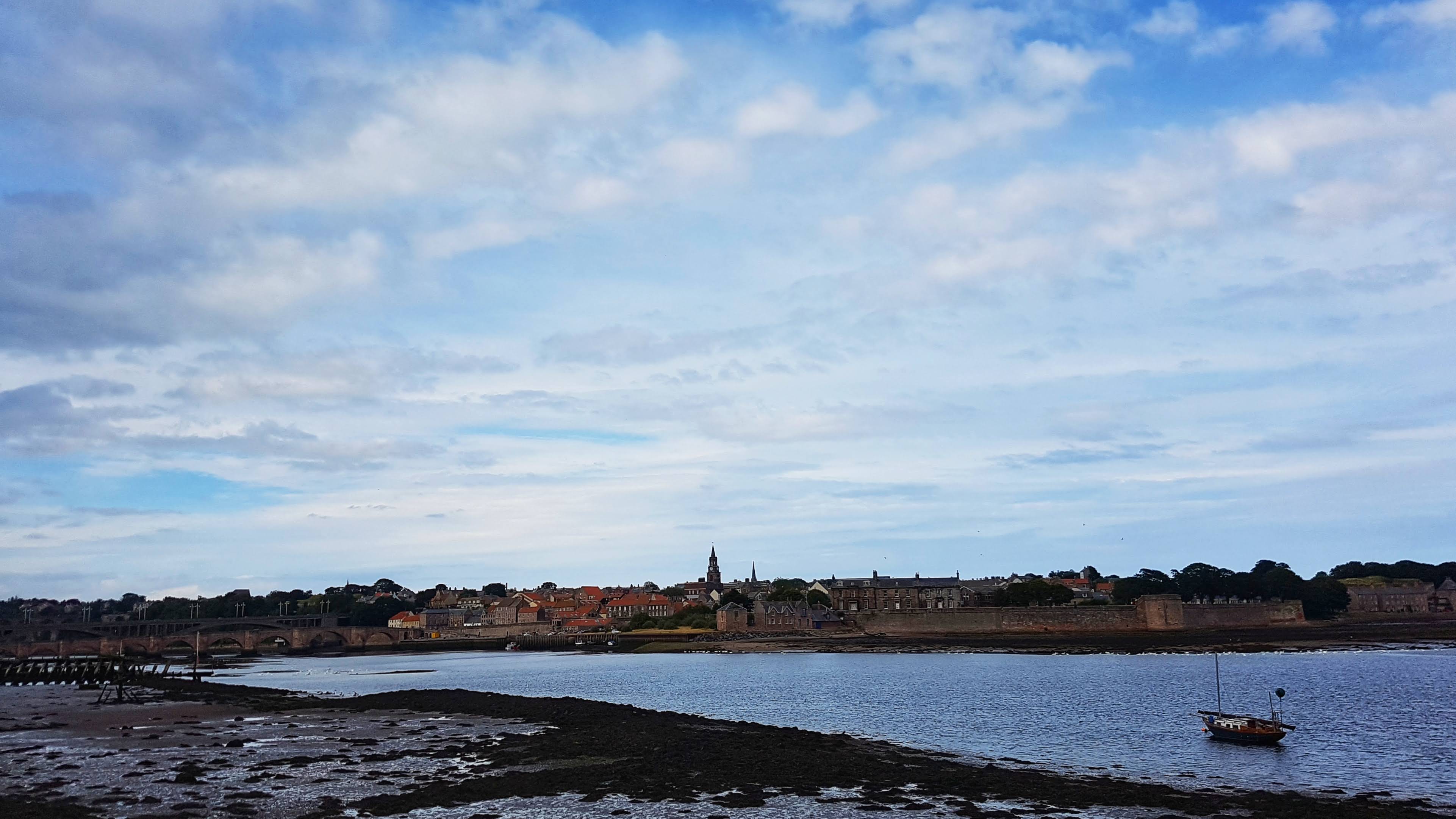
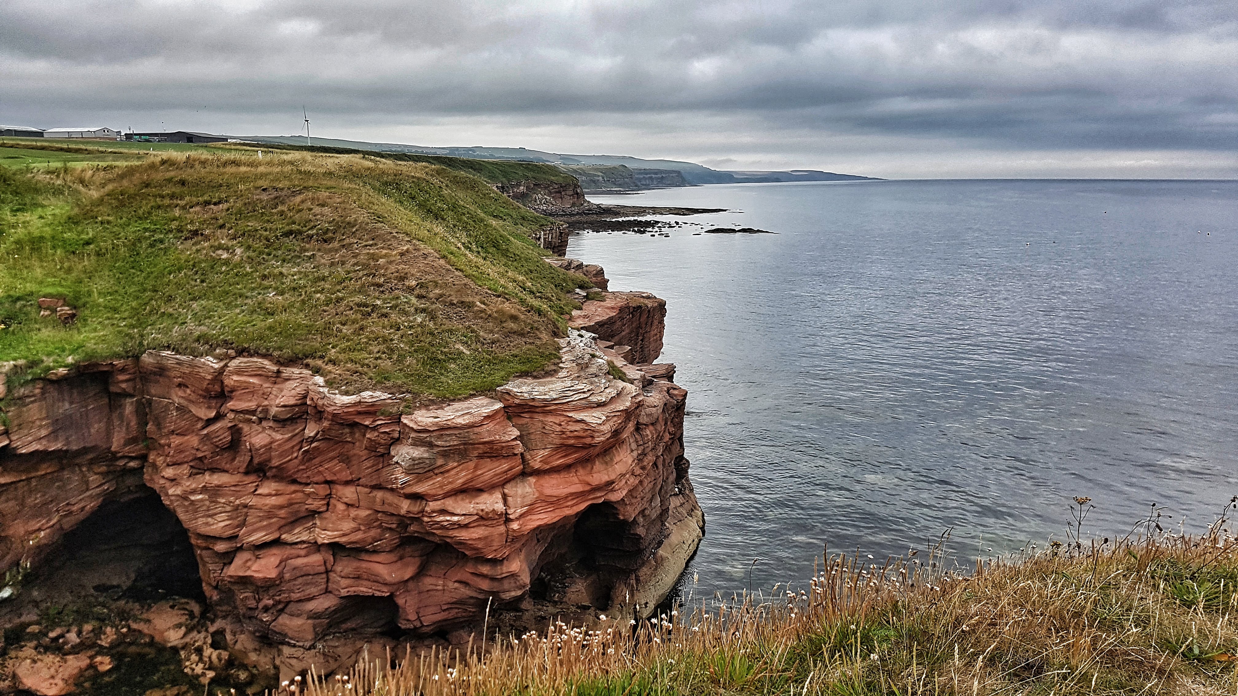
Berwick-upon-Tweed is the northernmost town in England, so close to the border with Scotland that it has changed country allegiance on more than one occasion (The football team plays in the Scottish Second Division) and has been fortified to protect itself from attack over the generations.
Spittal taken from the Caravan Park.
Famous for its castle, its walls and its impressive railway bridge, we didn’t actually spend any time in Berwick itself, staying at the Caravan Site in the town of Spittal (across the Tweed from Berwick).
Seahouses harbour.
We spent our leisure time south of Berwick itself, enjoying the famous Barter Book Shop in Alnwick, the beach at Seahouses and the Holy Island of Lindisfarne.
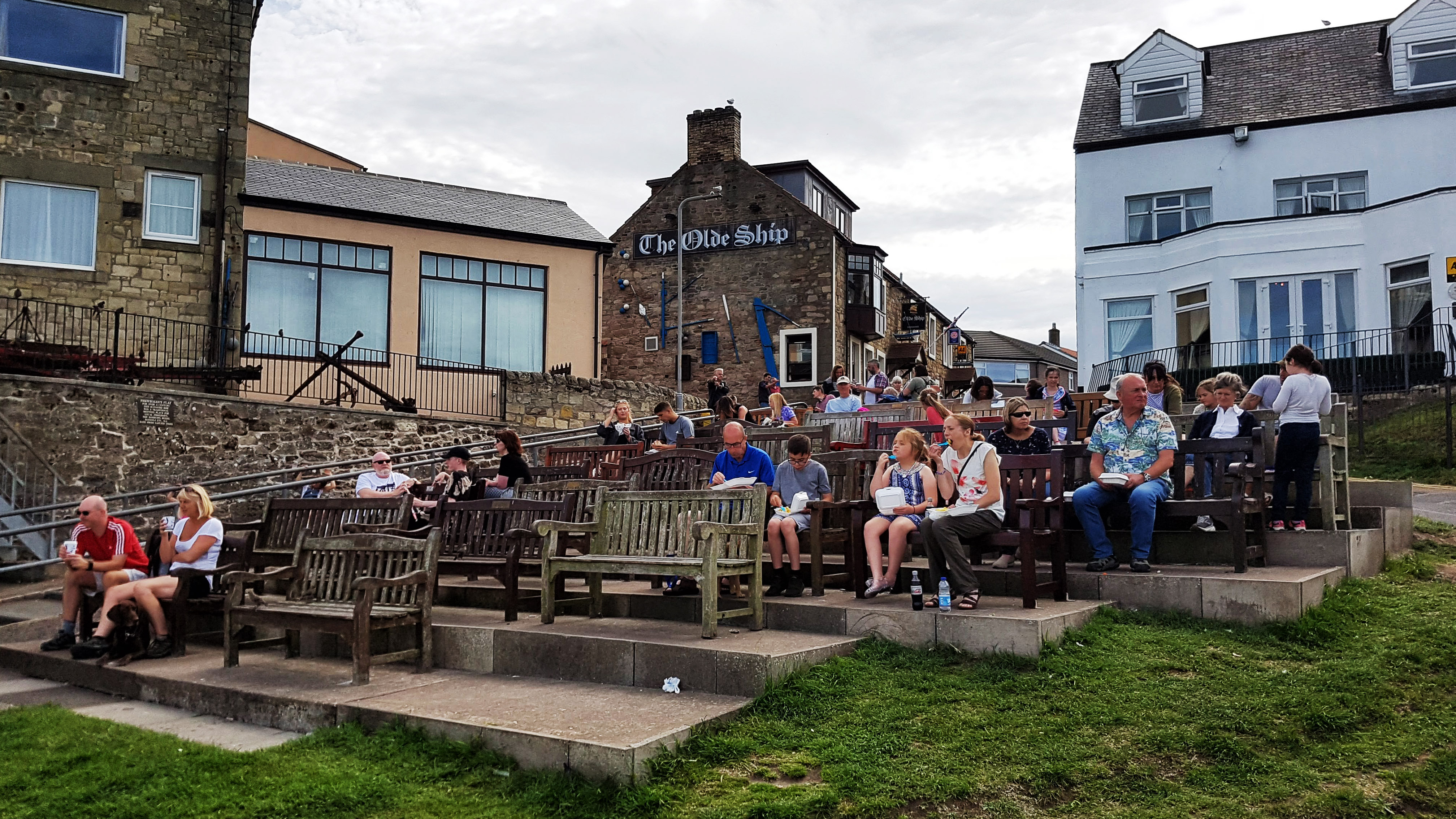
The multiple benches configuration at Seahouses harbour.
Having stayed near Alnwick on our previous visit we passed on the opportunity to revisit the impressive Alnwick and Bamburgh Castles.
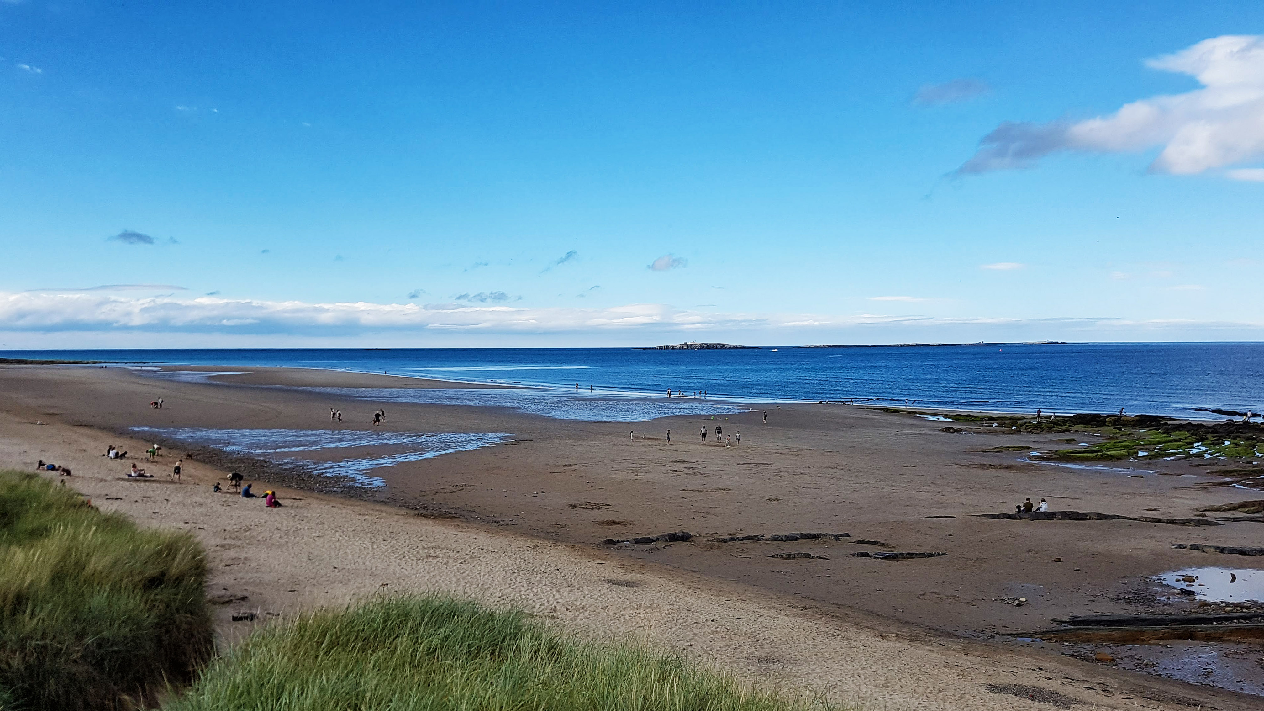
Seahouses beach.
Day 4 – Sunday 5th August 2018 – Exploring Berwick
Spittal Beach
Sunday morning saw us travel north along the A1 to Berwick-upon-Tweed, which is just about as far north as you can get in England before entering Scotland. I expected a tough run on tired legs but, surprisingly, I felt pretty fresh and blissfully free of Achilles pain after a calf stretch on some railings early in the run at Spittal promenade.
Berwick-on Tweed – inspired by Lowry.
I headed to the historic town of Berwick, stopping frequently to take photos, some of which inspired (poorly) by the work of Lowry, who apparently loved the place and painted numerous scenes around the town.
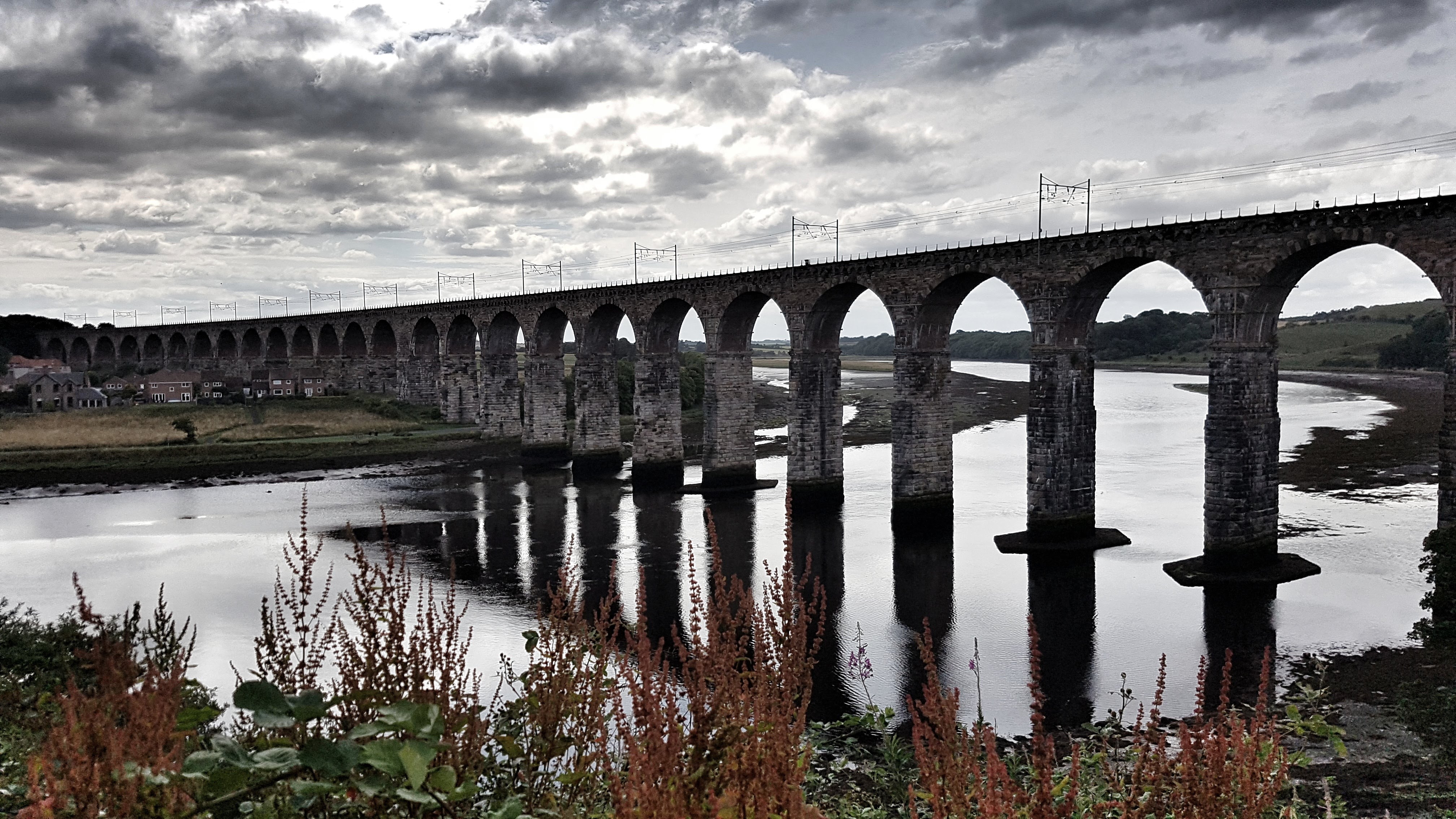
The Royal Border Bridge
I found the viewpoint for the spectacular River Border Bridge, which carries the same trains that run through Grantham, albeit more grandly than the all too low bridges that are the curse of Grantham lorry drivers. From there I found a shared cycle path (Route 1 if I remember correctly – a favourite from my 2016 holiday, which runs from Dover to Shetland) and headed along the riverside for a mile or so before heading on more dedicated cycle lanes which brought me tantalisingly close to, but not quite at, the Scottish border.
At the top of the main climb for the day I checked Google Maps in the hope of making a loop of the run rather than an out and back. There were a couple of options but as they included running alongside the A1 I decided to play it safe and returned the way I came to Berwick. Feeling good I picked up the pace quite a bit back along the river path where I felt sure there would be a Strava segment to contest. To my disappointment there wasn’t, but I made a mental note that this would be one of many segments that I would have to create when I returned home and had access to a computer (And some decent internet). Alas I was only 4th.
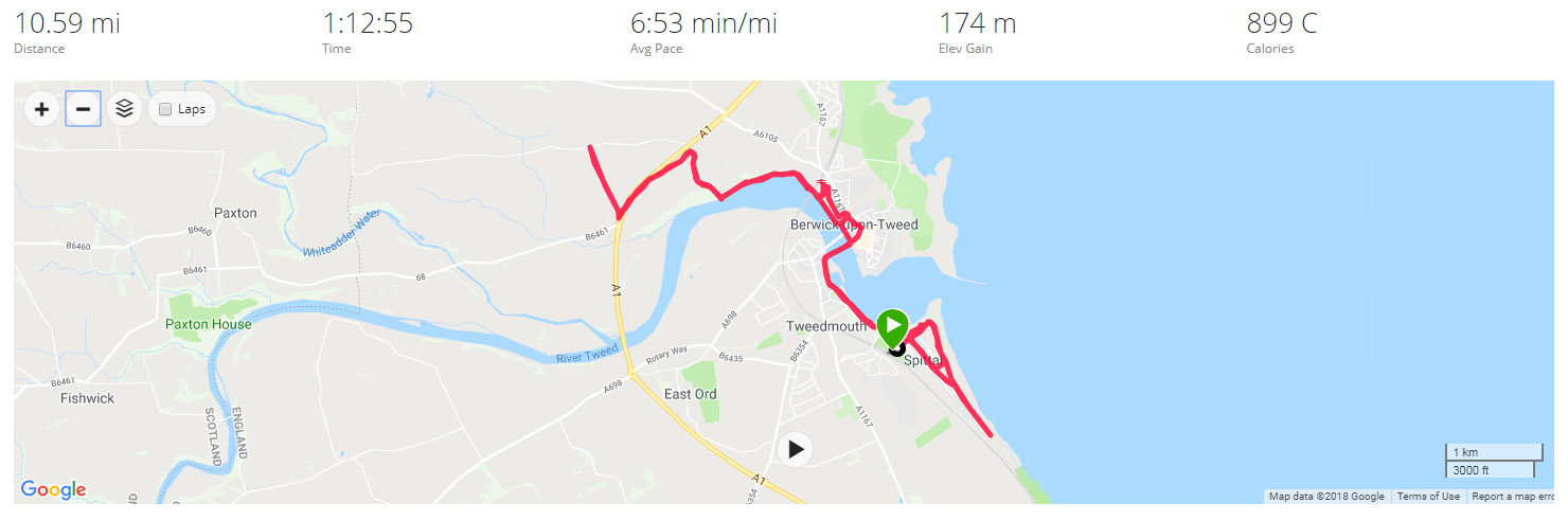
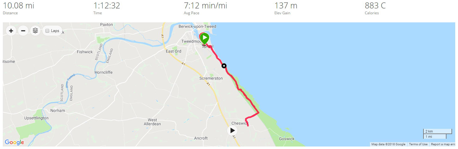
From there it was a continued tempo effort back to the Spittal promenade and along that for a segment attempt (This did have an existing segment – only 9th best for me) before returning back to the caravan site – 10.6 miles bagged.
Best Strava Segment Performance: Just a Climb – 1st/7*
* A segment I created.
Day 5 – Monday 6 August 2018 – Cows and Cliffs
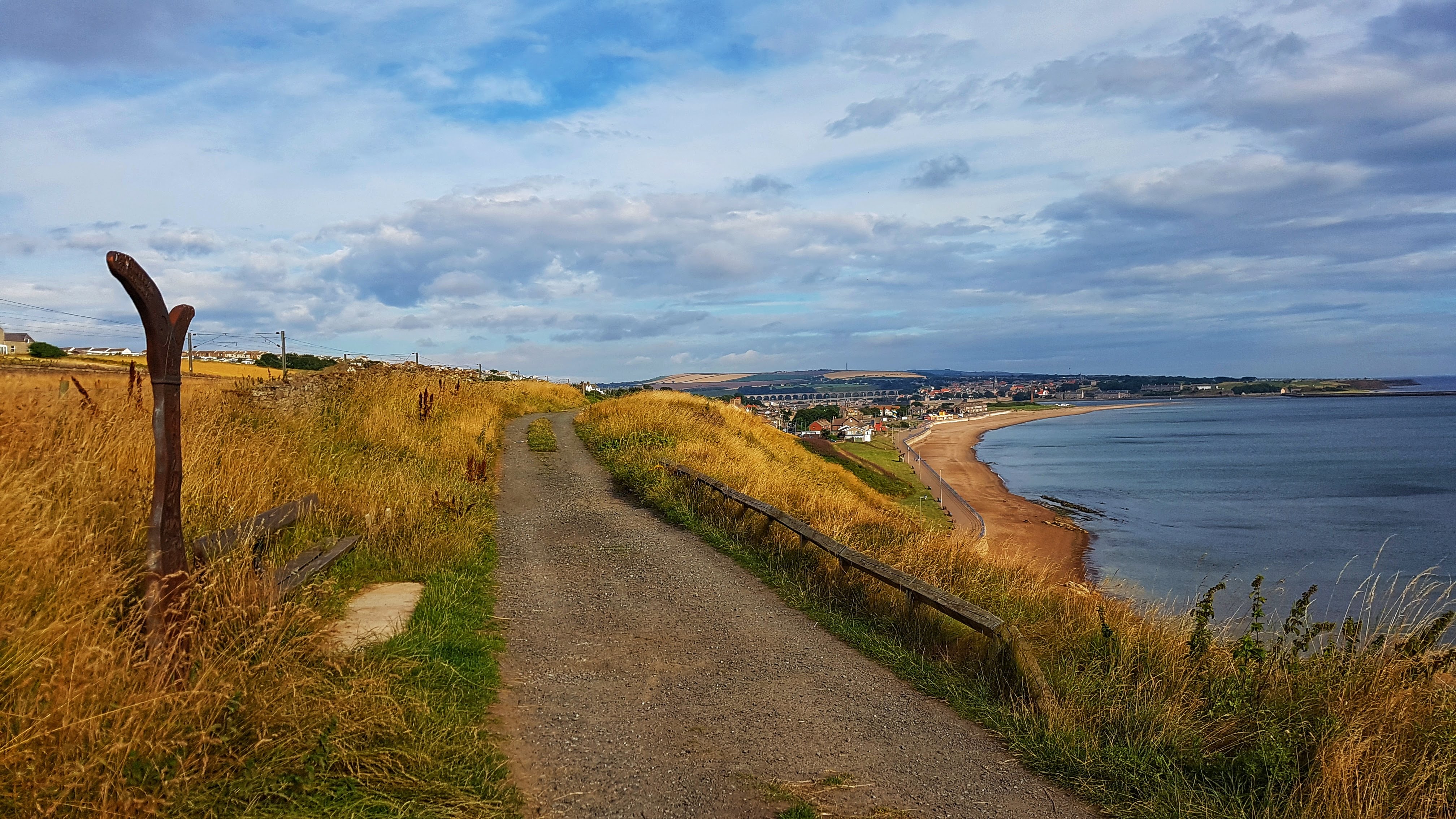
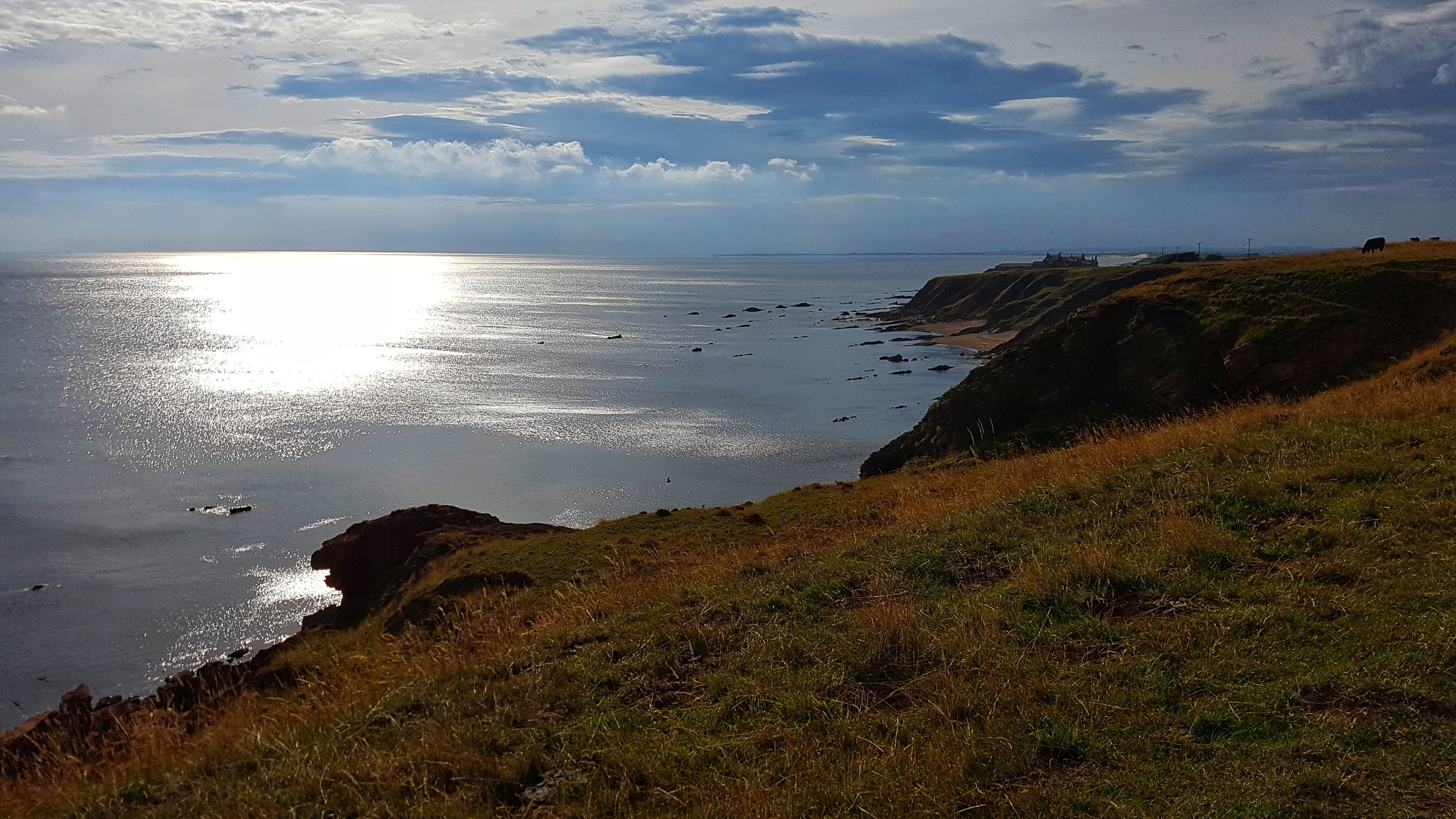
I’d spotted on Sunday’s run that Cycle Path Route 1 continued its way past Spittal promenade and along the coast southwards. On Monday morning I decided to run along this path on a straightforward out and back – making it just past the small village of Cheswick before turning around and returning.
The cycle path looking to Spittal.
As it was a cycle path – off road in parts, the terrain was never particularly demanding and not at all technical, which made for a pleasant, mostly trouble free run, where the emphasis was on recovering from the hard efforts of the previous two days. The coast line was at times stunning, other times obscured by the grass in the dunes of Cheswick Sands. I thankfully had a side wind for the entirety of the run – when I met it briefly head on near the turnaround point, it certainly did its best to stop me in its tracks!
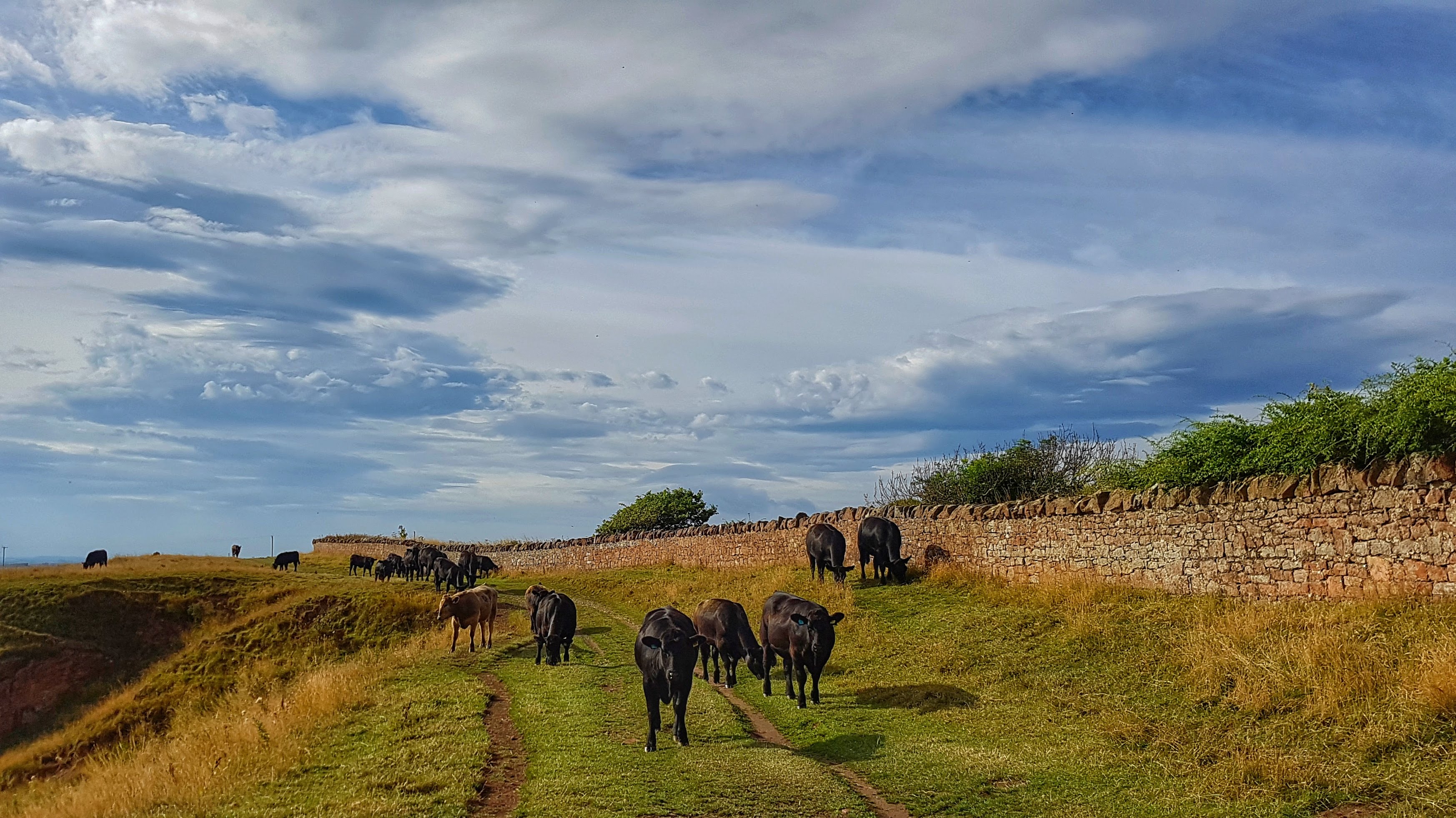
Cows on the cliff!
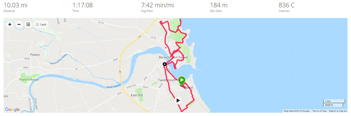
The only drama of the run came in the form of a fairly large herd of cows who had made themselves comfortable by the cliff’s edge on the cycle path fairly early on in the run and later on when I returned. I’m not a huge fan of cows and not at my best by the edge of cliffs – so the two combined made for rather interesting moments as I briefly stopped the Garmin and walked through the herd as unobtrusively as possible. Thankfully the cows seemed largely disinterested in me and more concerned with gorging themselves on the grass, and I was able to continue on my run, which ended just as the Garmin accumulated 10 miles entering the Caravan Park. I was disappointed to see there were no meaningful Strava Segments created so, once again, a note was made to, at a later point, create some of my own.
Best Strava Segment Performance: Quiet beaches to be found* – 4th/87
* A segment I created.
Day 6 – Tuesday 7 August 2018 – A Bit of Everything in Berwick-upon-Tweed
A Lowry Rip Off!
On a very overcast morning for the last run in Berwick, I was in the mood for exploring! Back it was into Berwick, running along the castle wall and ramparts; mimicking the work of Lowry and generally trying to see as much of the town as possible.
Cliffs In Berwick – a bit too much for me!
This exploration took me on a path around the back of the golf course and a holiday path. This was all well and good and I opted at a footpath junction to try and head to Marshall Meadows Bay. The path became increasingly technical, increasingly narrow and increasingly closer to the cliff’s edge. This was the explanation behind the slowest mile of the holiday at 10:09! – It wasn’t long before I abandoned this increasingly perilous idea and returned to the safety of the A1167 and the less scenic, but more comforting sights of a McDonalds drive thru and a Morrisions. This slow mile and the stop-start affair of the opening miles meant that this would be the slowest run, on average, of the Tour at 7:41 per mile.
Returning to Spittal it was clear I had to make up some miles to get to and beyond 10. So it was then a climb up the old A1, down Cow Road, over a Level Crossing, back through Spittal and a lap and an extension of the Caravan Park to bring it home in a smidge over 10 miles.
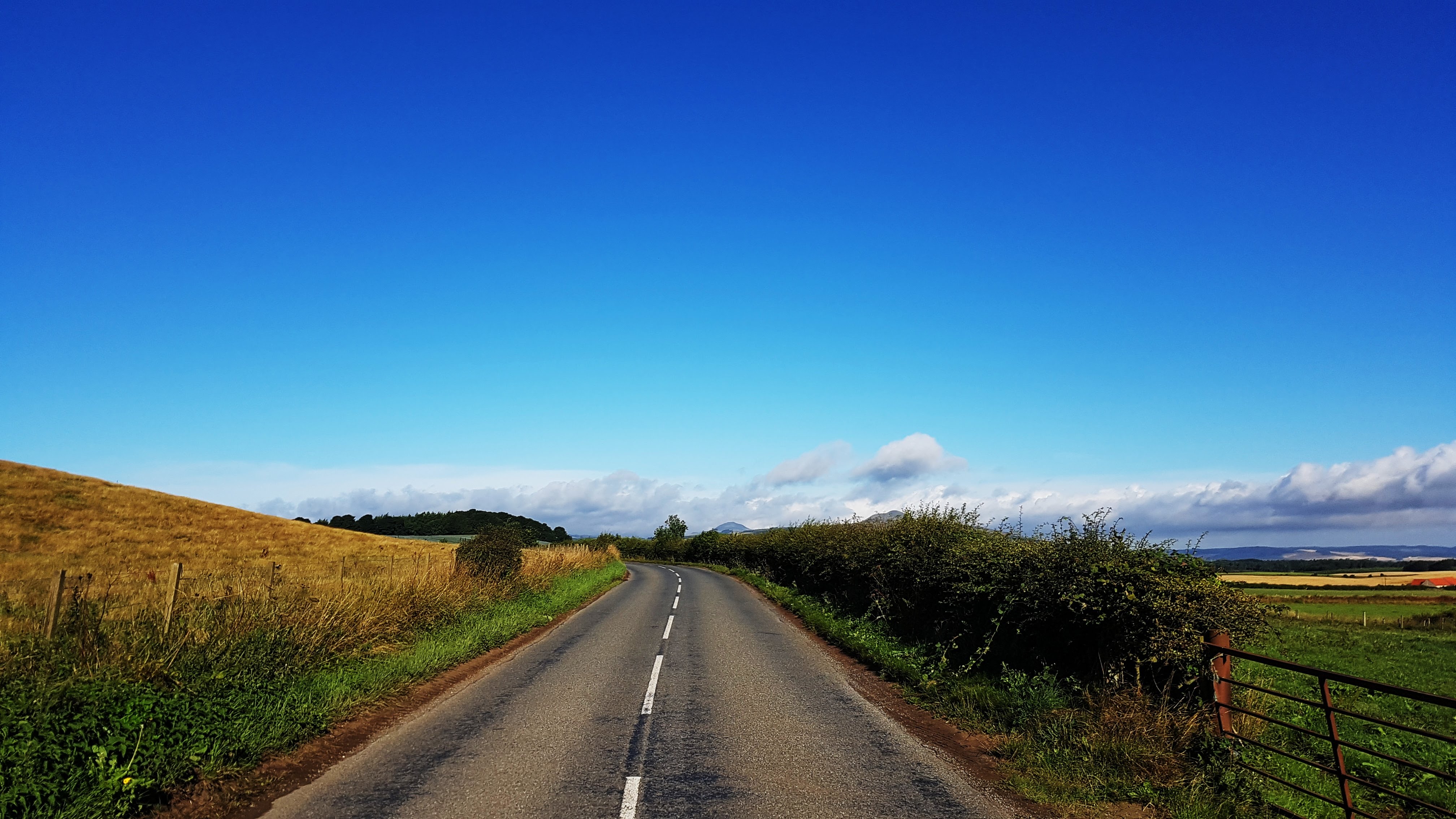
Markinch is a small town in Fife, Scotland, with a population of around 2,500 and lies to the east of the administrative centre of Fife – Glenrothes. It’s history is apparently much unknown, but relics of its past are said to date back to around 3000 BC.
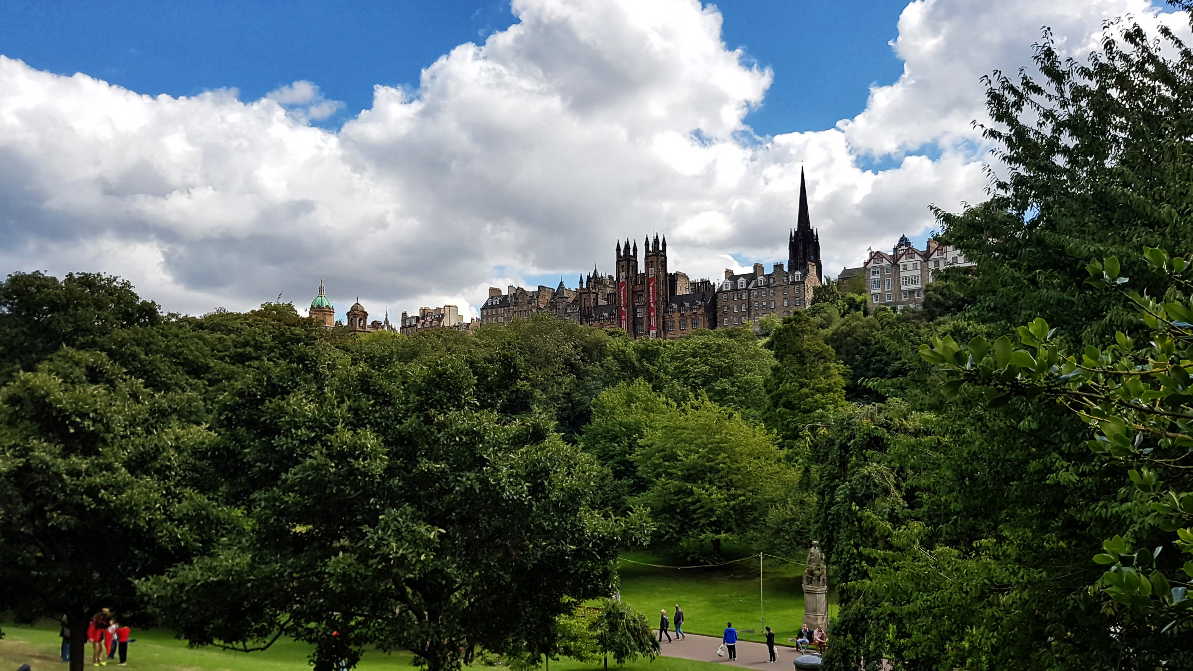
Lomond Hills Regional Park.Edinburgh with the throngs heading to the Festival.
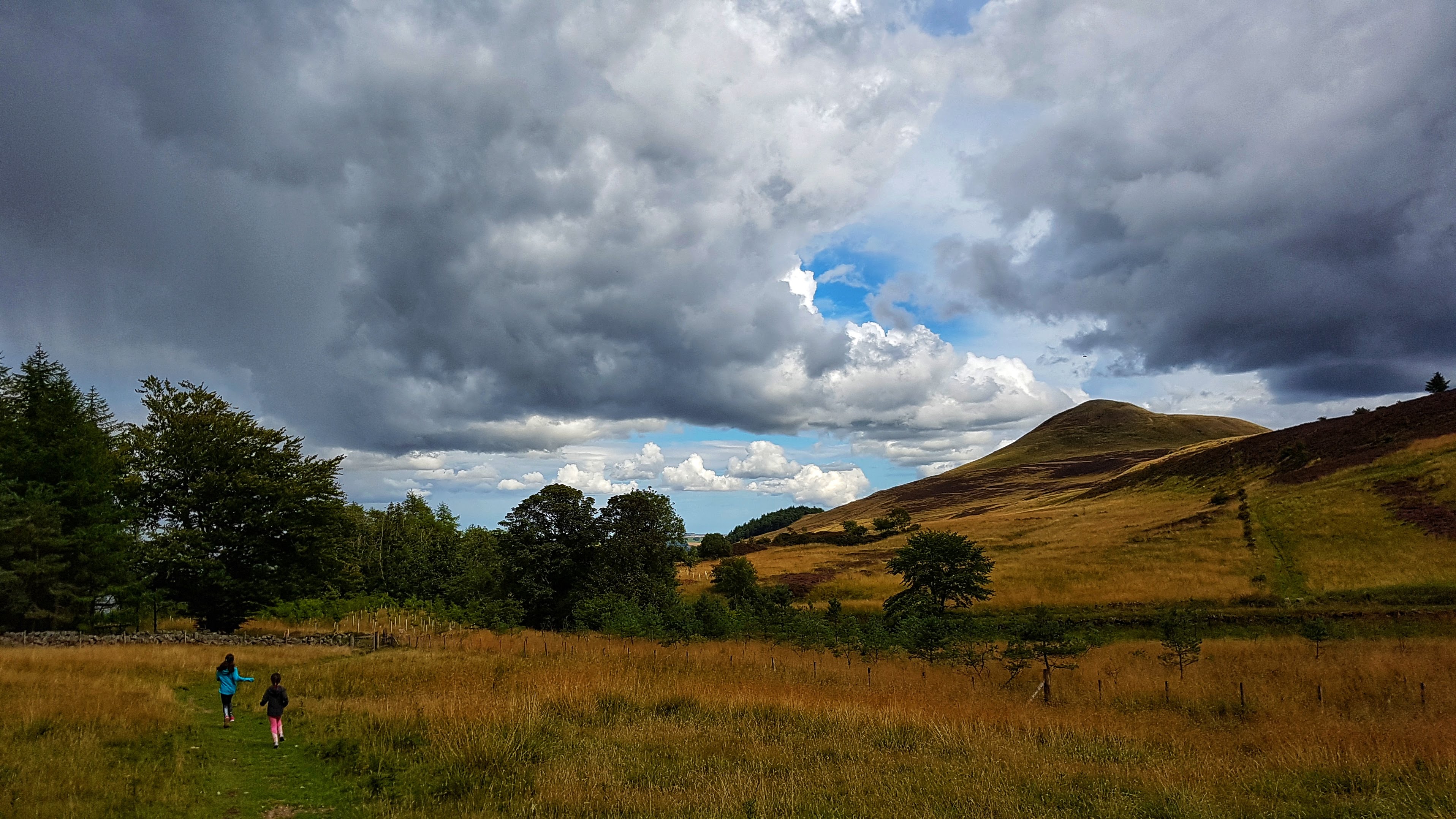
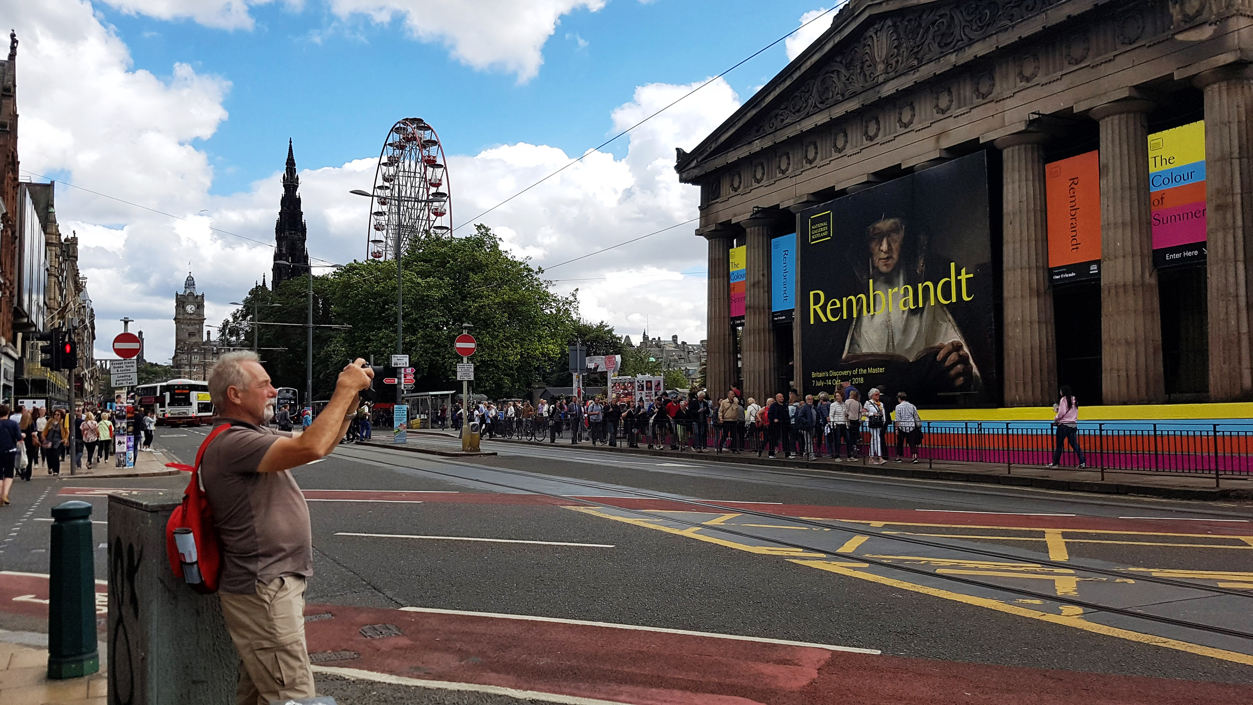
Thanks to its train connections we were able to enjoy the Edinburgh Fringe Festival and with a short car journey the following day the Lomond Hills Regional Park – where the rain well and truly hit us and would plague us for much of the remainder of the holiday!
More of Edinburgh.
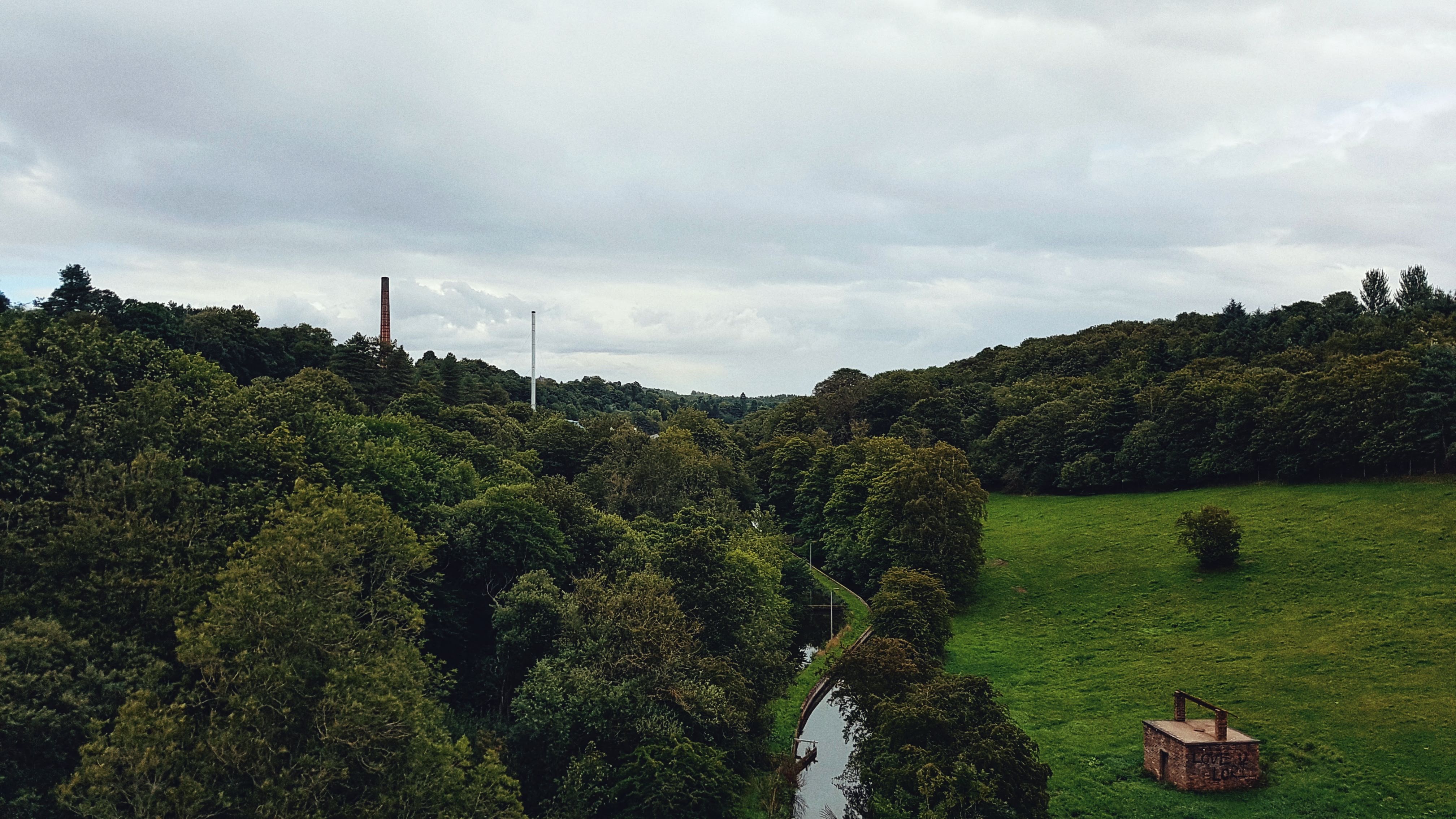
The Balbirnie Golf Course, where we stayed next to in its Caravan Park, provided traffic free running with its well signposted network of footpaths.
Lomond Hills Regional Park.
Day 7 – Wednesday 8th August 2018 – If You’re Fond of Bike Lanes and Rainy Air….
The route for my first run in Markinch came about by the need to check out where the train station was for our planned visit to the Edinburgh Fringe Festival the following day.
One of many cycle paths in Glenrothes.
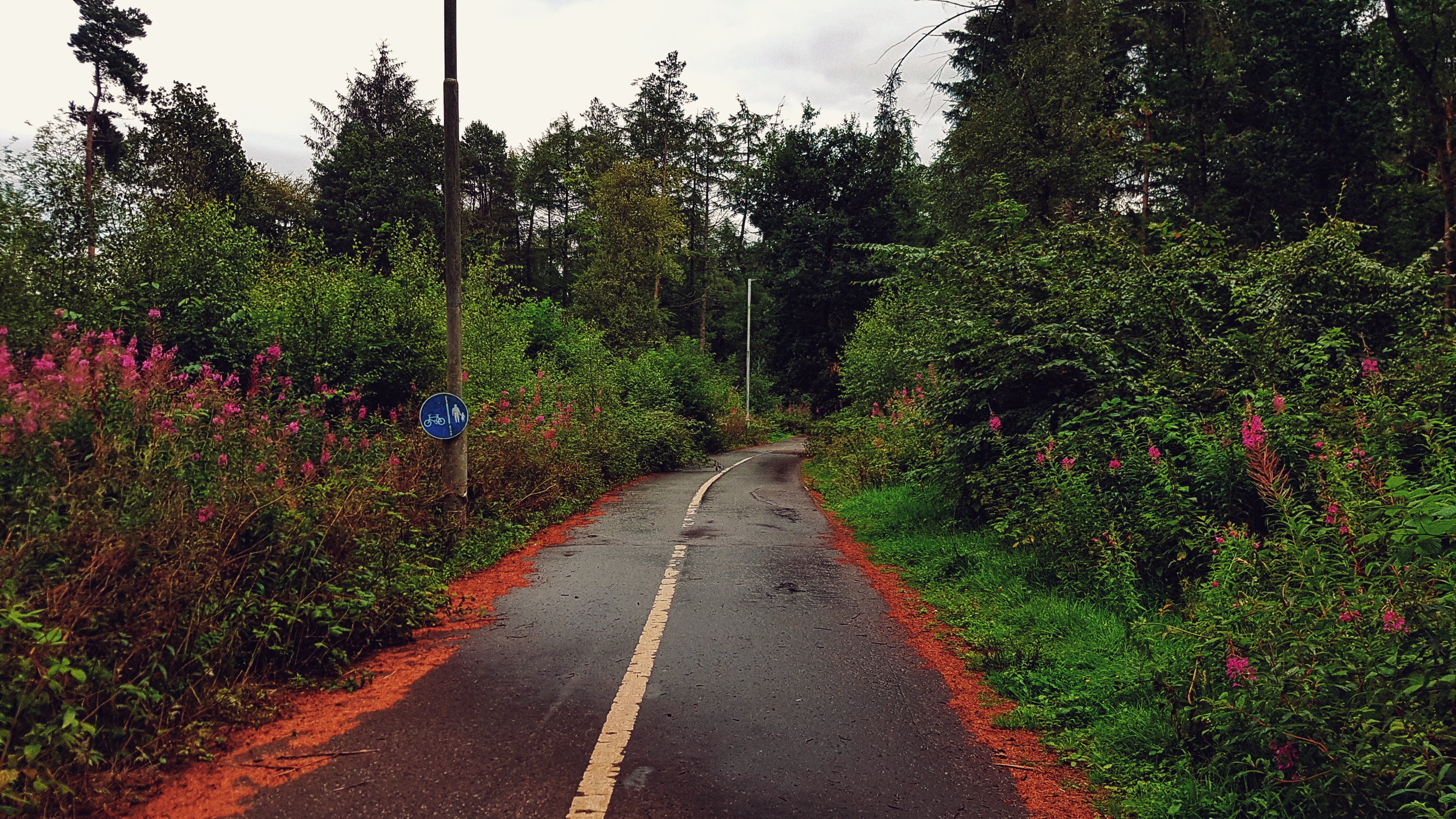
Once there I noted a bike path that looked interesting and so I followed it. That was around a mile and bought me out in a modern housing estate where not long after it split into two further cycle paths and then two more. I had choices on which one to take and so I chose the one that said Leslie – for no other reason than it was marked as being around 3 miles away which would be perfect for a 10 mile out and back run.
Another cycle path in Glenrothes – it even has a proper junction!
So what followed was not the most scenic run I’ve ever done in not the greatest weather (a bit rainy, not that warm) but what it was was a great example of a decent network of bike paths (I believe my path was a former railway line converted to become a cycle path) that kept the run blissfully traffic free.
View of the viaduct at Leslie.
Skirting to the south of Glenrothes I arrived at a large viaduct where a photo was required as I entered Leslie itself. A quick run up to the main high street and a look around before turning around and running back from whence I came. As I’ve often done on these type of runs over the years I tried to pick up the pace a bit for the return leg, suspecting there may be a Strava segment or two to target. I put particular effort into the run back to Markinch train station and was rewarded for with my first crown on an existing segment of the holiday.
Once I’d made my way back to the Caravan Park and uploaded my run to Strava it transpired that the Glenrothes area has a thriving Strava community with a plethora of segments, particularly on the cycle paths, including the semi official Boblingen Way Mile. I was tempted to return to have a proper stab at that section and others but the lure to explore other areas was too great!
Best Strava Segment Performance: Haig heave up ‘ta station – 1st/253
Day 8 – Thursday 9th August 2018 – Pre Edinburgh Festival Warm Up.
Thursday was the day earmarked for a full day of family fun at the Edinburgh Fringe Festival so Day 8 saw me having to get my sh*t together and be up an out of the caravan door as early as possible. I managed 7:40am, which by many others standard is fairly rubbish, but for me is pretty early!
Balbirnie Park Golf Club, resplendent in the ‘early’ morning light.
This early start meant more of a shuffle in the opening stages than usual, especially as much of the opening mile was a steady drag up the main road of the Balbirnie Golf Course grounds. Once up and out of the park I had options on where to attempt to run. The bridle paths I could see looked a touch too technical; the A92 a bit overwhelming with traffic. My options looked limited, but I saw a sign directing me to Star, which seemed an intriguing place to visit. Moreover, once I’d tackled a short stretch of Stob Cross Road I could take a left onto a road with no name marked as a cycle route, which I assumed would guarantee near traffic free seclusion.
Sadly, while I am sure this road is probably very quiet for the most part, running on it at the height of rush hour proved to be a somewhat traumatic affair. With numerous undulations, tight bends and blind spots aplenty, it was a case of trying as hard as possible to stay on the correct sight of the road to allow car drivers as much time to see me as possible. Alas on one bend I was stuck between a rock and a hard place with cars approaching from both directions and I must of given one of the drivers a bit of a scare for she chose to beep her horn for a good 5-10 seconds after she passed. All I can do is apologise for any distress concerned, but there was little I could do.
Thankfully this dangerous section only lasted a mile or so before I could take a left into the much quieter road running through Star. This village failed to live up to its grand sounding title, for while it looked pleasant enough, it was just a small village in Fife. Before long I had run through it and found myself back on the busy road a little further on.
The road from Star to Markinch – at times busier than anticipated!
Thankfully although there was more traffic than desired, including a bus and a heavy goods vehicle looking a little lost, there was no repeat of the earlier passing car dramas and I was able to make it back to the outskirts of the golf course unscathed.
I had though only covered around 6.5 miles so had to try and find another 3.5 miles to run. This involved me running back through the golf course with an unsuccessful attempt to follow the path that looped much of the Balbirnie Park grounds.
Markinch Park.
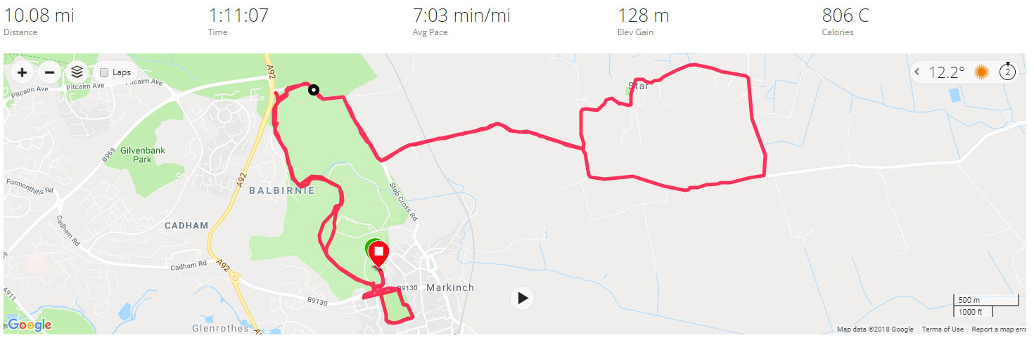
With a couple of miles still required I headed to Markinch Park which I looped twice, once reasonably quickly in the hope of grabbing any Strava segments set up. I managed to claim fourth. This was though a good day for Strava, with four first places secured on existing segments – not bad considering that for the most part it was a pretty low effort performance after the quicker efforts on the footpath the previous afternoon.
With the park run done, it was just a case of heading back to the caravan park, watching as the Garmin clocked over ten miles, stopping at 10.08, and changing quicker than a Mercedes AMG F1 pit stop to get to the train station in time for Edinburgh!
Best Strava Segment Performances: Star Escape – 1st/19; Balbirnie edge brow dual run – 1st/42; Brow Bash Blast – 1st/36; Golf drive to wall – 1st/92.
Day 9 – Friday 10th August 2018 – Cobbled together a loop with only a couple of wrong turns.
It was another relatively early start for the final run in Markinch, setting off at just after 8 am and heading again to the nearby Balbirnie Golf Club for an attempt at following the bridle path that circulates around the perimeter of the golf course.
A bridle path in Balbirnie Park Golf Club.
The first mile was pretty technical and a stop/start affair as I lost the path on several occasions and had to resort to Google Maps to work out where to run. Once the painfully slow opening mile (8:44) was out of the way the legs loosened up nicely and I settled down into running fairly comfortably under 7 minutes per mile for the remainder of the run. I had left the Golf Club accidentally after a mile and a half and soon found myself in new housing estate a cul-de-sac. This time I didn’t rely on Google Maps but my eagle eyes to spot a footpath that took me out onto the busy A92, which thankfully had a decent pavement to let me run south, skirting past Glenrothes – the town centre of which I never did get to see.
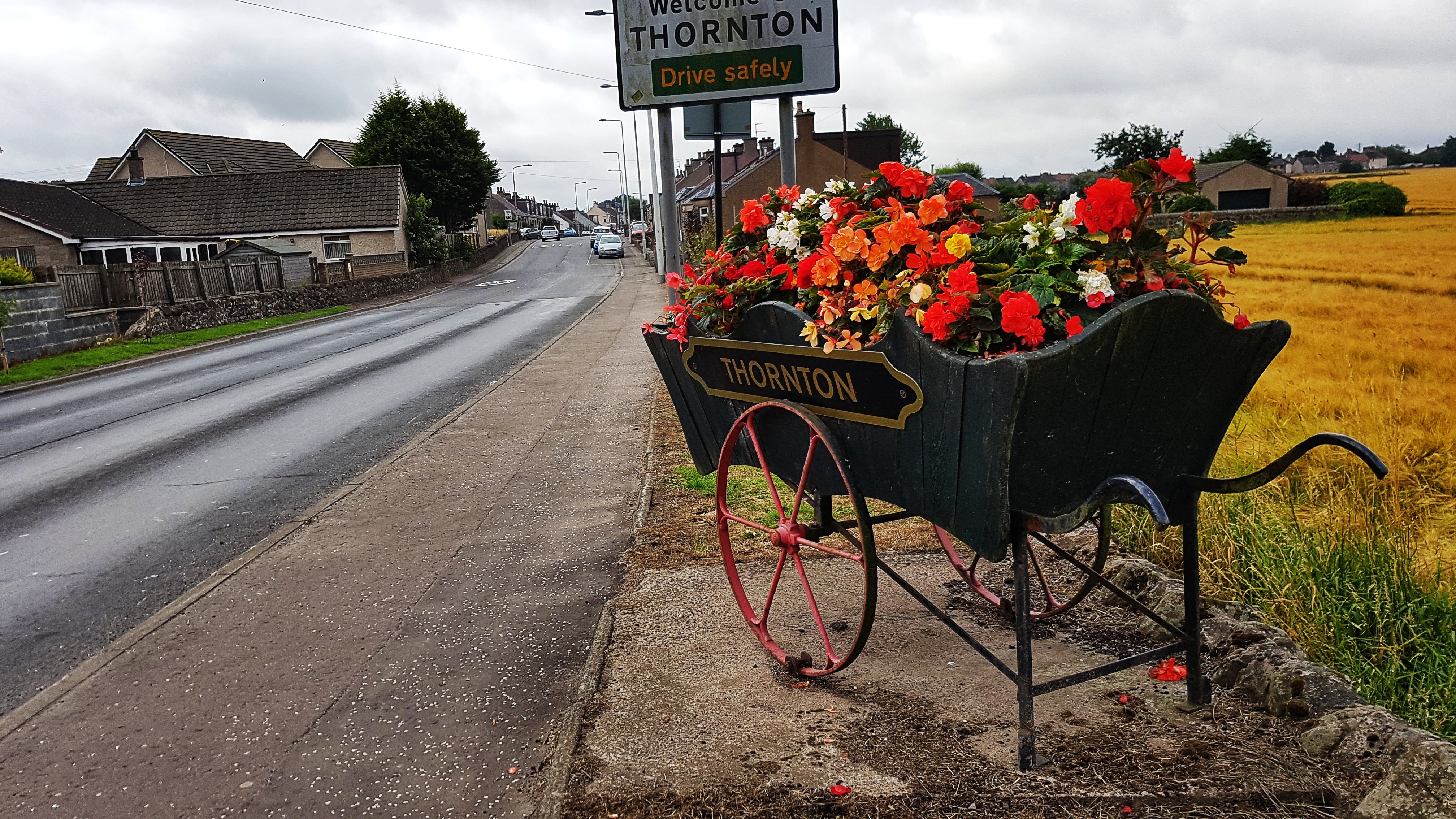
Thornton – the flower display was the highlight.
I left the A92 to hit the much quieter B9130 which took me to Thornton, a town whose flower display in a wheelbarrow above was probably its highlight. With six miles covered I was very keen to make the run a loop rather than an out and back affair and so consulted the Google Maps to try and chart a run back. A network of roads that took me north past the fantastically literal sounding Coaltown of Balgonie and back towards Markinch looked the order of the day so I headed to them.
I very nearly missed these roads before I realised that they were in fact a series of gravel paths, not dissimilar to many found on a run in England, but slightly more unusual in that they clearly fed some traffic as there were quite a few houses en route.
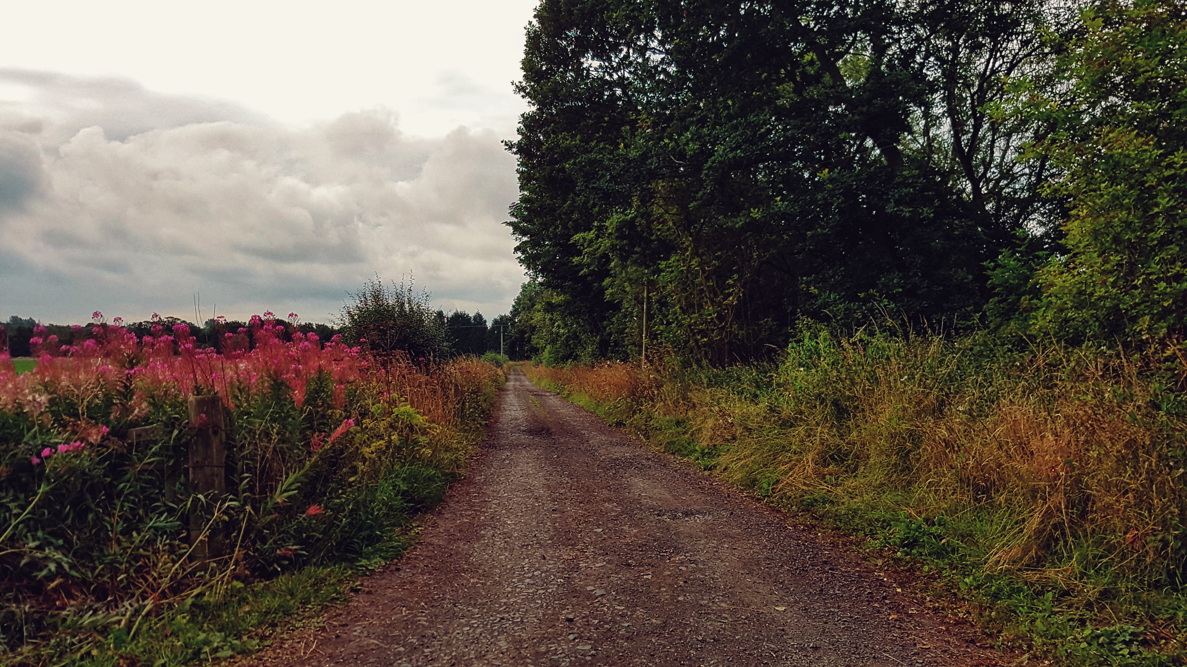
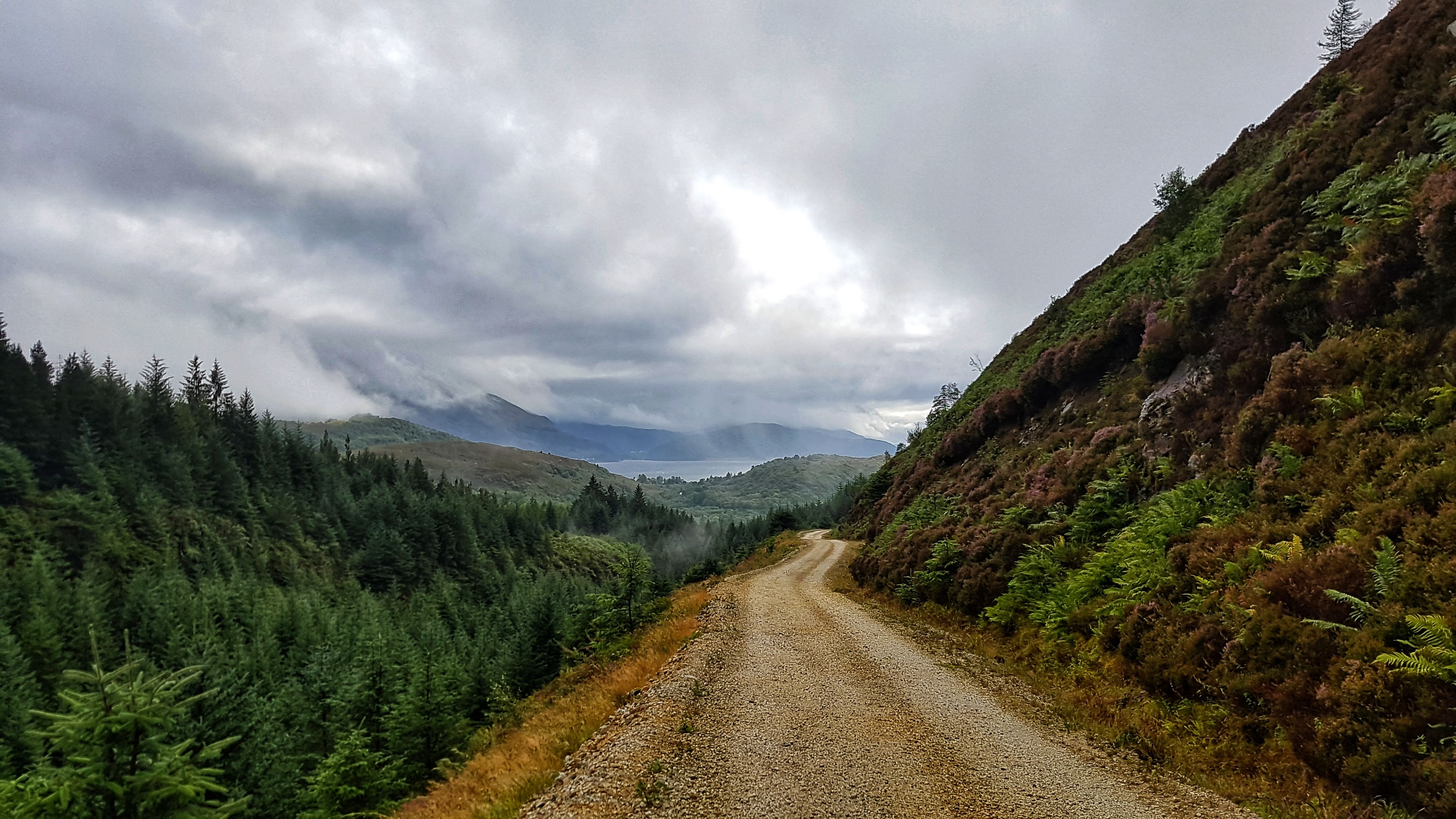
A gravel road heading out of Thornton.
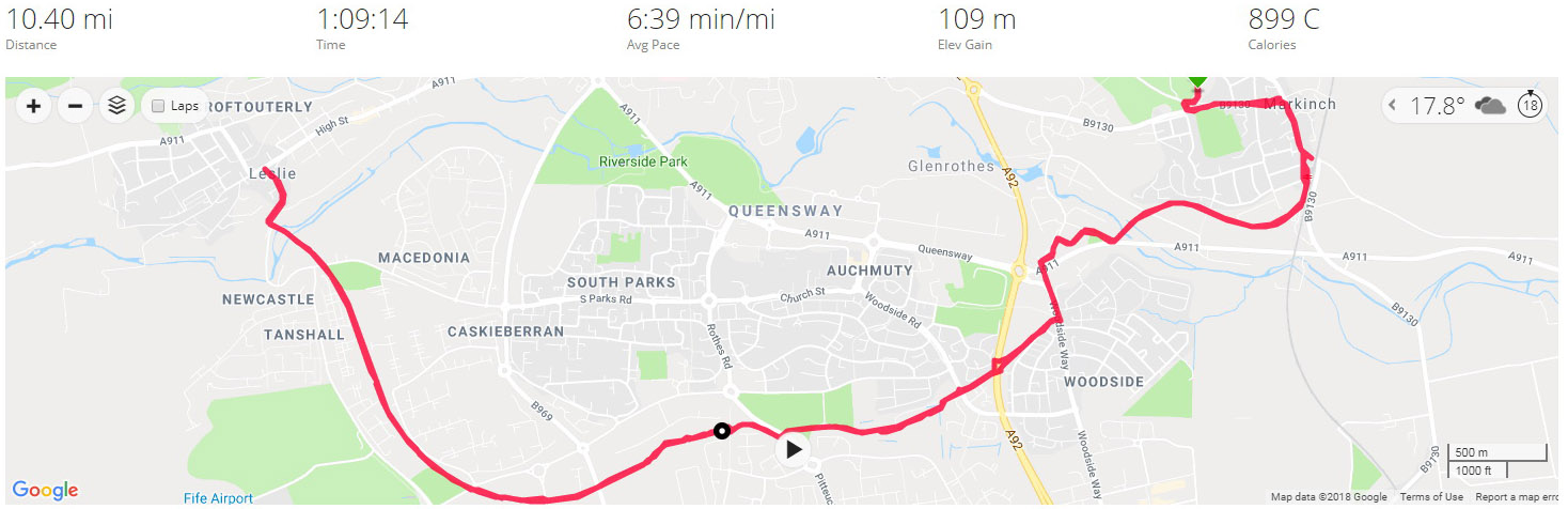
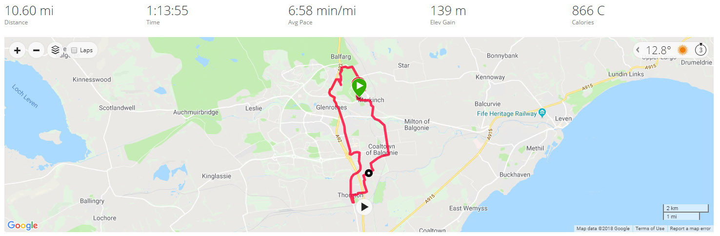
Nearly two miles later and I was back onto normal roads and a simple run back into Markinch made slightly tougher with a 2/3s mile climb averaging 3%. By the time I’d made it back to the Caravan Club I’d clocked 10.6 miles in a smidge under 7 minute mile average. With Leg 3 done and dusted it was onwards and upwards into the Highlands!
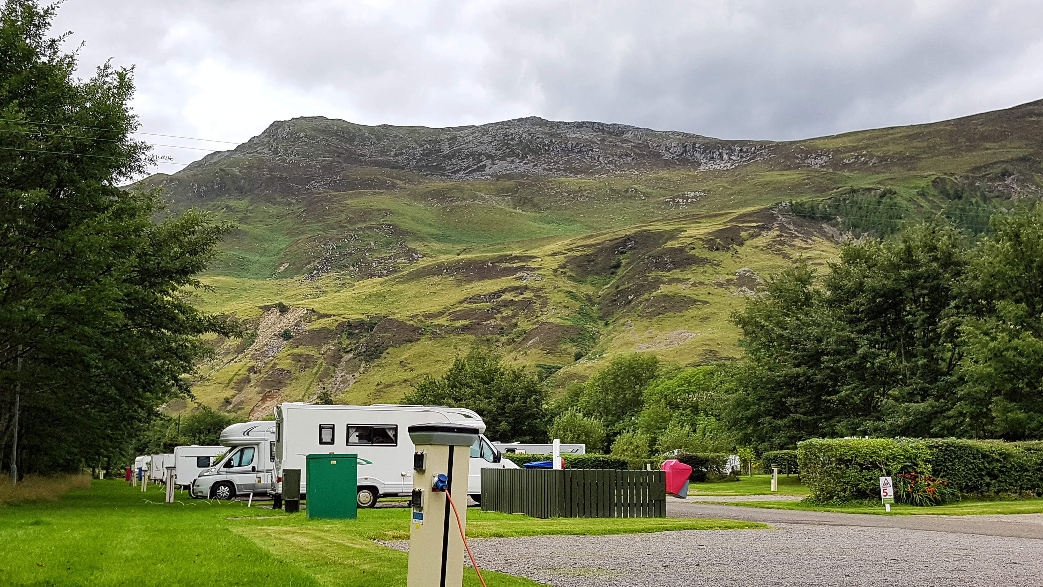
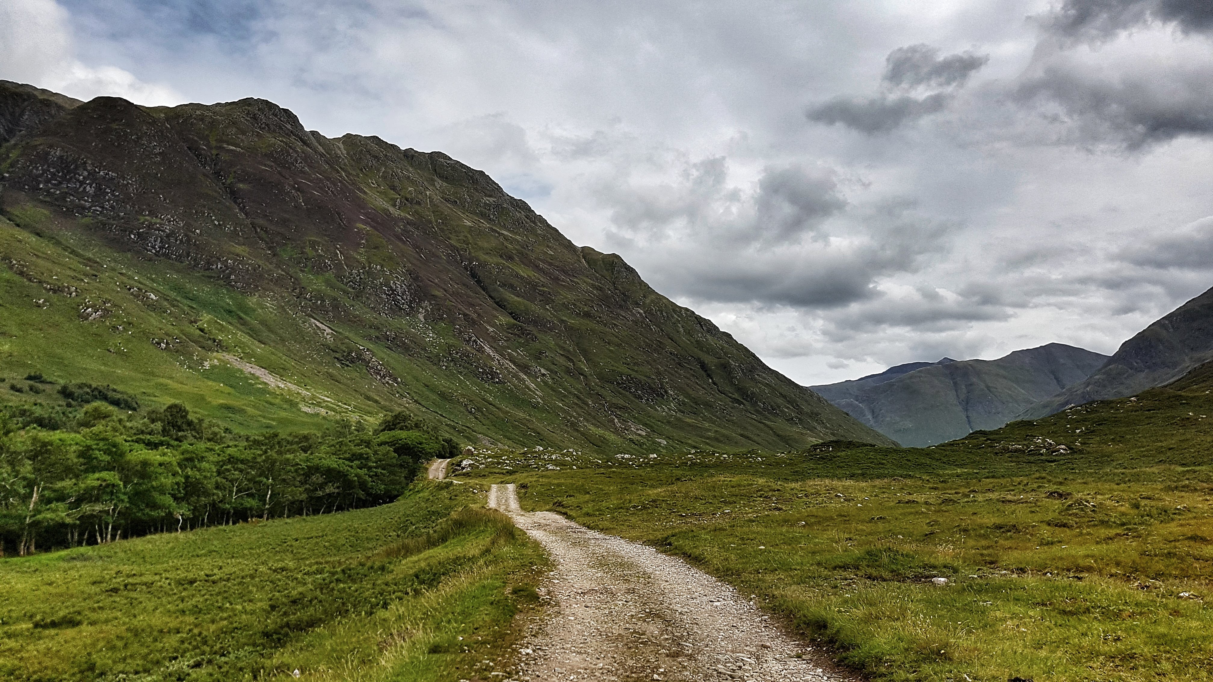
Morvich is a very small highland settlement within land owned by the Scottish National Trust consisting of no more than a few houses, a youth hostel or two, a mountain rescue centre and a Caravan Park in the Highlands of Scotland on the southern edge of Loch Duich.
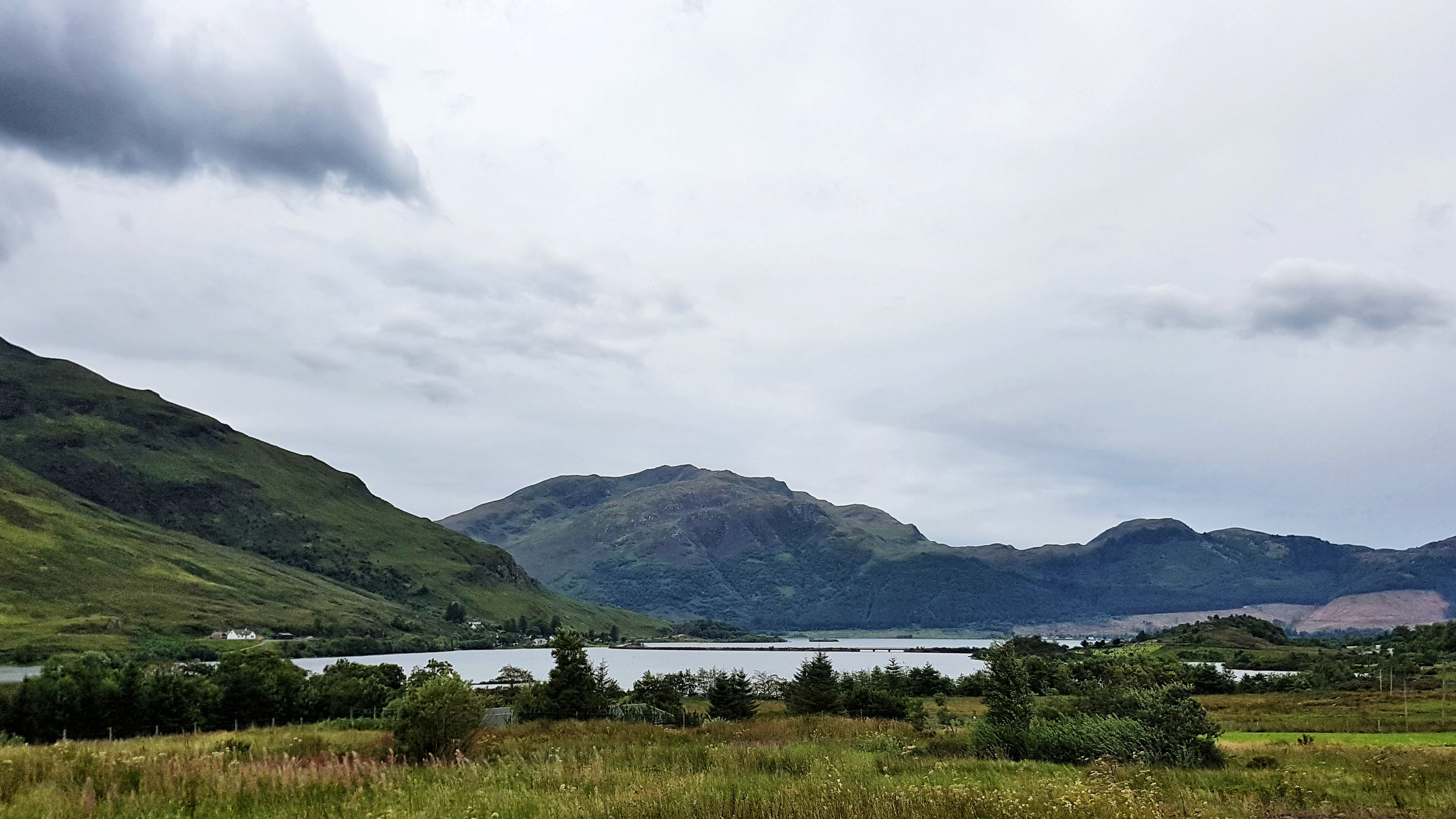
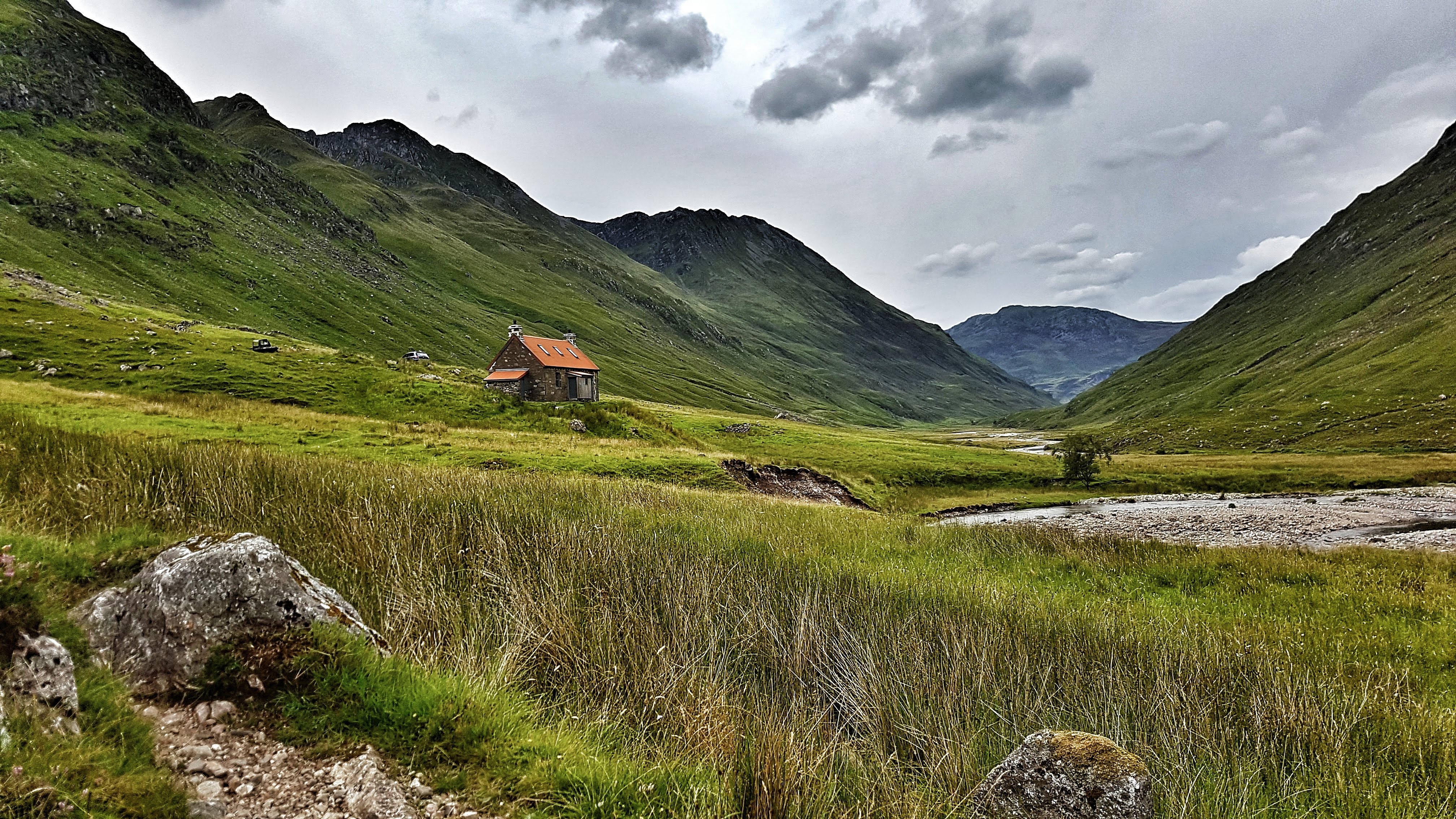
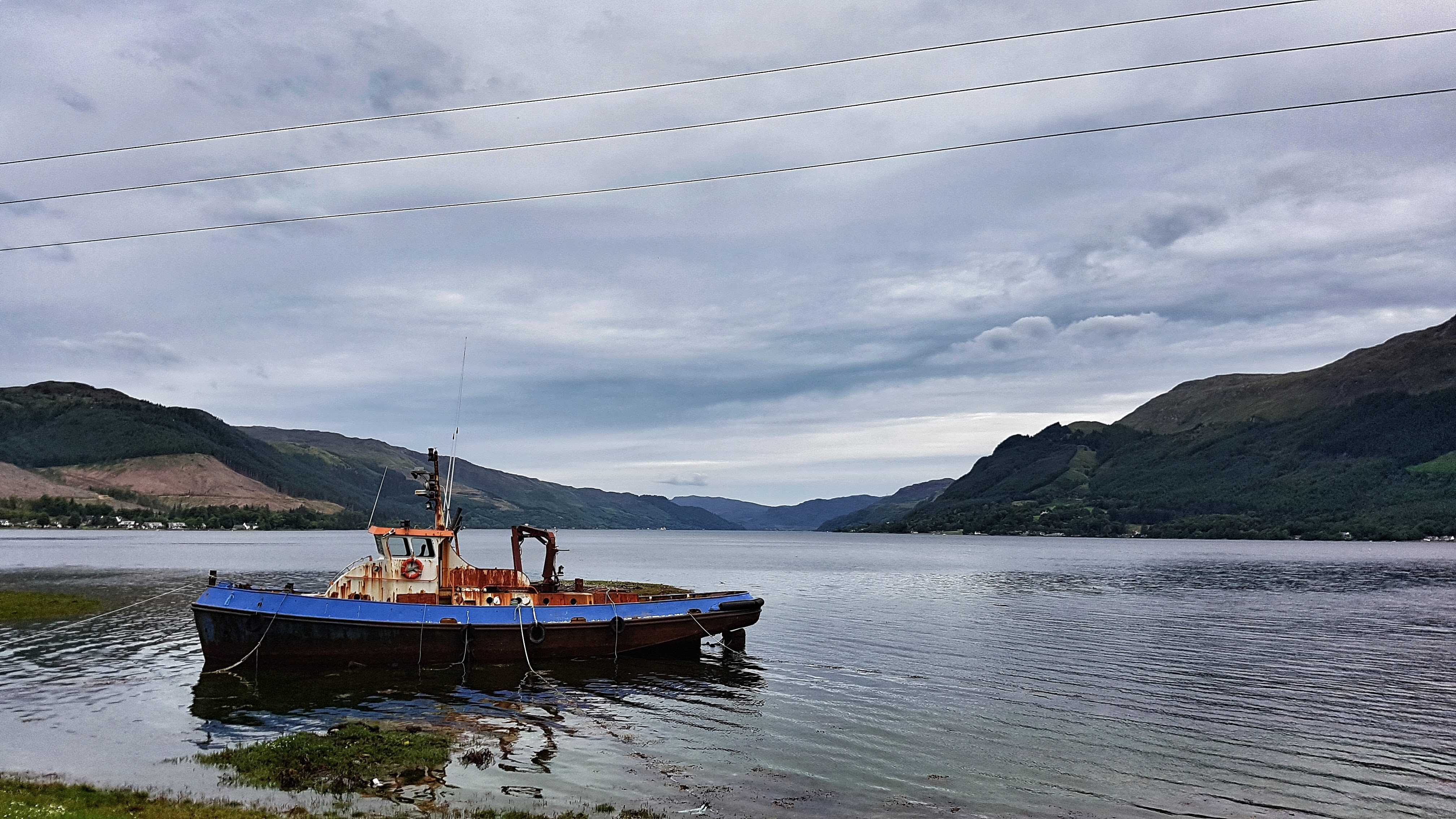
Loch Duich from the village of Morvich.
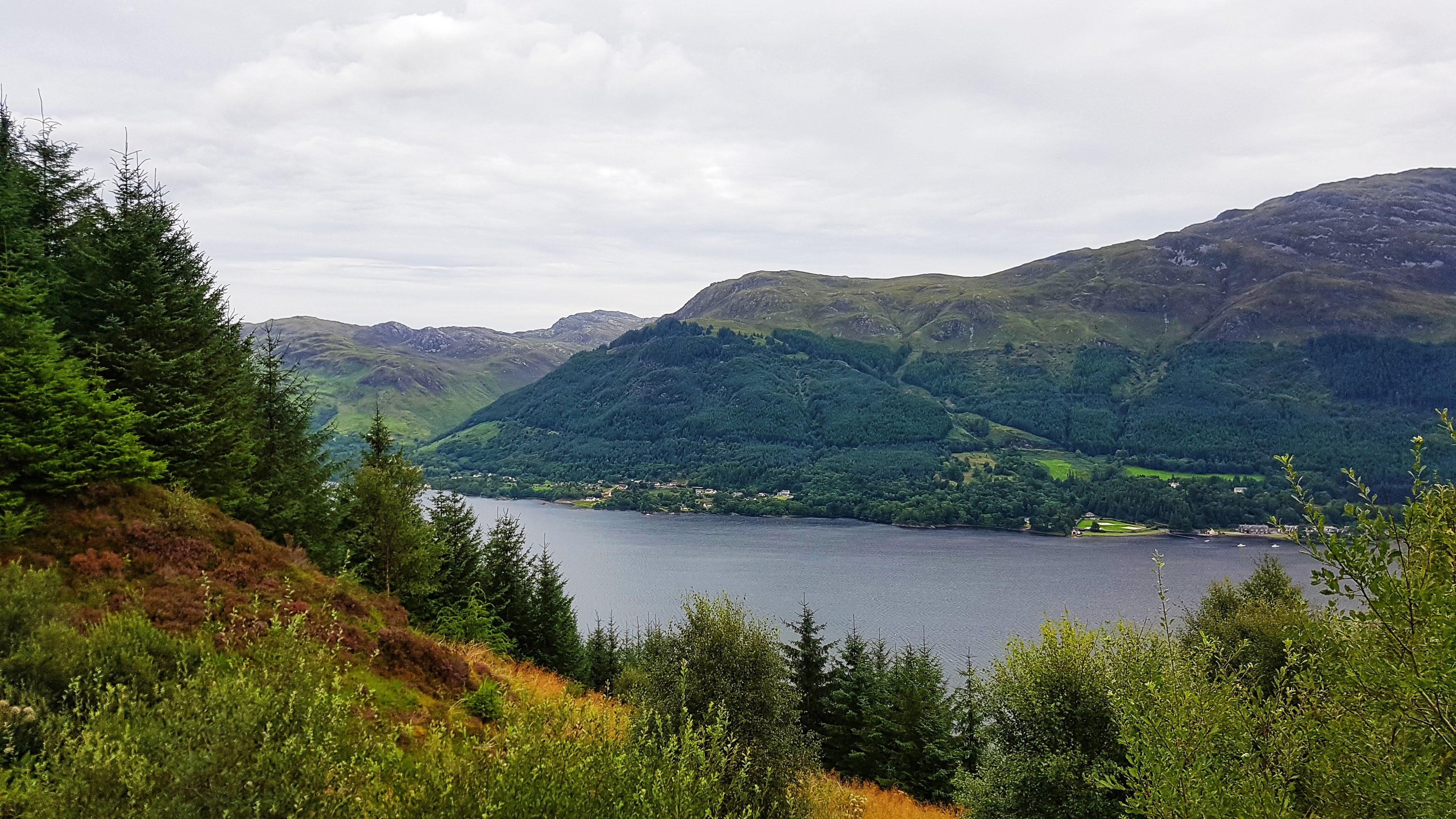
Morvich is very close to the A87 which heads north to the Isle of Skye and other popular tourist destinations. it is also a popular base for hiking.
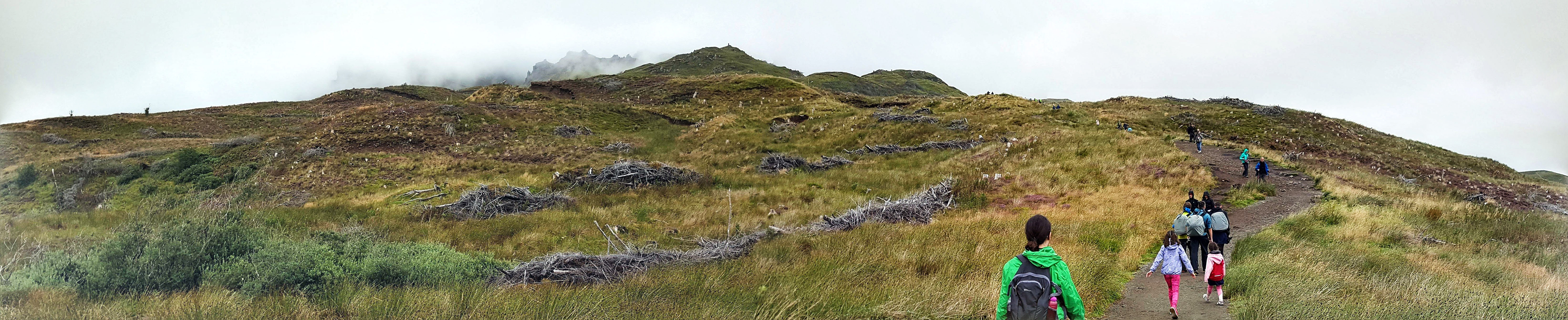
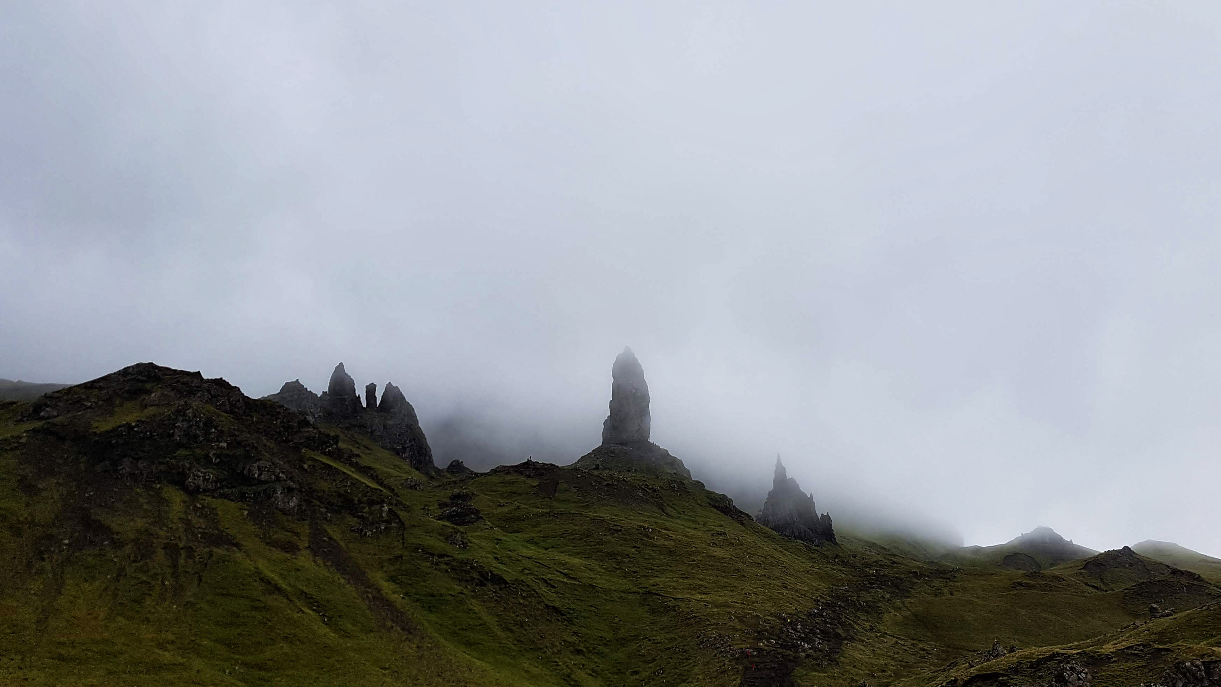
Heading to the The Old Man of Storr on the Isle of Skye.The Old Man of Storr on the Isle of Skye – the best we saw of it on a very cloudy day.
The Highlands is renowned for its climate that helps keep the grass lush and green and the lochs full of water. While it was noticeable how scorched much of the grass looked and how low the lochs appeared, the weather was mostly cloudy and sometimes wet on our visit – which is what we half expected, but was a touch disappointed nonetheless.
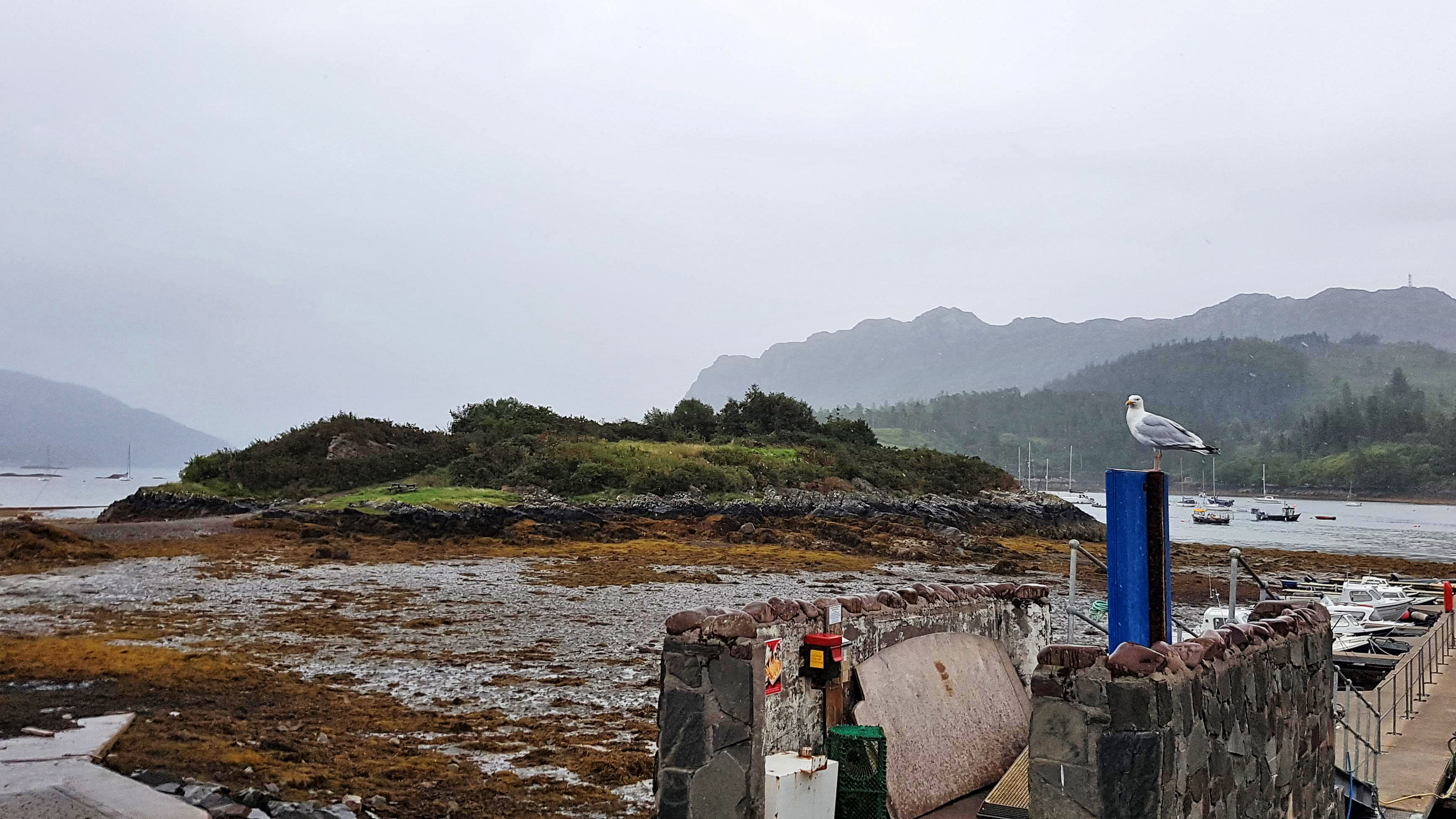
Plockton on a wet, drab afternoon.
Day 10 – Saturday 11th August 2018 – Almost Solitude 👌
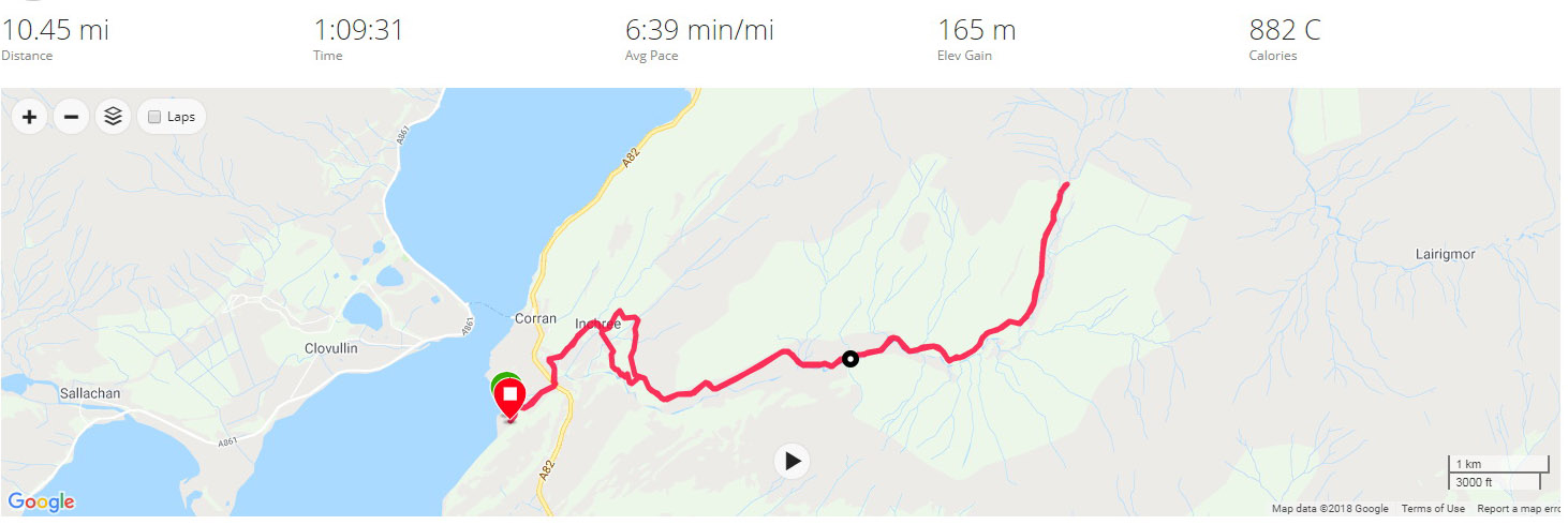
This was a run I was fearing and looking forward to in equal measure. The opportunity to run in the spectacular surrounds of the Highlands was a thrilling prospect. The thought of having to get my body up and active after a 180 mile drive towing a caravan on some of the more demanding A roads on these isles was less than attractive. Having done the drive, set up the caravan and had lunch I was ready to collapse. But there was a run to be done and so I changed into my kit and off I headed.
I’d already decided for my first run in the Highlands I was going to do an out and back on a track that appeared to run for several miles to nowhere in particular except for a building that was marked on Google Maps. Fearing some really tired legs I was pleasantly surprised that the opening mile was a not too slow 7:35. I was a touch disappointed to see the road turn into a gravel track (as I predicted) and then stop at a cul-de-sac of two houses. A quick inspection on the Google Maps showed that the track I wanted I’d missed (It was a gated bridle path I’d ignored a little while earlier). Heading back I felt my guts churn in a not pleasant way so I opted to head back to the Caravan Park to use the facilities and begin the run afresh.
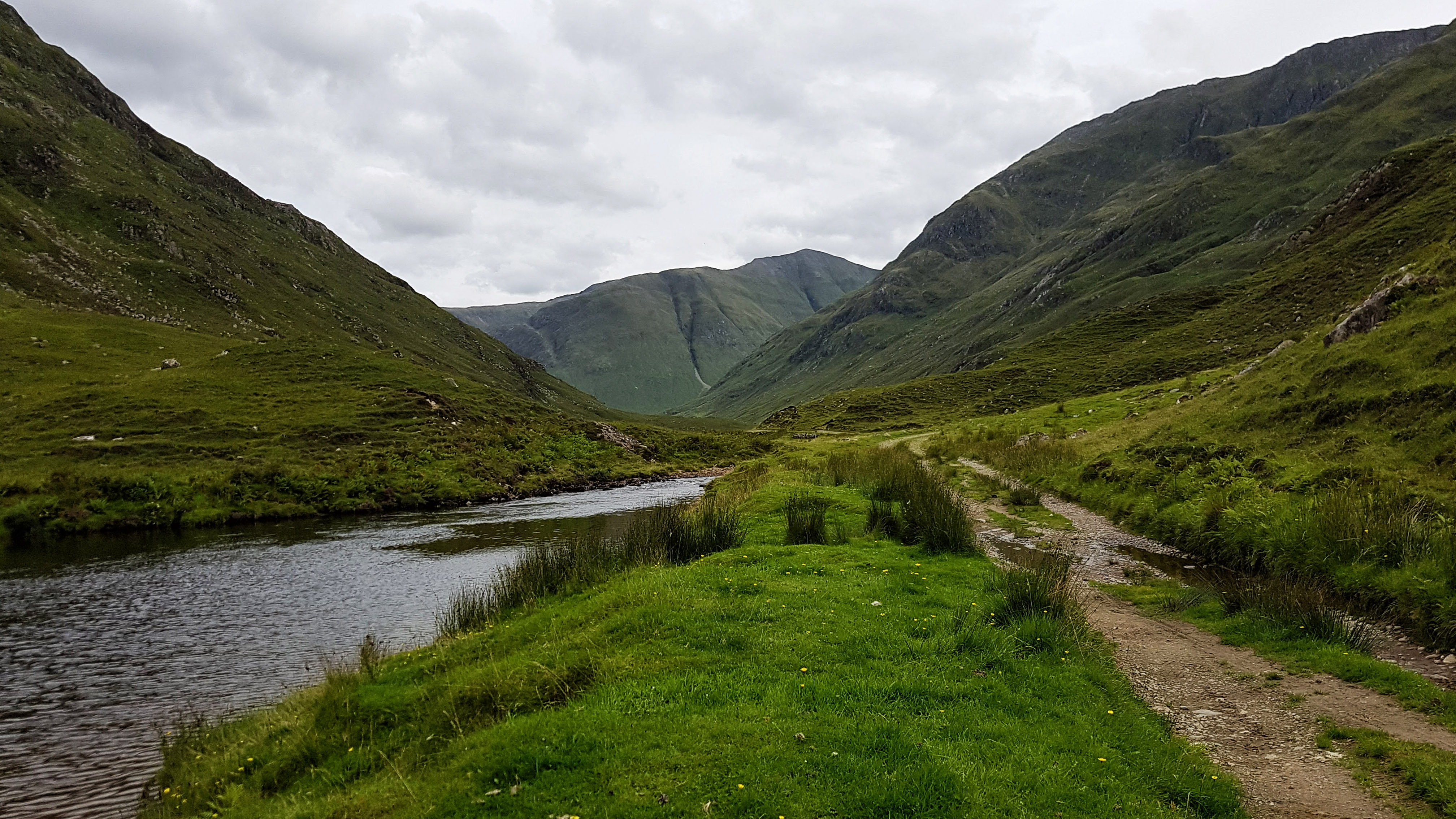
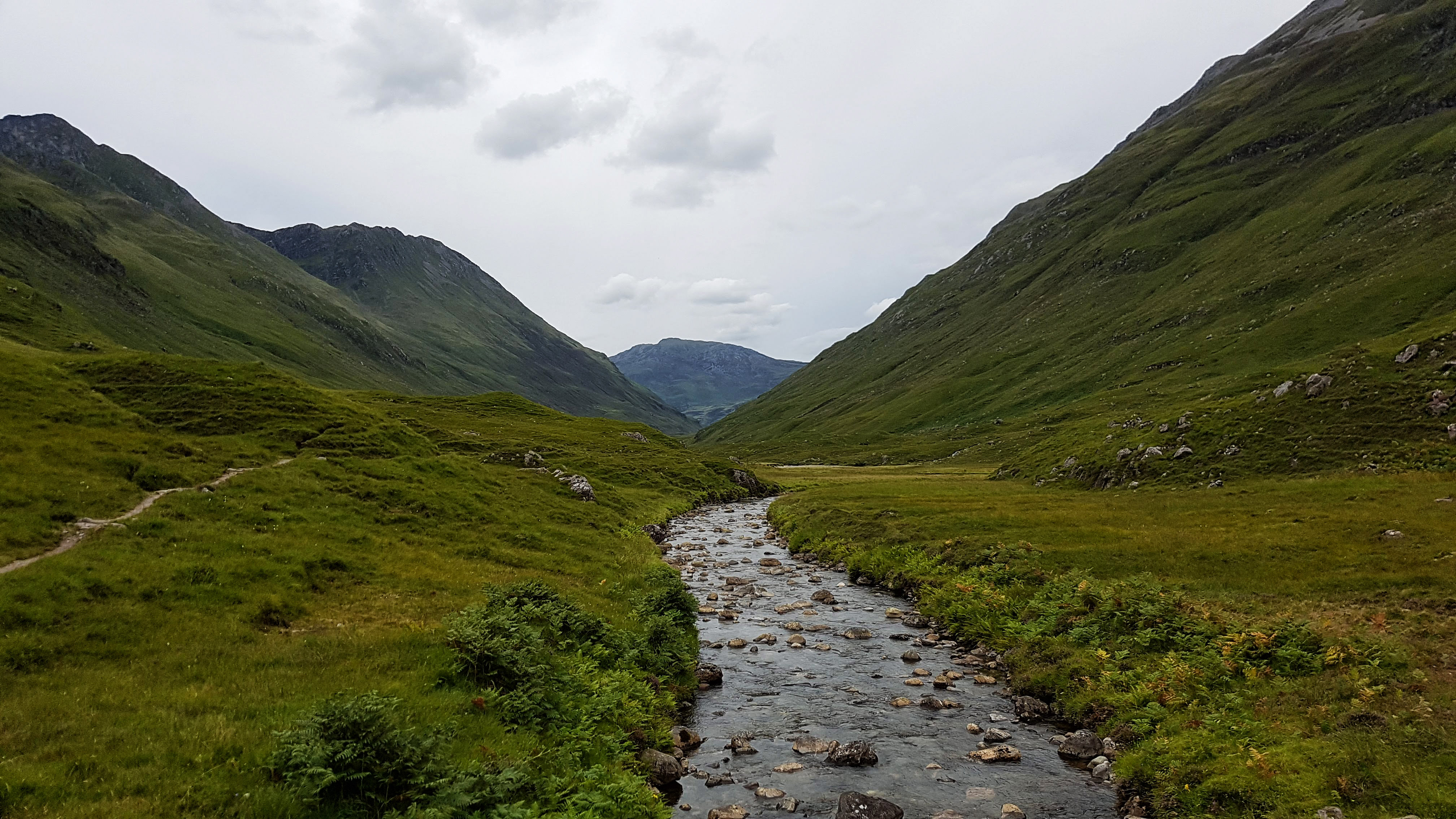
The beautiful trail running from Morvinch.
Feeling much better and a little lighter I resumed the run. Mile two was a 6:39 which was really quite unexpected. Finding the correct bridle path this time I set off on what turned out to be three and a half miles of almost pure solitude and pure bliss.
Spectacular views on the trail from Morvich. (Not a Strava picture)
Hugging the River Croe the path offered constantly changing views of the multitude of surrounding hills and mountains knwn as the Five Sisters of Kintail. The run out was a start / stop affair as I spent almost as much time admiring the scenery and taking photos as I did running.
Spectacular views on the path from Morvich (Also not a Strava picture).
The path was easy to run on at first but as the minutes passed the gravel began to get bigger and more of the path took on the form of small rocks, which were tricky to run on and required a good deal of concentration to avoid trips and potential ankle sprains.
The beautiful trail running from Morvinch – the sheep nearly the only company I found.
Despite the lack of recent rain there were also quite a few small streams to cross, most of which had rocks handily placed to tip toe across. I imagine in wetter times this run would have been far more challenging. It was at such a stream I encountered pretty much my only company for the day – a flock of sheep. The solitude was further broken a little while later when I passed a small group of young trekkers who looked distinctly weary. I passed them on the way back and rather creepily perhaps (for them) twice more on future runs as they were staying in the same caravan park.
A lone inhabited building in the middle of nowhere.
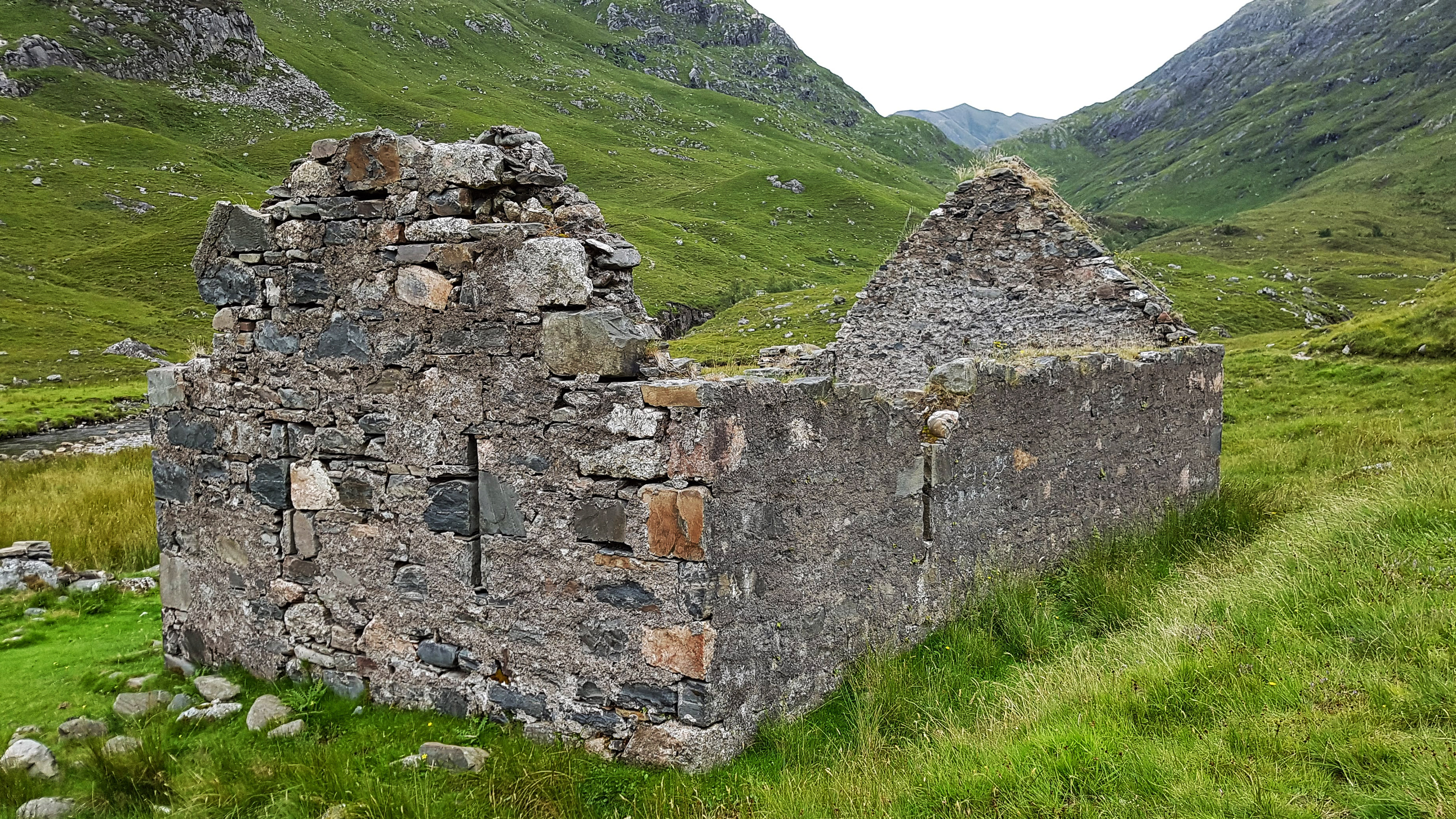
Having run a couple of miles before hitting the path I knew it would be around six miles before I hopefully spotted the lone building. Sure enough I crested a small rise and spotted it in the distance. As I passed it I had to stop and wonder how it must feel to live in a house as secluded as this and what fate befell the owners of a very derelict house next to it.
A derlict lone building on the trail (Another picture that failed to make the Strava cut).
Just a short way past the house was a bridge which I crossed and continued running for just a short way before I sensed it was going to get very technical very quickly as it narrowed and steepened. I turned back around and headed to the bridge – stopping for a minute or two to enjoy the tranquillity.
The view from the bridge (Not on Strava either).
With the sightseeing over it was a case of running the next four and a bit miles back to base. There was no stopping now as I enjoyed the moderately technical nature of the path which was by now really working the muscles in the feet and legs far more used to running on roads and fairly level terrain.
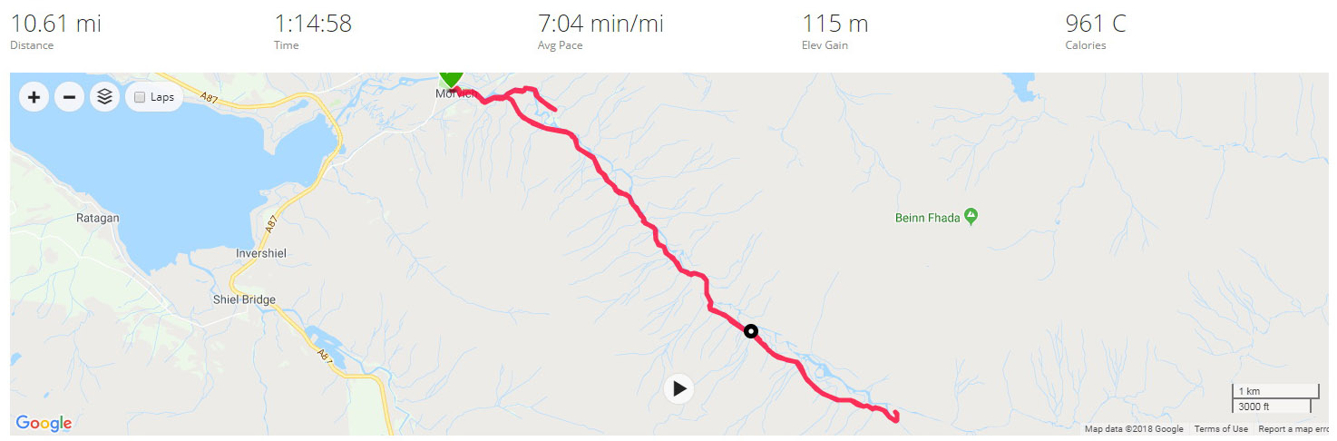
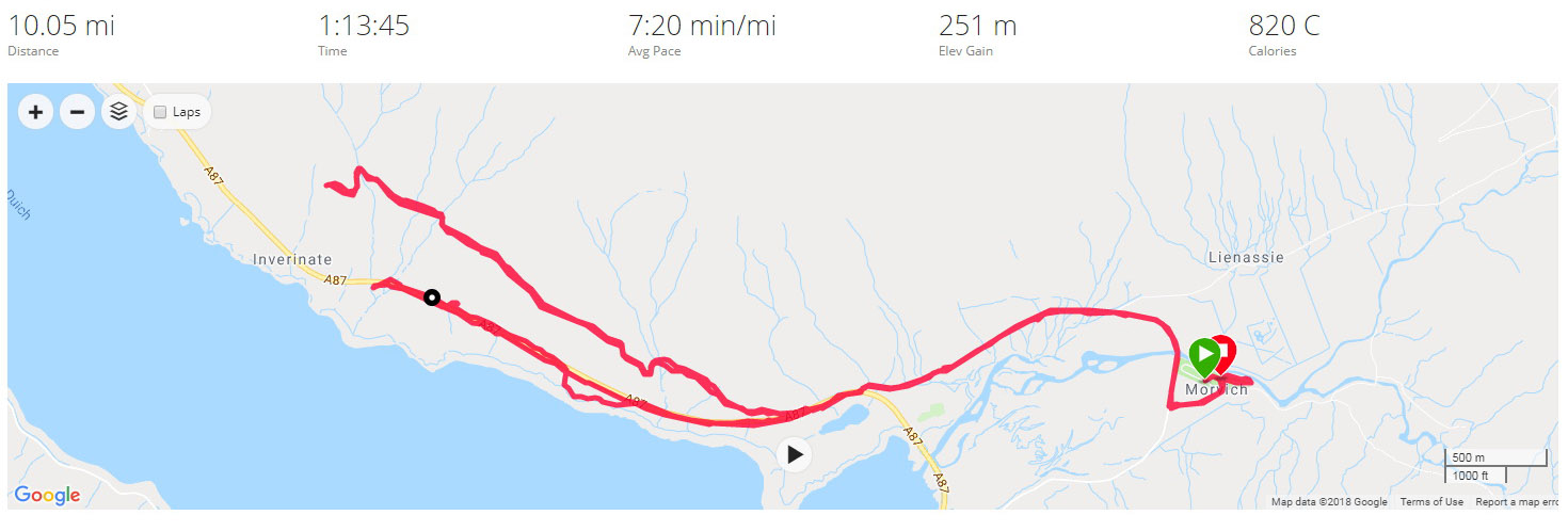
I wasn’t particularly interested in the pace of the run but was pleased to have covered the 10.6 miles in 7:04, especially given how tired I was after the long journey into the Highlands.
Once I’d uploaded my run, I noted there was a Strava segment that looked like it was for a race that takes place in the area. I had no chance of claiming that as I had stopped many times to take pictures. On my return home I did though create a similar segment for the return back to Morvinch which I was pleased to have claimed top spot! This though was not a run about segments but about soaking in the stunning scenery that this part of the world has to offer.
Best Strava Segment Performance: Back to Morvich – 1st/79
Day 11 – Sunday 12th August 2018 – Mam Ratagan and Back
The second run in Morvich and I decided to attempt to take to the only road I could relatively safely tackle in the area. The A87 has a section with a pavement as it heads to Inverinate but much beyond that and it is no place for a runner to be, especially in the month of August with the multitude of caravans and motorhomes flying along the twisting road.
The road I had to play with was the Old Military Road, which runs on the opposite side of Loch Duich and is signposted as a tourist route alternative to the A87 and the Isle of Skye via a ferry. While it was unlikely to be traffic free I was confident that the A87 would take the vast majority of the through traffic and it would be no more risky than many other country roads I have run on.
Heading off at 8:30am the run was immediately compromised by a landslide (which had occurred some time before we had arrived) on the most direct route out of Morvich to the A87. I had no alternative but to take the diversion onto the A87 and over the causeway and bridge that was built to bypass the A87 away from Morvich itself. This added around a mile each way to the run, but thankfully at least there was a pavement to run on.
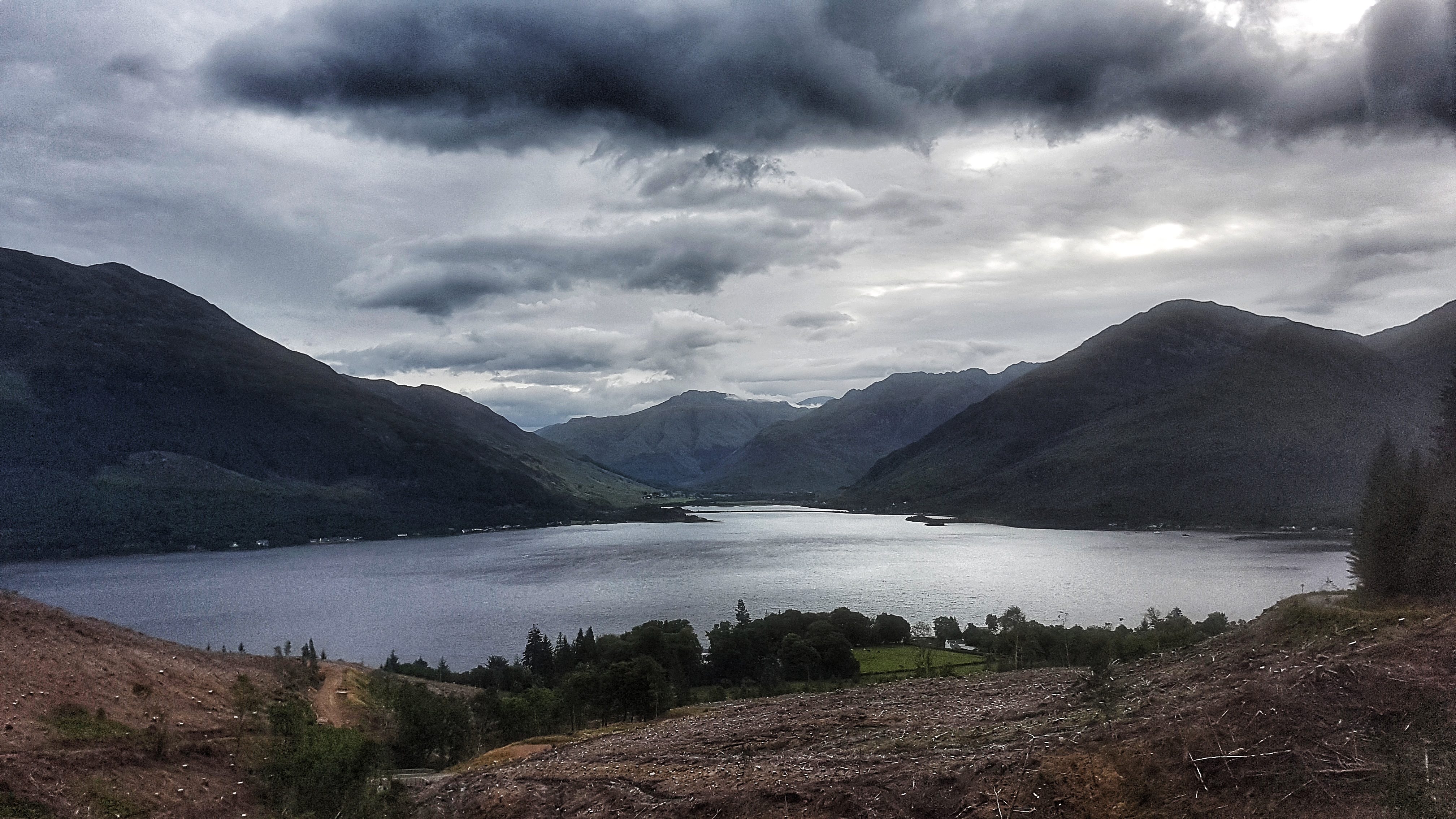
Loch Duich at Shiel Bridge.
Once over the bridge the pavement left the main road briefly to a quiet footpath before rejoining the A87 at Shiel Bridge. Just as the pavement ran out I could take the right turn over Shiel Bridge and onto the Old Military Road. This road was originally built in the 1750s before being rebuilt in the 1820s taking a route from Fort Augustus to Bernera. Having perused the road on Google Maps I fancied a run up to the Mam Ratagan viewpoint a few miles literally up the road.
My legs were not too bad after the day before – after the customary steady opening mile (7:34) I slipped into a comfortable pace of around 6:50 for miles 2 to 4. I then began the near two mile long climb which only averaged 5% but held some surprises along the way. Part of the Highlands experience has to be running some proper hills, so I was, in a perverse way, looking forward to the challenge.
Loch Duich running up Mam Ratagan.
It began as a drag and then as I worked my way further and further up it began to steepen: 8%, then 10% then, as it approached where I assumed was the top it was signposted as 18% average but in places felt much steeper – not quite the 30% the Strava segment suggests, but probably short sections were around 20-25%.
Slowly making my way up I stopped briefly to take a photo before taking on the final onslaught via a set of steep hairpin bends which made my running feel like a crawl to the extent where walking felt like it could have been a quicker option.
View from Mam Ratagan.
With one final effort I finally reached the Mam Ratagan viewpoint. I stopped briefly to take in the scenery and to take a photo, but as I was sharing the experience with a young couple who had clearly slept the night there in their car (A common occurrence in Scotland where laws on where you can stay overnight are different from the rest of the UK) were thankfully doing nothing more than brushing their teeth, I kept the visit short. While the view there was good, the abundance of growing trees at this point, made the vista slightly lower down the hill, in my opinion, slightly superior.
A little later on in the day, it was a surprise when I uploaded my run to the world that I had claimed both the Old Military Road Climb segments on Strava despite at least one stop to take photos. That said, the road is not exactly over frequented by runners, based on the single digit numbers of those who have uploaded to Strava and covered the segment. It may though be more popular with cyclists as it features in the Scotland edition of the seminal Britain’s Greatest Cycling Climbs. I only discovered this by chance from a club mate who noted my effort on Strava and wondered if I’d deliberately targeted it. I was a bit disappointed to find out that I never quite made it to the top of the climb as described in the book. It’s a long way to go back to finish the job!
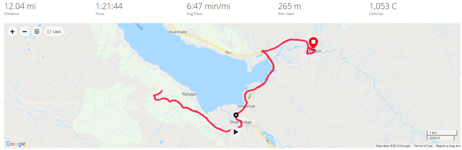
The out section of the run covered with just under six miles on the Garmin I knew it was going to be run closer to 12 miles than the customary 10. As I plunged down the steepest section of the climb I had some severe pains in the quads which normally precedes a bout of debilitating cramp. I tried my best to relax and not tense the legs and was relieved when the gradient reduced a little and the pains subsided, not to the point of them disappearing, but enough for it to not affect the remainder of the run.
Having taken a hit with the uphill (a 7:05 and a 7:59 mile, although Strava GAP has them both as sub six minute miles) the average pace for the run recovered as I continued the 2.4 mile downhill run back to Shiel Bridge, running 5:58, 6:15, and 6:28 for miles 7-9. Back on the A87 I decided that it was probably best to continuing pushing rather than easing up as far as the quads were concerned, so continued with 6:37, 6:30 and 6:29 miles, not stopping at any point of the run, to end the 12 miles in 1:21:43 at an average of 6:47. This was pretty pleasing considering the severity of the climb I’d run as I passed the halfway mark in the Tour of Britain.
Best Strava Segment Performance:s Old Military Road Climb – 1st/12; Old Military Road Climb – 1st/7; Down Old Military Road to Shiel Bridge – 1st/2; Keeping Safe on the A87 – 1st/72; From the A87 to Morvich – 1st/28
Day 12 – Monday 13th August 2018 – Loch Duich – high and low
Having tackled the only obvious footpath on the Saturday and the only real safe road on the Sunday, I must admit I was wondering where I was going to run for the third and final run in Morvich. It was only when I was driving back along the A87 near Inverinate with the family from a trip to Kyle of Lochalsh and a rainy Plockton, that I spotted on the side of the road a sign for a footpath into woodland. This looked as though it could be just what I needed!
A long journey to the Isle of Skye was planned for later in the day so it was out of the caravan fairly early at 8 am for the Monday morning run. The first mile was fairly slow and tortuous while the legs struggled to wake up on the road out of Morvich. I wasn’t long on the A87 when I spotted a different path to the woodland than the one I’d seen the day before, and grabbed the opportunity to explore without hesitation.
A woodland path heading towards Inverinate.
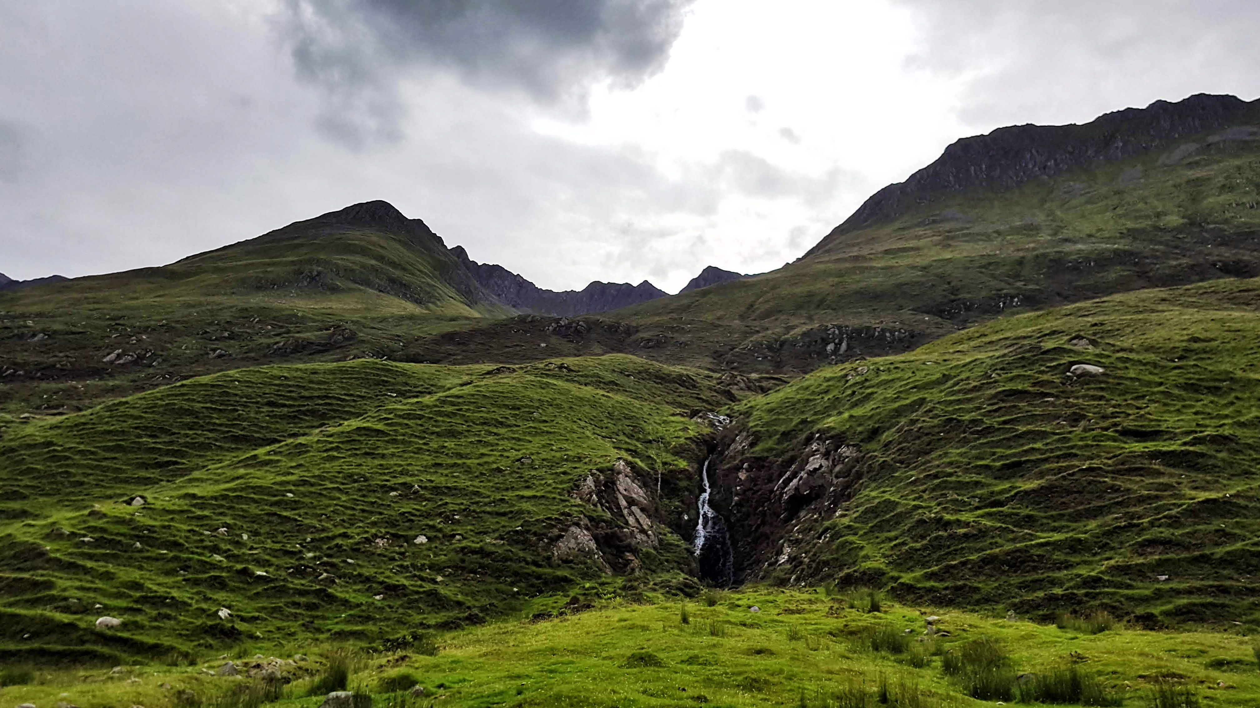
I soon began heading upwards: rocks, trees, and the occasional stream to the right of me, trees, trees, and more trees to the left. It was quite hard work as I climbed a not especially steep gradient, the legs still a little unwilling to activate. Mile three was a pedestrian 9:01, although Strava GAP reckons it was worth a 6:45 once the elevation is taken into account.
After a mile and a half of climbing the hill levelled off and there was quite a rock formation to the right of me and quite a remarkable view to the left of me, with a splendid vista of Loch Duich around 200 feet below me. I stopped to reel off some photos and take stock of the view before carrying on along the track. Alas as the track became less pronounced and the abundance of grass more apparent I feared the end was nigh and indeed it was that the path came to an abrupt end.
Loch Duich – high.
There was little else to do but turn around and head back from where I came – this time quicker thanks to gravity but not especially fast – this was not a day where any world records would be set. Two thirds of the way down I spotted what looked like an alternate route but reckoned it would be prudent to stay on the path I knew. This took me back on the A87, but with only just over five miles covered, I knew I had to do some more exploring to make up the distance.
So I headed up the A87 back towards Inverinate, knowing there was a pavement beside it for a good deal of the way. I passed some houses and a small primary school; once the houses ceased a fairly long uphill drag commenced. I spotted the gate to the woodland path I’d spotted in the car the day before and tried to get in. However I couldn’t get the gate to open and the sight of an unleashed dog staring at me with angry eyes in the distance made me think better of this route and went back to the main road.
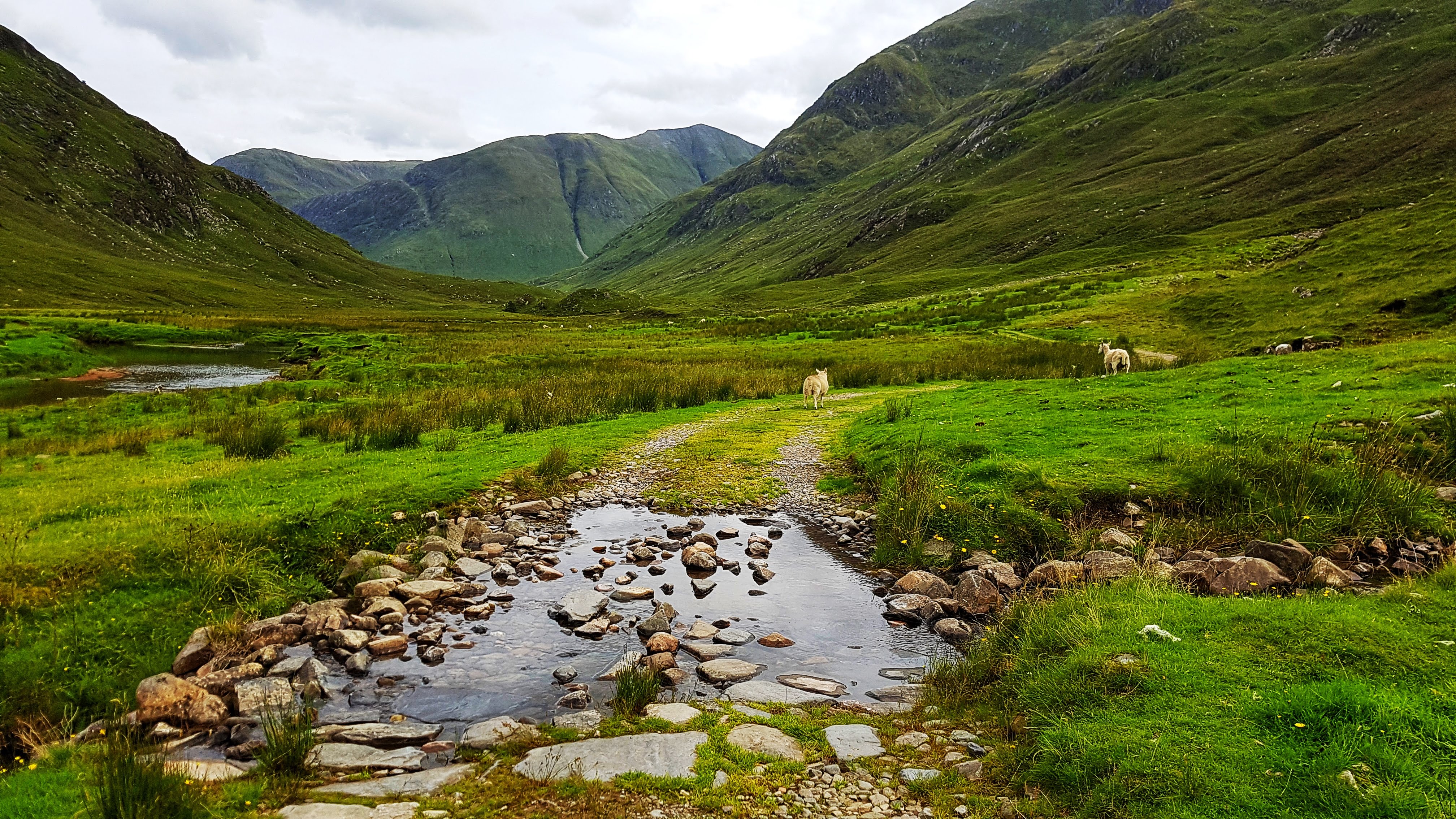
Loch Duich – low.
After a mile and a half or so I reckoned I could turn around and head back and clock 10 miles by the time I reached the Caravan Park. This I did via a small diversion from the A87 down a small footpath and a quiet road where the select group of residents could enjoy a most tranquil view of Loch Duich each and every morning. Buoyed on by quite a long gentle down hill run I was able to maintain a good steady pace for the remaining couple of miles in 6:35 and 6:25 respectably. This couldn’t prevent however, at 7:20 per mile, this run being the fourth slowest of the Tour. But what it lacked in pace it made up with one of the most memorable Surprise Views of the holiday.
Bunree Caravan Club Site – probably the best backdrop we’ve stayed at (And the poorest weather!)
Bunree lies just north of Onich on the eastern shore of Loch Linhe and consists of little more than a few houses and a Caravan Site. With the A82 nearby however it is only a few miles from Glencoe and Fort William – which is the main town in this part of the Scottish Highlands and just a few miles from Ben Nevis.
Glen Nevis before the rain again came down!
While the views are undoubtedly spectacular, poor weather for the majority of out three day stay meant our tourist exploits were limited to an afternoon in Fort William, a very wet walk in Glen Nevis, and an enjoyable short walk up to Inchree Falls – just a mile or so away from where we were staying – where we were also able to spot some red squirrels!
Day 13 – Tuesday 14th August 2018 – Lost the woodland trail so played it safe on the A82…
Not long after arriving at the spectacular Bunree Caravan Site I was reading the welcome brochure over lunch and it soon became clear that the place to head to for my first run was the nearby Glen Righ Forest, which promised miles of paths and tracks – ideal for walking and mountain biking. They didn’t specify running per se but I knew that this could be a runner’s playground!
It was a wet and wild afternoon in the Highlands so I was a little delayed heading out as the caravan’s awning was doing it’s best impression of being a sail as we struggled to attach it to the caravan and peg it down before it blew away. Finally at 3:40 pm I was on my way – thankfully the rain had stopped and the wind began to die down, the sun even threatened to make an appearance!
Half a mile of single track road later and I was on the busy A82, but it was just a case of crossing it and heading onto a small road that took me through the small village of Inchree and on to the Glen Righ Forest car park. There was an information board which offered up two circular walks – one was to the Inchree Falls, the other called Wades Road Walk, named after the Military Road.
I wanted to save the waterfalls experience as a family one so I opted for the Wades Road Walk, which was advertised as 3.8 km long. I set off along a trail which was narrow but very well maintained and not that technical as it made it’s way rapidly deep into the heart of the forest.
The photo doesn’t do justice to the colours in this forest (and the severity of the climb!)
The trail may not have been technical, but boy was it steep! My first mile, that took me to the car park, was a 7:34, my second mile 9:01, but Strava GAP rates it as a 6:12, having climbed 440 feet in just over 3/4s mile at an average of 9%, with a savage section of just 0.13 mile which averages 17% on the Strava Segment. I’m not sure the steepest bit of it is 72.7% as Strava claims, but I reckon it was around 33% for around 20 seconds of running. Given that I did this section at 10:47 per mile pace, yet sit third in the Strava segment gives an idea of its severity. The amusingly spoonerised segment for the entire climb Hairway to Steven has me second, a minute off the leader, which would have been less had I not stopped to take the photo above!
Arguably the most scenic half mile of running on my Tour in Glen Righ Forest.
Just as I felt like my legs would give up completely, thankfully the climb fizzled out as I presumably joined the Old Military Road. Following the coloured post I took a left turn or two and began to drop back down the hill I had just risen. It was probably a combination of the adrenaline still coursing through me after the hill as I began to hurtle downhill, the sun just attempting to break through after four days of thick cloud cover and the stunning scenery, with views of the forest, the mountains and the Loch below, but this half mile of running (as shown in the photo above) was perhaps the most enjoyable and scenic of the entire Tour.
Alas the views were not to last forever as the descent got steeper and steeper and dropped back into the forest, round some pretty tight alpine style hairpin bends. I think I missed the turning back to the car park for I continued to drop, quite quickly (a 6:22 third mile) past some holiday lodges and suddenly onto the A82. I had to rely on Google Maps to advise me that I had popped out around a third of a mile north from where I had last seen the popular A road.
Luckily for me, although the overwhelming majority of the A82 has no pavement and is wholly unsuitable for running on, this section did in the form of a shared cycle path. Even more fortunate was the presence of an information board just a little way along the road which explained that this cycle path ran from North Ballachulish to Fort William, using the Corran Ferry and the continuation of the path on the A861 to offer cyclists especially an alternative route to Fort William, avoiding the busy A82.
The Corran Ferry – one of the few remaining ferry services in the Highlands – taking passengers from the A82 to the A861.
With less than four miles covered I knew that I would have to do plenty of exploring to make up the ten miles. I had wanted to spend longer on the forest tracks, but didn’t really fancy another long climb up. Instead I first turned right onto the A82 and headed down to the Corran Ferry crossing, which had a boat just about to depart. Free to foot passengers, I briefly considered taking the short journey across the water but, thought the better of it given that my stomach was giving a few distress signals.
I decided I would instead head back initially to the caravan site to use the toilet facilities before using the cycle path on the A82 towards North Ballachulish to make up the distance. Relieved of stomach cramps I was soon back on the main A82, enjoying a cycle path that was, at that time, used by no-one other than myself.
There was around a mile of running to take me from Bunree to the more populated village of Onich, which sits mostly on the A82 and features a large number of B&Bs, which offer splendid views of, and easy access to the shores of Loch Linhee, which when I dived briefly off the road to take a photo, felt and smelled far more like a sea beach than the side of a lake.
I ran along a bit further, the cycle path looking a lot more like a pavement and barely suitable as a means of taking bikes along. I got to within 3/4s mile or so of Ballachulish Bridge – fortunately for me as someone who really does not like crossing bridges, it was time to turn around and head back to keep the run at 10 miles. The pace had picked up by itself almost without effort, the final three miles 6:21, 6:22, and 6:11 as I enjoyed the relatively flat terrain and good surface underneath me.
All that was required once returning to the Caravan Park was a quick lap of the site to ensure the run came in at over 10 miles, taking in the fine views around us and making it over to the laundry room to deposit my well worn running clothing!
Best Strava Segment Performances: Hairway to Steven – 2nd/90; Onich to Keppanach – 2nd/51.
Day 14 – Wednesday 15th August 2018 – More time in Glen Righ Forest
With road based options limited, unless I wanted to catch a ferry, the nearby Glen Righ Forest with the promise of miles and miles of forest tracks and footpaths was bound to be the spot at which I would spend the vast majority of my time at Bunree running. After a wet and wild night that made sleep difficult in the caravan, it was a fairly tardy 8:40 am before I set off for the Day 14 in the 21 day run challenge.
I decided I would head initially on the forest track I exited the forest from the afternoon before and carry on running to see where it would take me. This route up to the quarry was not as severe as how I made my way up to the same place the day before, but it was still a mile and a half or so of climbing at an average of 6% which, with legs that had not fully woken up, was something of a challenge. It was surprising to see on my return that I had bagged the existing Strava segment for the climb as I didn’t think I was running particularly fluidly and had clocked a 8:15 mile after an initial 8:13 mile. The devil was in the detail though as I had climbed nearly 600 feet.
Following a brief plateau there was a choice of paths to take. I consulted Google Maps and took the one that appeared to go on for the longest distance. On I climbed for another mile and a half or so, still heading uphill, but not quite so slowly now the gradient had eased to a more manageable 4% average.
Loch Linhe from Glen Righ Forest – mountains obscured by pesky low cloud.
Once again the views were quite spectacular and I couldn’t help but stop two or three times to take some pictures and just take in the splendour, which would have been even greater were it not for the low cloud that continued to plague our stay in the Highlands.
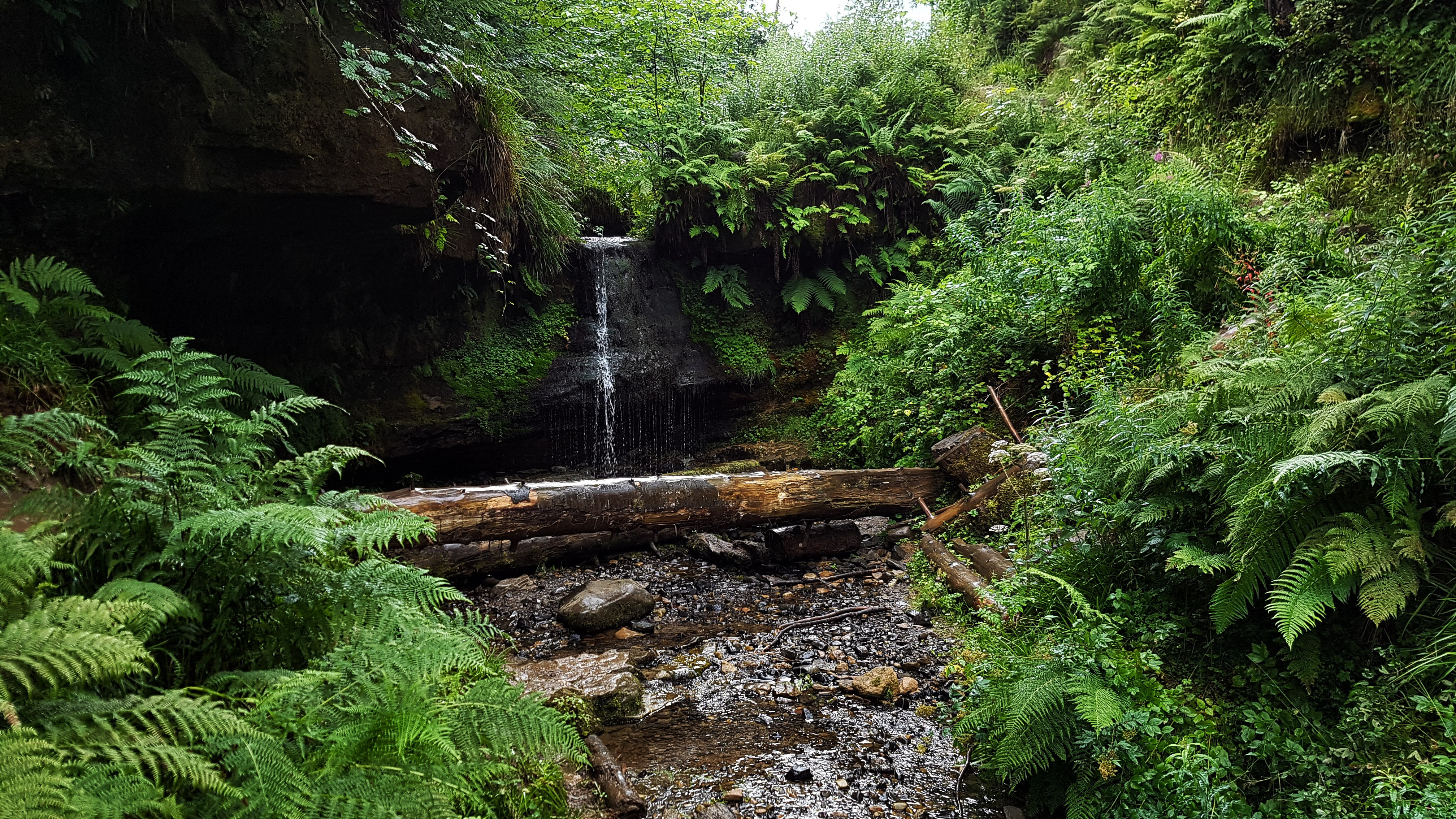
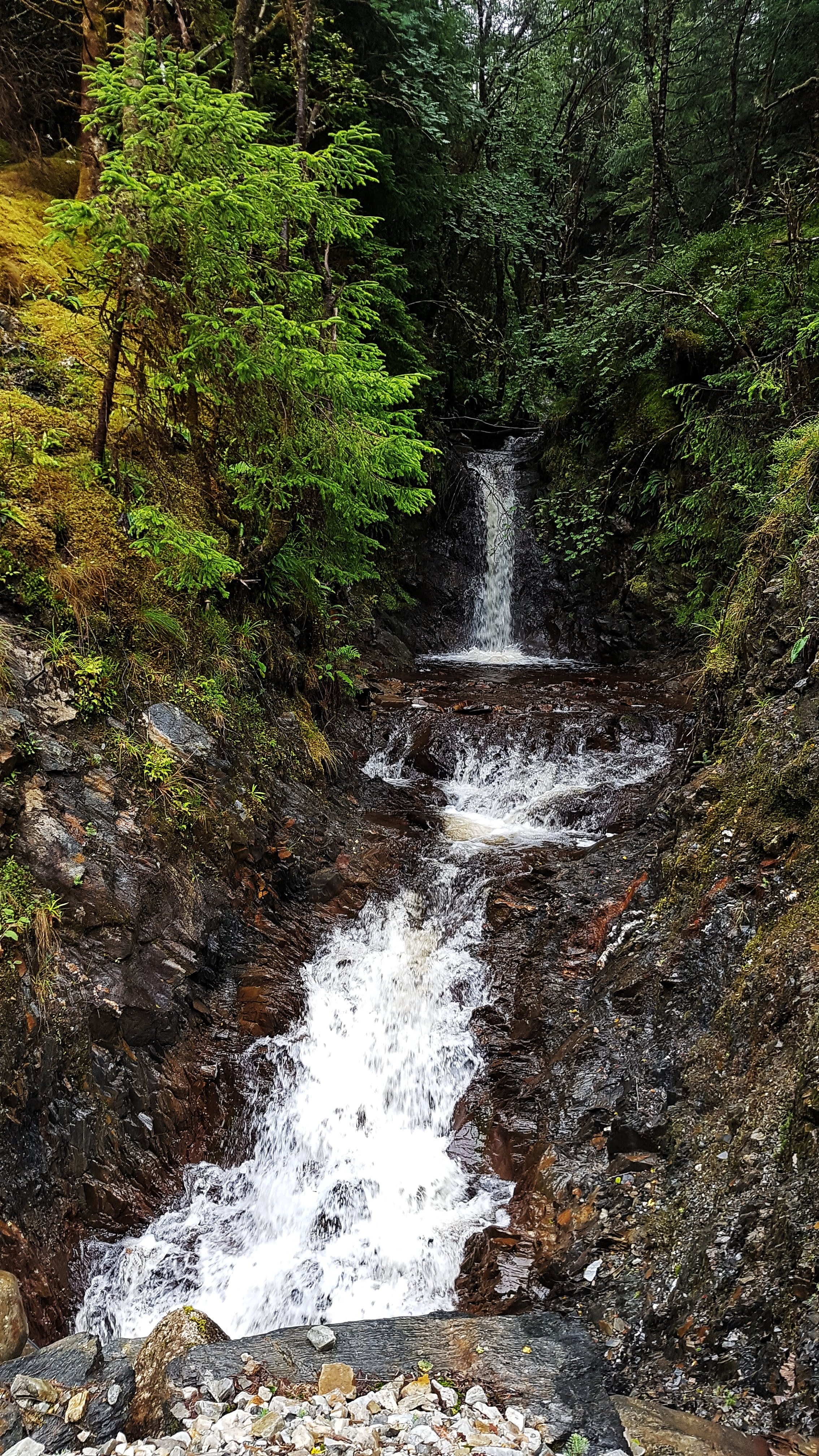
Just one of many small waterfalls in Glen Righ Forest.
As I climbed the views were typical to those above – scenic Loch to the left of me, forest and numerous small waterfalls to the right. I didn’t want it to end but when the Garmin clicked to around 3.5 miles there was the tell tail signs that this track was not going to last for ever. The road levelled out for a little while followed by what I presume is a large turning circle for quarry vehicles cut into the rock face. Then the gravel track gradually faded to grass, not long after coming to a halt as forest untouched by humans stopped me in my path.
The end of the Road in Glen Righ Forest.
With no alternative but to turn around and head back, it was a more or less a case of relaxing and let gravity do its stuff as I began a long three mile plus descent back down to the A82: 6:26 for mile 5, then 5:49 and 5:38 for miles 6 and 7. As the gradient was not too severe it was an enjoyable descent as I took in the glorious scenery one final time – for I knew that tomorrow I would explore a different part of the forest.
Back on the A82 and with three miles left to fill I decided to do a bit of research for the next day’s run trying to find the forest path on Google Maps that went on much further than any of the other paths. First I headed back to the forest car park where I’d headed to the previous day and began to run towards the Inchree Falls before noting that the map didn’t think this was the right path. Going back on myself it then appeared to show the path cutting through a set of private holiday chalets which most definitely did not have a large track running through it.
Fortunately all this ultimately pointless exploring meant that once I’d returned to the caravan site and done a lap, or maybe two, the ten miles was covered – barely – just 0.03 miles over the required amount. A slightly frustrating end to a run that had begun so beautifully, but I knew there was always tomorrow and hopefully a run along the elusive path deep into the forest!
Best Strava Segment Performances: Gate to Quarry – 1st/21; To the end – 1st/11; From top to bottom – 1st/1(!); From A82 to Inchree Carpark – 1st/77.
Day 15 – Thursday 16th August 2018 – As far as I could go without a hard hat.
Our last day in the Highlands brought a slight change to the now conventional timetable where I would run in the morning before heading off somewhere with the family on my return. Because of the poor weather forecast we decided to head off early for our planned walk at Glen Nevis before returning in the afternoon for a run while the kids would be entertained with a film or two we promised they could watch as a reward for their walking efforts.
This plan backfired somewhat when the weather, as we drove to the Ben Nevis Visitor Centre, deteriorated rapidly with a heavy storm only abating 20 minutes or so after we had parked. We managed to enjoy a family walk where we only got quite wet. That was until the last mile or so when the heavens, once again, opened in quite spectacular fashion, leaving us all soaked to the bone and me heading off back to the car to rescue the others huddling under an inadequate tree!
After returning back to the caravan for lunch and a chance to dry off, I set off on my run at just after 4pm. Unlike the past two runs I knew exactly where I was heading. The previous afternoon we had enjoyed a short walk to the Inchree Falls back in Glen Righ Forest. On that circular walk I noted that at a junction in the forest tracks there was a road to the right that matched the long track on Google Maps I had failed to find on my run earlier that morning.
Inchree Falls – well worth another brief stop.
Heading once again to the Inchree car park and setting off on the relatively steep but not too technical path up to the Inchree Falls I had planned to carry on past them as I’d taken the liberty of photographing them the previous day to include on my Strava photos for the run. However, on reaching them with the skies partly cloudy but definitely with some sunshine, the waterfalls were far more photogenic than the day before, so there was an unplanned brief stop to capture their splendour once again.
The path from the waterfalls climbed a little further before reaching the junction, where I turned right and headed along the track to who knew where. From the walk the previous day I knew that it must lead to something for we were passed by a car or two heading from somewhere. The forest track, although unpaved was in good condition to be driven on and a cattle grid gave more clues that this was not exactly a relic from the past.
Heading to where? In Glen Righ Forest.
As I climbed as far as the road wanted to go I was presented with the view above – the hills and mountains mostly clear to see for the first time since arriving in the Highlands. To the right of me were wild Highland cattle enjoying the pastures. In the distance on the bend I could see a building or two which looked like it served an industrial purpose. As I passed this an LPG lorry squeezed past me. It was quite strange to experience traffic on a road which appeared to be heading deep into nowhere.
I continued running for another couple of miles, the pace very comfortable at around 6:40 a mile, the road twisting and turning gently, a parked car where a moderately sized river (presumably heading to Inchree Falls) hugged the track, a house or two – one long since derelict, the other clearly currently lived in. Then some noise of construction – off the track and in the forest covered hills a small hut and machinery seemingly clearing the trees from the hill and smoothing the ground on the hill itself.
The path took me away from this work for another mile or so when I approached a small bridge and a warning sign telling me in no uncertain terms that entry was forbidden by law unless you were wearing a hard hat. Quite what was beyond the bridge and sign I wasn’t totally sure, but I wasn’t going to risk life and limb to find out, especially as the Garmin had very conveniently just clicked over the five mile mark, making it very conveniently a ten mile out and back run in total if I retraced my steps to the letter.
Heading back to base after reaching as far as I could legally go in Glen Righ Forest.
Just as the photo above was taken the heavens opened once again that day and I was soon pretty wet, but with the legs feeling really good – perhaps the best they’d felt all holiday, and the scenery continuing to delight with every twist and turn, I didn’t mind the rain at all. The return miles back to the A82 were a 6:34, 6:24, 6:13, 6:21 and 6:02 – speeding up as the road began to head downhill for the final mile where I missed the waterfall path and continued on the main track back to the car park. It wasn’t all running however as it included a brief spell of enforced walking. The ten or so Highland cattle who were on the pastures had settled on the road and although the signs said they were fairly tolerant with humans, I didn’t want to stress them or have them testing their sizeable horns by running towards them in a speedy manner!
Crossing the A82 it was just a case of returning to the Caravan Park. Feeling great still the pace effortless gravitated towards 6 minute miles, but felt as if I was almost jogging. This run may have just have edged it as the most enjoyable on my Tour of Britain: very nearly road and traffic free but on a surface that was easy to run on; some stunning views with a the waterfalls, mountains and forests all looking amazing when the sun peeked through the clouds for the first time in days; an out and back run that forced a turnaround at just at the right moment; and legs that felt as if they were coming into some kind of good form rather than feeling exhausted like they should have been.
With the run done it was time to say goodbye to the Highlands and prepare for the long journey back into England!
Best Strava Segment Performances (all created by me post run – there were no segments at the time of running): From A82 to Inchree Carpark – 1st/77; To the Waterfall 1st/1 (bit surprised by this); Random Segment #1 – 1st/29; Back from the warning sign back – 1st/14; Drop back to the car park – 1st/49.
Leg Five Summary
Distance Run: 30.7 miles. Average Pace: 6:48 per mile. Accumulated Time: 3:28:47. Average HR: 140; Total Ascent: 727 meters.
For our penultimate stop on our grand tour of northern Britain we headed 200 miles south from the Highlands via the mostly beautiful, at times challenging, A82, and the less scenic but undeniably easier to drive M74, which magically became the M6 as we returned to England and stayed at Dalston Hall Caravan Site, where a misjudgement over the height of the barrier very nearly wrote off our caravan!
Dalston is a large village around 4 miles southwest of Carlisle. Home of a Nestle factory ‘which has been on the outskirts of the village since 1952, processing 65 million litres of milk each year, and almost one billion sachets of Nescafe Cafe Menu products’ there was also a very nice fish and chip shop which we visited on the Saturday night!
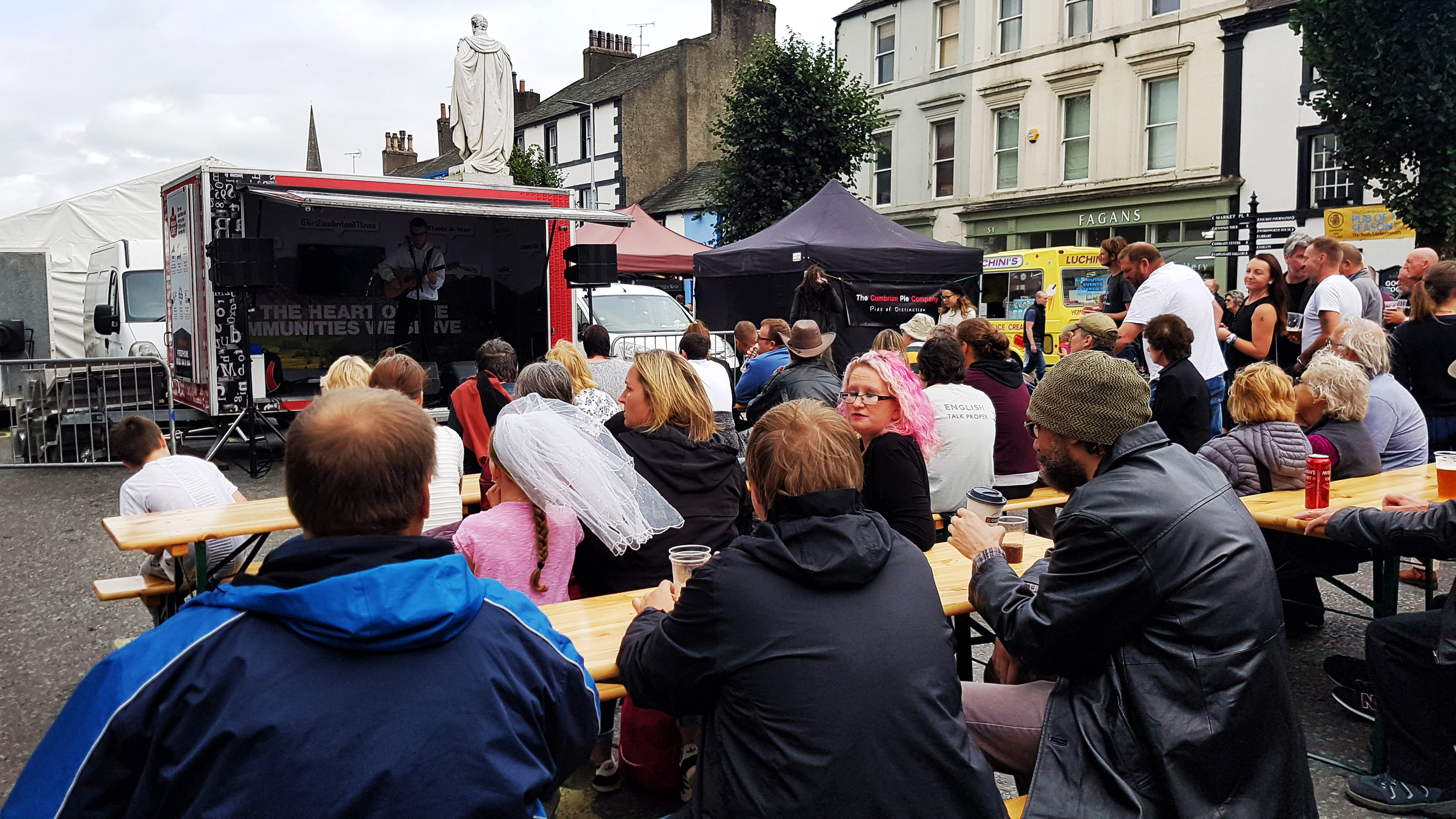
A festival in Cockermouth.
Lying north of the Lake District, there was no shortage of places to visit on our short stay. We enjoyed Wordsworth’s house in Cockermouth, which happened to have a festival on that day (Our third on our trip!).
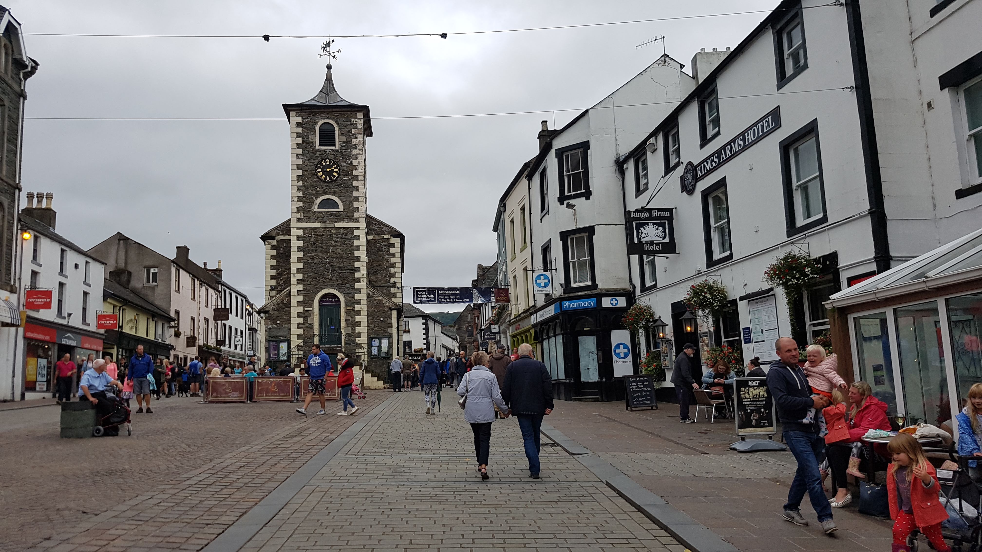
Keswick high street – Pedestrianised since our last visit nearly ten years ago!
We visited Keswick for perhaps the fifth time – we really enjoyed the Puzzling Place – a museum crammed with mind bending illusions and puzzles.
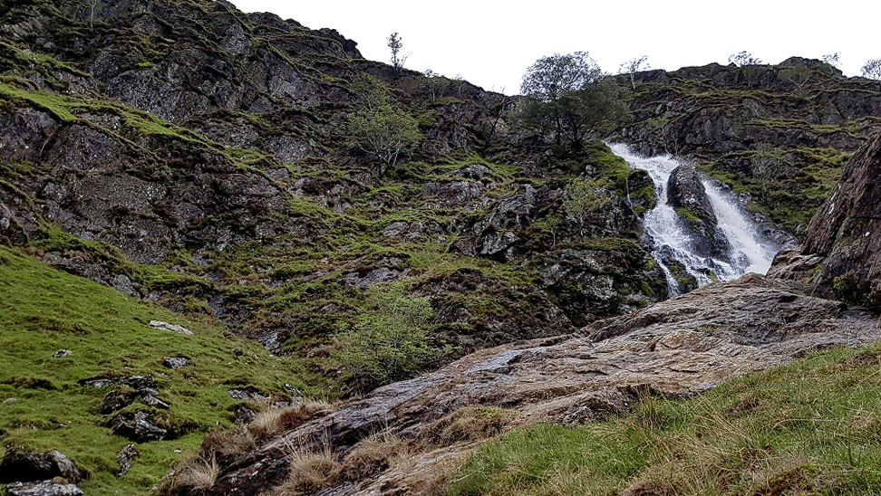
Moss Force at Newlands Hause.
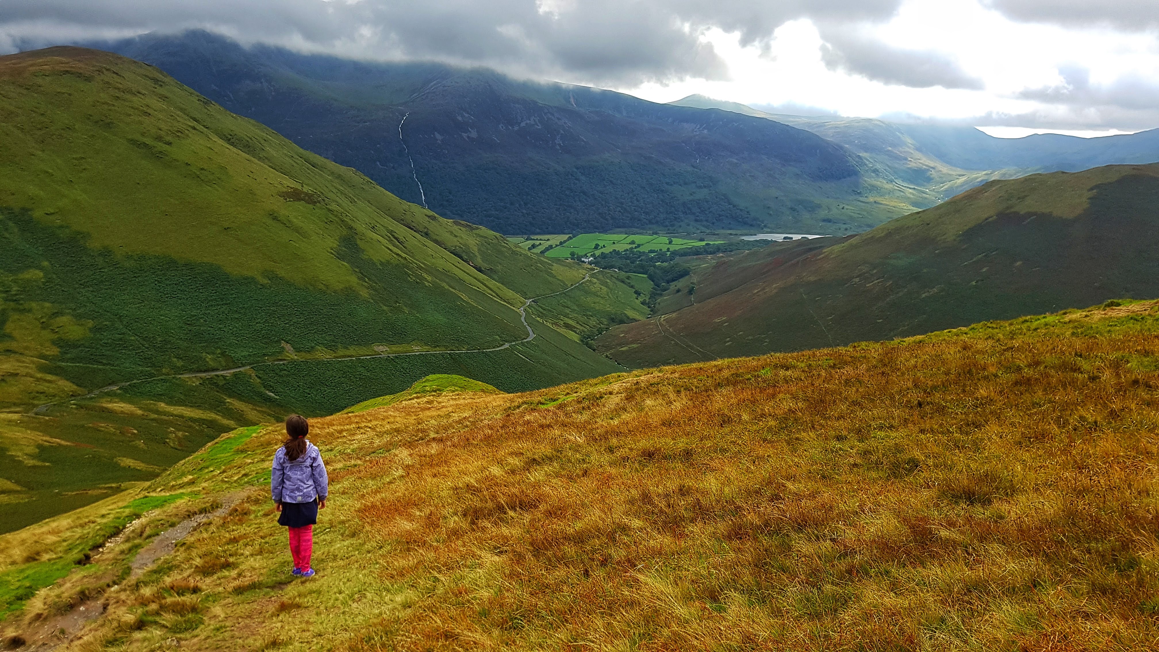
From there we headed to Moss Force and Knott Rigg on Newlands Pass near Buttermere for some enjoyable Lake District hill scrambling and challenging driving. Carlisle provided a welcome playground for the kids who were beginning to tire of daily walks and we left Carlisle thinking that we definitely need to return to the Lake District again for a longer than three night stay.
Knott Rigg with Newlands Pass and Buttermere in the distance.Knott Rigg.
Day 16 – Friday 17th August 2018 – Into Carlisle and Out Again
After the long drive south back into England I wanted little more than a simple, uncomplicated afternoon ten mile run with perhaps the odd sight or two to enjoy. The first issue was that the road on which the Caravan Park lay, was a fairly busy, fast B-Road, with plenty of traffic heading out of Carlisle towards somewhere. I wanted to head to Carlisle itself but didn’t fancy running on the road. Thankfully the owner of the caravan park told me there was a footpath that ran to a cycle path that ran all the way to Carlisle and beyond.
The footpath on Dalston Manor Golf Course I became pretty familiar with.
Cycle paths are great for uncomplicated running I thought, so at a few minutes before 4 pm I headed off, under fairly leaden skies but, for the time being, dry. The route to the cycle path was quite a fun affair – across a golf course, down through some woodlands, along a well manicured grass path in a field, through another section of woodland before popping out on the main B Road just before Dalston, but right next to a private road which, if you headed along, through the self operated level crossing (a first for me!) headed to the long awaited cycle path. This sounds simple but required a fair amount of stopping and Google Map checking to assure myself that I was going in the right direction.
All this twisting and turning meant, at 8:02, the first mile was pretty slow, but once on the cycle path the pace naturally lowered to or just under 7 minute miles. I was though, having discovered that day there was a parkrun in Carlisle taking place on Saturday morning, taking it deliberately easy.
The cycle path running close to the railway.
The path ran alongside a fairly quiet railway, at times it got very close to the railway – close enough to almost be able to touch a passing train if you were to be so stupid. I wasn’t so I carried on running. Arriving at the small village of Cummersdale I was briefly running on road before joining another path that was a little more undulating having left the path of the railway and instead copying the path of the River Caldew.
Cummersdale Holmes cycle path in Carlisle (Not a Strava picture).
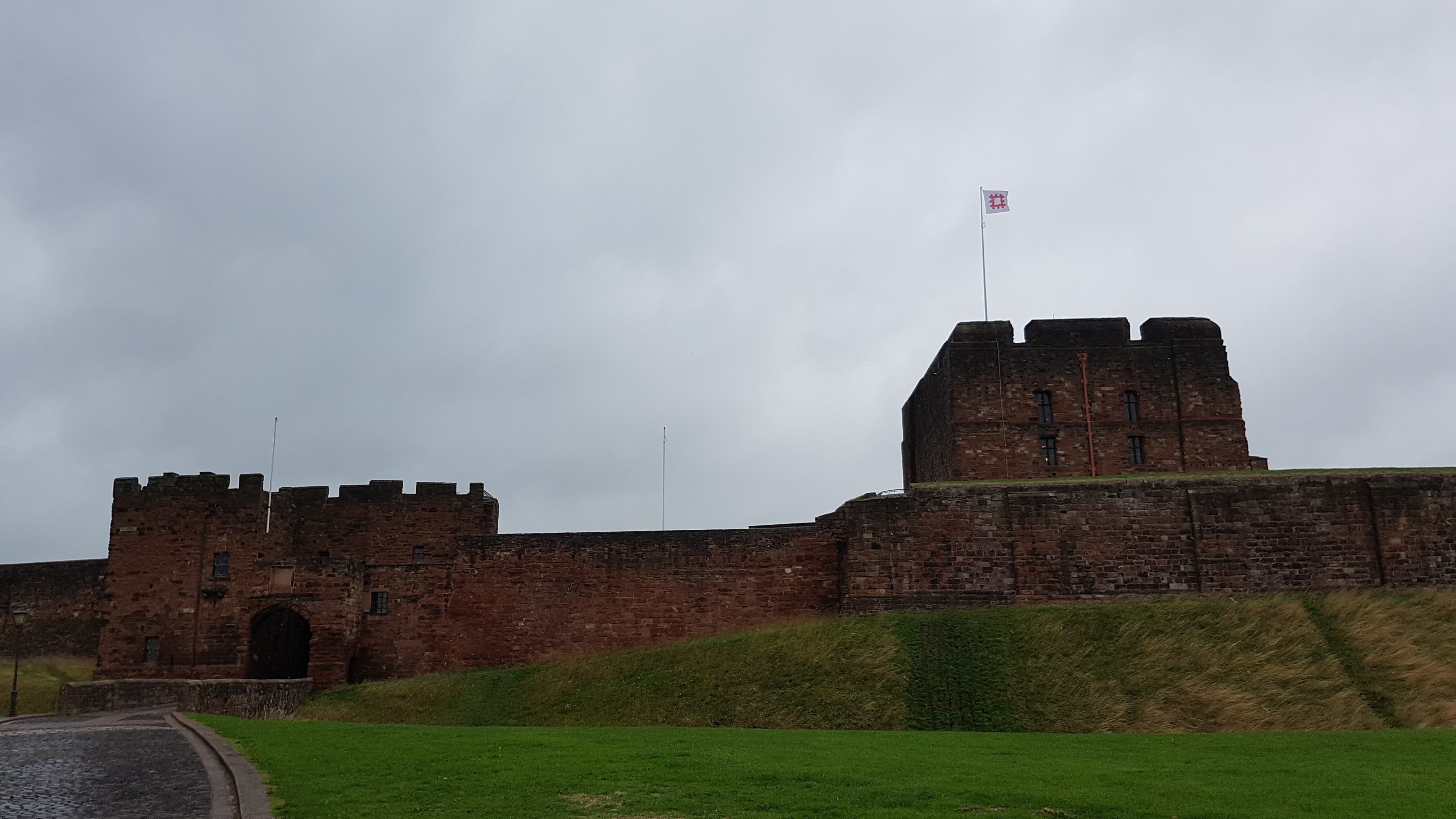
After five miles of running I was beginning to wonder if I’d ever reach Carlisle, but the welcoming sight of a signpost for Carlisle Castle assured me that I was indeed in the heart of the city.
Carlisle Castle.
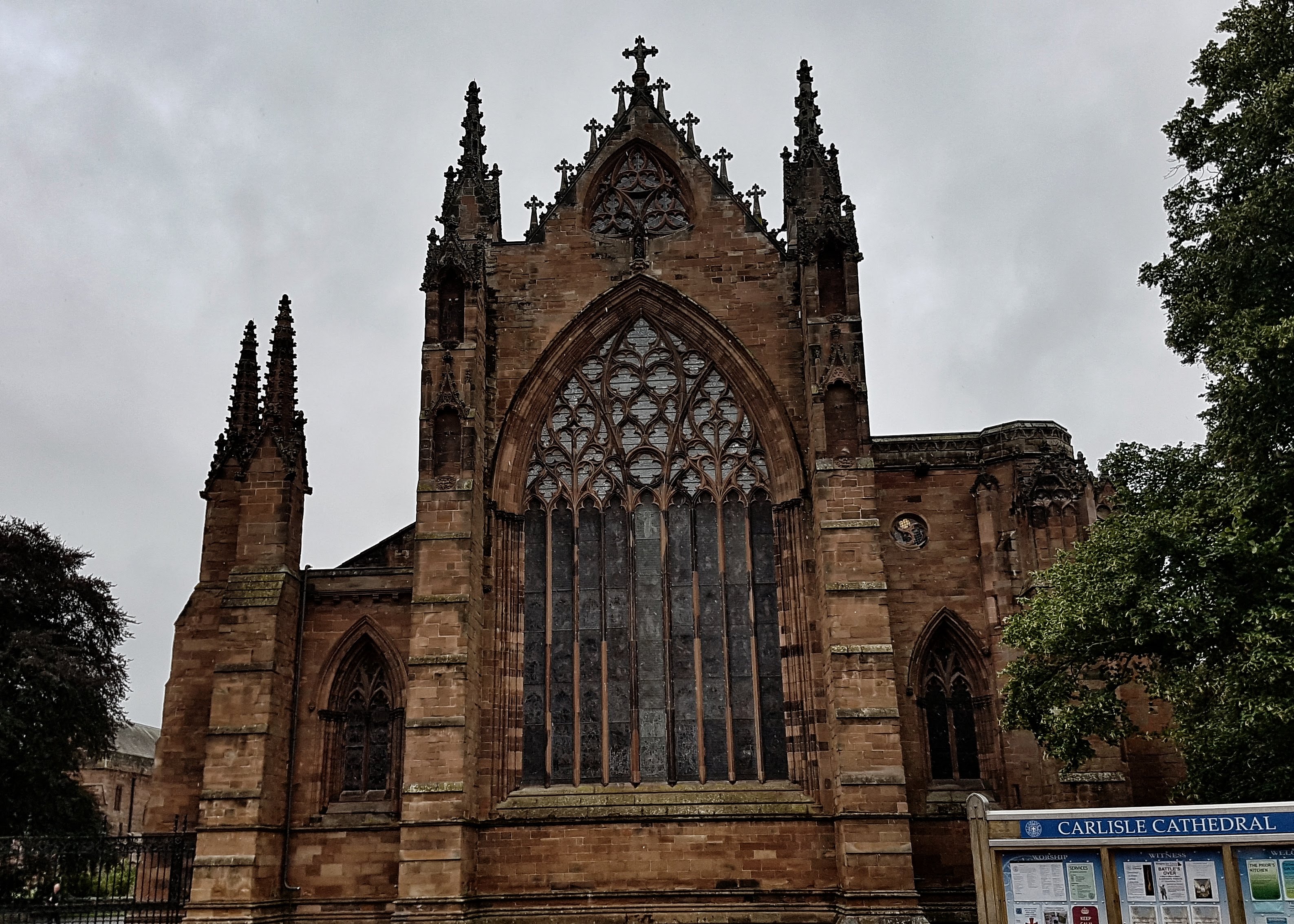
Crossing a pedestrian bridge I stopped briefly to take a photo of the outside of the castle. Behind me was a the busy A595 which didn’t look to fun to run along so with some more Google mapping I cut into the heart of Carlisle, passing the Cathedral and through the pedestrianised shopping centre.
Carlisle Cathedral – just before the rain came.
I then got a little lost trying to get myself on the Dalston Road which I figured may just take me back to Dalston where I was staying. Things weren’t helped by a squally shower making things decidedly unpleasant for a while before things calmed down, but didn’t exactly brighten up.
I ran along Dalston Road for a couple of miles, where in total I managed to notch up a trio of 7:11 miles. At a set of roadworks I noted that I could take a quiet road back to the small village of Cummersdale where I reckoned I could rejoin the cycle path back to the Caravan Park rather than face running on the busy main road back during the heart of a Friday evening rush hour.
Once I’d worked out that I could follow the road down to the main cycle path and ignore the foot paths across muddy fields, it was with some relief that I was back on the cycle path, where I knocked out a couple of easy six fifty something miles to bring me back to to the Caravan Park via the twists and turns of the unofficial footpath of the golf course. A ten and a third mile done with the minimum of energy expenditure followed by the plushest showers I’ve ever used at a Caravan Park! Happy Days!
Best Strava Segment Performance: Richie to pirelli lane – 36th/490
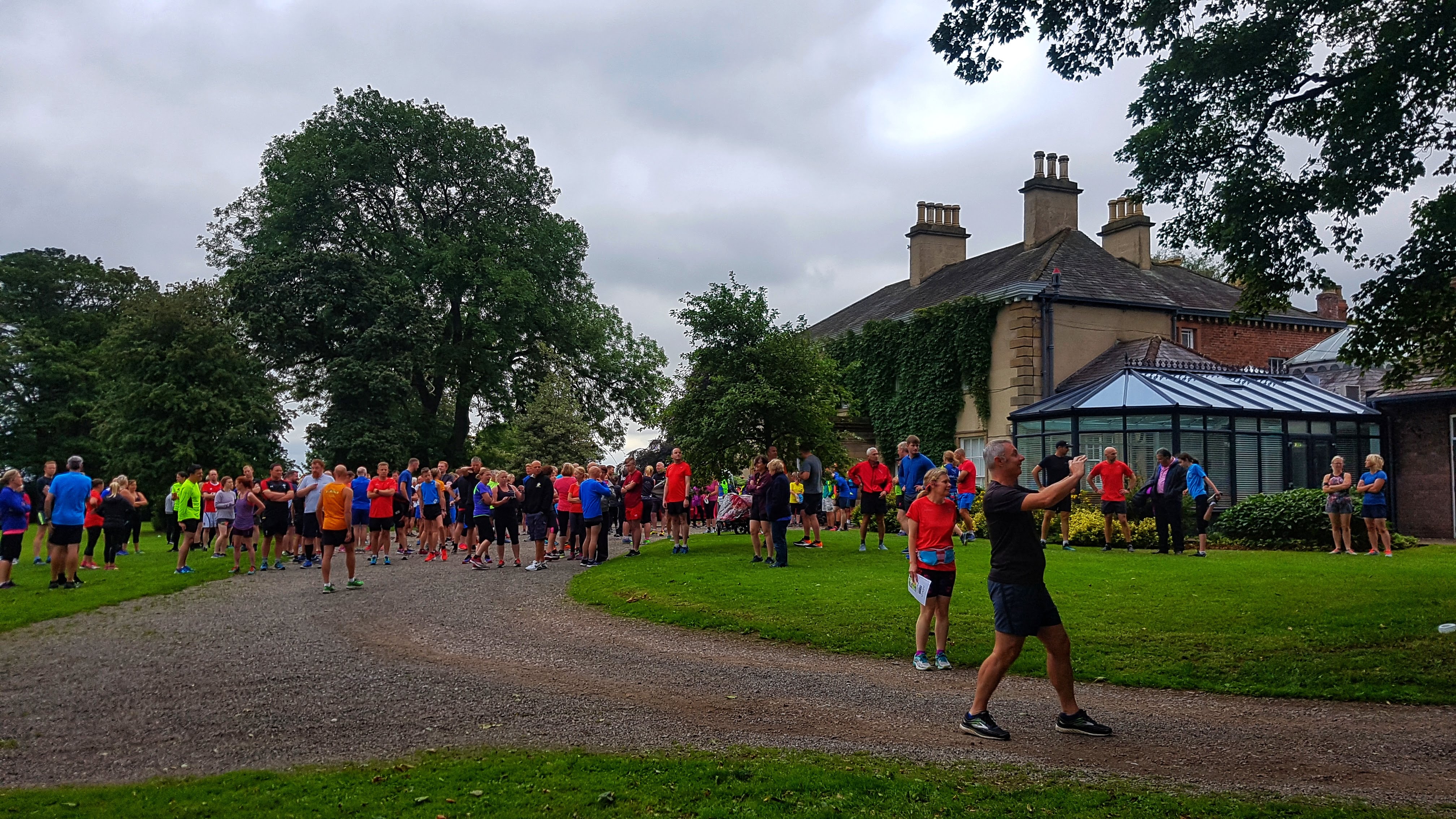
Day 17 – Saturday 18th August 2018 – Five miles then Carlisle parkrun (1st, 17:59), five miles to end it.
Unlike the Tees Barrage parkrun in Stockton that I was aware of in advance of us setting off on holiday, I genuinely wasn’t aware that there was a parkrun in Carlisle until a day or so before arriving at Dalston. I really don’t know why I didn’t think there would be a parkrun in a city, but it never crossed my mind.
Once I knew there was, there was the logistics of trying to get to it by running and not driving. Fortunately it was only three and a half miles away – as long as I ran on the busy B road from Dalston into Carlisle, a mile or so would have me running on the road. I reckoned that, at just after 8 am, the traffic would not be so bad and thankfully I was proved correct, with less than a handful of cars passing me, all able to give me plenty of space as they passed.
Chance’s Park, home of Carlisle parkrun.
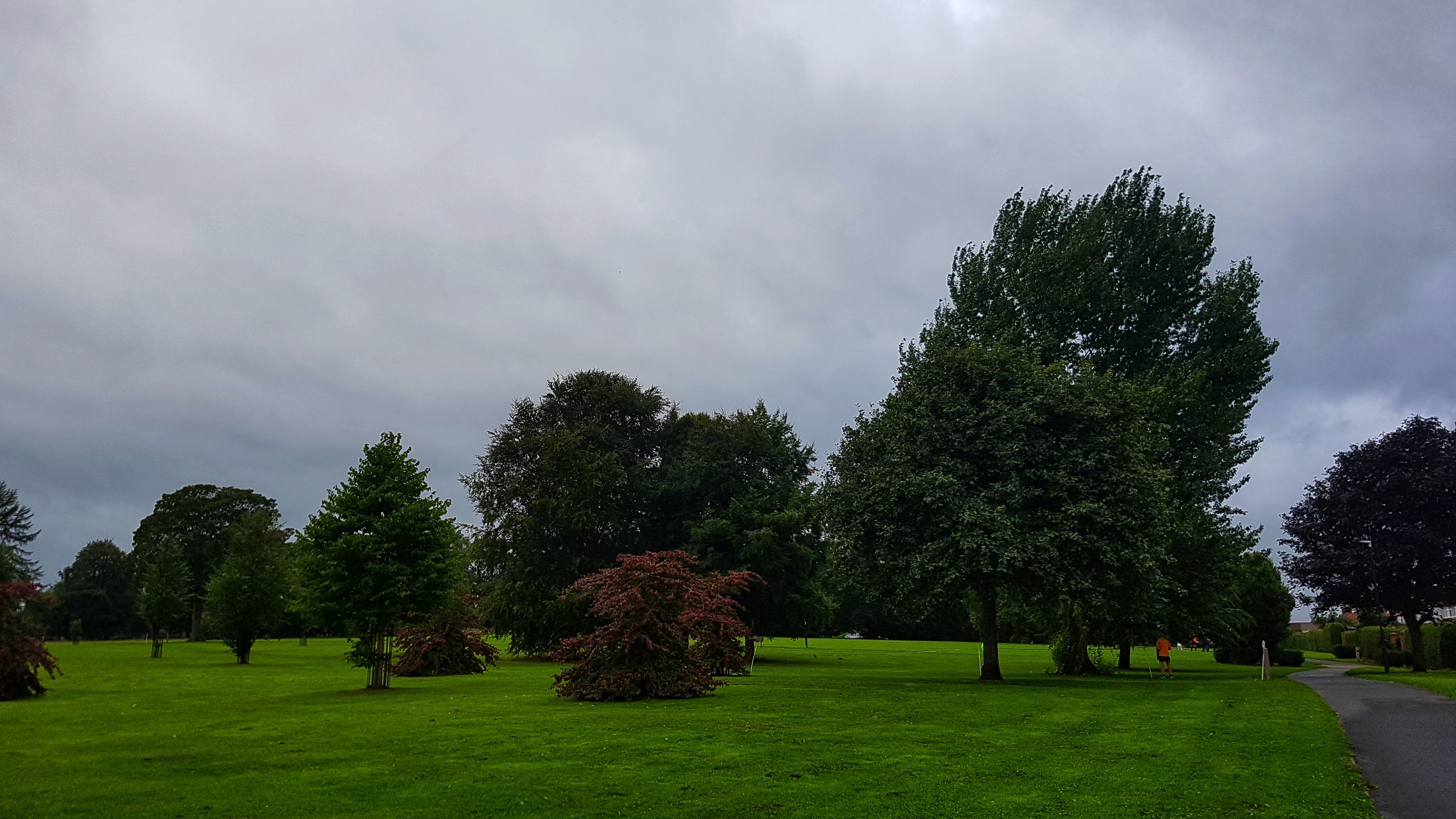
Considering I had to run through some back streets to make it to the park, I got to Chance’s Park, venue of Carlisle parkrun, relatively smoothly. I did double check with a pair in high-vis bibs that I was in the right place, they assured me I was and I relaxed somewhat. I chatted briefly to another pair of parkrun tourists, our paths would cross later, before heading off for a couple more miles or so working my way around the park, using the toilet facilities, and generally trying to kill half an hour or so before the 5K run began. The pre-parkrun miles were all run at a relaxed pace, the slowest 7:40, the quickest a 7 flat as I ended with a few strides to try and wake the legs.
The pre-run brief for first timers to Carlisle was far briefer than the one I enjoyed at Stockton. There was no map, no real information on where the course went other than it was three laps and we were shown where it began and finished. I had a fair idea of where we went, but I thought it would be prudent, whatever the pace, to not attempt to lead (if such a thing was possible) until the end of the opening lap. There was an intriguing aside from the marshal who pointed out that a lot of the Strava uploads from the parkrun showed the course to be 3.2 miles (5K is 3.1 miles), but was confident that the course was indeed exactly 5K. (I also overheard a couple of regulars who said the course was definitely long as it had been changed slightly from what it was originally).
Before the start of Carlisle parkrun.
At a few minutes past nine I lined up at the front of the 260 odd strong field and waited for the next pre-run biref to commence and finish. Finally at around 9:05 we were on our way. There was the usual surge of runners to the front, I was probably only just in the top ten after 300 meters, but slowly worked my way through to sit fourth at the back of a group of four.
The three lap parkrun was a twisty affair, partly run on grass, partly on footpaths, fairly constantly undulating and for today, pretty windy. It was reminiscent of a cross country course minus mud and spikes and with more tarmac – for which I was grateful. It was a good example of a parkrun in a regular kind of park. After all the definition of what constitutes a park has been stretched somewhat over the years to allow a parkrun to take place.
I stayed fourth until we reached the bottom of the park and made a hairpin bend that took us climbing back up a longish drag. I was confident I knew where the course went from here and felt the pace slow a touch so I pushed on and took the lead near the top of the hill, enjoying the immediate gradual downhill run following a hairpin which meant the pace naturally picked up. I went through a mile in 5:43, which I was pleased with given the undulating twisty nature of the course.
As I turned again sharp left to begin the second lap I tried my best to relax and enjoy the run. Halfway around the second lap before tackling the main climb again, I reckon I only had a few seconds on the second placed runner, by the time I reached the top it had pushed out to 15 or so and I knew that, barring disaster, first place was assured. The second mile was 5:35 and my legs felt great, bounding with confidence and purpose.
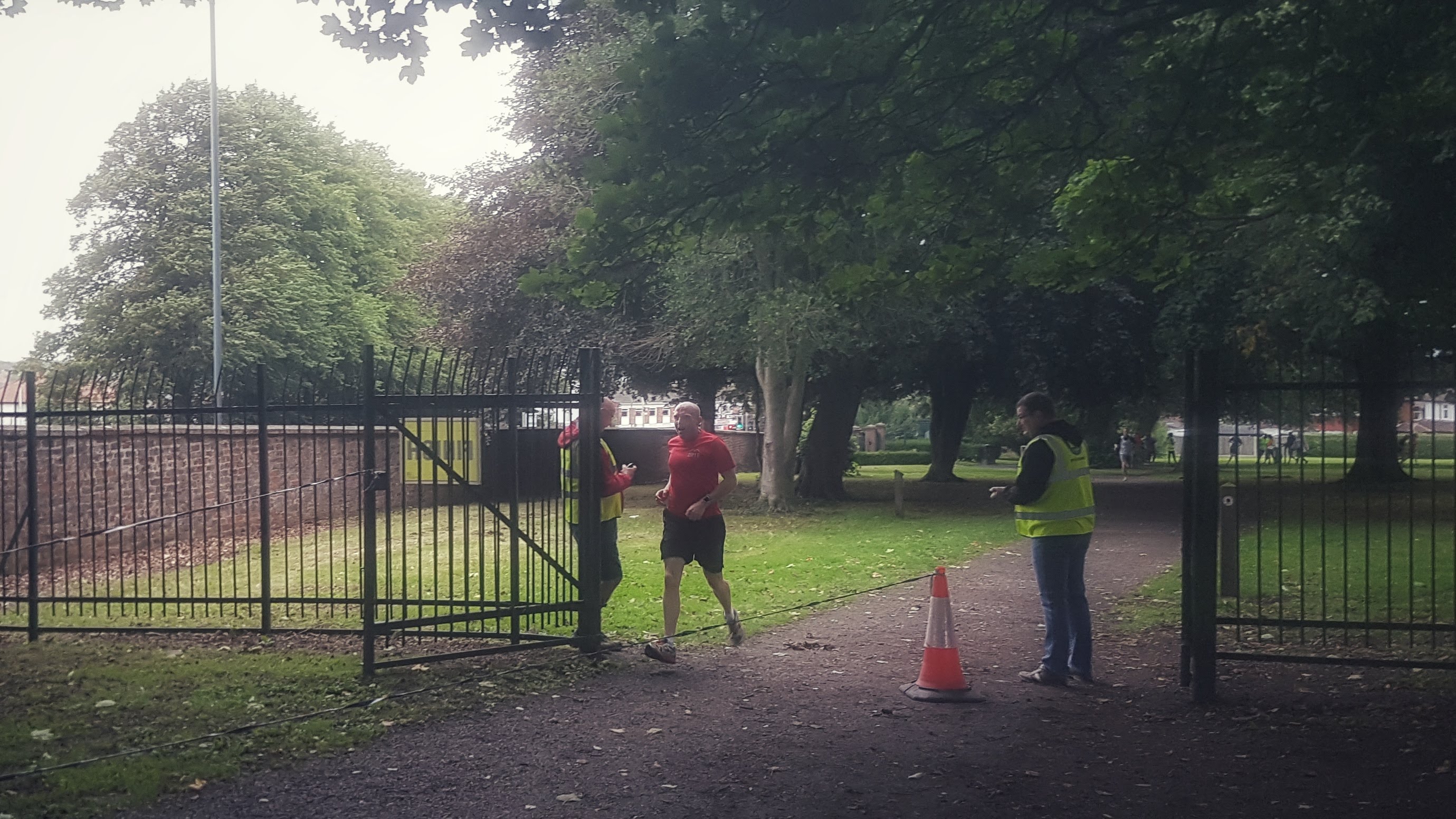
The final lap was much the same as the second, I was strongest of the field on the climb and extended my lead further. By now the biggest issue was back markers, of which there were many on a three lap course and on narrow pavements were tough to navigate at times. The third mile was a 5:36 and it was a very long 0.1 of a mile (as it was 0.2) of slightly uncomfortable slightly uphill running to the finish line. I finished first in 17:59, 38 seconds clear of the second placed runner. Given my splits I expected a bit quicker time but, I do believe the course was indeed a touch long.
The end of Carlisle parkrun.
I hung around a few minutes to clap some of the runners behind me home. The tourists I met earlier in the morning came home in a low 20 minutes, which for the girl as a 15-17 junior was very impressive – especially on her first parkrun attempt. She did however feel she was robbed of a position by another runner and I decided to leave before the argument got potentially heated.
Returning to a comfortable pace I made my way back to the Caravan Site. I reckoned the busy B road was indeed looking quite busy so I opted, as I had the day before, to take the left hand turn down to Cummersdale and the bicycle path back to Dalston. This meant that the run was as near as it can be half marathon distance by the time I’d run a lap or two of the caravan park. The average was a pleasing 6:49 and all was good, even if the legs felt pretty tired by the end. It was my third first place at parkrun in a row and I knew that, although the times suggested otherwise, there was some pleasing form arriving in the legs.
Best Strava Segment Performance: Carlisle Parkrun – 17th/1216
Day 18 – Sunday 19th August 2018 – Wet Dalston Loop
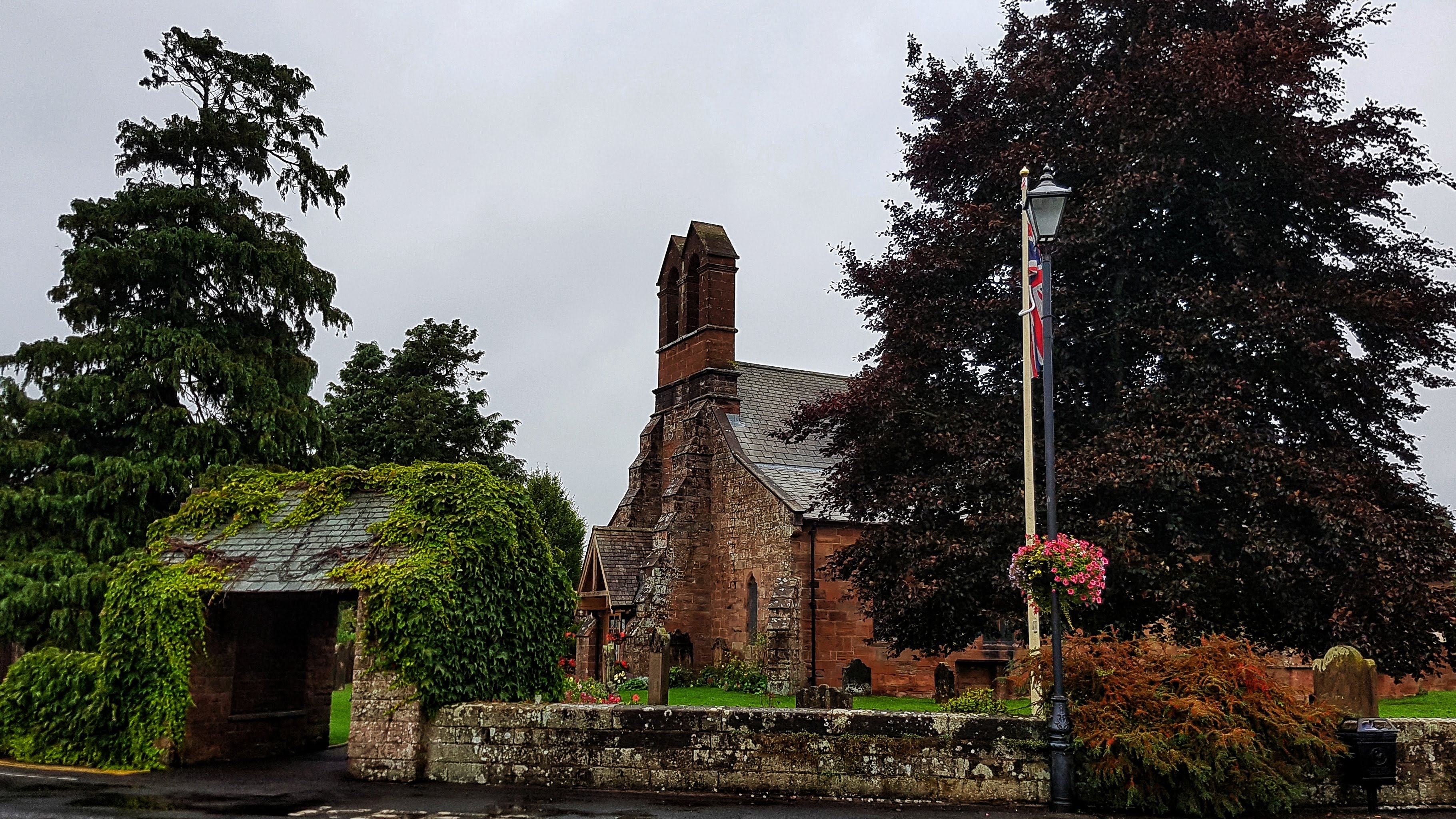
For the final run in Dalston I decided to head into Dalston itself, pick a road and see where it would take me, hopefully making a loop out of the run rather than an out and back. As it was 8:30 am on a Sunday morning I reckoned I could safely make the 200 meters or so of road without pavement before making it into Dalston. This I managed to do, running for a mile or so through the large village waiting patiently for the legs to wake up, stopping a the church to take a photo which kind of matched the vintage ones in the nearby fish and chip shop the evening before.
The church in Dalston.
You may spot the pavement is wet and indeed it was raining, lightly at first and gradually intensifying during the run with heavy bursts of precipitation that eased and then returned for the entirety of the run. Fortunately it wasn’t cold, indeed the rain had apparently been blown in by the back end of a tropical storm, so it was actually almost as pleasant as running in the rain can be.
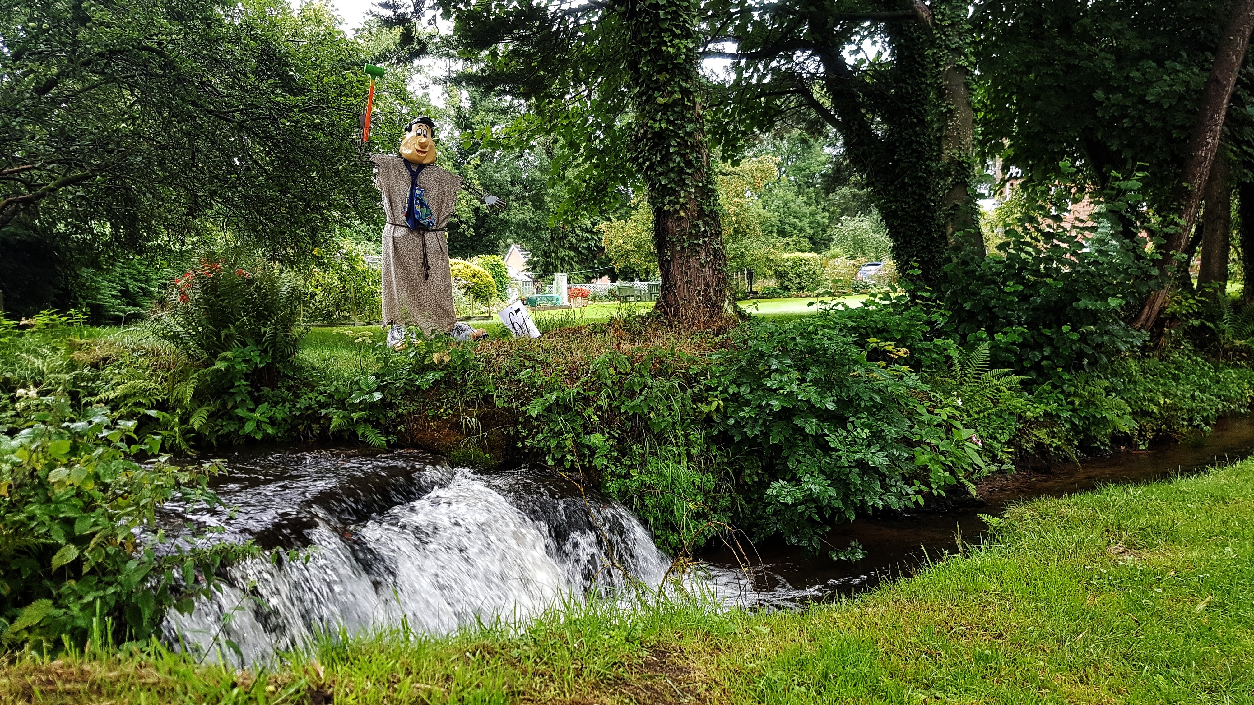
Fred Flintstone looking after someone’s garden in Dalston.
Through Dalston I spotted a sign for a footpath and cycle path so I took that, which went briefly went through park before leading to a bridge and a private road containing an old factory and then some very pleasant looking houses alongside a stream, one of which was guarded by Fred Flintstone!
I found myself popped out at the other end of Dalston. A quick look at Google Maps showed that if I went up a short hill and turned right, there was a quiet country lane that could lead to more country lanes and the possibility of a loop. I ran along this road for a couple of miles, occasionally stopping to see when this road or roads that would allow me to loop around would appear.
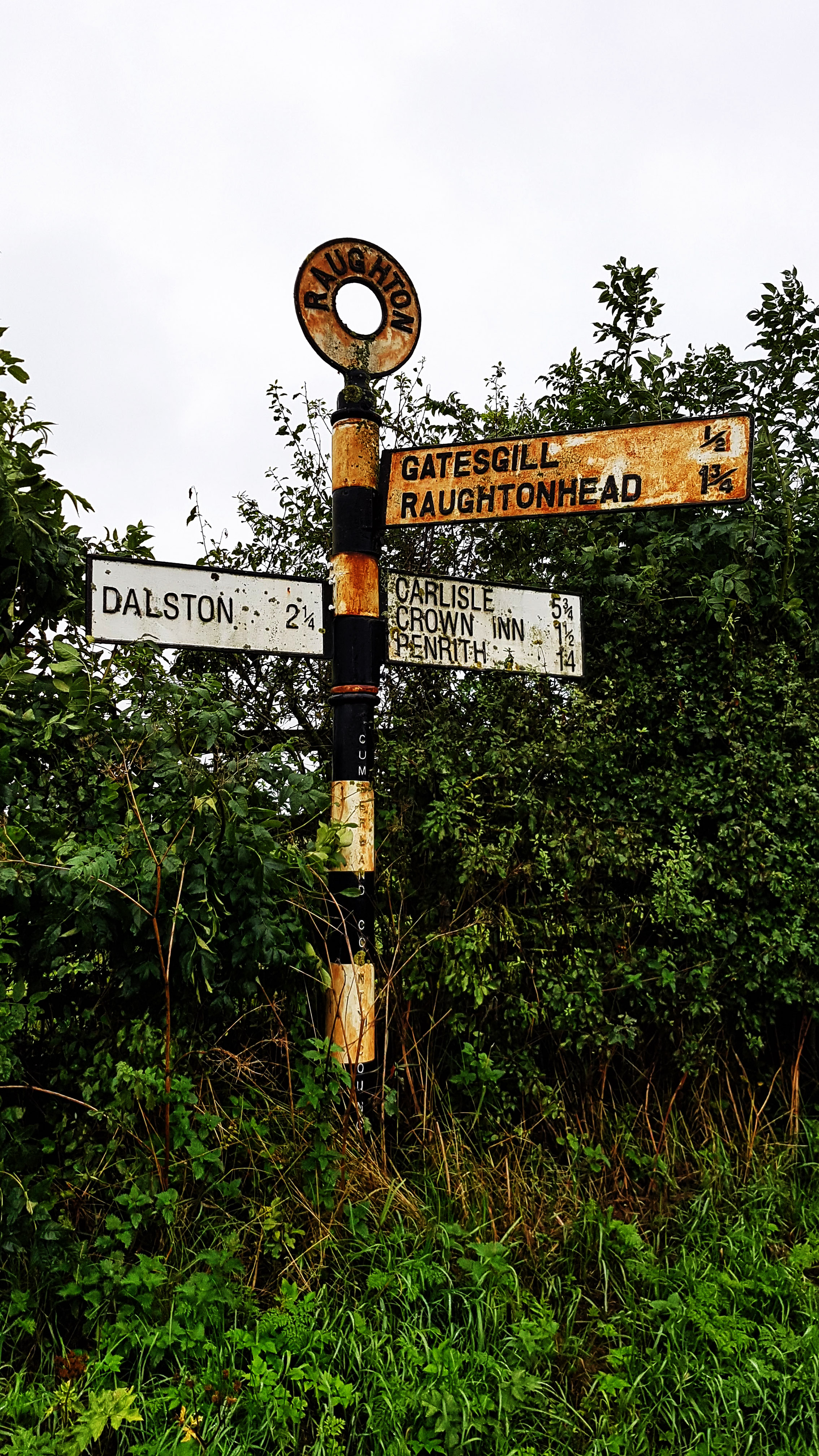
An old sign post – I headed to the ‘village’ of Crown Inn…
I stopped at some houses with a very old looking sign post that included the familiar names of Dalston, Carlisle, Penrith, and Crown Inn. How odd I thought to myself that a pub would be advertised on a road sign post. I know there are examples of this – the road known as the Cat and Fiddle is the pub on top ofhill upon which it sits upon is one that springs to mind, but still, I can’t think of many other instances where a pub is so ingrained in the landscape it merits a place on a road sign. I did though wonder, with the sign being so old, whether it still existed.
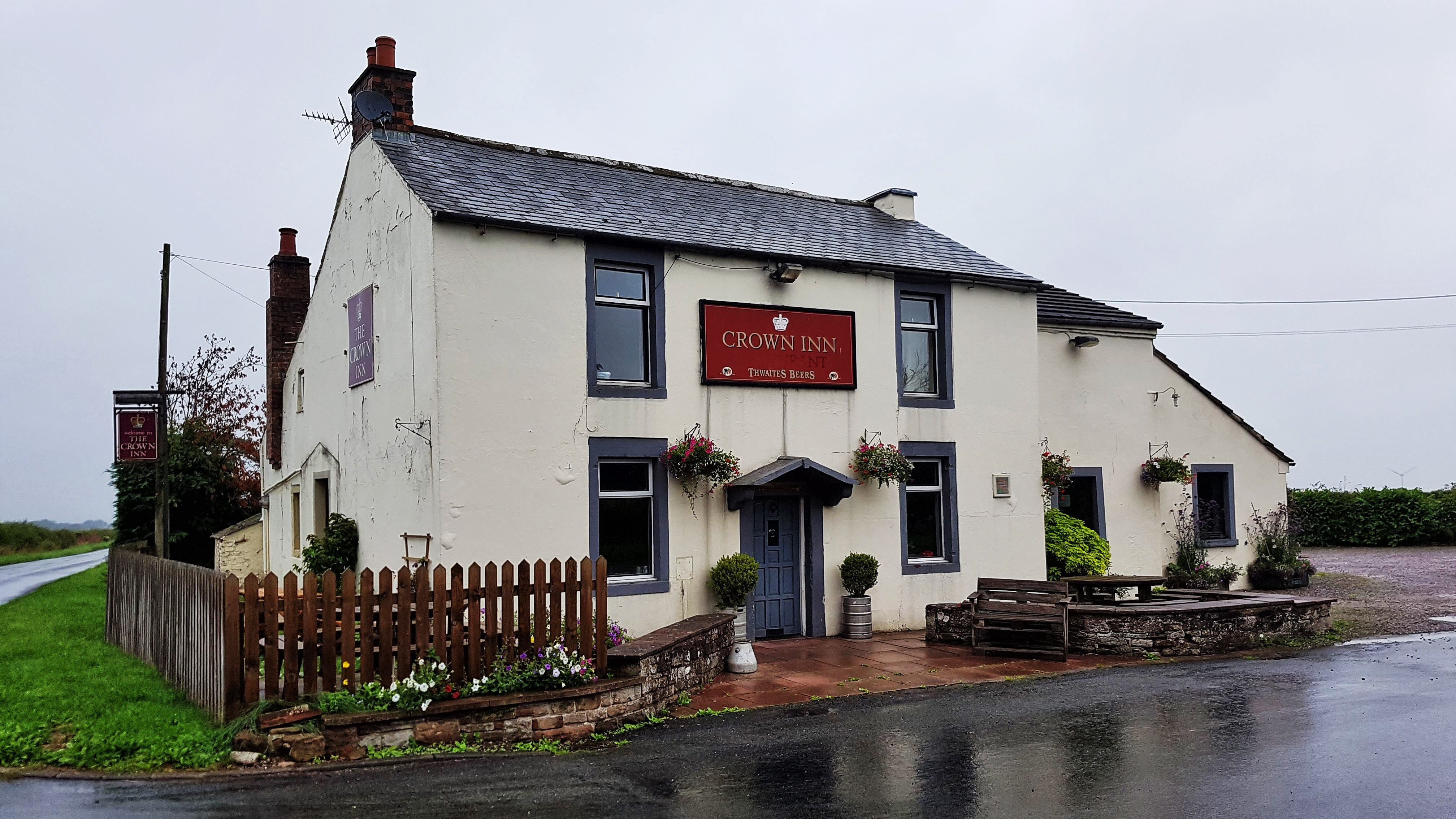
The Crown Inn – a pub worthy of a signpost in the middle of nowhere!
So I continued along the road for another mile and a half which took me to a set of cross roads with just one solitary building, which was The Crown Inn. It was not the most spectacular pub, looking a little tired – although most would with the weather I was running in. After a brief stop I turned left and headed towards Durdar. The pace picked up, having struggled to break 7 minute miles I was not running 6:30 and quicker. It was only when I got back and checked the elevation profile did I realise that I had been climbing ever so gently 300 feet for the opening five miles of the run, and was now doing the same but going downhill.
What struck me about this road to Durdar, although it was almost totally devoid of road traffic and had no road markings, it had the hallmarks of a road that was once much busier. Wide enough to almost be an A road with junctions here and there that suggested that this road was once much busier. Indeed around half a mile further along the road was another pub, which had clearly closed some years ago and was in a state of some disrepair. I haven’t been able to confirm it but I can only assume that, pre-M6, this road may have been a far busier, more important road taking drivers north or south – hence the sign posted pub on a crossroads in the middle of nowhere with another not far along the road, both convenient stopping points for the long distance driver. I guess once the M6 arrived this road ceased to have any vital purpose other than taking drivers from one village to the next and, perhaps, taking some slack if there is ever a drama on the nearby M6.
I made it to Durdar with eight miles on the clock and turned left at the cross roads. This road back to Dalston was just as wide as the one I was on, but was still a busy popular road judging by the volume of traffic on it. I can’t say it was the most pleasant experience running on this busy road for three miles or so, in the rain, constantly changing from one side of the road to the other to keep myself visible to traffic on the bends and hills.
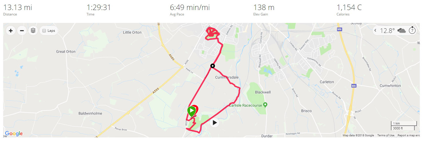
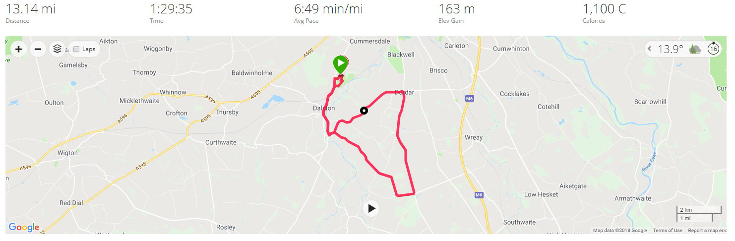
It was a relief at 11 miles when I returned to the house guarded by Fred Flinstone and the footpath I’d left some miles earlier. I could relax and head back to the caravan site. I opted at the end of the run to take the unofficial footpath through the golf course once again to my caravan, to make the run a second consecutive half marathon effort. Rather eerily I clocked 13.13 miles (exactly the same as the day before) in 1:29:35, just four seconds slower than the day before. A sub 3 marathon clocked over the 24 hours!
With that run done it was farewell to Carlisle and on to the final destination of the holiday – Yorkshire!